
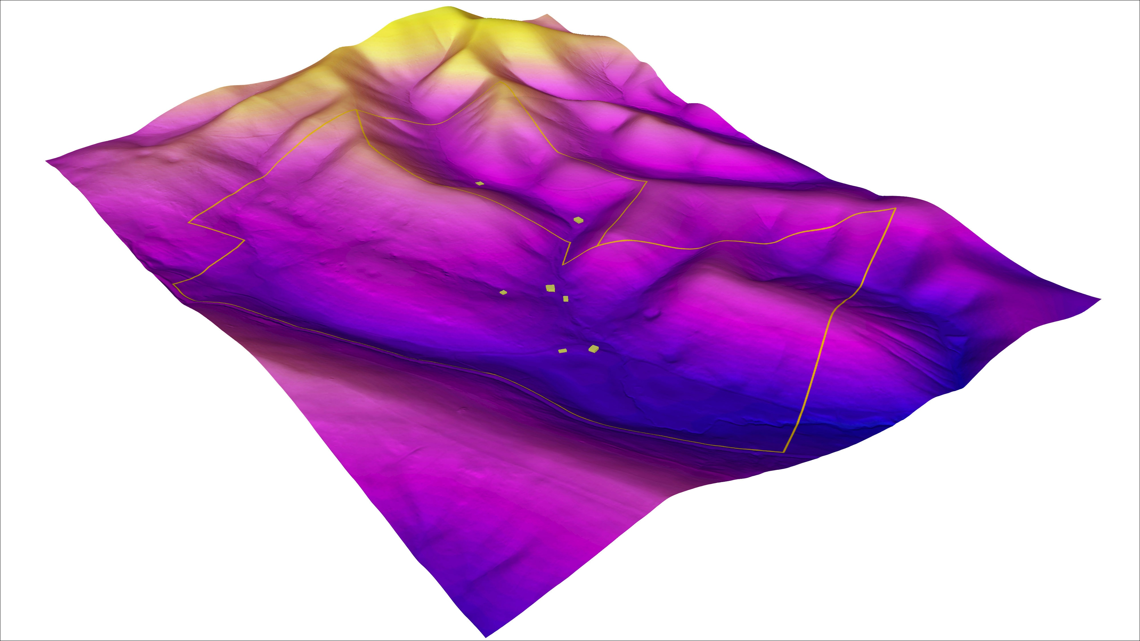
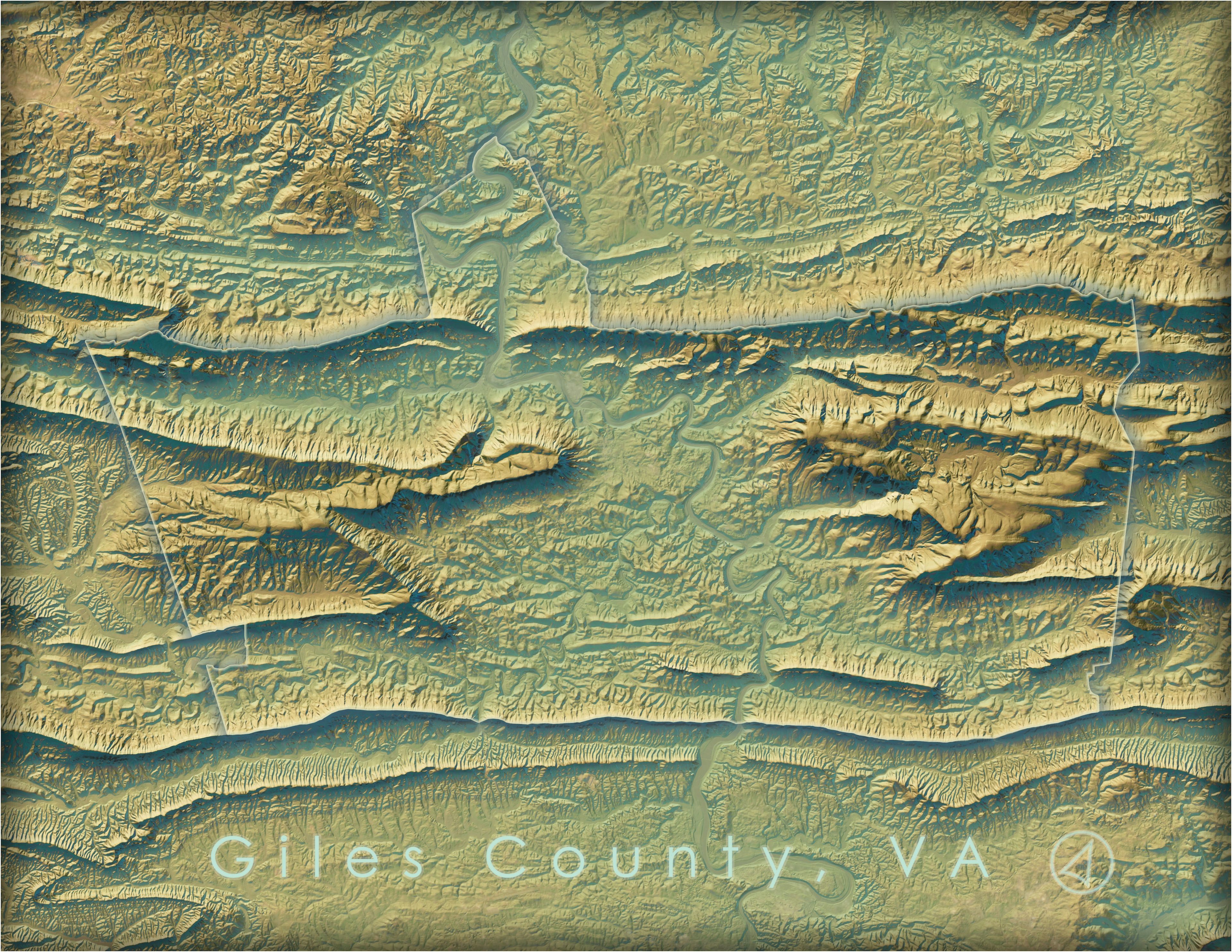
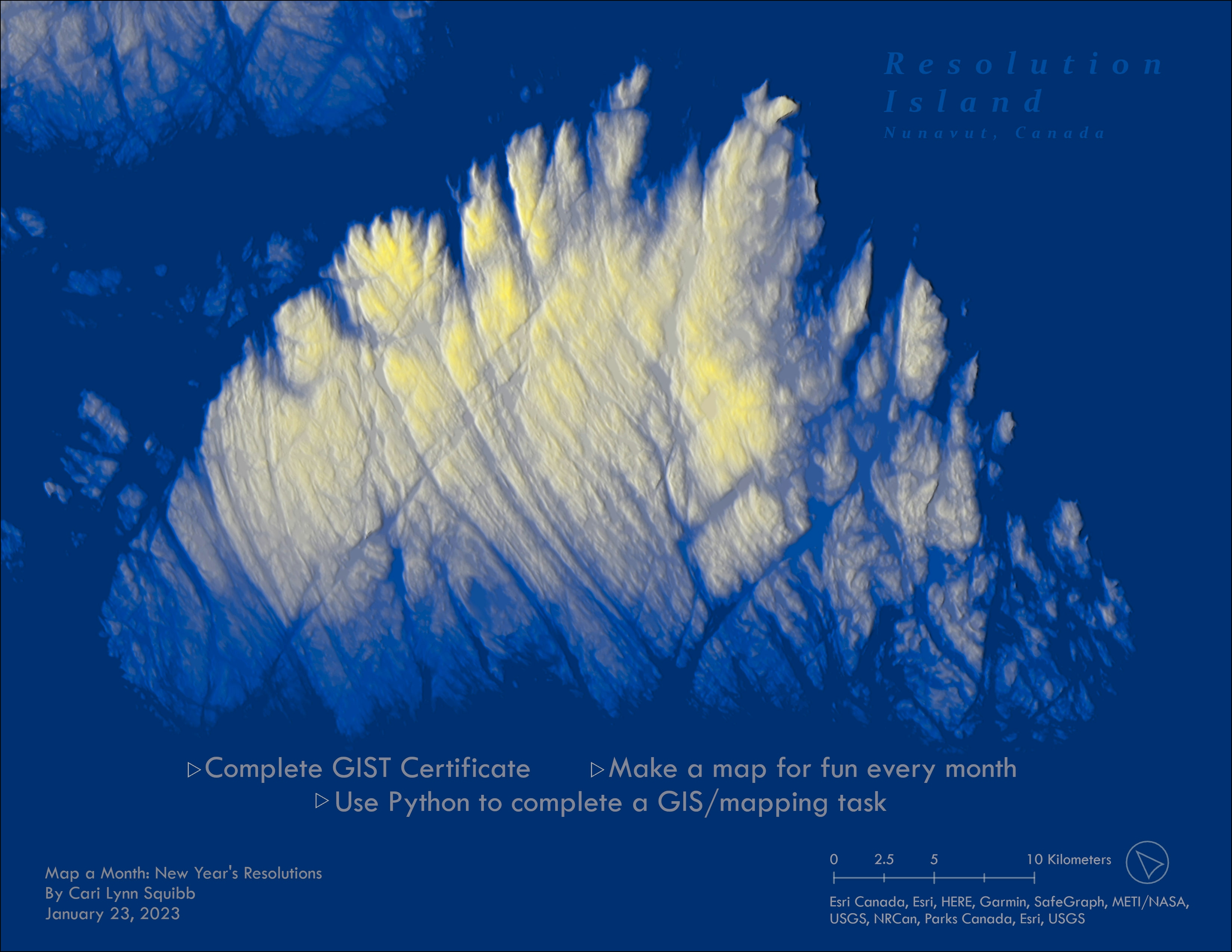
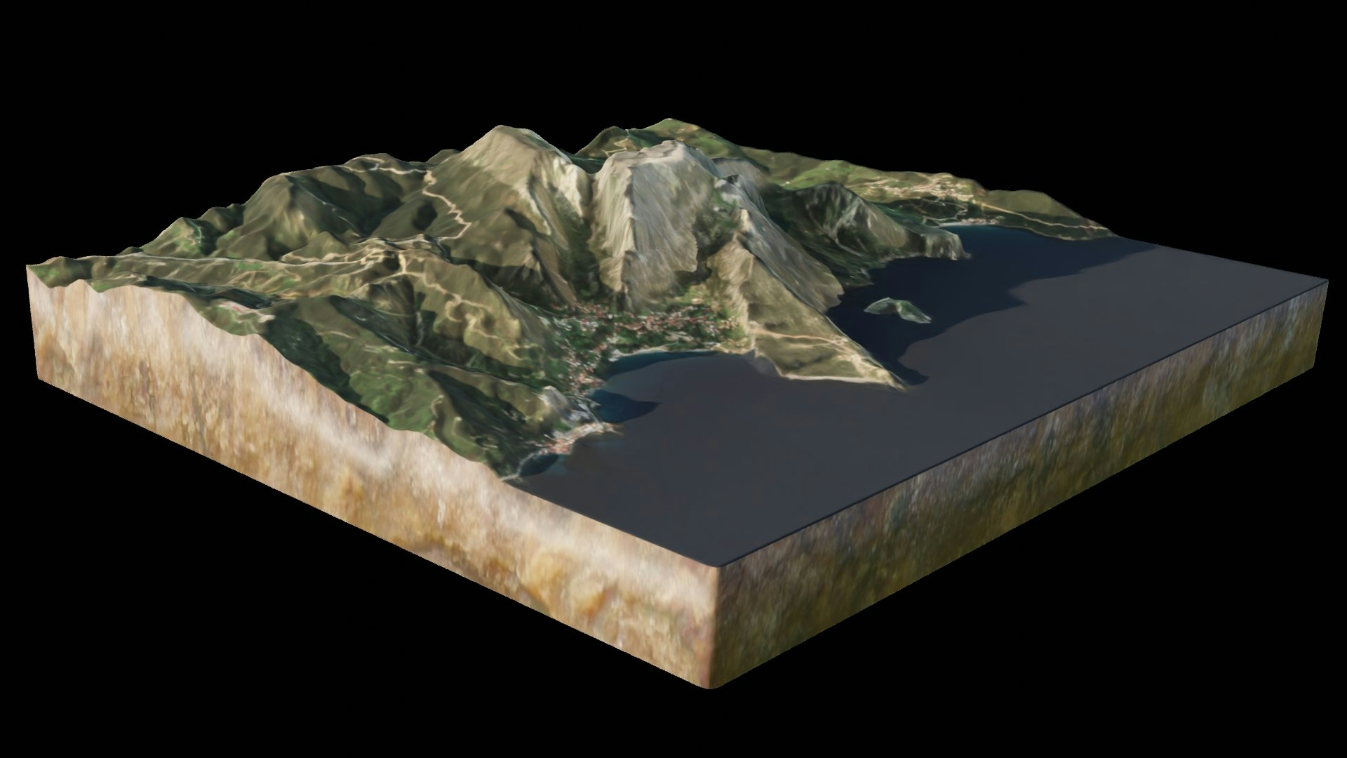
Created as a Christmas present for my family, I used the terrain elevation layer from Esri's Living Atlas to make this hillshade map of the farm we grew up on in southwestern Virginia. The property boundaries and building footprints were downloaded from Regrid.com and edited for accuracy. Z-values were calculated using the terrain data and the footprints were extruded to become 3D building models (ran out of time to add the correct roofing structures).
DEM Data for Virginia farm
Tools used
ArcGIS Pro
Plug-ins used
None
tags
3d mapDEMExtrudedRaster
More by Cari Lynn Squibb


You might also like
_9083060.png&w=3840&q=100)

.png&w=3840&q=100)


.gif&w=3840&q=100)


_1639877.jpg&w=48&q=40 "Guilherme Herculano de Oliveira")
.png&w=3840&q=100)


Join the community!
We're a place where geospatial professionals showcase their works and discover opportunities.