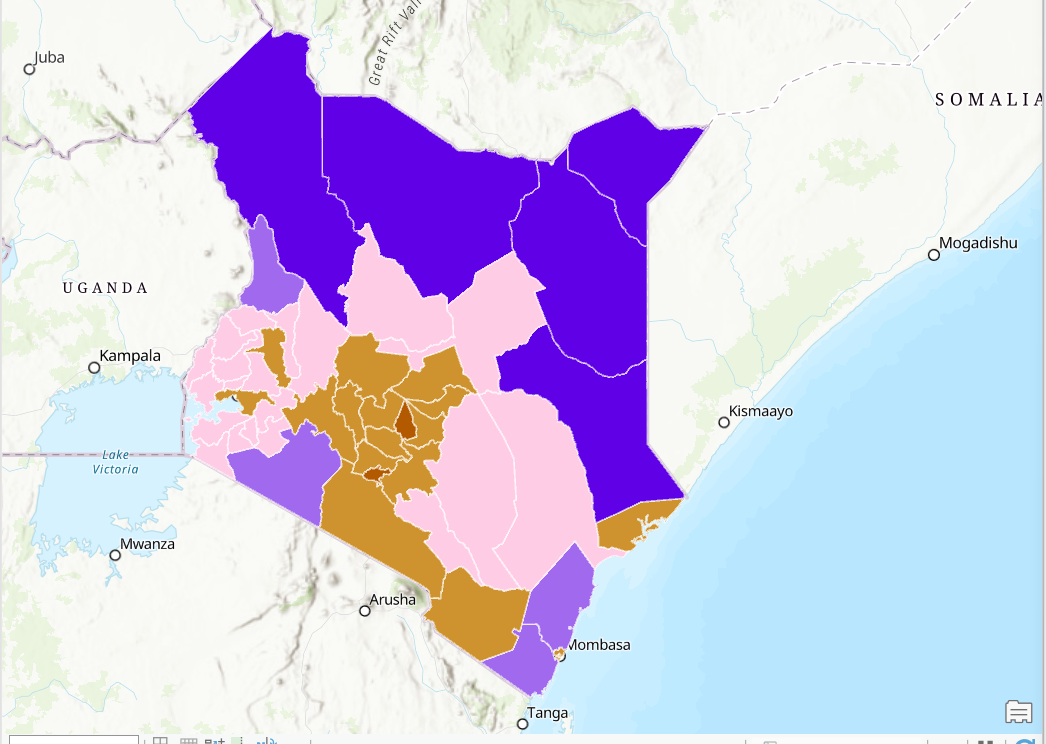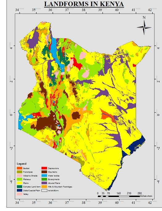
Introduction: This project presents a comprehensive geospatial analysis of landforms across Kenya, utilizing ArcMap as the primary tool for data processing and visualization. The endeavor aimed to characterize and understand the diverse landforms that shape Kenya's topography, providing valuable insights for environmental planning, natural resource management, and geoscientific research.
Project Overview:
Data Compilation:
The project commenced with the compilation of relevant geospatial datasets, including digital elevation models (DEMs), satellite imagery, and geological maps. These datasets formed the foundational layers for the subsequent analysis of landforms.
Digital Elevation Model (DEM) Processing:
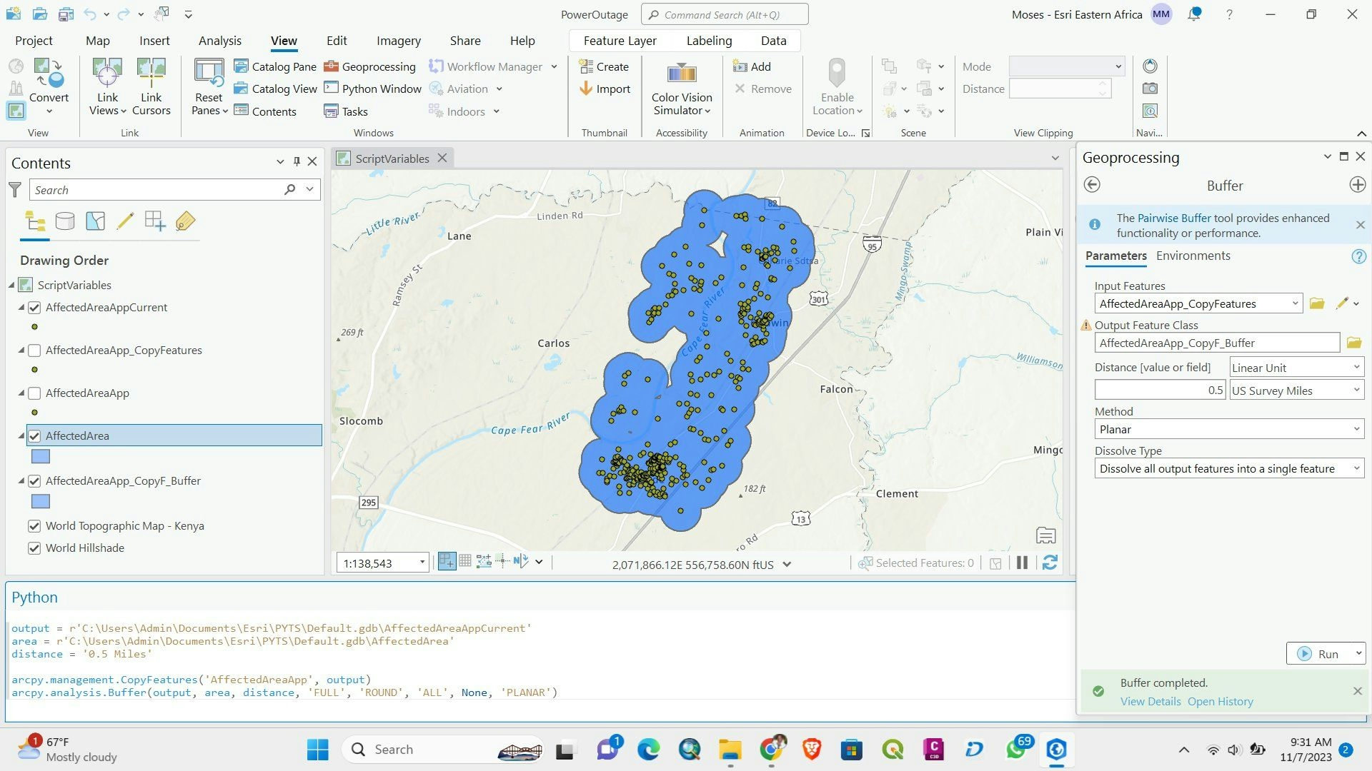
Leveraging ArcMap's geoprocessing capabilities, DEMs were processed to extract elevation information, slope gradients, and aspect data. These processed layers served as the basis for identifying and categorizing distinct landforms.
Landform Classification:
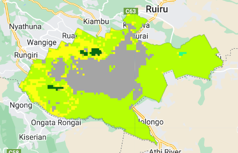
Utilizing geomorphological principles, landforms such as mountains, valleys, plateaus, and plains were classified based on elevation, slope, and land surface characteristics. This process involved the application of spatial analysis tools within ArcMap.
Visualization Techniques:
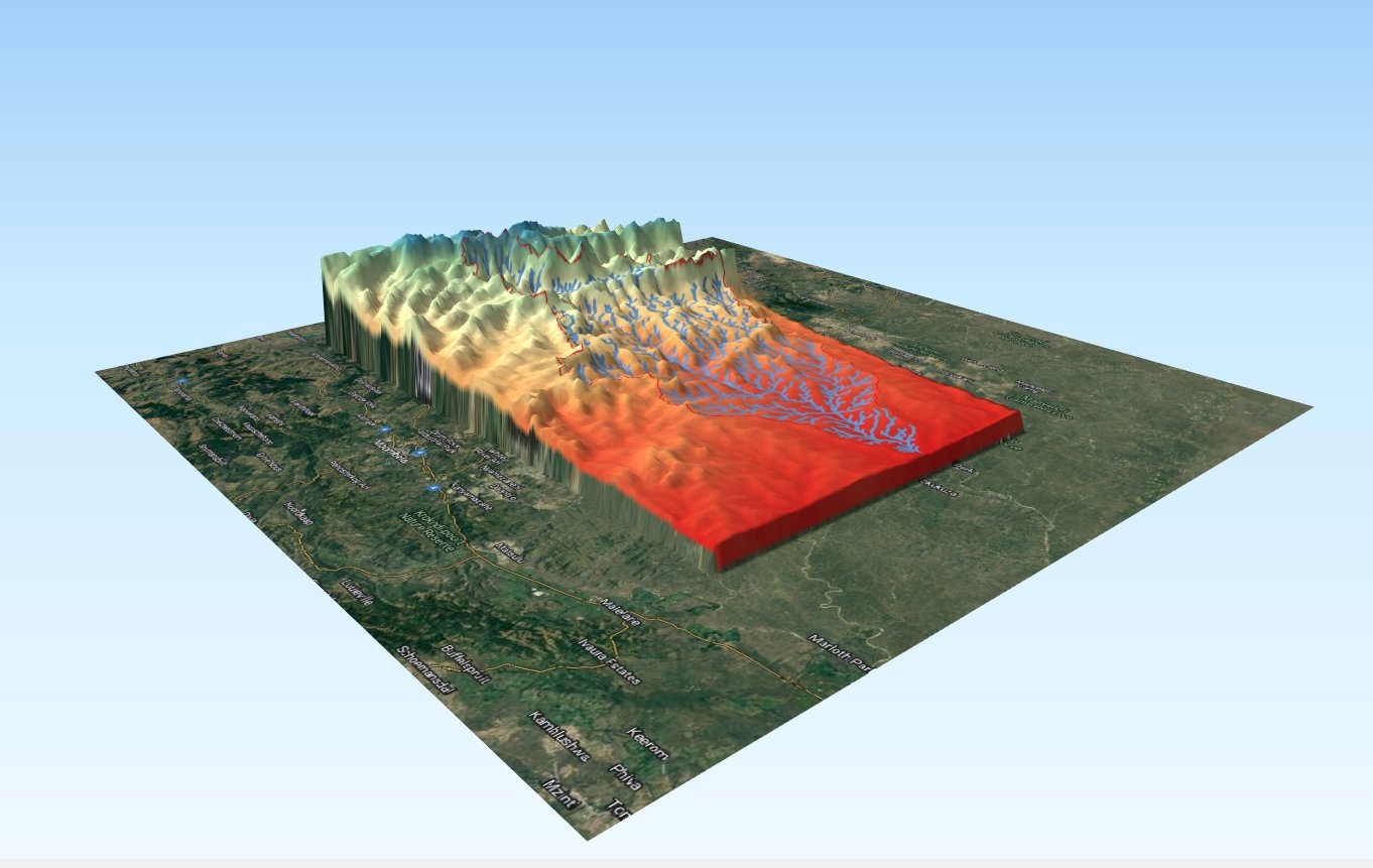
Employed various visualization techniques, including hillshade models, contour maps, and 3D representations, to enhance the visual interpretation of landforms. These visualizations allowed for a more intuitive understanding of the geographical features.
Geological Context:
Integrated geological maps and information into the analysis to provide a geological context for the identified landforms. This aspect of the project contributed to a more holistic interpretation of the landscape's evolution and geological history.
Benefits and Significance:
Environmental Planning:
The detailed analysis of landforms aids in environmental planning by identifying areas with unique topographic characteristics. This information is crucial for making informed decisions related to infrastructure development, conservation, and disaster risk management.
Natural Resource Management:
The identification and classification of landforms contribute to effective natural resource management. Understanding the distribution of landforms informs decisions related to agriculture, water resource utilization, and biodiversity conservation.
Geoscientific Research:
The project provides a valuable dataset for geoscientific research, offering insights into the geological processes that have shaped Kenya's landscape. This information contributes to ongoing studies in earth sciences, geomorphology, and geological history.
Educational Resource:
The visualizations and classification of landforms serve as an educational resource, both for academic purposes and public awareness. They provide a clear representation of Kenya's diverse topography and the geological forces that have shaped it over time.
Conclusion: This geospatial exploration of landforms in Kenya using ArcMap represents a significant contribution to the understanding of the country's physical geography. The project highlights the versatility of ArcMap in handling complex spatial data and underscores the importance of geospatial analysis in elucidating the diverse landforms that define Kenya's landscape.
Keywords: ArcMap, Geospatial Analysis, Landforms, Digital Elevation Model (DEM), Visualization, Environmental Planning, Natural Resource Management, Geoscientific Research, Geological Context.