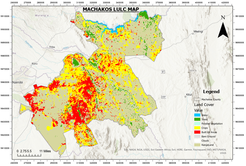
Title: Land Use and Land Cover Mapping for Machakos County
Introduction:
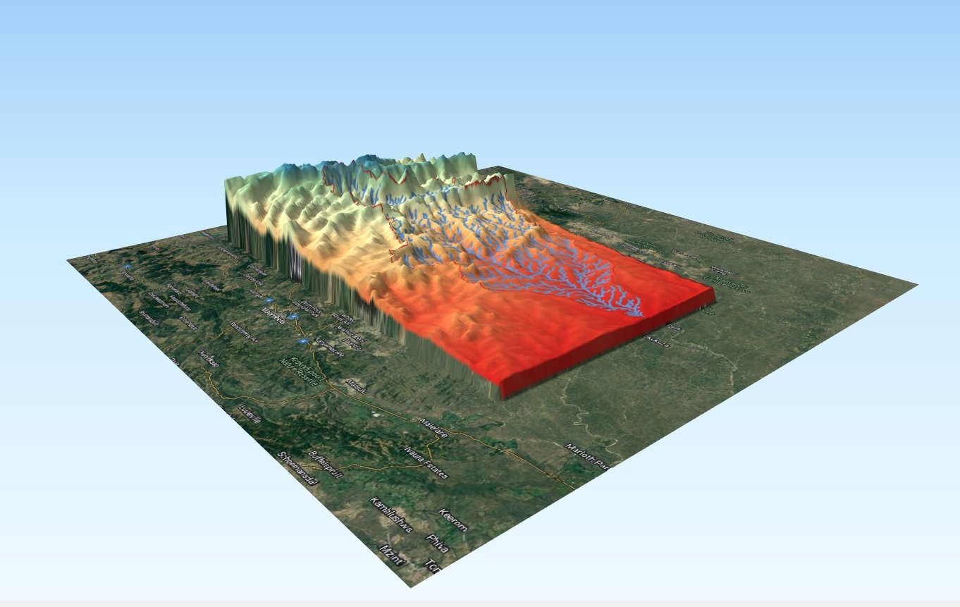
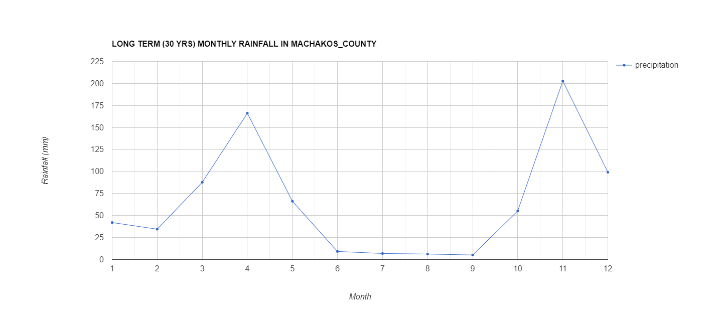
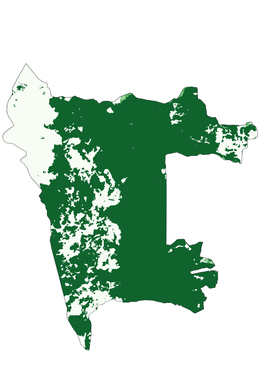
In this project, I undertook the task of creating a detailed Land Use and Land Cover (LULC) map for Machakos County, leveraging datasets from the ArcGIS Living Atlas of the World. This comprehensive mapping initiative aimed to provide valuable insights into the spatial distribution of various land uses and land covers within the county.
Project Objectives:
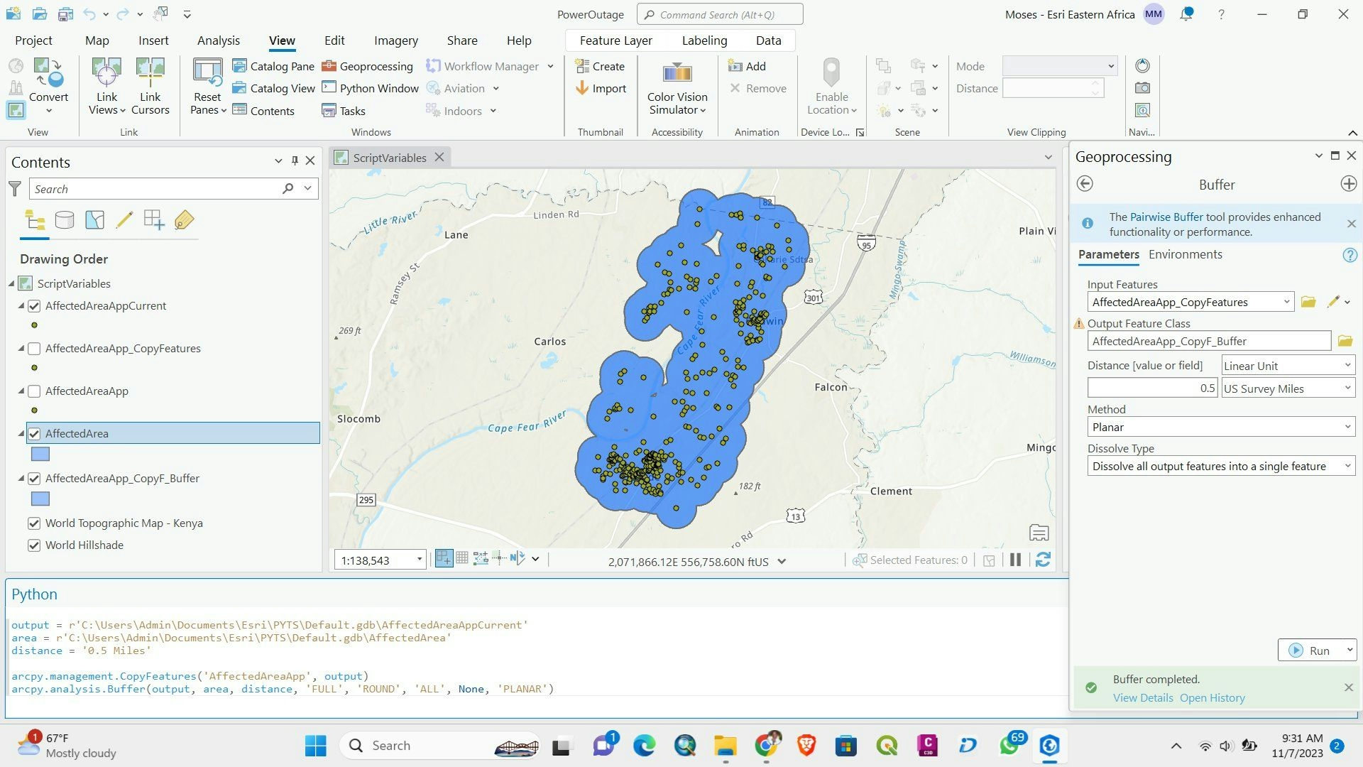
Spatial Data Collection: Utilized data from the ArcGIS Living Atlas of the World, ensuring access to high-quality and up-to-date geographic information.
Data Preprocessing: Conducted thorough preprocessing of spatial data to ensure accuracy and consistency, including data cleaning, transformation, and integration.
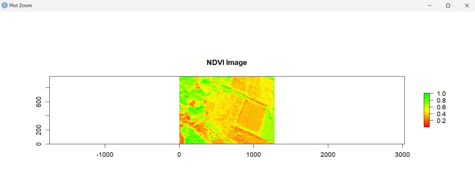
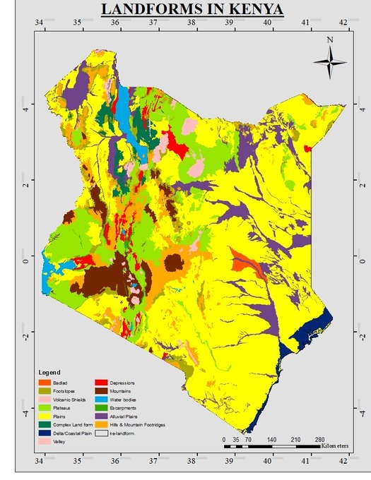
Classification Techniques: Employed advanced classification techniques to categorize land into distinct classes, such as urban areas, agriculture, water bodies, forests, and more.
Accuracy Assessment: Implemented accuracy assessment methodologies to validate the reliability of the classification results, ensuring the precision of the LULC map.
Mapping Outputs: Generated detailed LULC maps with a focus on Machakos County, providing a visual representation of the landscape and land use patterns.
Benefits of the Project:
Resource Planning and Management:
The LULC map serves as a crucial tool for local authorities and planners in Machakos County for effective resource planning and management. It aids in identifying areas suitable for agriculture, urban development, and conservation.
Environmental Monitoring:
Enables continuous monitoring of environmental changes, including deforestation, urban expansion, and changes in water bodies. This information is vital for sustainable environmental practices and conservation efforts.
Disaster Risk Reduction:
The detailed mapping facilitates better disaster risk reduction strategies by identifying vulnerable areas prone to natural disasters such as floods, landslides, or wildfires.
Infrastructure Development:
Supports infrastructure development planning by highlighting areas with high population density, encouraging the targeted development of amenities and services.
Decision Support System:
Provides decision-makers with a comprehensive spatial dataset, enhancing their ability to make informed decisions related to land management, conservation, and sustainable development.
Conclusion:
This LULC mapping project for Machakos County contributes significantly to the field of spatial analysis, providing a valuable resource for policymakers, planners, and researchers. The accurate and up-to-date information generated through this project is crucial for promoting sustainable development, environmental conservation, and effective land use planning in the region.