Sign up or log in to your Spatialnode account.

Takes less than a few seconds.

Washington Yarn Map

Cari Lynn Squibb
Cari Lynn Squibb•

December 29, 2022

Washington Yarn Map

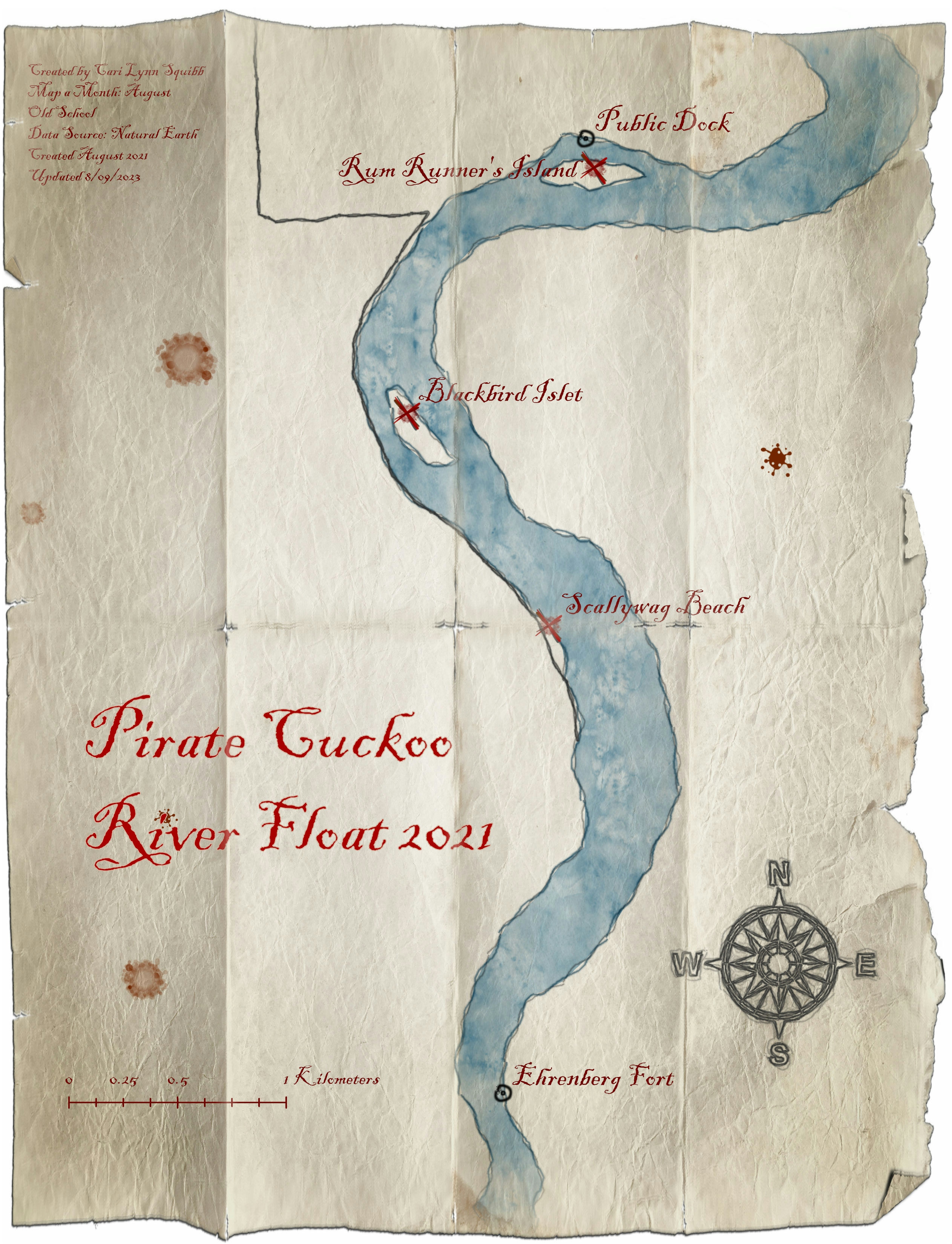
Created as a Christmas present for someone who crochets as a hobby, I used a John Nelson tutorial and data from Esri's Living Atlas to make this cozy knitted map of Washington.

Demo

Tools used

ArcGIS Pro

Plug-ins used

None

tags

ArcGIS ProJohnNelson

More by Cari Lynn Squibb

Map a Month: February
16
Map a Month: June
Map a Month: June
7
Map a Month: September
11
Map a Month: August
Map a Month: August
29
Final Project for GIST12
43
Map a Month: March
Map a Month: March
9
Map a Month: July
Map a Month: July
9
Map a Month: May
Map a Month: May
17
DEM Data for Virginia farm
40
Map a Month: April
Map a Month: April
10
Map a Month: January
32
Midterm Map for GIST12
58

You might also like

Languages of India
Eid
Languages of India
Eid
75
POPULATION DENSITY
PETER BOATENG
POPULATION DENSITY
PETER BOATENG
6
Mapa de Curvas de níveis de 1 m
Marcus Vinicius Zamorim da Costa
Mapa de Curvas de níveis de 1 m
Marcus Vinicius...
9
Trilhas em um Parque de São Paulo
Carla Américo
Trilhas em um Parque de São Paulo
Carla Américo
5
Tree Canopy in Redlined Districts
Sean Willis
Tree Canopy in Redlined Districts
Sean Willis
125
VIAS DA PROVÍNCIA DO ZAÍRE
Raduel Fernando da Fonseca
VIAS DA PROVÍNCIA DO ZAÍRE
Raduel Fernando...
365
Flooding in Forest City Malaysia
Paul-Emile Vallette d'Osia
Flooding in Forest City Malaysia
Paul-Emile Vallette d'OsiaPro
6
Land Use Mix Of Woodstock Municipality.
Sunder Gurung
Land Use Mix Of Woodstock Municipality.
Sunder Gurung
69
Hipsometria do corrego Marrecas
luiz felipe maçon
Hipsometria do corrego Marrecas
luiz felipe maçon
4
Using Nominatim to Route in Leaflet
Joseph Thuha
Using Nominatim to Route in Leaflet
Joseph Thuha
517
Nzoia River Relative Elevation Model
Atieno Owino
Nzoia River Relative Elevation Model
Atieno Owino
75
Projeto - Análise Espacial [2/2]
Matheus Ferreira Nunes Gresler
Projeto - Análise Espacial [2/2]
Matheus Ferreira...
20

Join the community!

We're a place where geospatial professionals showcase their works and discover opportunities.

Sign Up for free