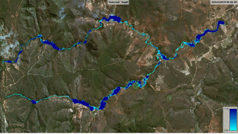
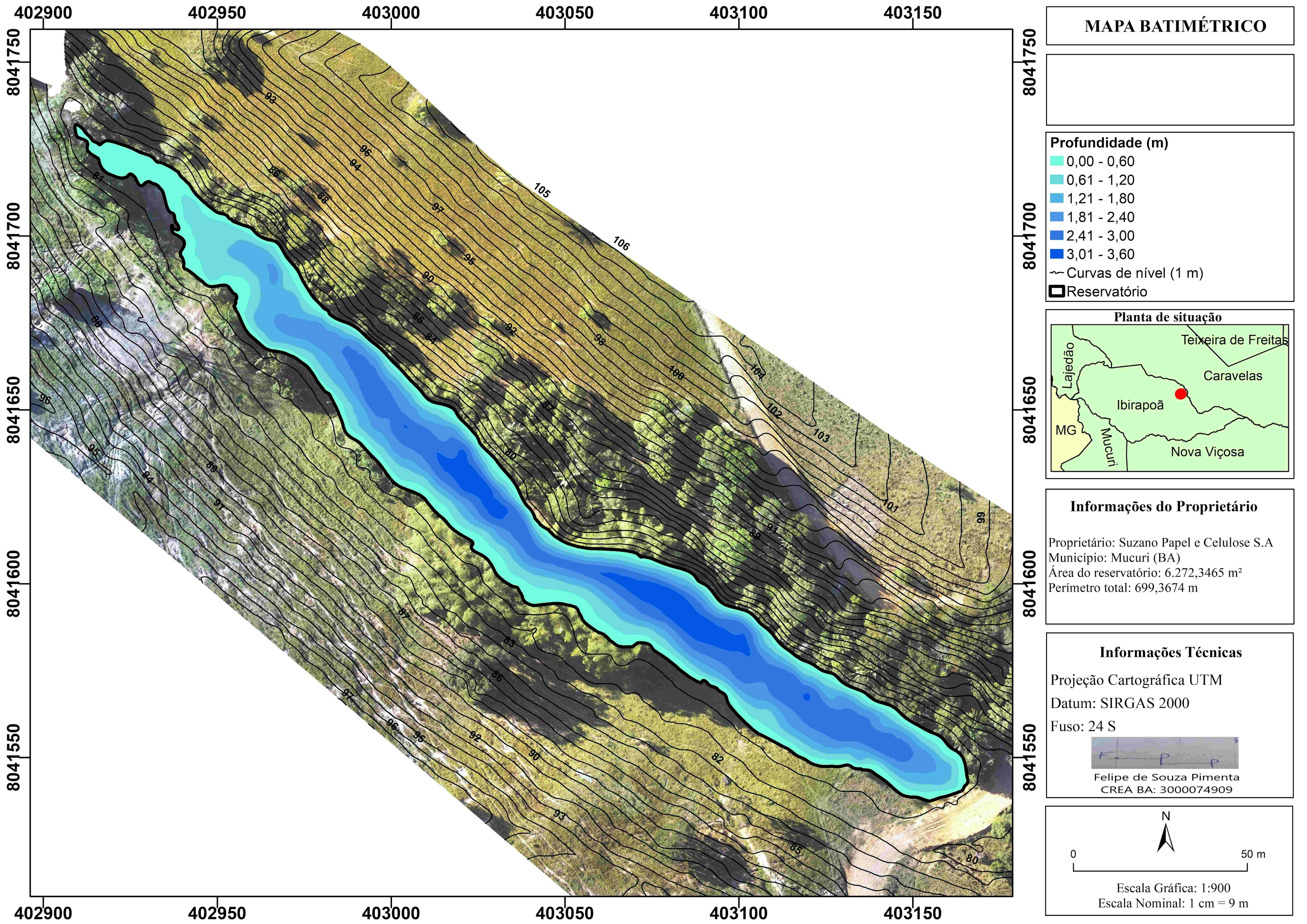
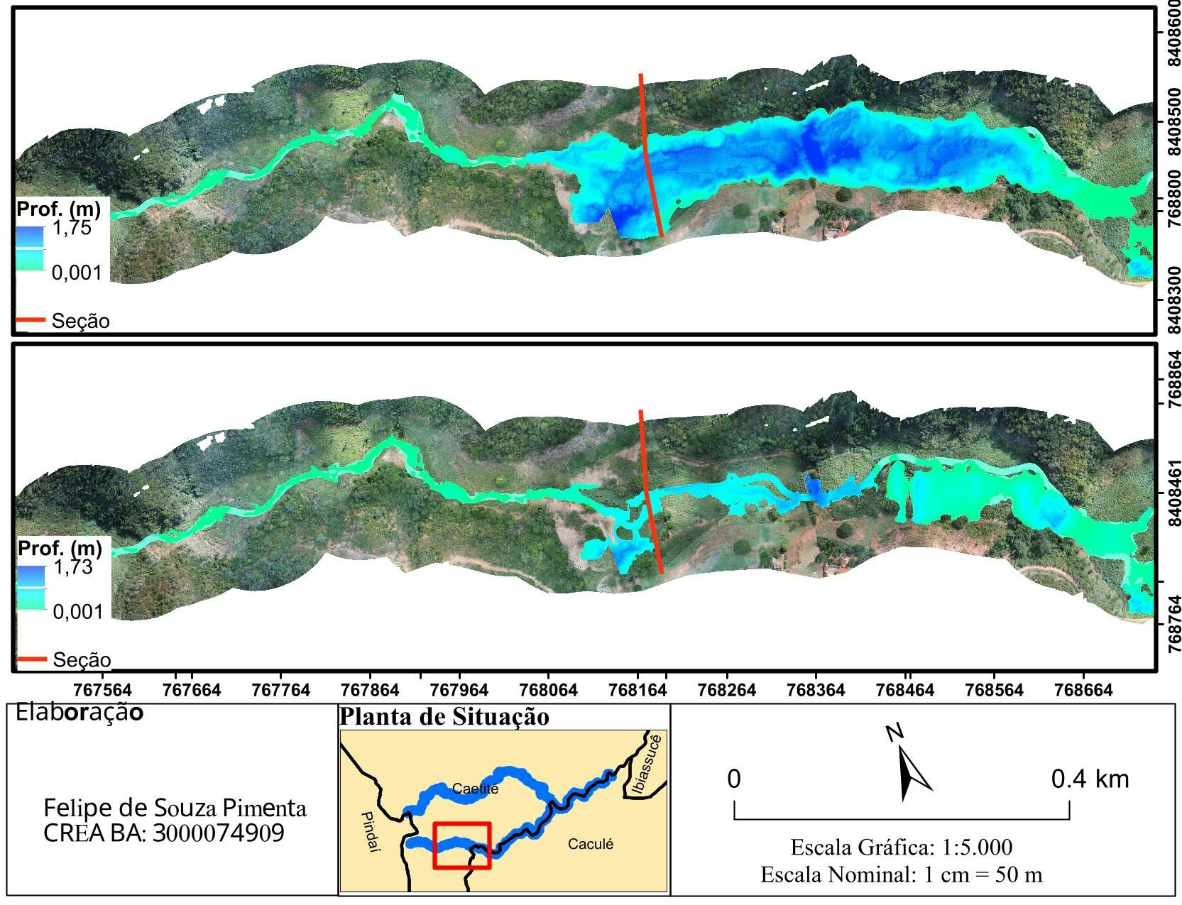
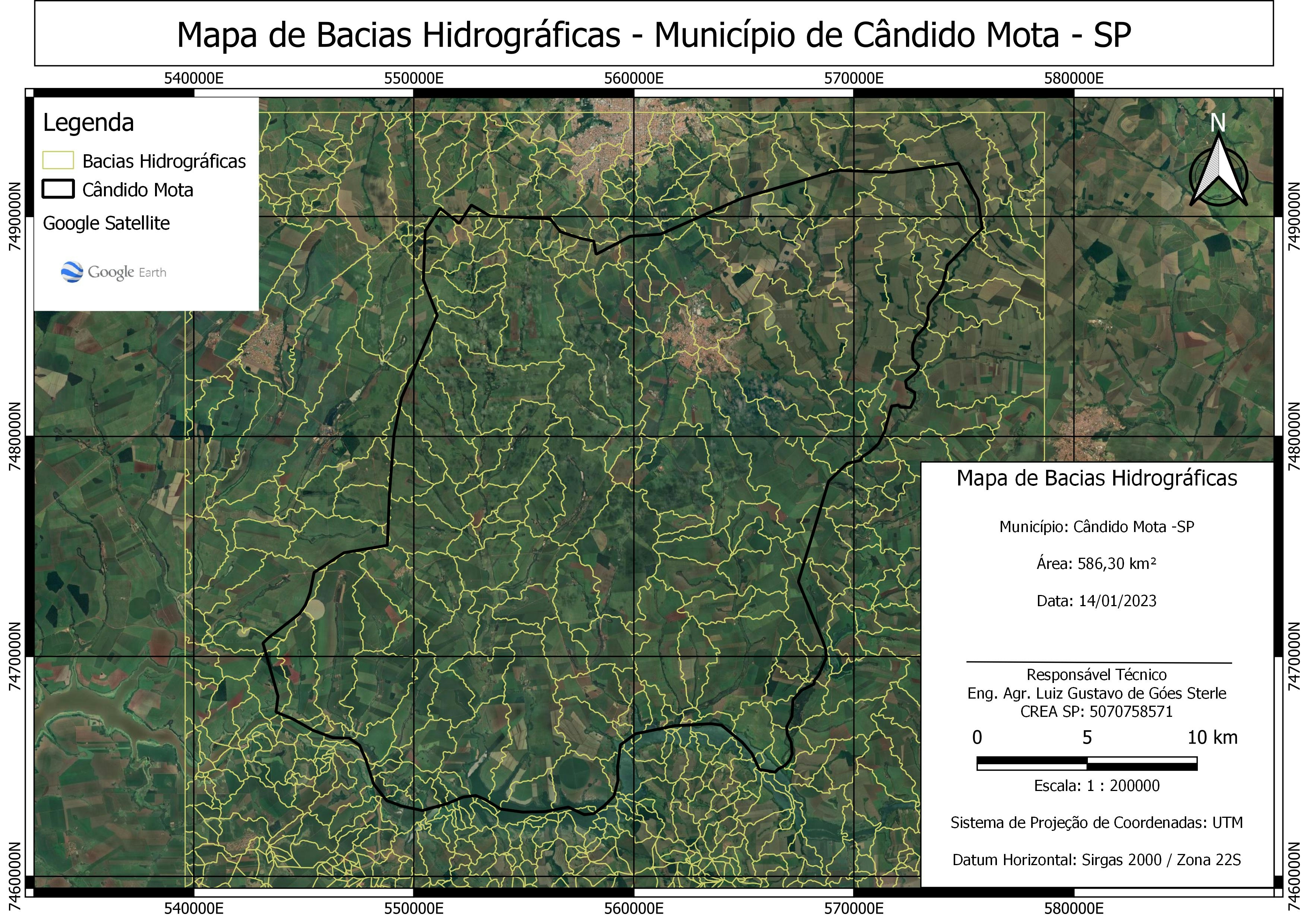
Modelagem Hidrodinâmica de cursos d'água

Tools used
ArcMapStatistica
Plug-ins used
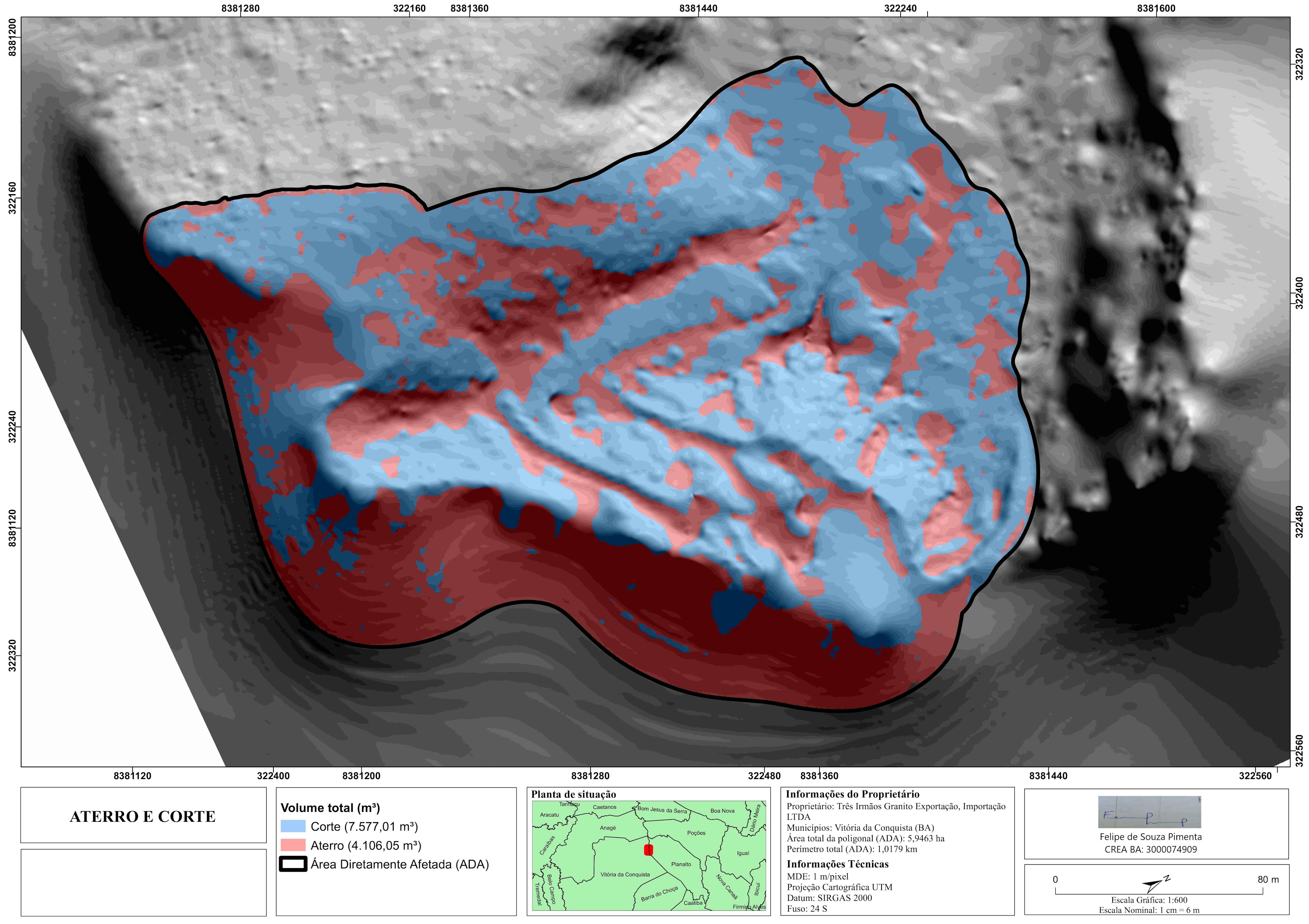
Fuzzy OverlaySpatial analystSpatial JoinWeighted Overlay
tags
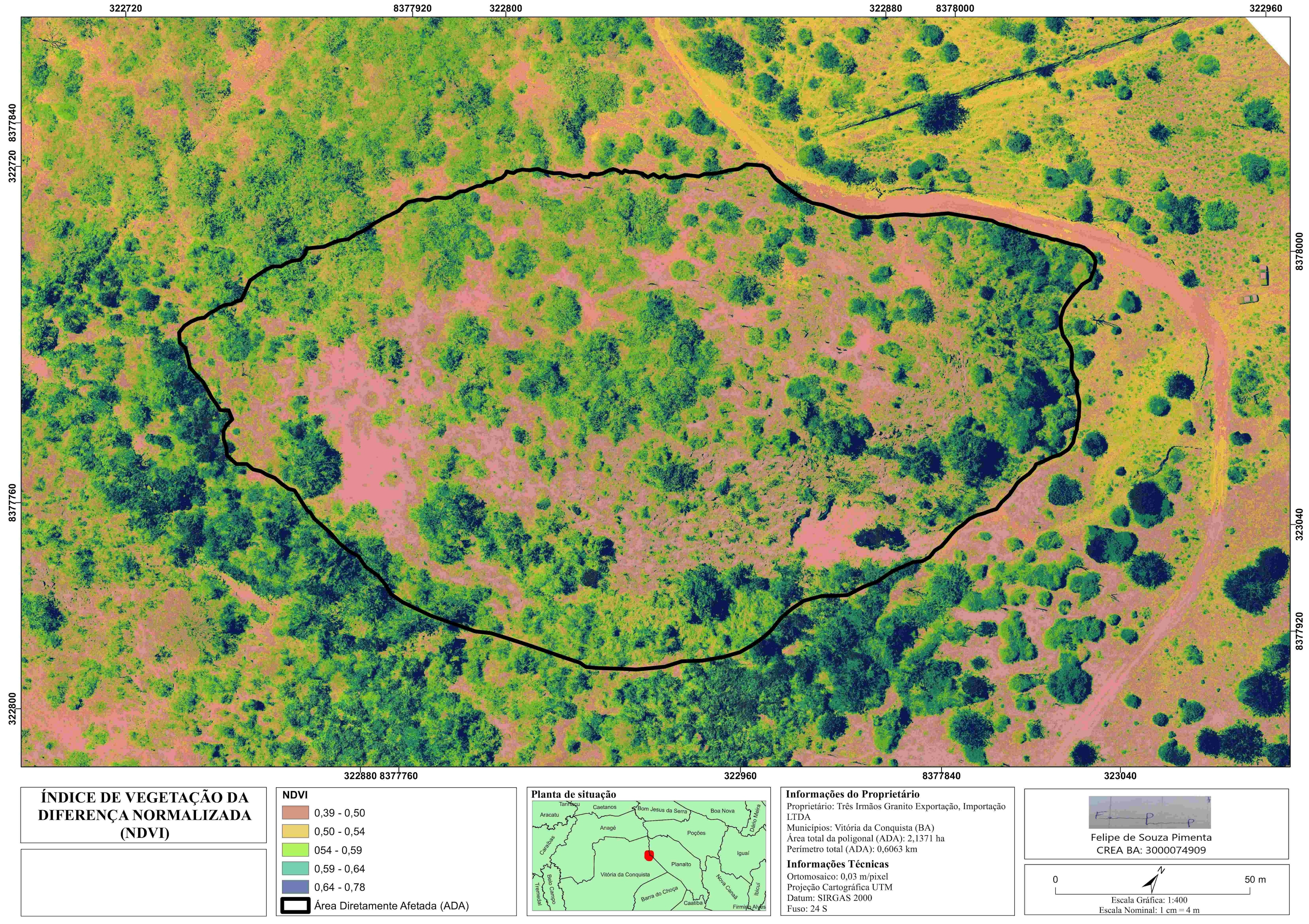
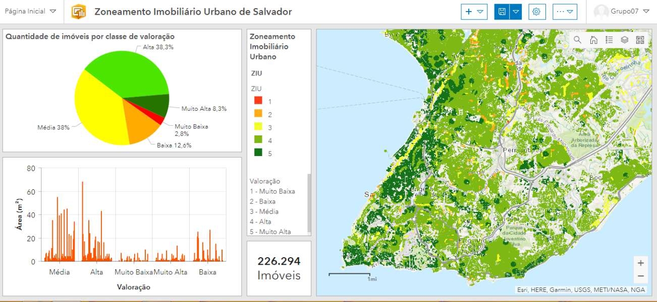
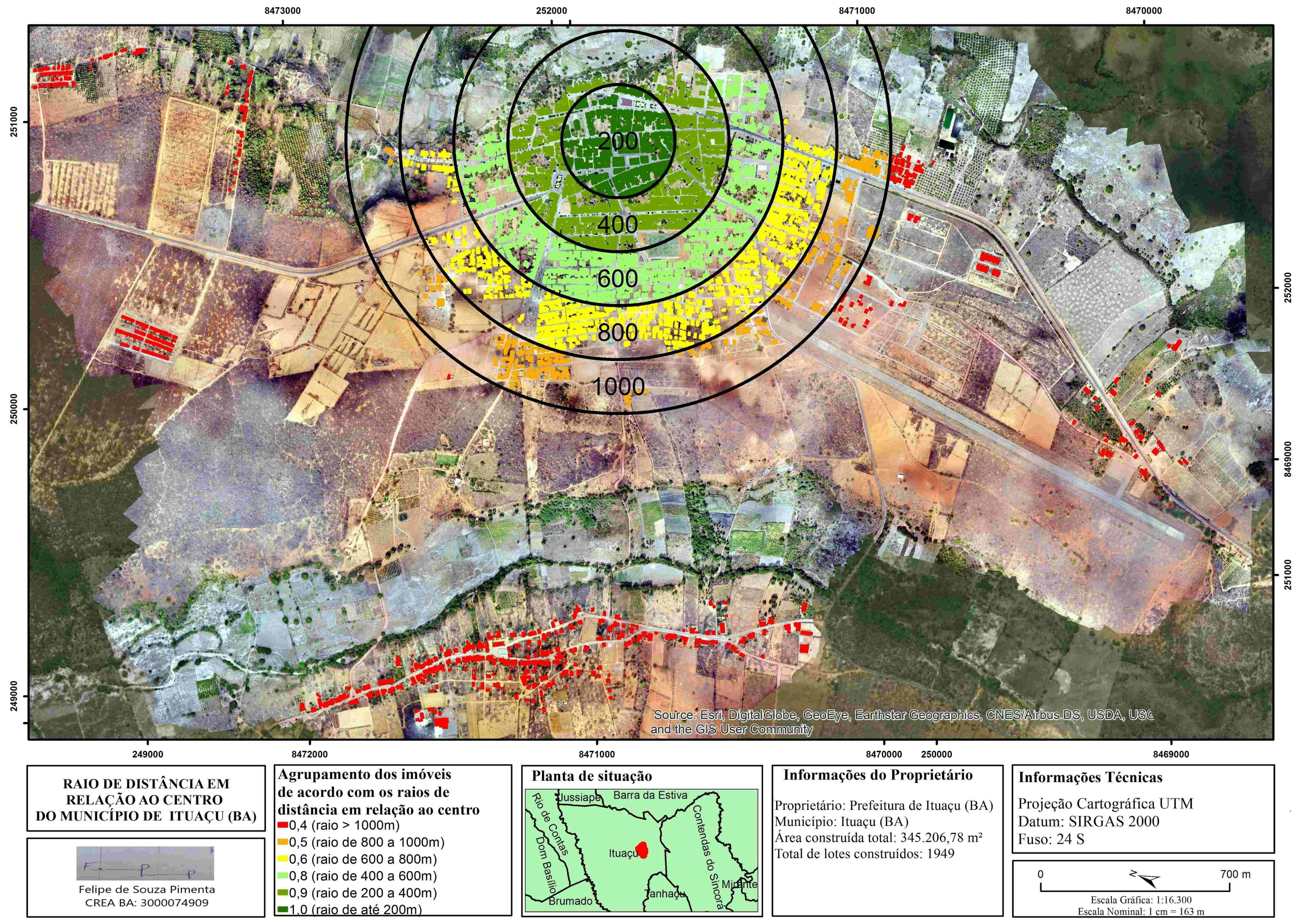
Análise multicritérioGISIBGE
More by Felipe Pimenta

You might also like


.svg "Keran Nkongolo")


Join the community!
We're a place where geospatial professionals showcase their works and discover opportunities.