
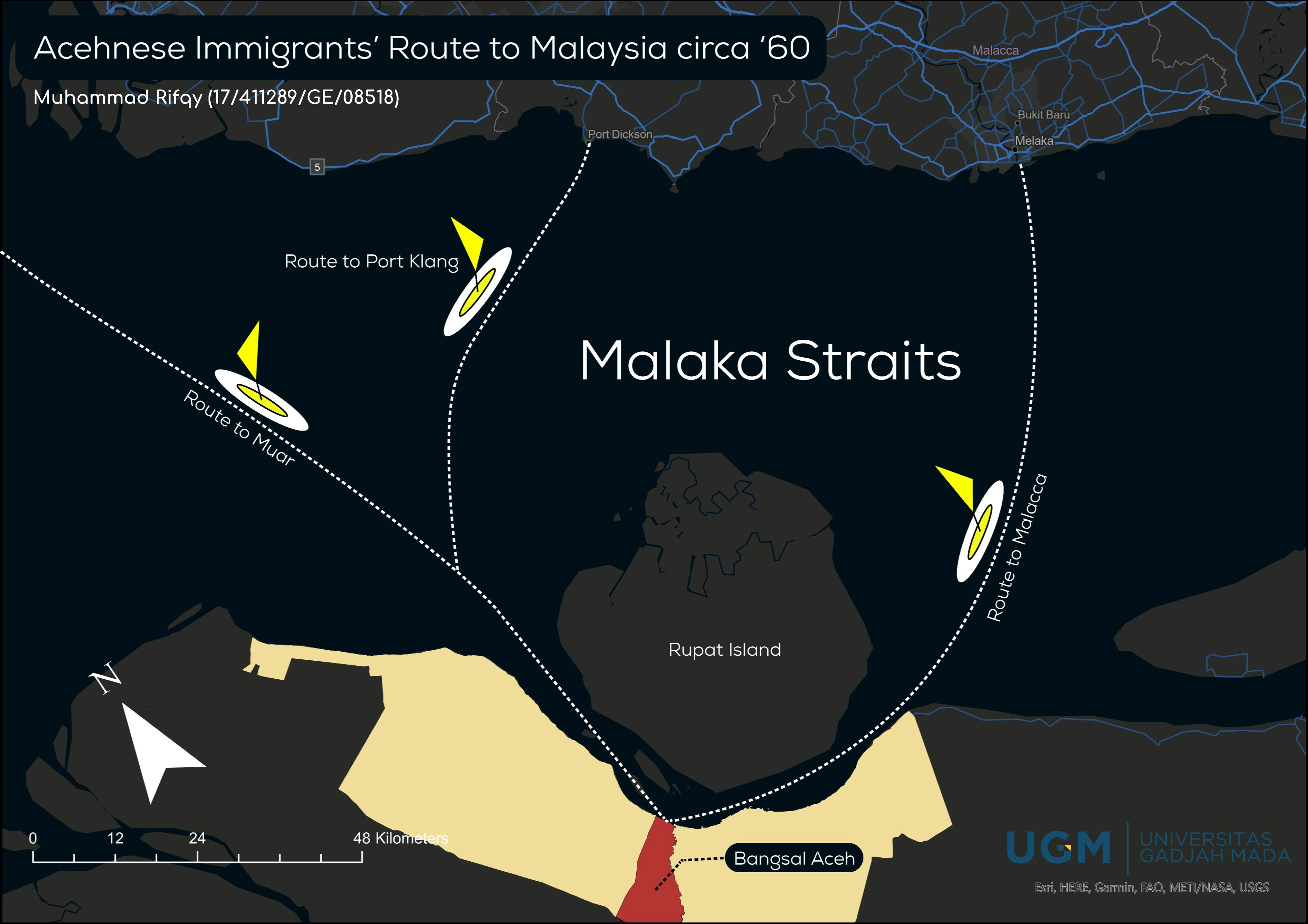
this map was made to reconstruct the route that the immigrants took to Malaysia in the period time of 60s. not the best map that could reconstruct correctly due to the insufficient data
Acehnese Immigrants' Route to Malaysia
Tools used
Adobe IllustratorGoogle MapQGIS
Plug-ins used
prettymap
tags
Locationmap design#mappychallengemodern map
More by Muhammad Rifqy
![Lexical Map of [Shovel] in Malay Lang](/_next/image?url=https%3A%2F%2Fstorage.googleapis.com%2Fspatialnodefiles%2Fprojects%2FPetaDialekCangkul1_9000385.png&w=3840&q=100)
1_1537132.png&w=3840&q=100)
You might also like
.png&w=3840&q=100)


Join the community!
We're a place where geospatial professionals showcase their works and discover opportunities.