
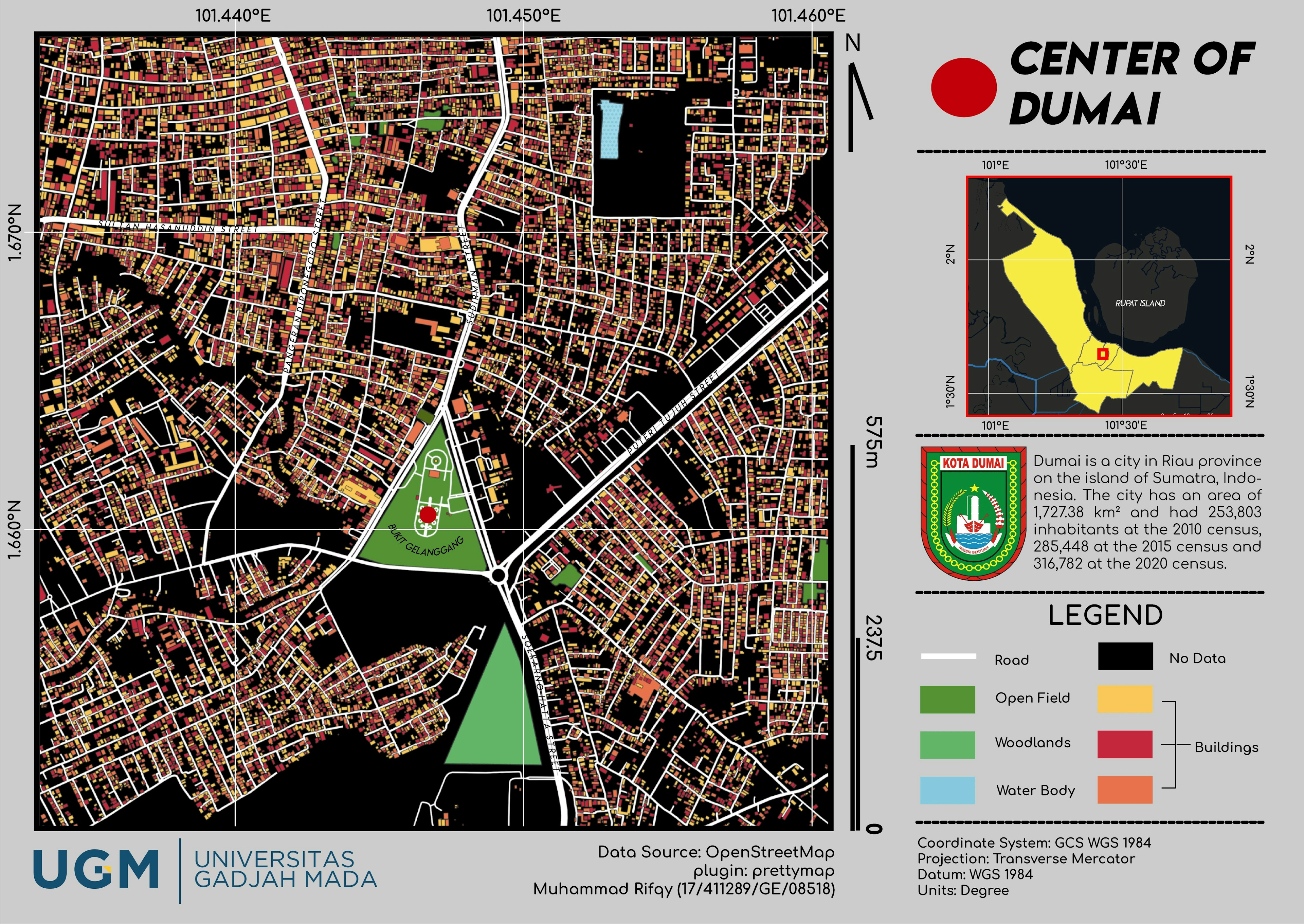
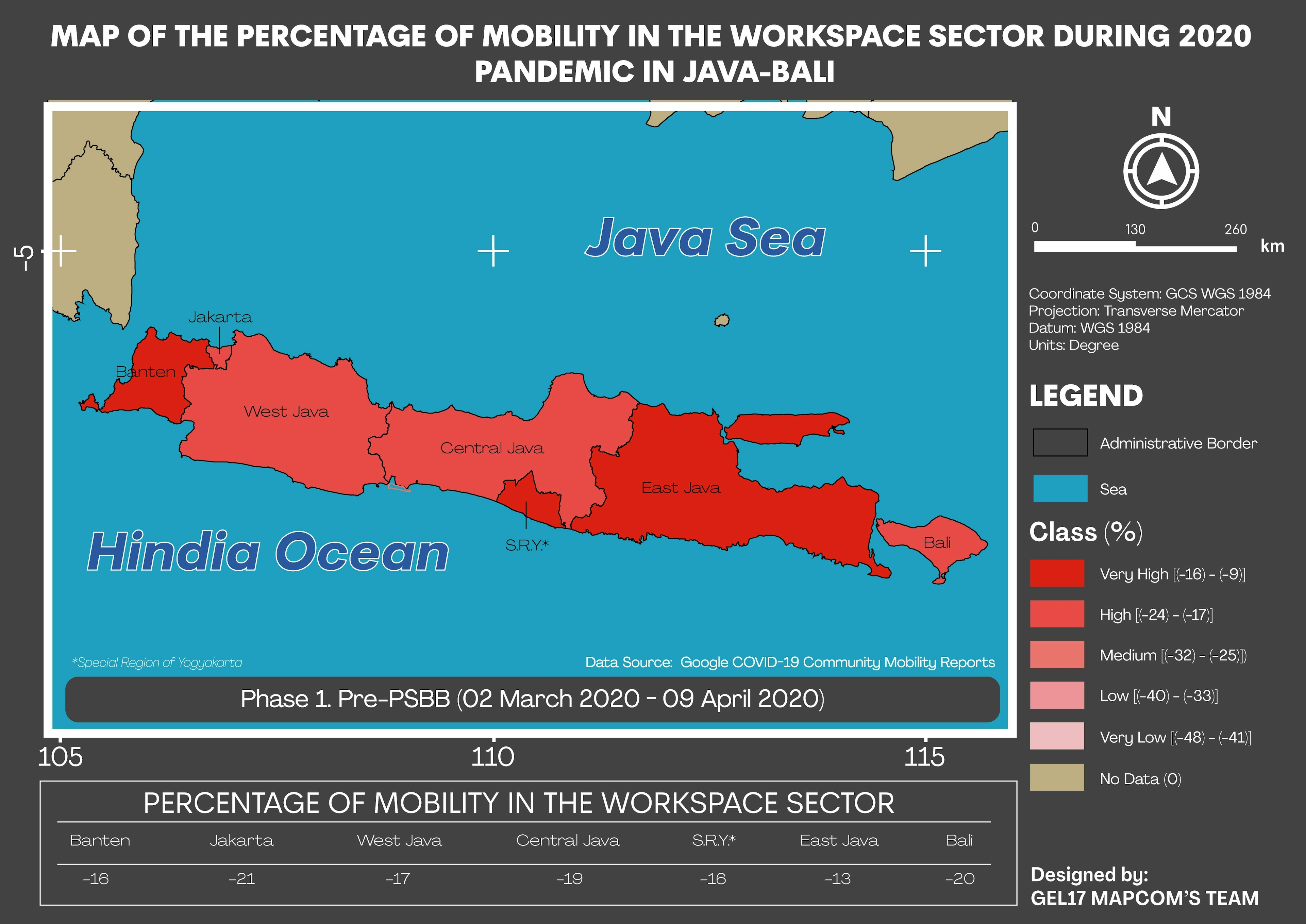
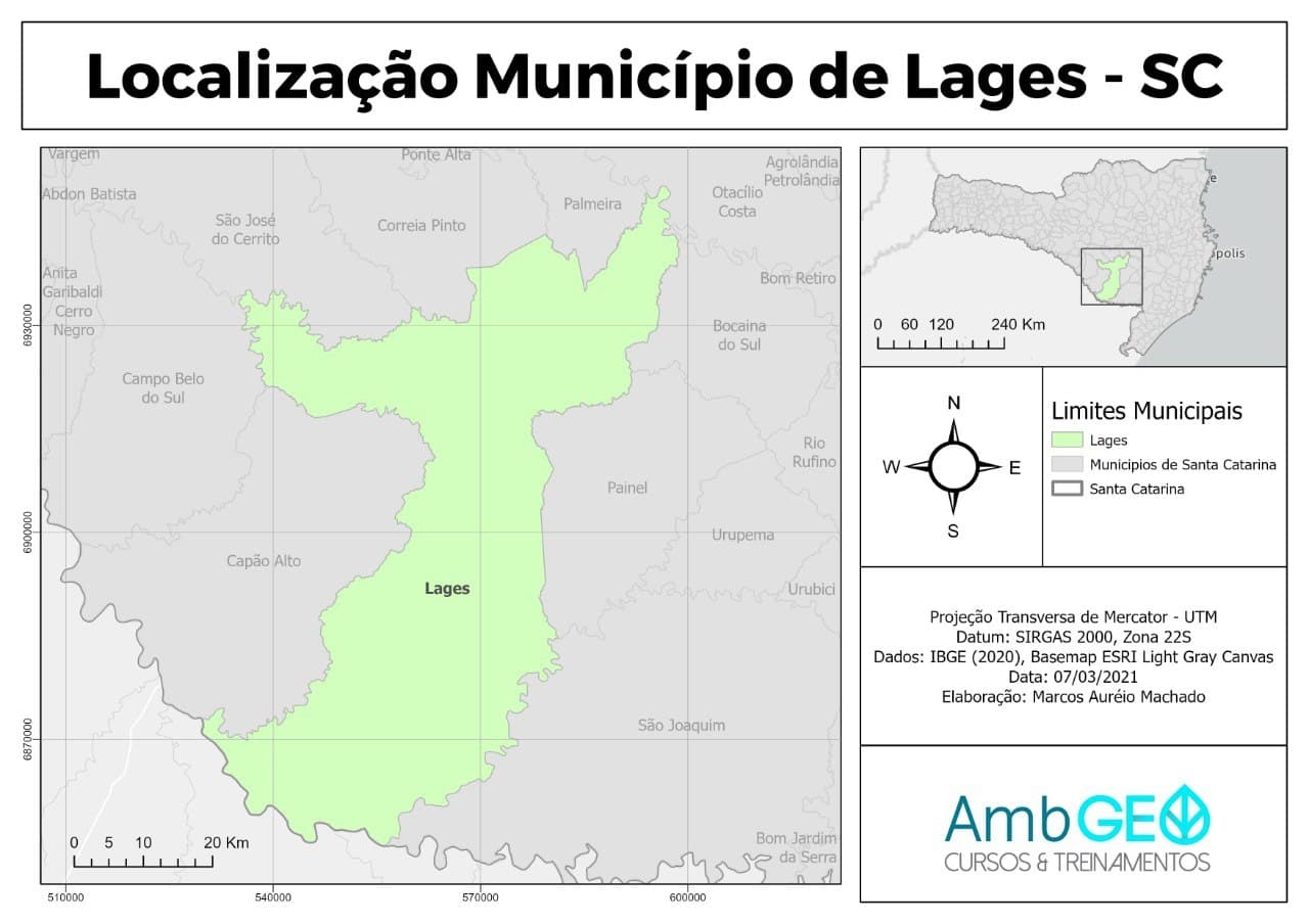
Made this map by using the prettymap apps to extract the OpenStreetMap data into .png data
Center of Dumai
Tools used
Adobe IllustratorGoogle MapQGIS
Plug-ins used
prettymap
tags
cityLocationmap design#mappychallenge
More by Muhammad Rifqy
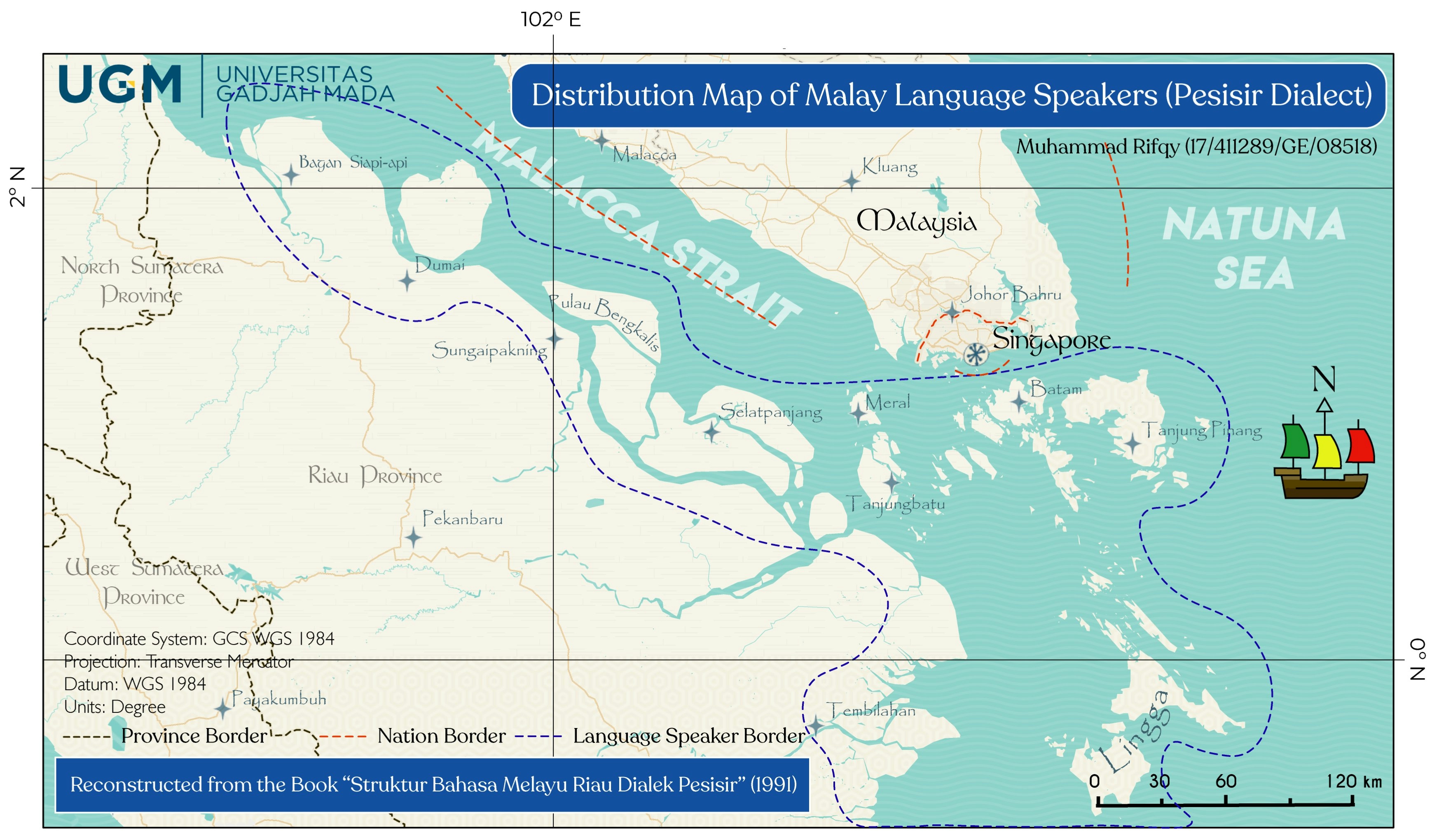
![Lexical Map of [Shovel] in Malay Lang](/_next/image?url=https%3A%2F%2Fstorage.googleapis.com%2Fspatialnodefiles%2Fprojects%2FPetaDialekCangkul1_9000385.png&w=3840&q=100)
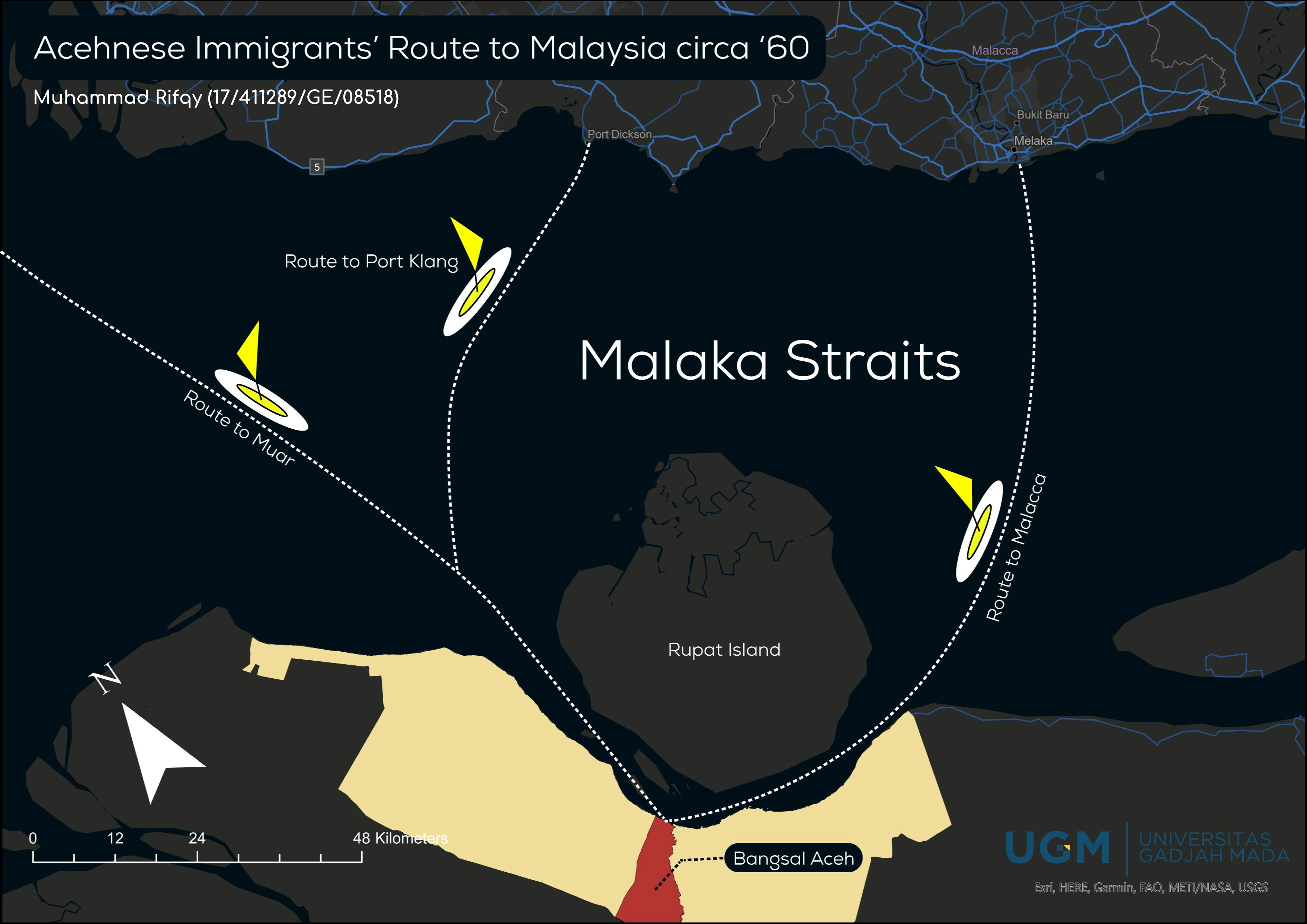
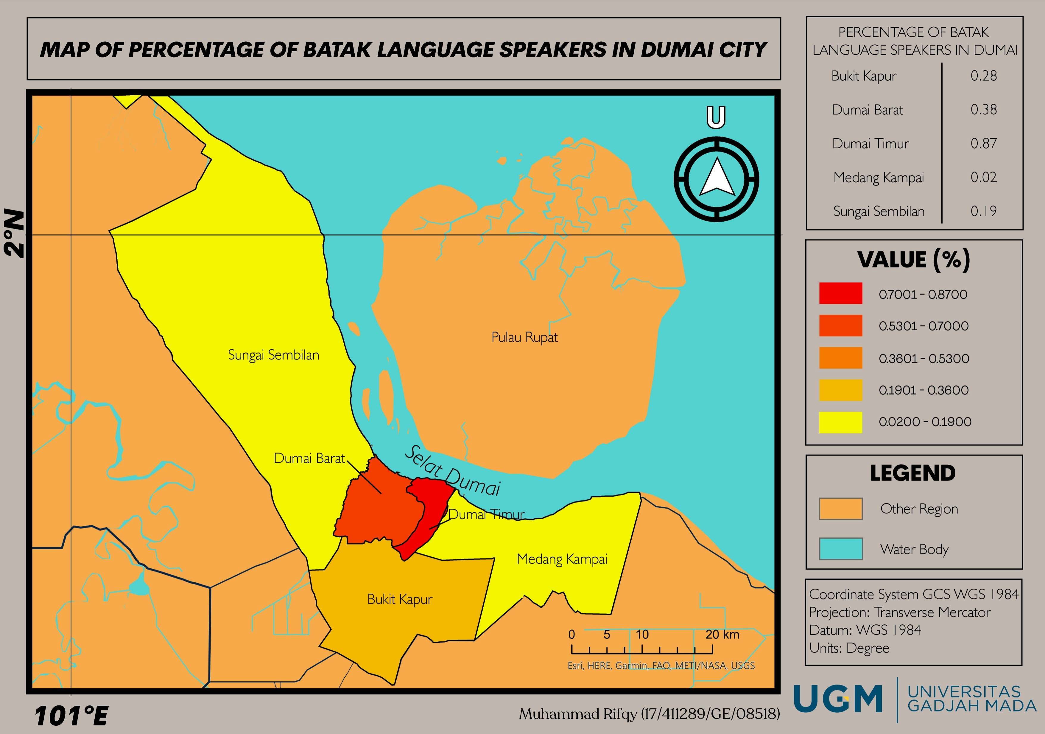
1_1537132.png&w=3840&q=100)
You might also like


Join the community!
We're a place where geospatial professionals showcase their works and discover opportunities.