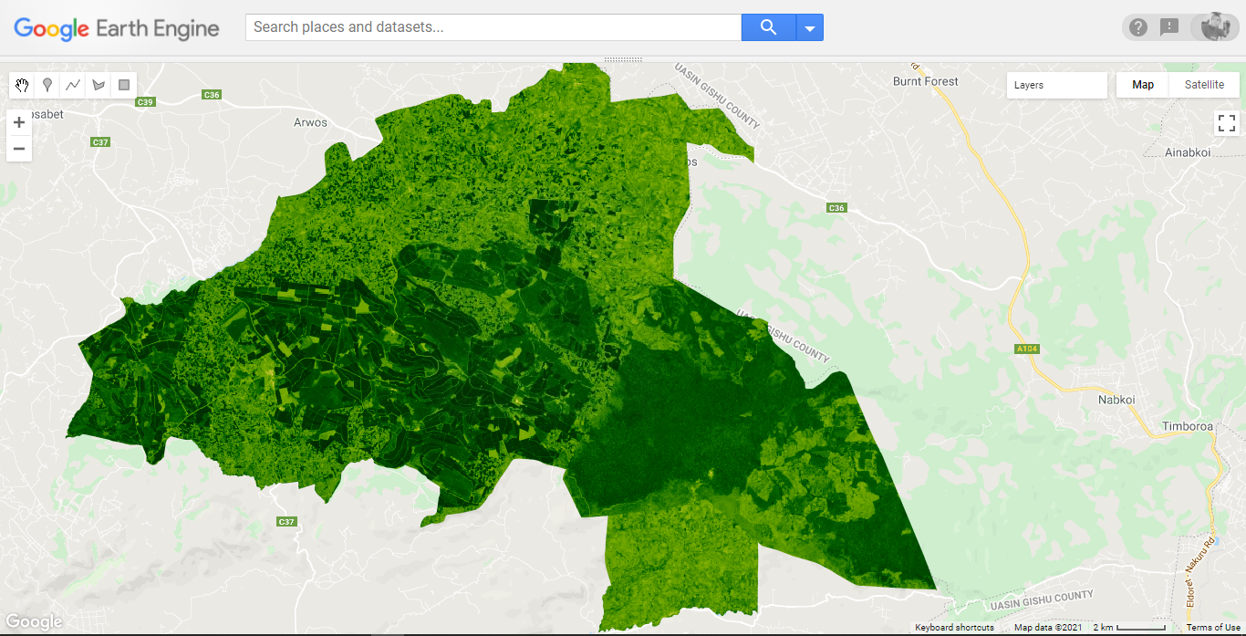
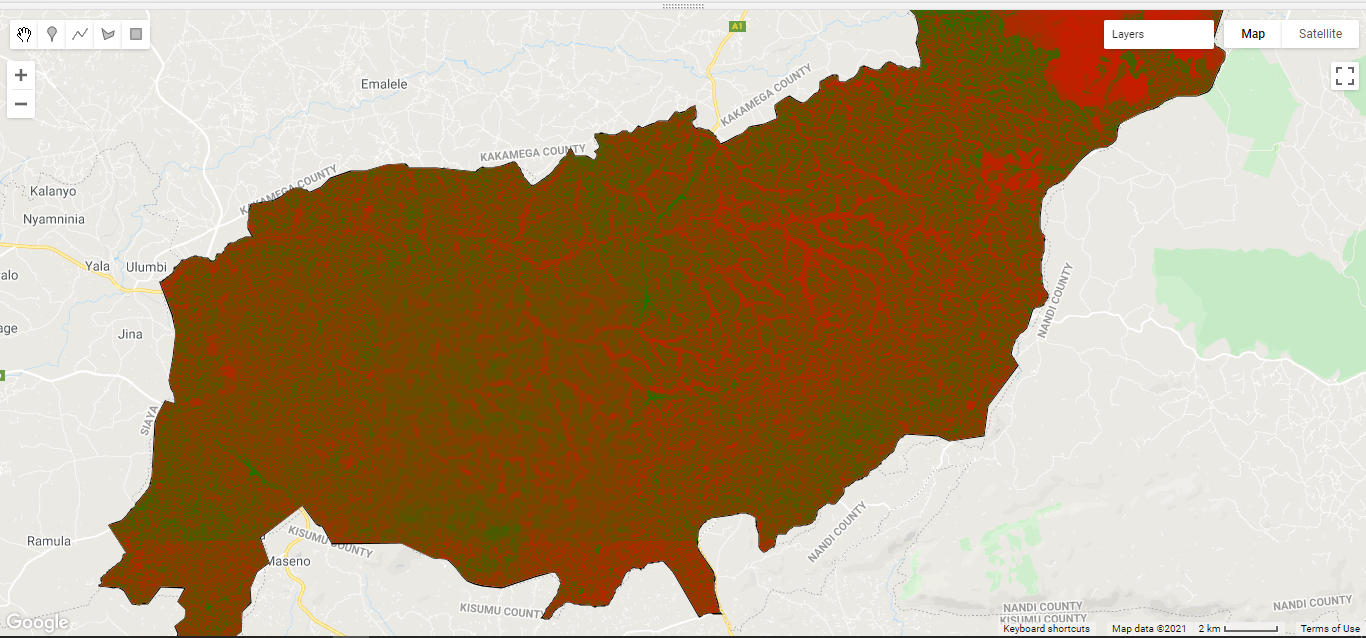
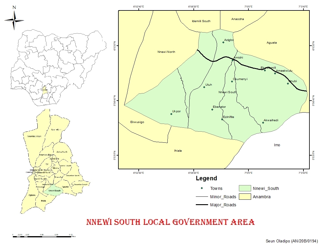
Sign up or log in to your Spatialnode account.

Takes less than a few seconds.

Nandi County NDVI

Joseph Thuha
Joseph Thuha•

November 13, 2021

Nandi County NDVI
Demo

Tools used

Google Earth Engine(GEE)Javascript

Plug-ins used

Google Earth Engine(GEE)Javascript

tags

Google Earth Engine(GEE)Javascript

More by Joseph Thuha

How to use proportional circles in Leaflet
324
How can you create your own Django Applications leveraging on data from Google Earth Engine?
How can you create your own Django Applications leveraging on...
805
REST APIs to create standalone app
611
Vihiga County NDVI
Vihiga County NDVI
833
Using Nominatim to Route in Leaflet
509
Locate Countries Game.
908
How to use the MarkerCluster plugin in LeafletJS
325

You might also like

People Mover Aeroporto de Guarulhos GRU
Matheus Amaral Prates
People Mover Aeroporto de Guarulhos GRU
Matheus Amaral Prates
63
Elevation Map Bay of Bengal (Bangladesh)
Loviena Garcia
Elevation Map Bay of Bengal (Bangladesh)
Loviena GarciaPro
13
Mapa de caminhamento ADA e AID
Lucas Moreira
Mapa de caminhamento ADA e AID
Lucas Moreira
14
Environmental Auditing
omoogun bankole
Environmental Auditing
omoogun bankole
2
Jump Watershed Lithology
Isaac Ajayi
Jump Watershed Lithology
Isaac AjayiPro
12
Vulnerabilidade Ambiental
DOUGLAS HENRIQUE MANOEL PEREIRA
Vulnerabilidade Ambiental
DOUGLAS HENRIQUE...
8
Correlation between LST and NDVI
Ojo Aladesola Monica
Correlation between LST and NDVI
Ojo Aladesola Monica
35
Size of deforestation patches
Rayane Pacheco
Size of deforestation patches
Rayane Pacheco
81
Uranium mines in Niger (2021)
Guy-Arnaud Puthomme
Uranium mines in Niger (2021)
Guy-Arnaud Puthomme
12
PointCloud Web Platform
Efstathios Lymperis
PointCloud Web Platform
Efstathios Lymperis
62
Mapa artístico - Belém do Pará, Brasil
Taís Alcântara
Mapa artístico - Belém do Pará, Brasil
Taís Alcântara
26
Digital Elevation Model of Oyo State.
Olawuyi Abolade Pelumi
Digital Elevation Model of Oyo State.
Olawuyi Abolade Pelumi
32

Join the community!

We're a place where geospatial professionals showcase their works and discover opportunities.

Sign Up for free