Sign up or log in to your Spatialnode account.

Takes less than a few seconds.

Vihiga County NDVI

Joseph Thuha
Joseph Thuha•

November 15, 2021

Vihiga County NDVI

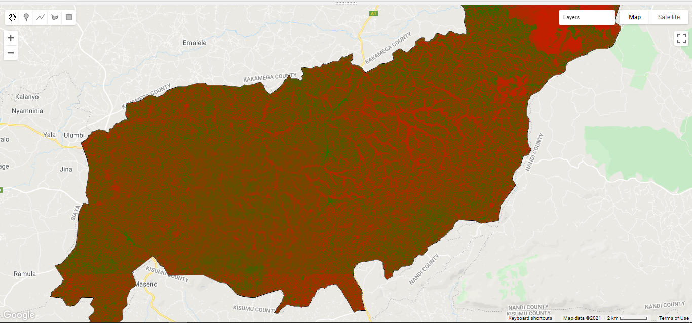
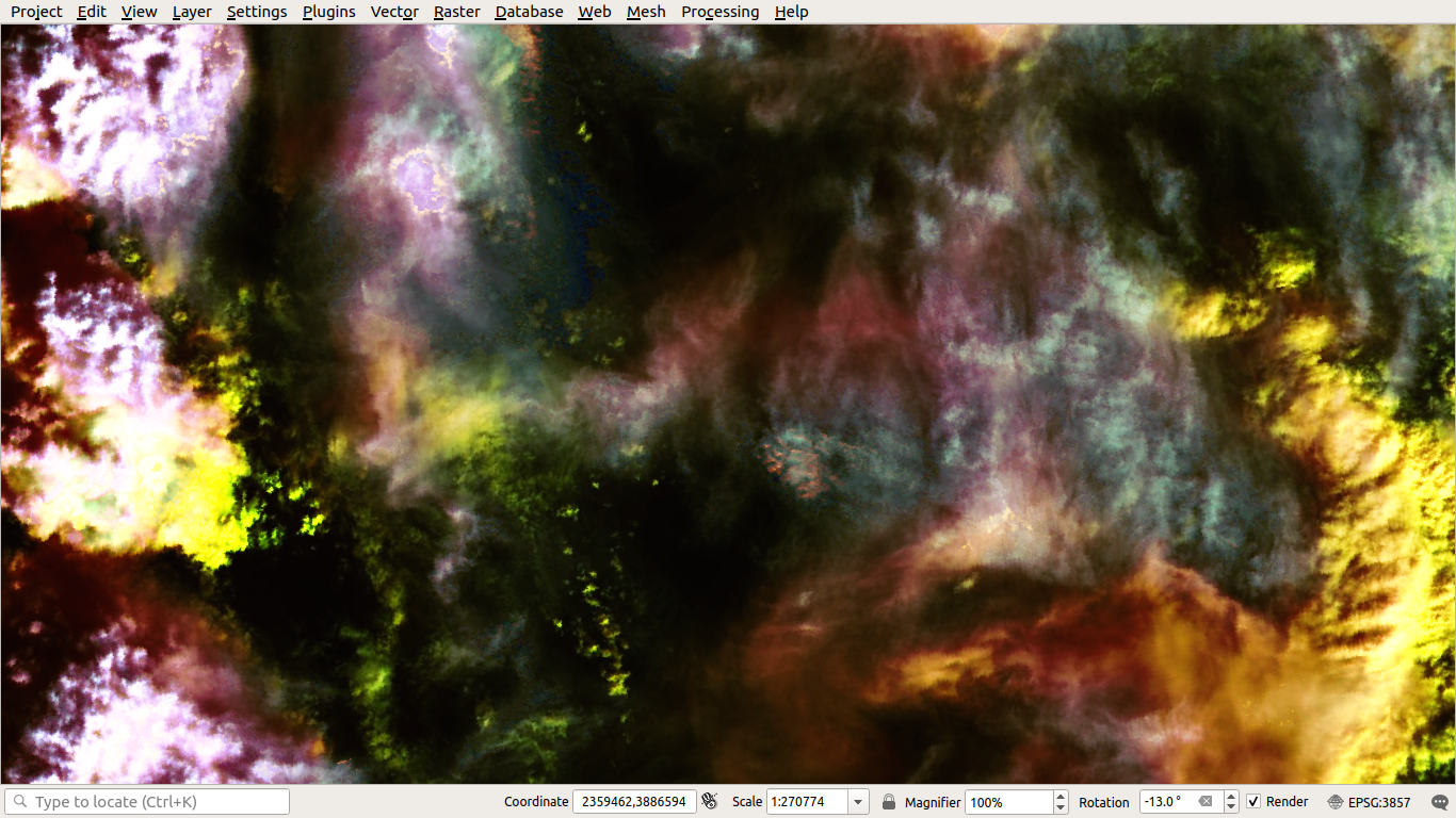
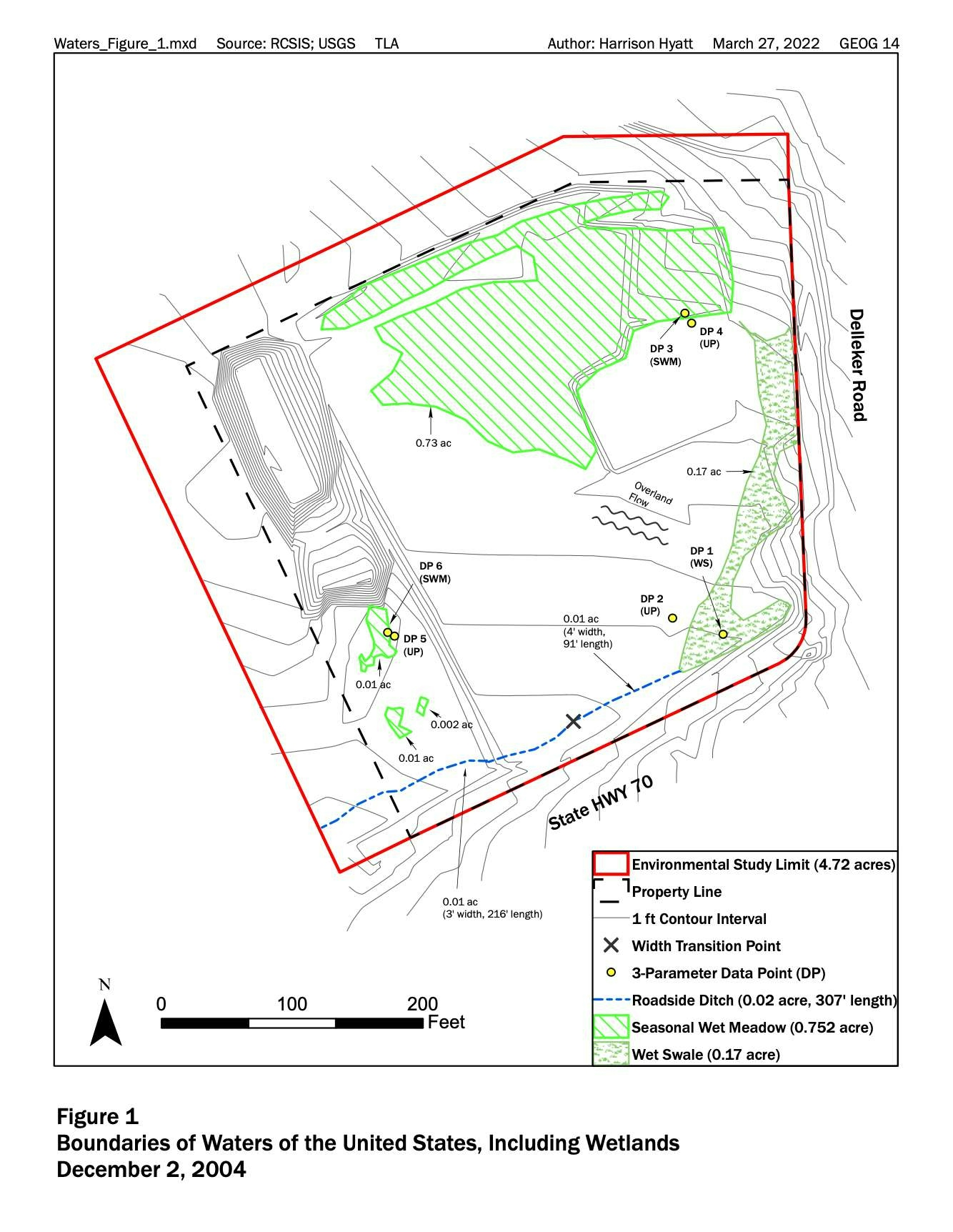
This is a visualization of Vihiga County NDVI done using Google Earth Engine. The "Redder" the pixel, the more vegetation there is.

Demo

Tools used

Google Earth Engine(GEE)Javascript

Plug-ins used

GEE

tags

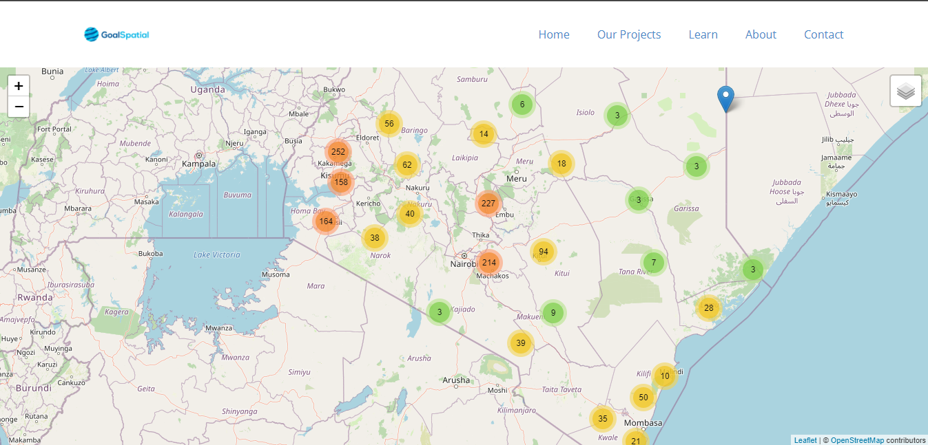
GeodjangoJavascriptLeafletJSMarkerClusters

More by Joseph Thuha

How can you create your own Django Applications leveraging on data from Google Earth Engine?
How can you create your own Django Applications leveraging on...
807
Nandi County NDVI
Nandi County NDVI
621
Locate Countries Game.
909
REST APIs to create standalone app
611
How to use proportional circles in Leaflet
324
How to use the MarkerCluster plugin in LeafletJS
325
Using Nominatim to Route in Leaflet
516

You might also like

Carta Hipsométrica
RODRIGO DE ARAUJO BELOTE
Carta Hipsométrica
RODRIGO DE...
20
Visualizing Patch Metrics with Fragstats
Ali Mulla
Visualizing Patch Metrics with Fragstats
Ali Mulla
33
Acehnese Immigrants' Route to Malaysia
Muhammad Rifqy
Acehnese Immigrants' Route to Malaysia
Muhammad Rifqy
133
Mapeamento dos Membros do Campus Online
SUSANE LAIS DA SILVA CHAVES
Mapeamento dos Membros do Campus Online
SUSANE LAIS...
3
Health Facility Mapping and Management
Dee Geodata Sage
Health Facility Mapping and Management
Dee Geodata Sage
29
Citrix Cycle Raleigh Bike Share Rides
Ryan Cooper
Citrix Cycle Raleigh Bike Share Rides
Ryan Cooper
341
Impact of Ernesto Storm on Puerto Rico
Talvinder Gill
Impact of Ernesto Storm on Puerto Rico
Talvinder Gill
11
Population of South America - 4000 years
Sebastian Silva
Population of South America - 4000 years
Sebastian Silva
130
Travelling under social influence
Katalin Peter
Travelling under social influence
Katalin Peter
24
Delineations of Asa River Watershed
Emeka Ude
Delineations of Asa River Watershed
Emeka Ude
95
Quadro Natural em Chã Preta/AL
Lucas Almeida
Quadro Natural em Chã Preta/AL
Lucas Almeida
26
Vegetation Change Analysis
Kit Tompkins
Vegetation Change Analysis
Kit Tompkins
7

Join the community!

We're a place where geospatial professionals showcase their works and discover opportunities.

Sign Up for free