Sign up or log in to your Spatialnode account.

Takes less than a few seconds.

Liberty Ibadan Street Map

Emeka Ude
Emeka Ude•

November 14, 2022

Liberty Ibadan Street Map
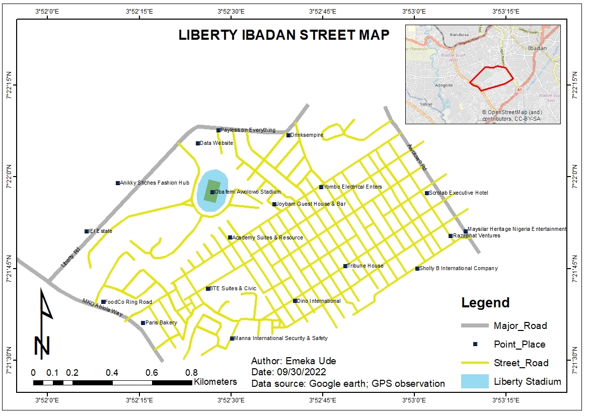
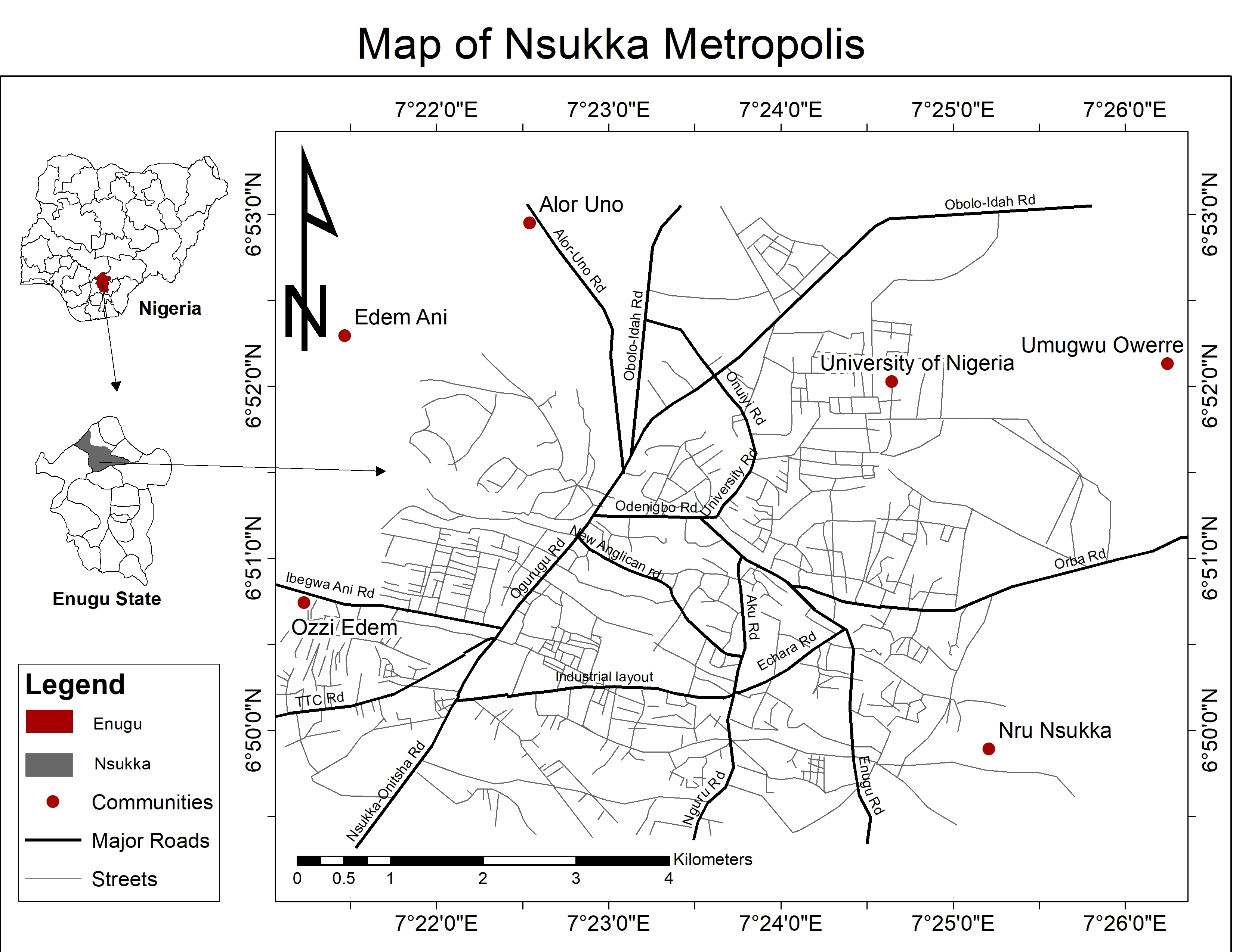
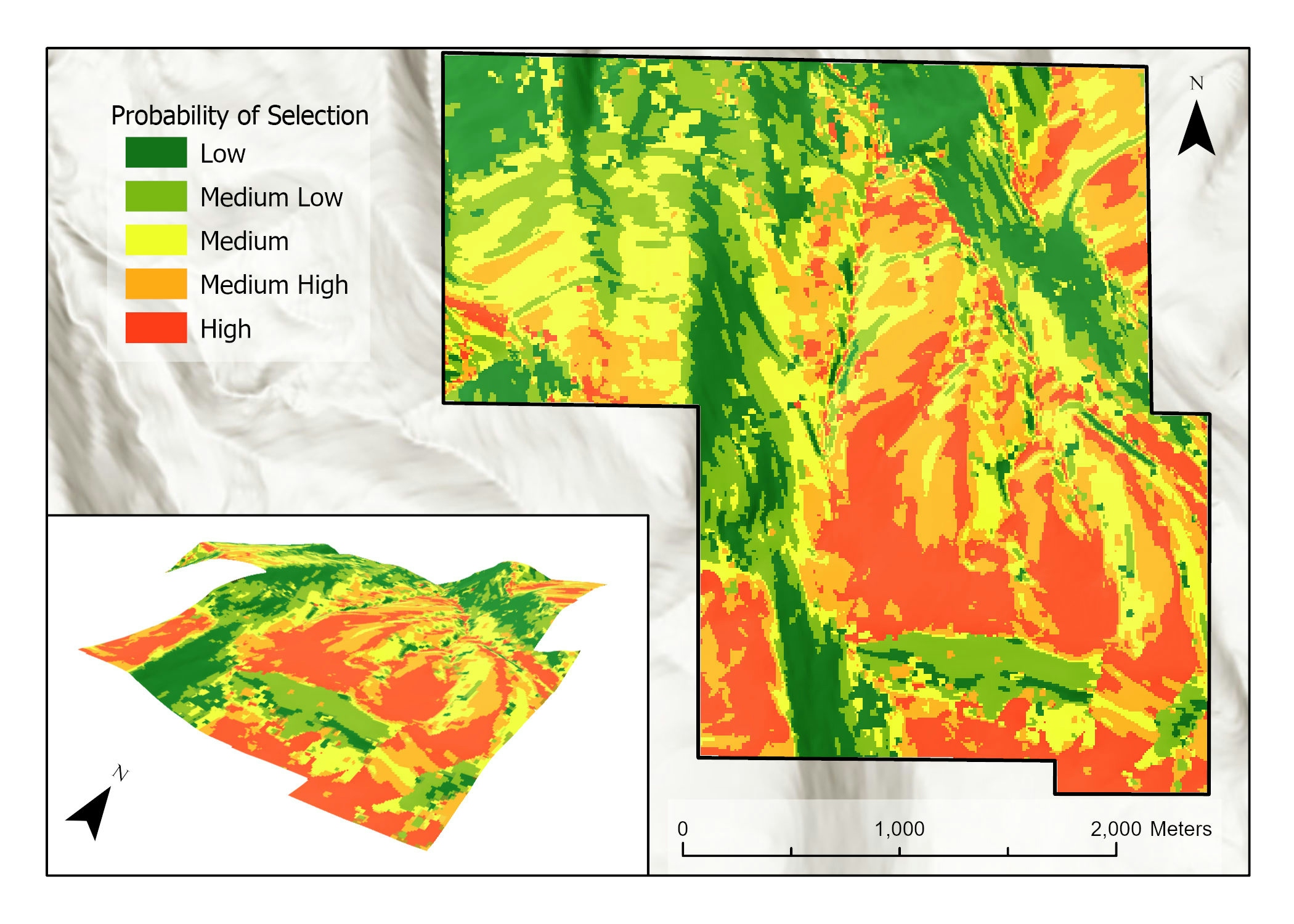
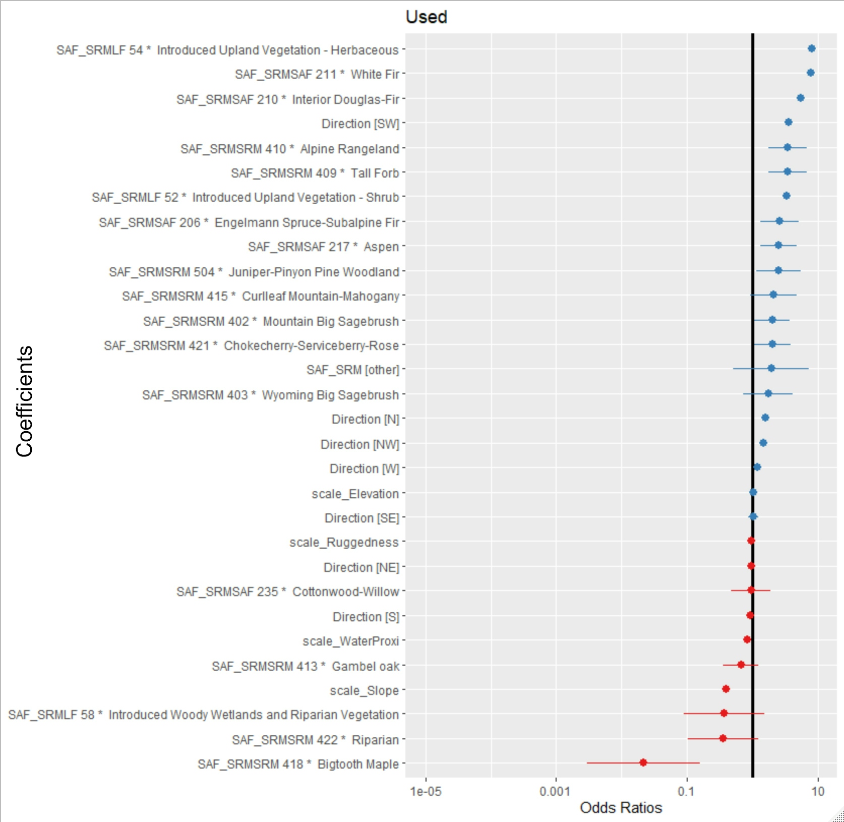
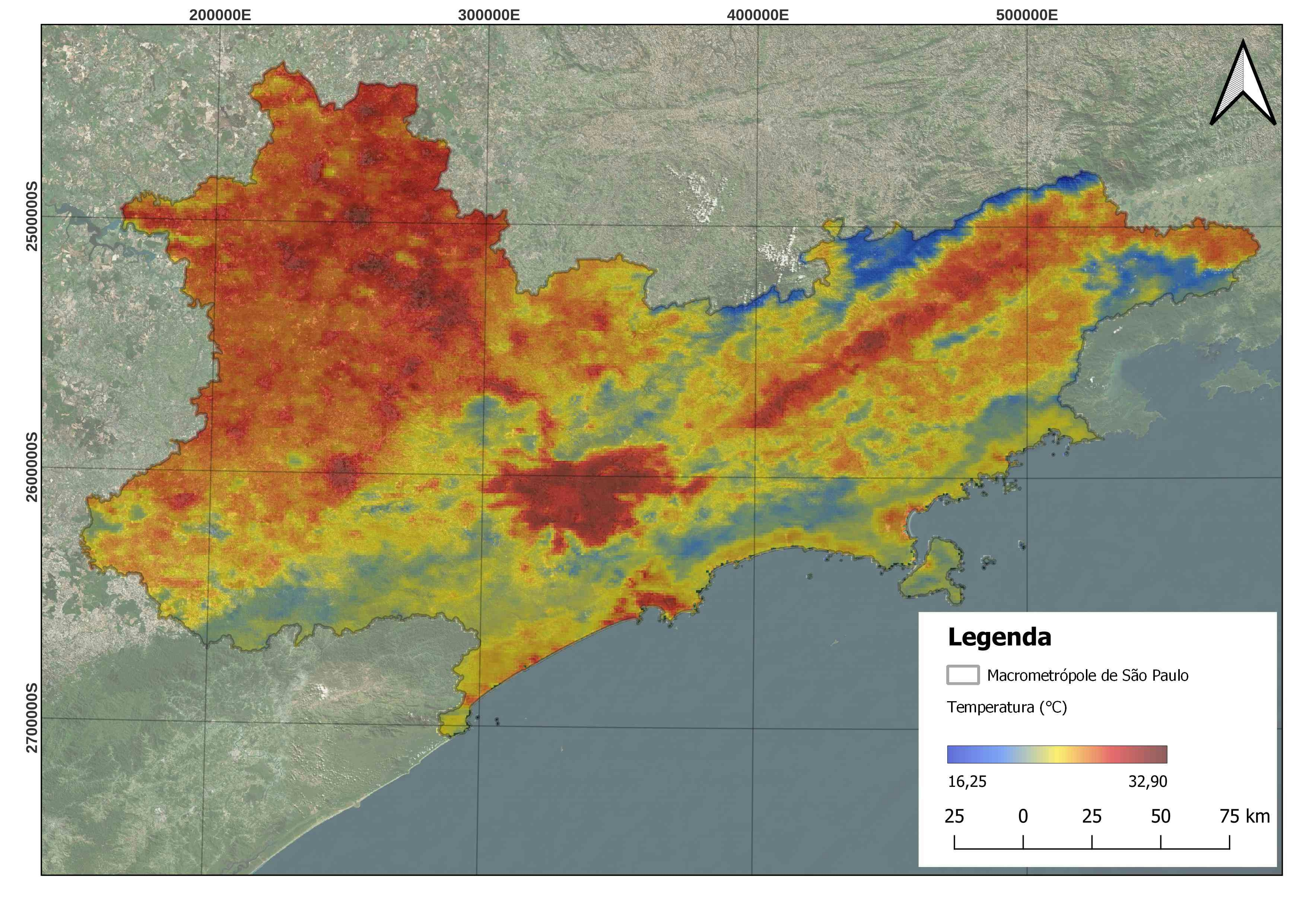
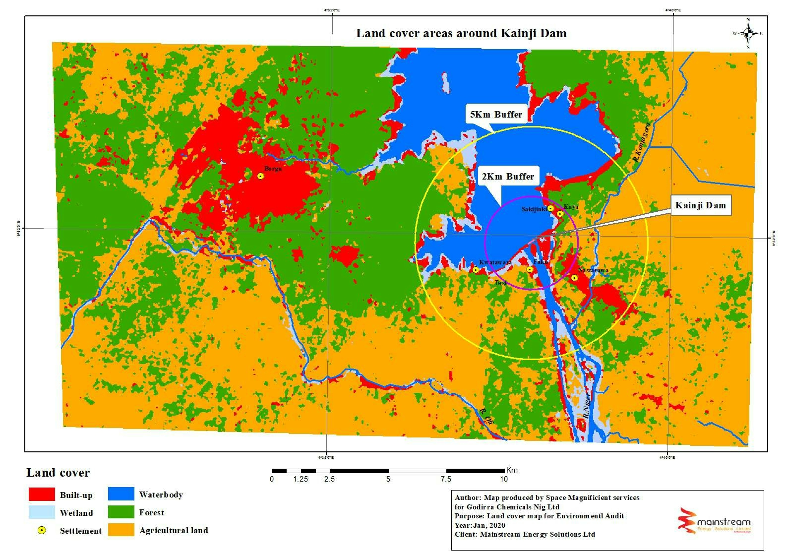
  • This project involved georeferencing of extracted google earth image and further sketching of the different location elements including roads, streets, businesses and places.

Tools used

ArcMap

Plug-ins used

ArcMap

tags

georeferencingLocationroad networks

More by Emeka Ude

Topographic Map of Obukpa
145
Traverses of Geophysical Survey, Unilag
15
Topographical Map of Lagos Mainland
104
Elevation Map of Abakaliki Nigeria
57
Hourly Ozone Distribution in California
74
Geochemical Map in Southwest, Nigeria
24
Study Area Map of Nsukka Metropolis
128
Delineations of Asa River Watershed
112
Temperature Along Nigerian Coastal Line
35
Osun State elections 2022
98
EzeAni Groundwater Quality
51
Study Area in Southwest Nigeria
28

You might also like

Elizabeth Albernaz
Precipitation Isohyet Map
Elizabeth Albernaz
36
Block Group Suitability for Park
Jason Boatjri
Block Group Suitability for Park
Jason Boatjri
32
Gothenburg
miriam
Gothenburg
miriam
22
Predicting Sheep Resource Selection
Ryan Shields
Predicting Sheep Resource Selection
Ryan Shields
69
Best Routes to Multiple Fire Hydrants
Matthew Tomitz
Best Routes to Multiple Fire Hydrants
Matthew Tomitz
15
Environment of Palhoça
Lucas Eduardo Gomes
Environment of Palhoça
Lucas Eduardo Gomes
10
Temperatura da Macrometrópole da RMSP
Sidney dos Santos
Temperatura da Macrometrópole da RMSP
Sidney dos Santos
118
Land use
omoogun bankole
Land use
omoogun bankole
9
Flood hazard map
Katalin Peter
Flood hazard map
Katalin Peter
18
Northern Morocco Shaded Relief
Hamza Bouarakia
Northern Morocco Shaded Relief
Hamza Bouarakia
98
ABERDARE FOREST MONITORING 2017 to 2021
Monica Wanjiru Chuchu
ABERDARE FOREST MONITORING 2017 to 2021
Monica Wanjiru Chuchu
25
Mapa de zoneamento do bairro da Sé
Rodrigo Chemite Barbosa
Mapa de zoneamento do bairro da Sé
Rodrigo Chemite Barbosa
12

Join the community!

We're a place where geospatial professionals showcase their works and discover opportunities.

Sign Up for free