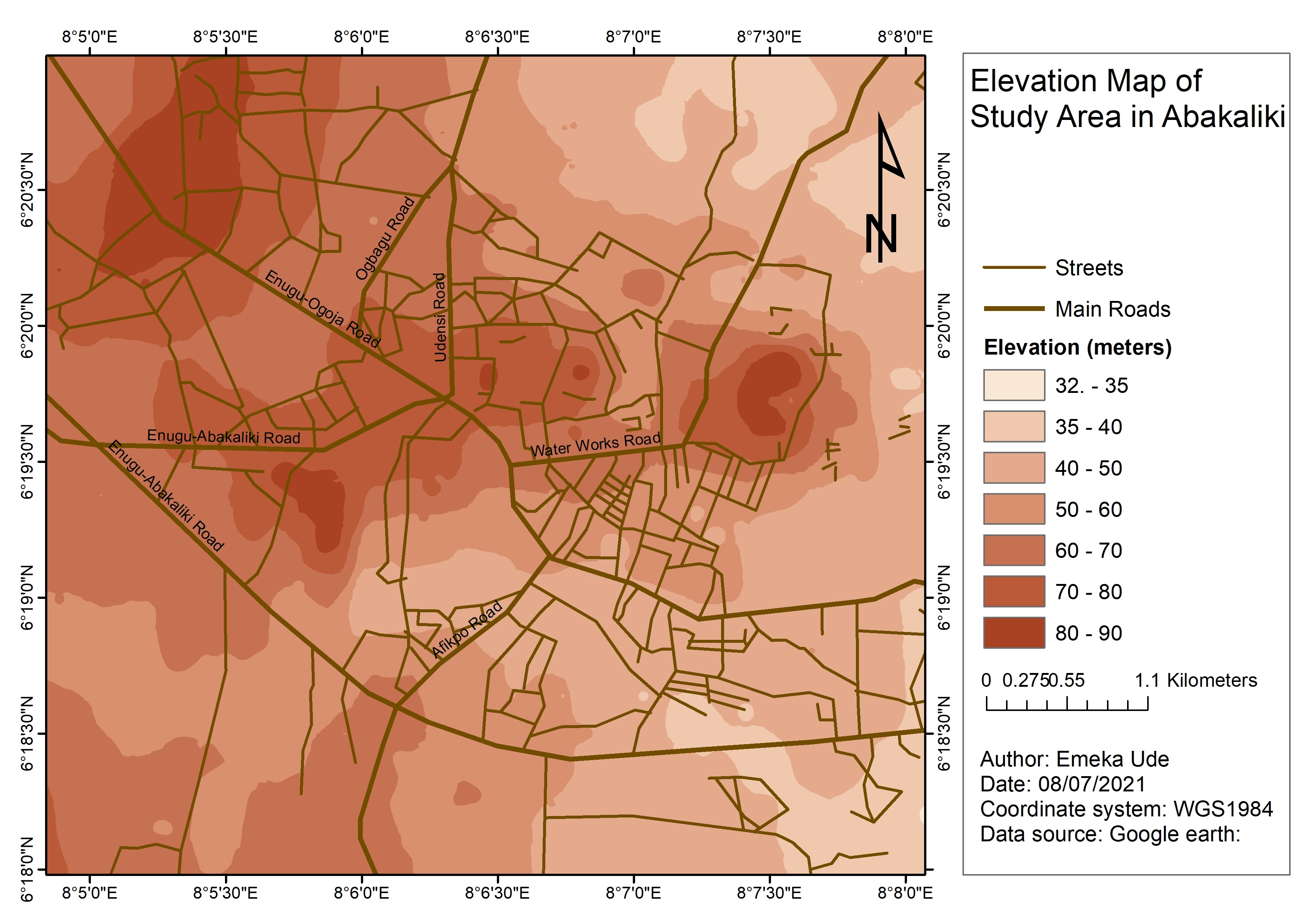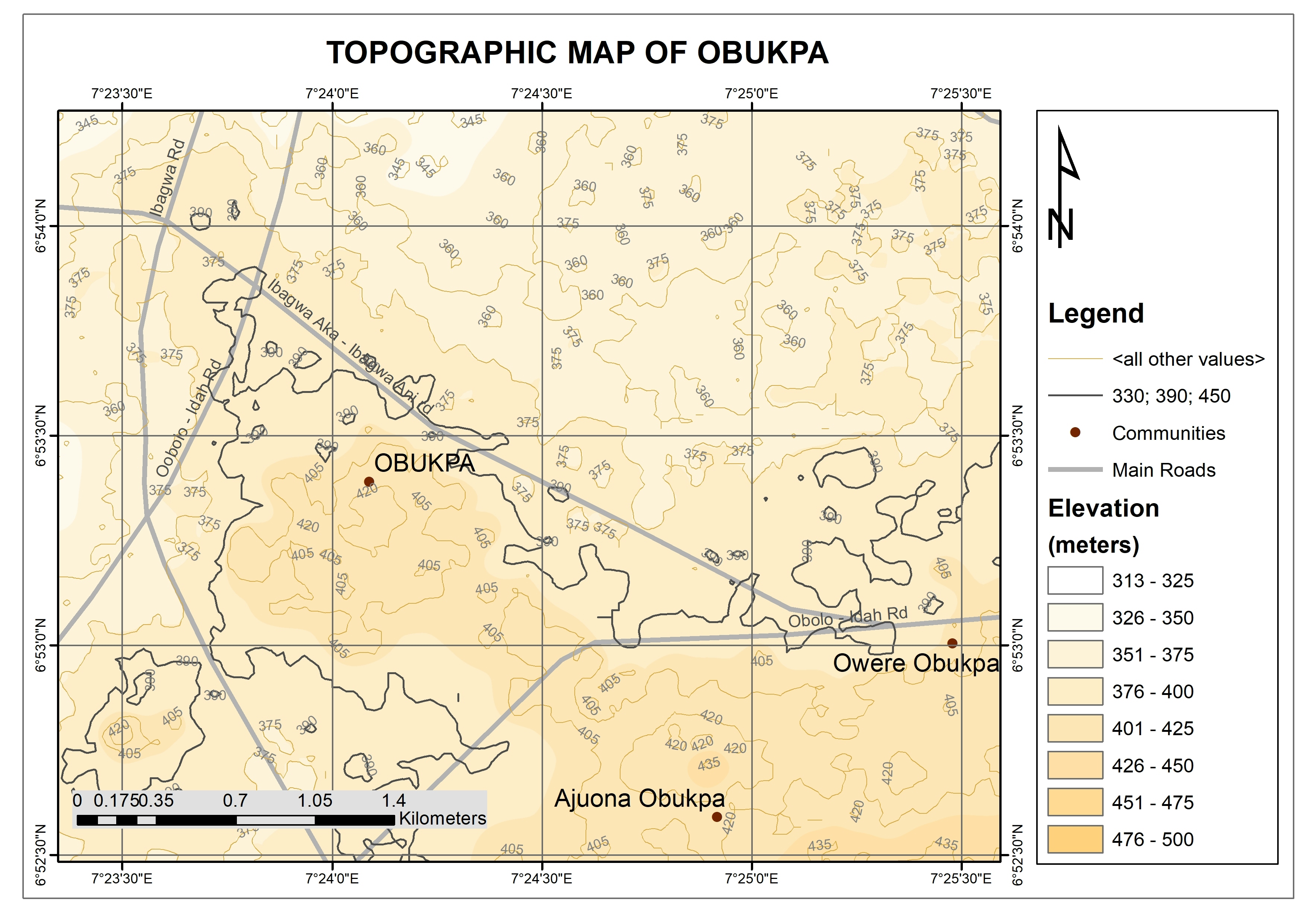
This map shows the elevation and contours of Obukpa community of Nsukka.
The Digital Elevation Model file of the study area was downloaded and processed to generate the contours and the elevation distribution.
Topographic Map of Obukpa
This map shows the elevation and contours of Obukpa community of Nsukka.
The Digital Elevation Model file of the study area was downloaded and processed to generate the contours and the elevation distribution.
More by Emeka Ude
You might also like
We're a place where geospatial professionals showcase their works and discover opportunities.