Sign up or log in to your Spatialnode account.

Takes less than a few seconds.

Traverses of Geophysical Survey, Unilag

Emeka Ude
Emeka Ude•

July 10, 2023

Traverses of Geophysical Survey, Unilag

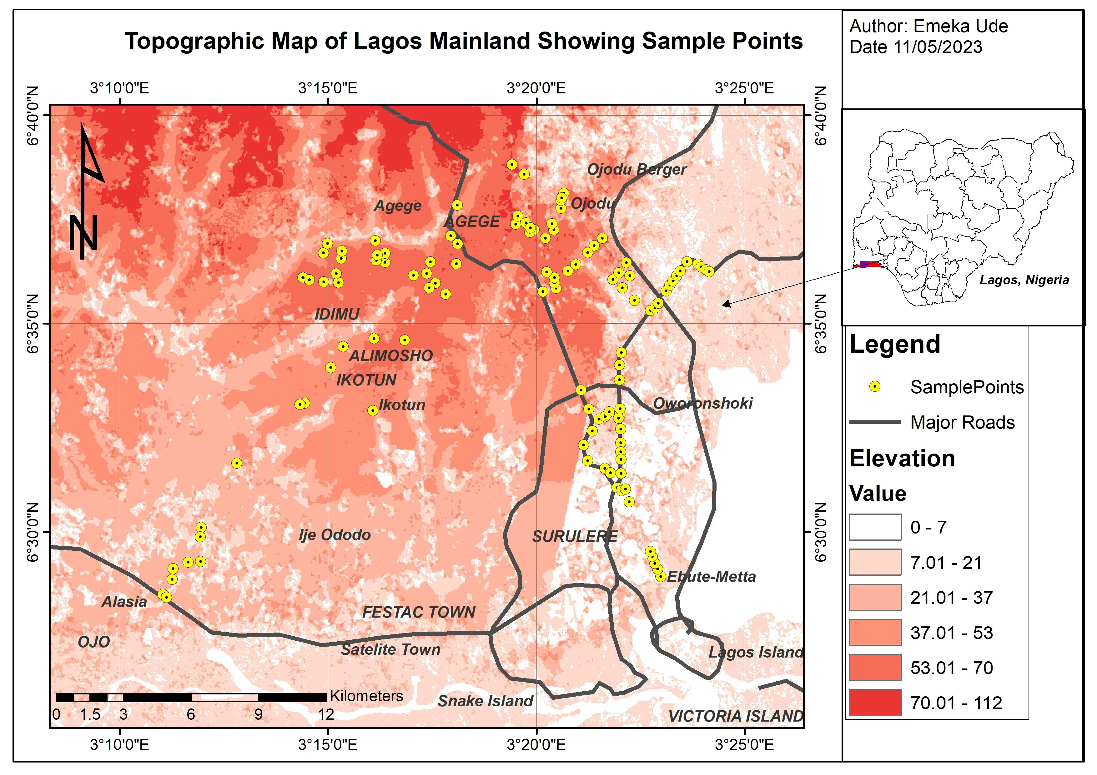
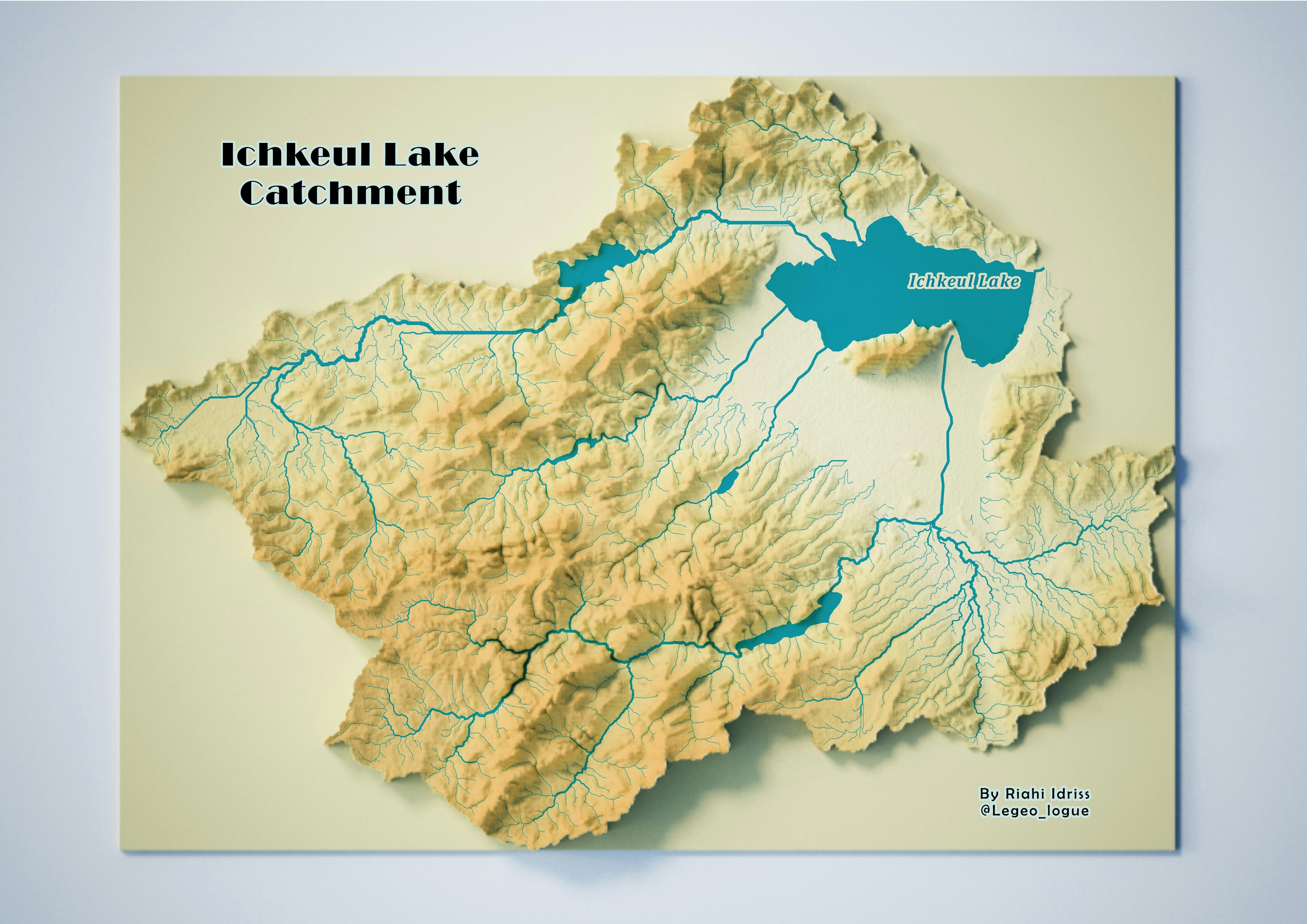
This is a geophysical survey traverse. Implemented in University of Lagos.


Tools used

ArcMapMicrosoft Excel

Plug-ins used

ArcMap

tags

Geophysics lagos, Nigeriatraverses

More by Emeka Ude

Osun State elections 2022
95
Topographical Map of Lagos Mainland
91
Geochemical Map in Southwest, Nigeria
21
Temperature Along Nigerian Coastal Line
34
Topographic Map of Obukpa
137
EzeAni Groundwater Quality
47
Hourly Ozone Distribution in California
66
Study Area Map of Nsukka Metropolis
115
Delineations of Asa River Watershed
100
Liberty Ibadan Street Map
36
Study Area in Southwest Nigeria
25
Elevation Map of Abakaliki Nigeria
52

You might also like

Springfield Urban Heat Island
Emma Stern
Springfield Urban Heat Island
Emma Stern
31
UHURU PARK LOCATION-NAIROBI, KENYA
John Wahome Gathoni
UHURU PARK LOCATION-NAIROBI, KENYA
John Wahome Gathoni
61
Hipsometria
Márcio Marques de Alencar Arraes
Hipsometria
Márcio Marques...
46
Pavimentação das Faces - Rio das Ostras
Rayanne Cardoso
Pavimentação das Faces - Rio das Ostras
Rayanne Cardoso
9
Alocação de fazenda turística
Eduardo Nardez
Alocação de fazenda turística
Eduardo Nardez
10
Cartographic Explorations
Sunder Gurung
Cartographic Explorations
Sunder Gurung
23
Emergency Evacuation Analysis
Sunder Gurung
Emergency Evacuation Analysis
Sunder Gurung
34
Wildfire Propagation using ABM
Kevin Le
Wildfire Propagation using ABM
Kevin Le
20
Map for a project in Eastern Siberia
Sara Fatimah
Map for a project in Eastern Siberia
Sara Fatimah
33
Evolution spatio-temporelle de la ville de dakar depuis 1983, 1945 à 2020
IVES MALONGO KOKINAMBILI
Evolution spatio-temporelle de la ville de dakar depuis 1983, 1945...
IVES MALONGO KOKINAMBILI
134
Land Cover Mapping with Python
Bertrand Lobo
Land Cover Mapping with Python
Bertrand Lobo
110
Mapa de registro de monitoramento
Lucas Moreira
Mapa de registro de monitoramento
Lucas Moreira
10

Join the community!

We're a place where geospatial professionals showcase their works and discover opportunities.

Sign Up for free