
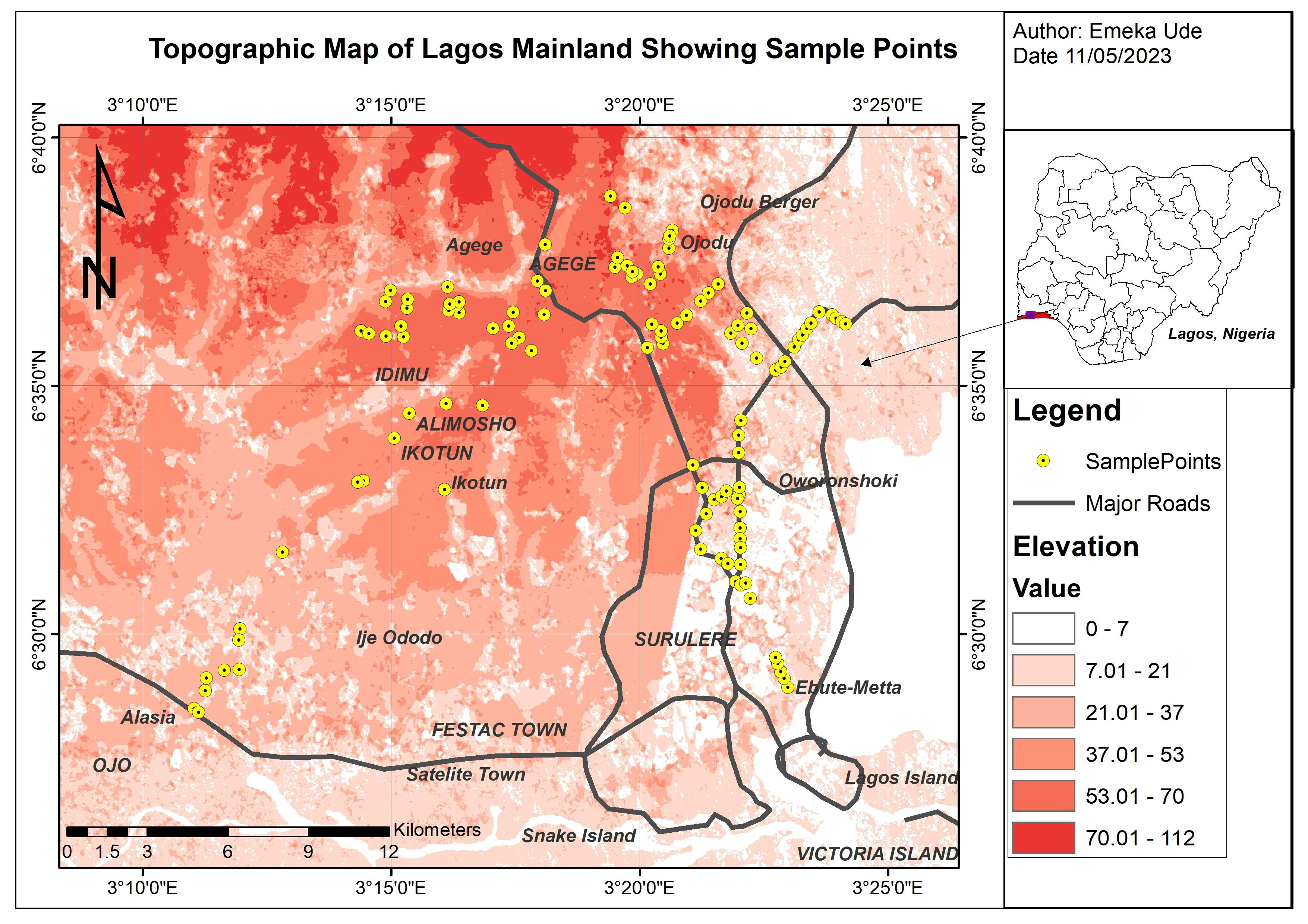
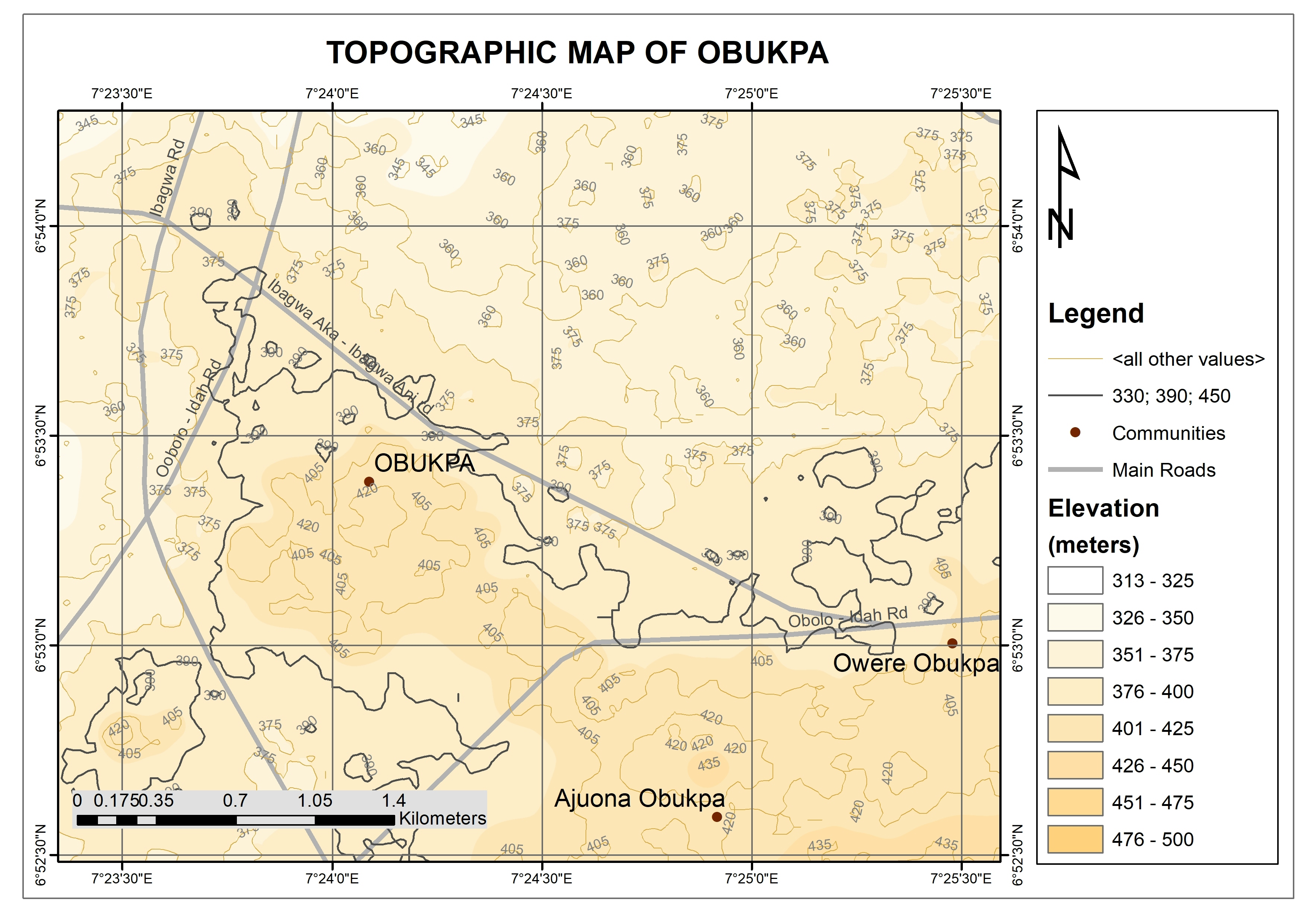
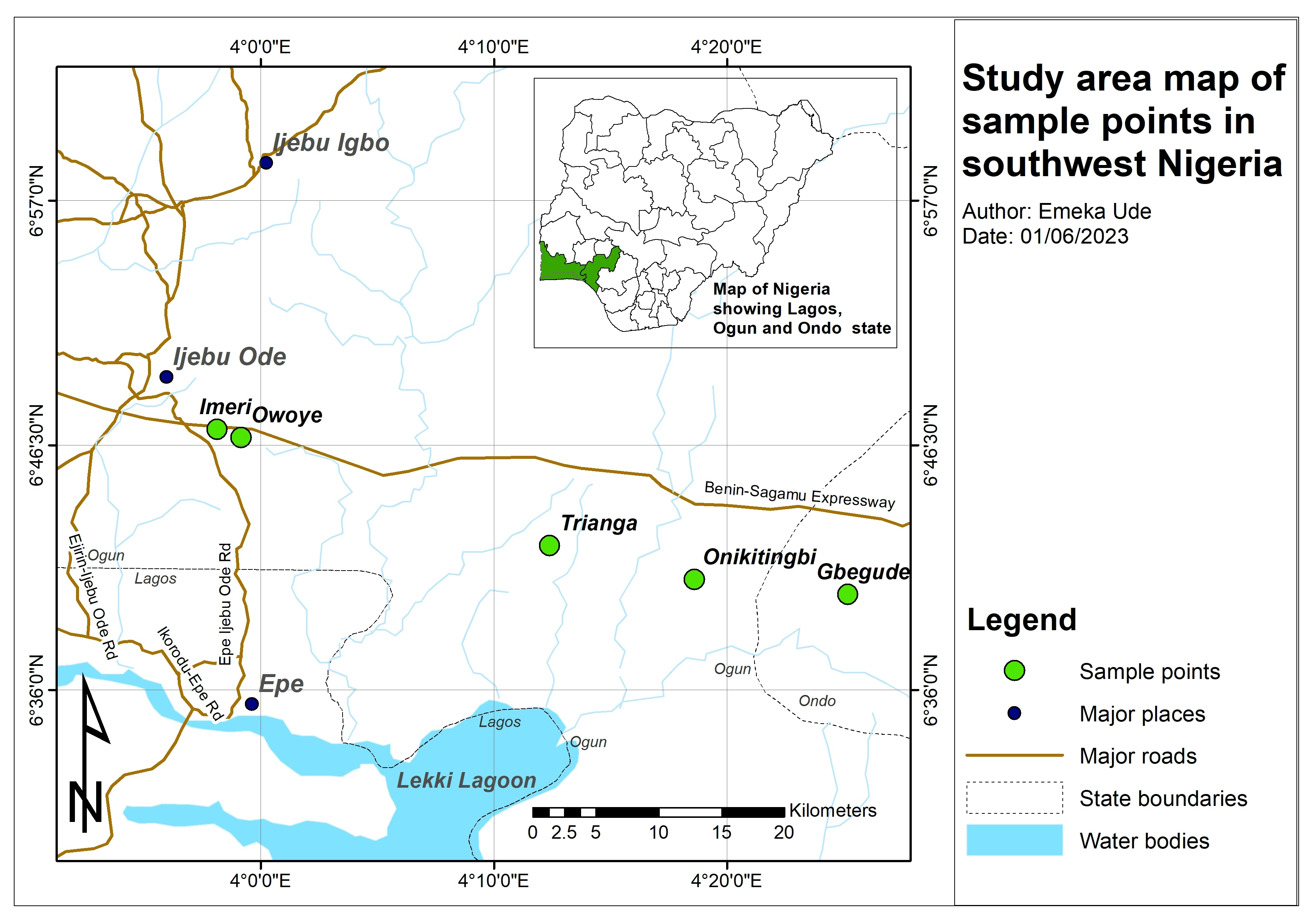
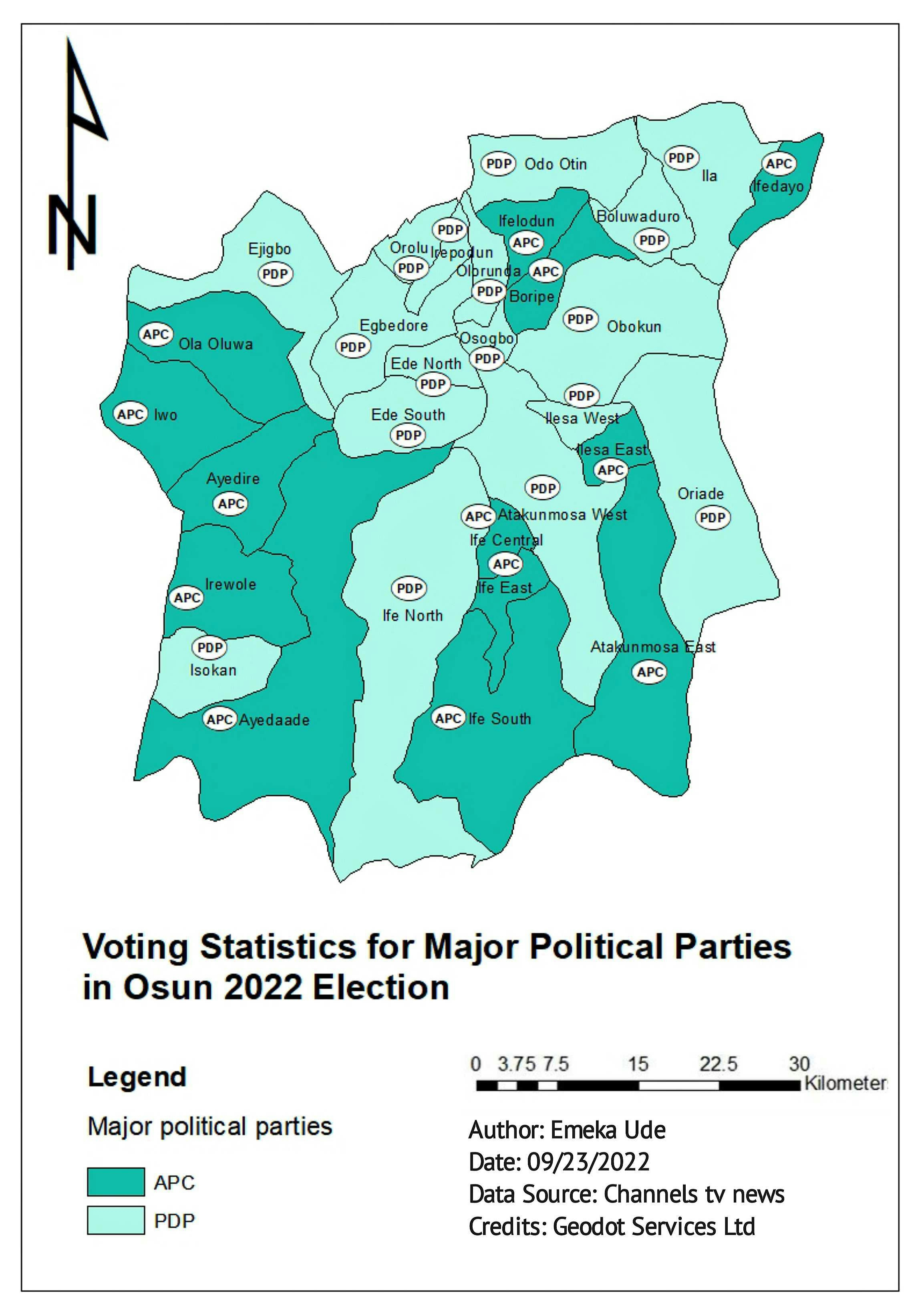
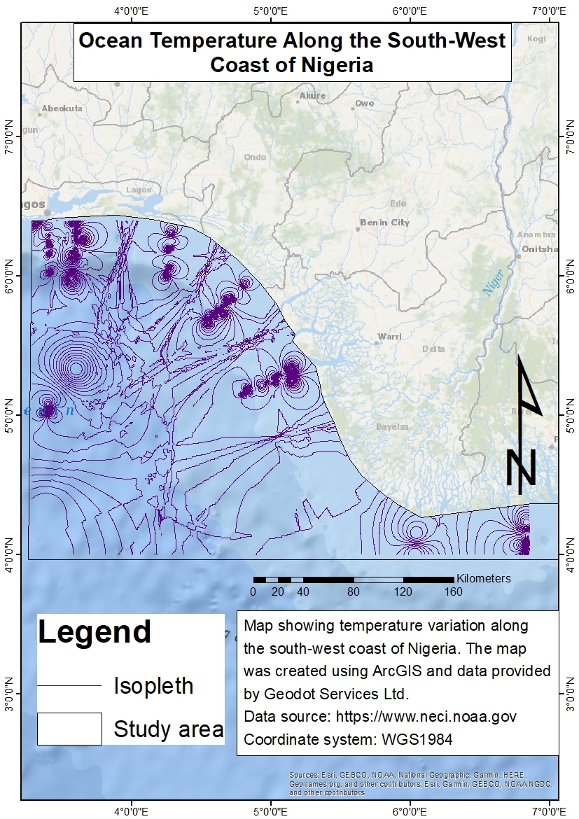
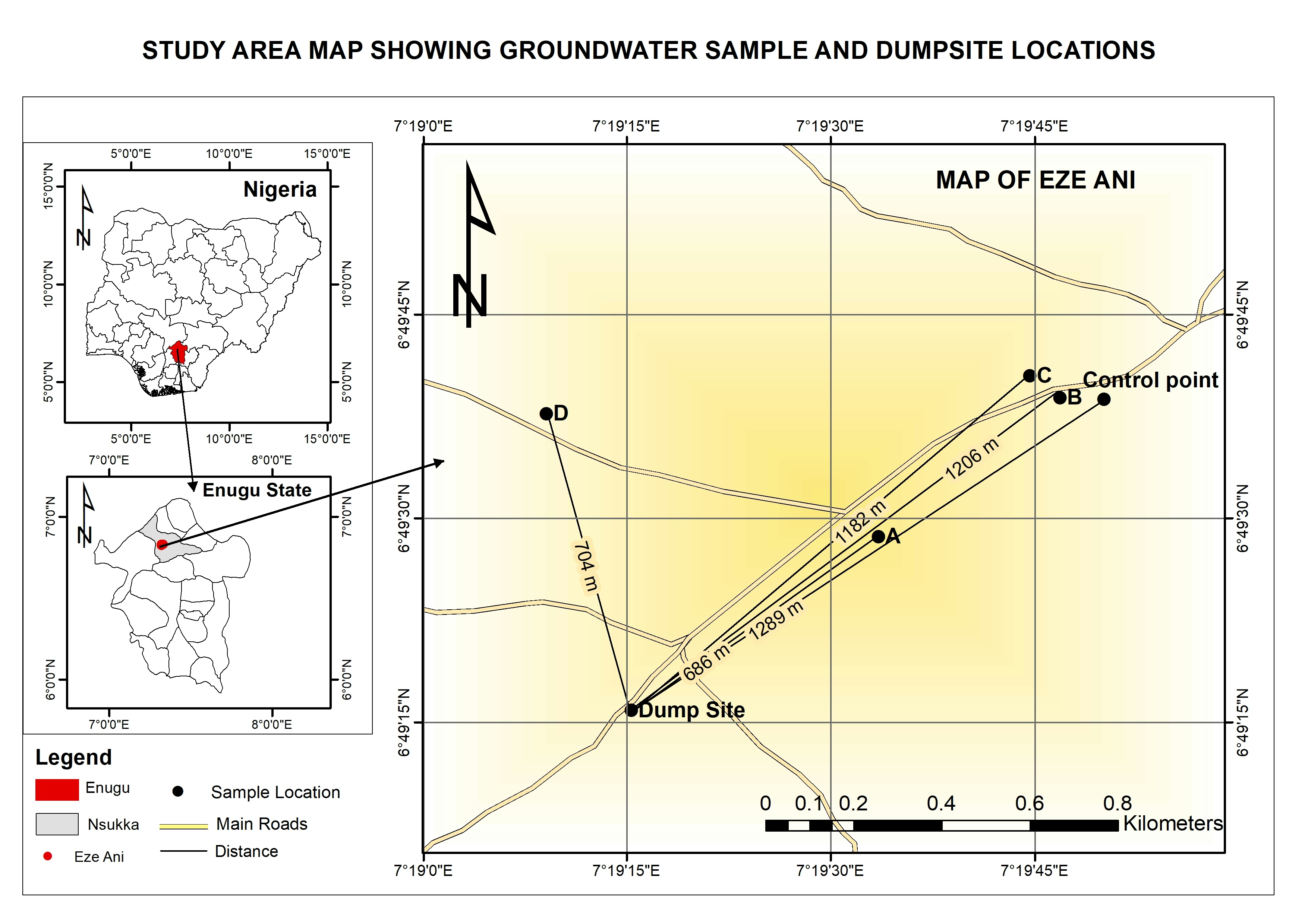
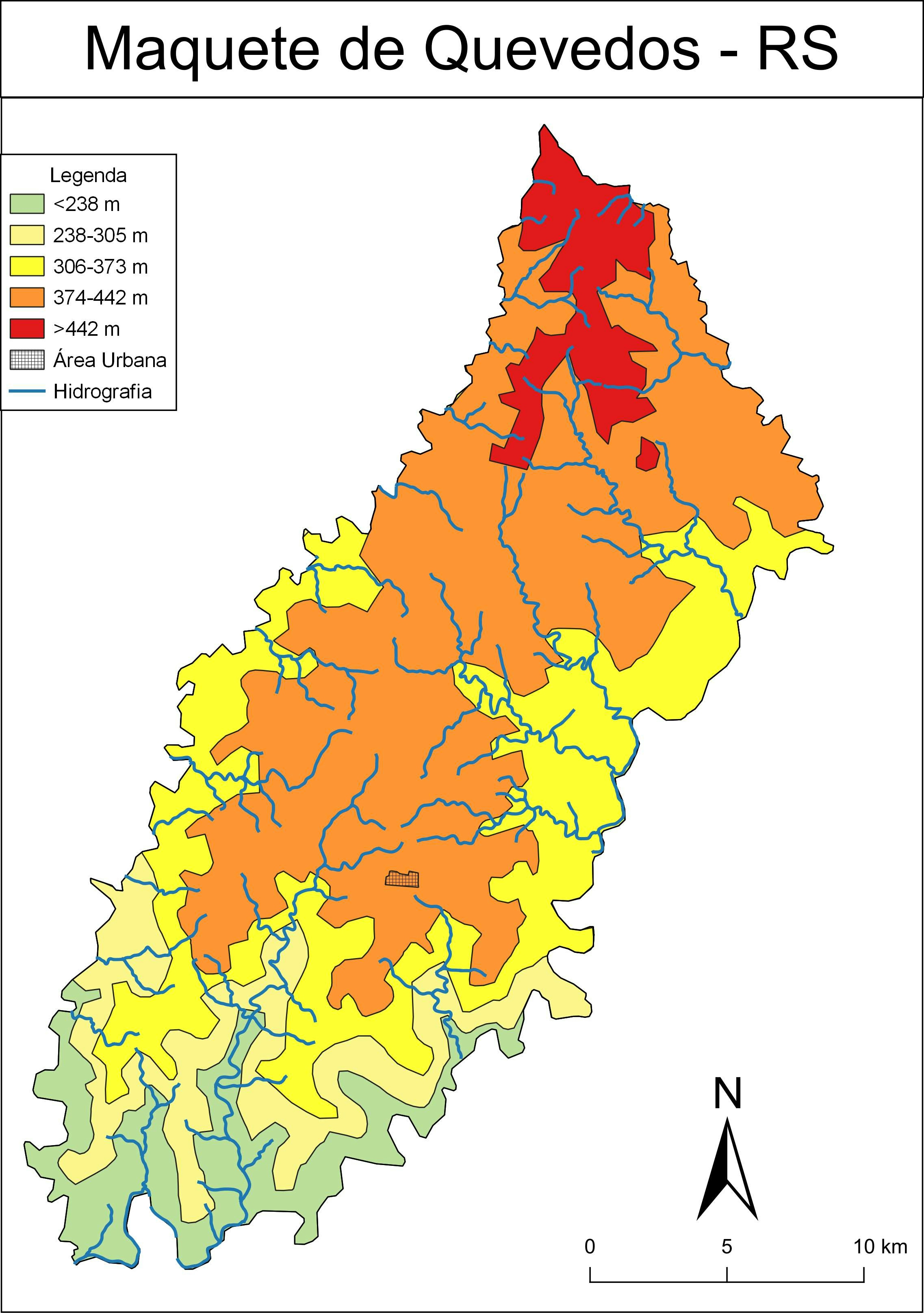
A study that shows spatial distribution of sample points with the base map of topographical map.
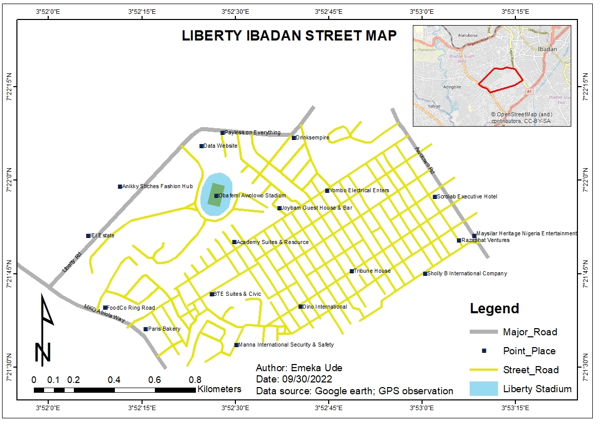
Topographical Map of Lagos Mainland
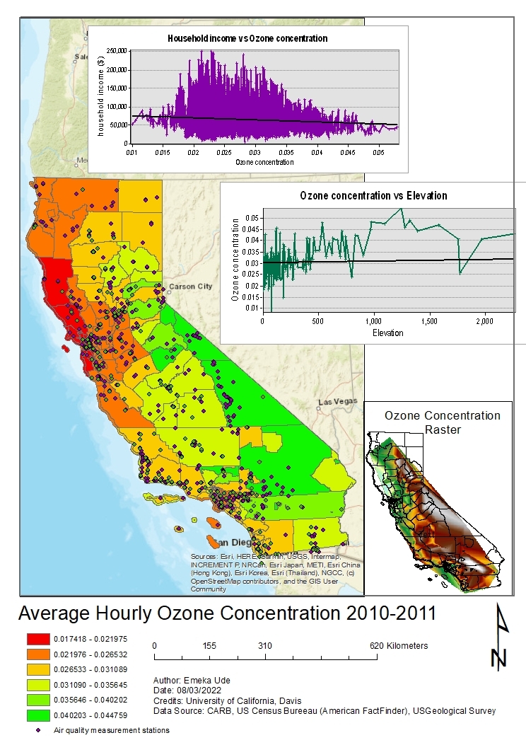
Tools used
ArcGISArcMapGoogle Earth ProMicrosoft Excel
Plug-ins used
ArcMap
tags
Elevationlagos, Nigeriatopographic map
More by Emeka Ude


You might also like


Join the community!
We're a place where geospatial professionals showcase their works and discover opportunities.