
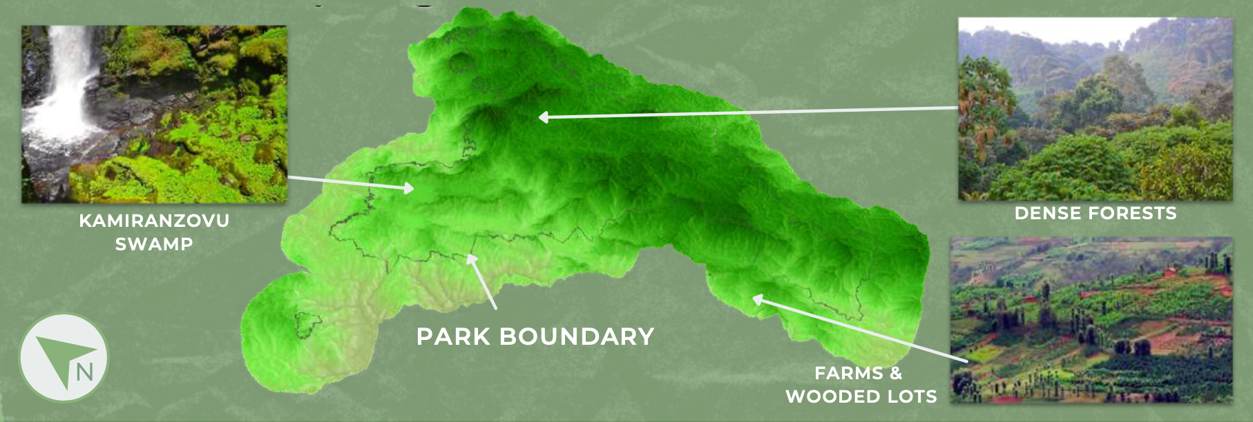
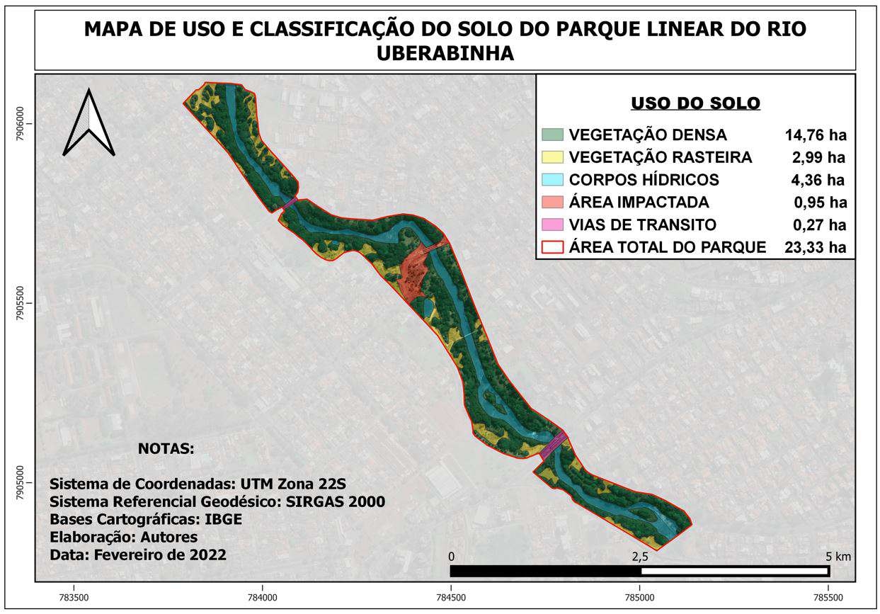
This project assessed progress on Rwanda's national forest restoration plans around Nyungwe National Park.
Forest Trends in Nyungwe National Park
Tools used
ArcGIS ProOpenStreetMapQGIS
Plug-ins used
MESMA
tags
3Ddeforestationforestland cover
You might also like


")


Join the community!
We're a place where geospatial professionals showcase their works and discover opportunities.