

These maps were created as part of the work of R. Weidlich et al. It visualized the verity of carbonates morphology in the East Mediterranean deep water.
Carbonate Morphology
Plug-ins used
ArcGIS
tags
Data Visualization
You might also like


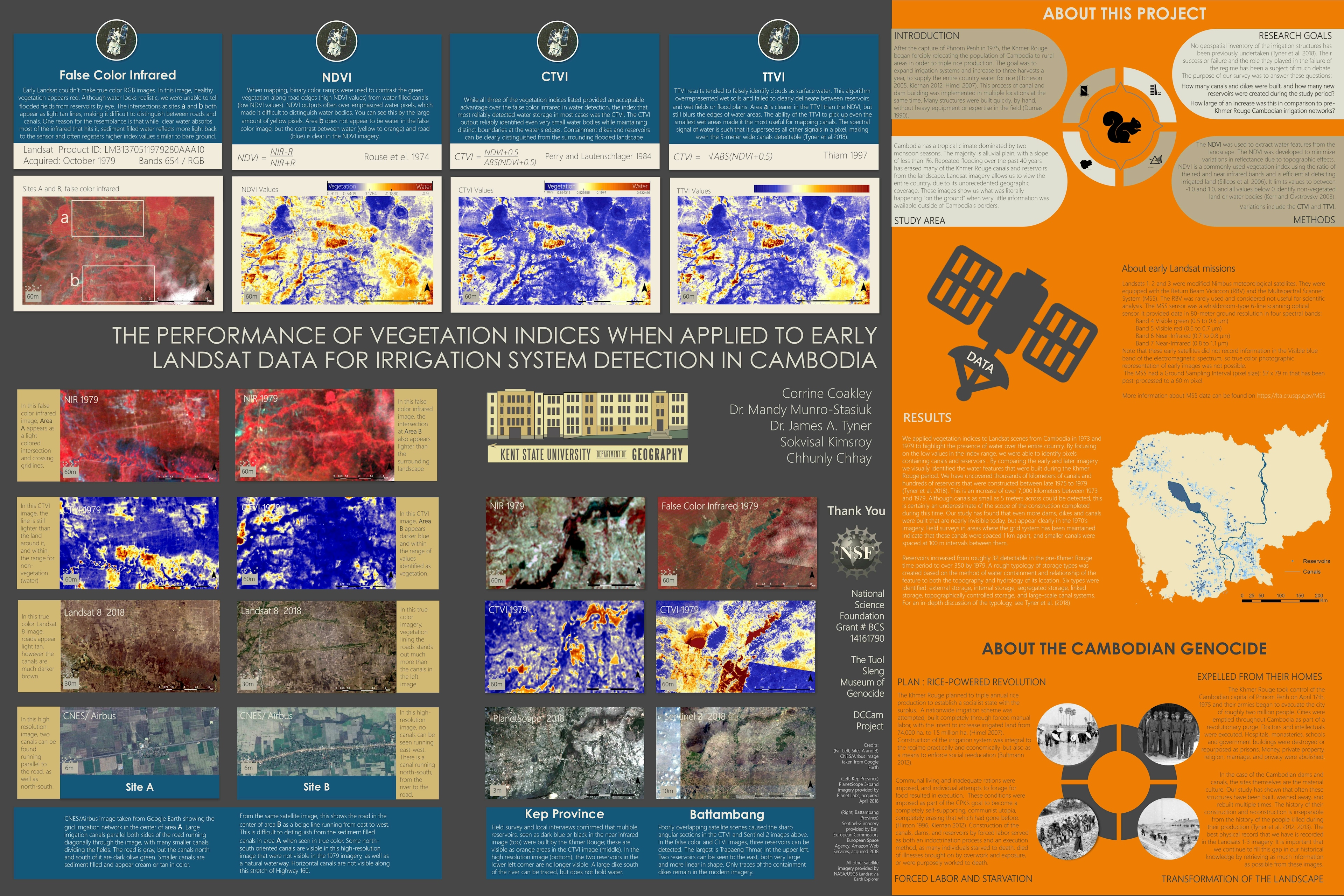
.svg "Corrine Coakley")


Join the community!
We're a place where geospatial professionals showcase their works and discover opportunities.