.svg "Corrine Coakley")
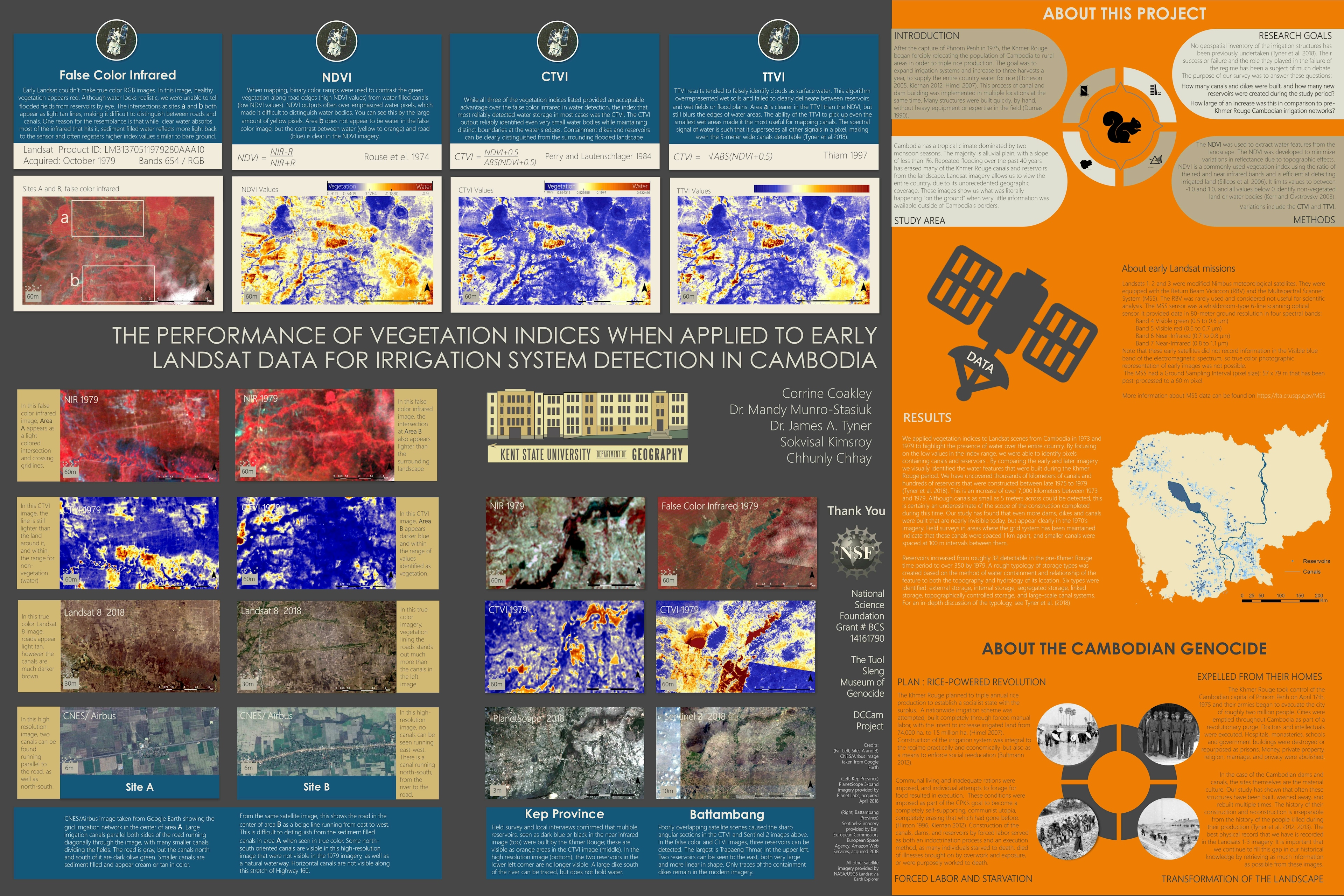
This project was part of the preliminary work towards my PhD. The first step was to identify canals and irrigation networks that existed before and after the Khmer Rouge period in Cambodia. I performed this analysis over the entire area of the country. The only data available to us is in early Landsat imagery and declassified satellite photos. I wanted to detect water in canals that often are only 15 feet wide, on imagery that had a native resolution of a roughly 60 meter pixel.
I needed to run several different vegetation and water indices in order to discover which index performed the best at correctly identifying canals and being able to distinguish defined water channels as opposed to flooded fields. The CTVI proved to be the best at accurately detecting irrigation and water storage features.
Landsat 1-3 data does not have a blue band, so no "true color" images were possible. This also made cloud removal not an option, as often there was only one usable image for each location. There was also the difficulty of distinguishing between linear features such as roads, and the canals, which run parallel to the roads for many kilometers. This poster discussed the variations in results between the index analyses and how successful each was at identifying both roads and water features.
Feedback I received included the fact that although the blue/orange false color representation was easier for the eye to distinguish water from ground, the natural expectation is for water to show up blue in a map, and that the blue/orange color ramp was too jarring. When I remade the maps for publication, I changed the color ramps to a brown/blue that fit the ground/water representation much better.


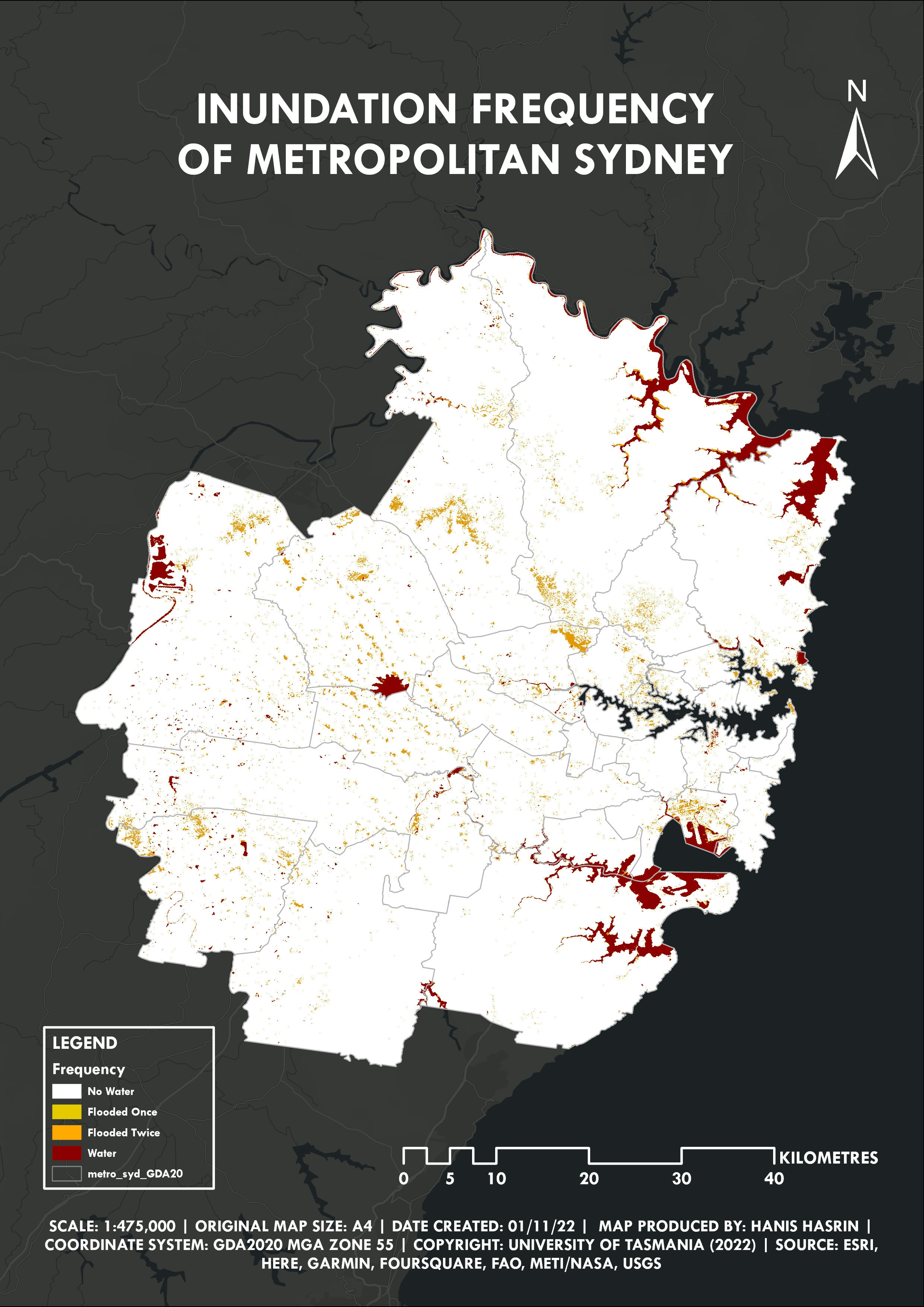


![Projeto - Análise Espacial [1/2]](/_next/image?url=https%3A%2F%2Fstorage.googleapis.com%2Fspatialnodefiles%2Fprojects%2F9c96159b-e45d-4811-b8b1-236f8d9c3a98layoutmapametro.png&w=3840&q=100)
