Sign up or log in to your Spatialnode account.

Takes less than a few seconds.

USO E OCUPAÇÃO DO SOLO

Mapa_Geo
Mapa_Geo•

July 13, 2022

USO E OCUPAÇÃO DO SOLO

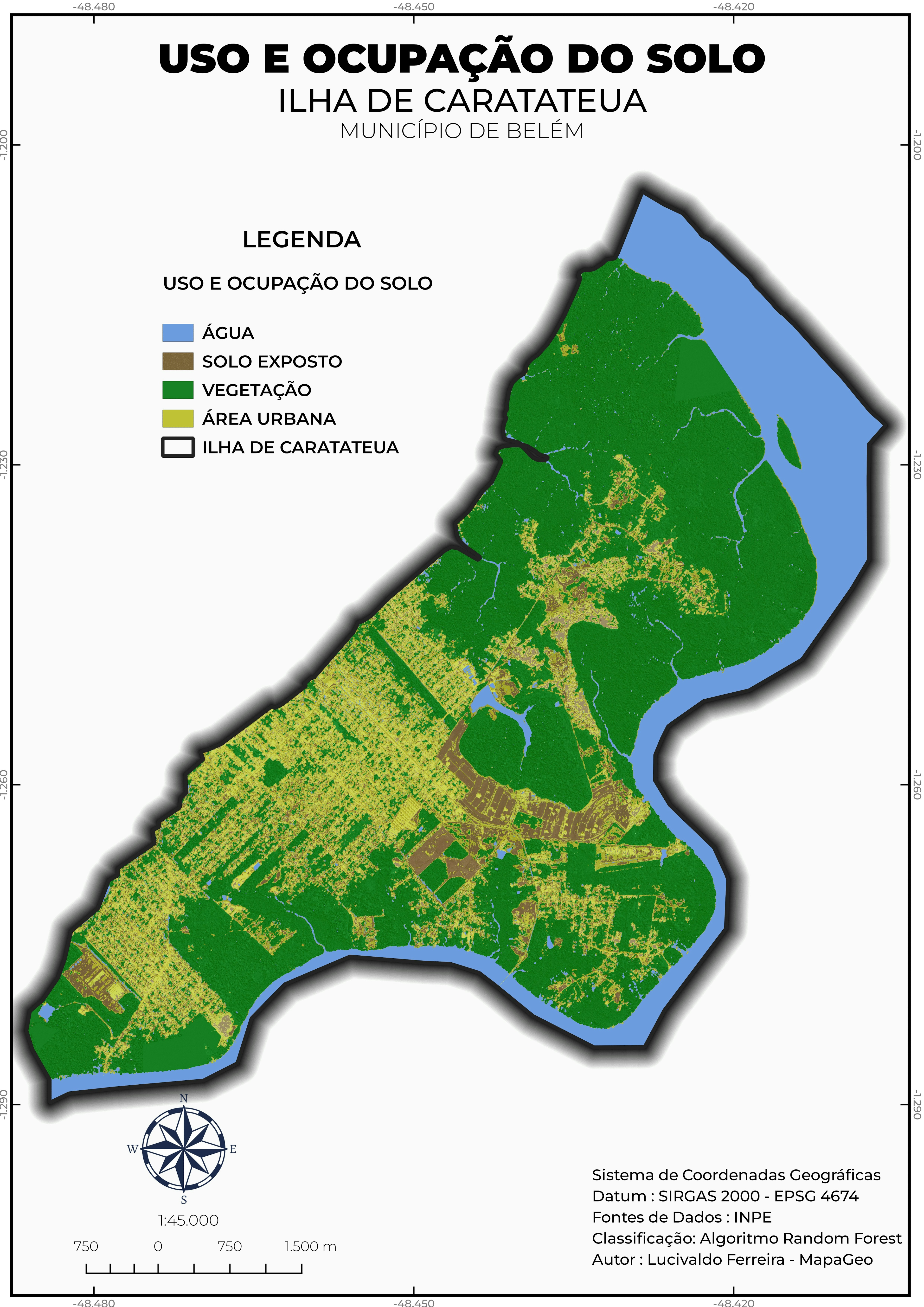
Este mapa representa o uso e ocupação do solo a partir da classificação supervisionada


Plug-ins used

Dzetsaka

tags

ArcGIS ProgeoprocessamentoMAPASQGIS

More by Mapa_Geo

HIPSOMETRIA E CURVAS DE NÍVEL
95
MUNICÍPIO DE BELÉM EM 1988
44
LOCALIZAÇÃO DO MUNICÍPIO DE BELÉM
132

You might also like

Spatial Interpolation
omoogun bankole
Spatial Interpolation
omoogun bankole
14
USING NDWI indice to understand flooding
Craig Tolliver
USING NDWI indice to understand flooding
Craig Tolliver
30
World Carbon Emissions
Holly Bluer
World Carbon Emissions
Holly Bluer
15
Cambio de coberturas - Deforestación 🪵
Jair Granados Chacón
Cambio de coberturas - Deforestación 🪵
Jair Granados Chacón
13
Some Strategical Projects of the KRI
Peshawa Salih
Some Strategical Projects of the KRI
Peshawa Salih
6
Heat Map of the population of Alberta
Cody Hodge
Heat Map of the population of Alberta
Cody Hodge
264
Mapas/produtos gerados em Campo II(UFRN)
Arthur Braz Farias
Mapas/produtos gerados em Campo II(UFRN)
Arthur Braz Farias
39
CTFS Plot Locations in Panama
Milton Solano Sequeira
CTFS Plot Locations in Panama
Milton Solano Sequeira
45
USA Tornadoes
Sammer
USA Tornadoes
Sammer
20
Height Above Ground Level
Dakota Crane
Height Above Ground Level
Dakota Crane
2
Storybook Stile
Pedro Ferreira
Storybook Stile
Pedro Ferreira
35
Industrial Area Potential
Ananda Rianti Dewi
Industrial Area Potential
Ananda Rianti Dewi
21

Join the community!

We're a place where geospatial professionals showcase their works and discover opportunities.

Sign Up for free