Sign up or log in to your Spatialnode account.

Takes less than a few seconds.

MUNICÍPIO DE BELÉM EM 1988

Mapa_Geo
Mapa_Geo•

July 13, 2022

MUNICÍPIO DE BELÉM EM 1988

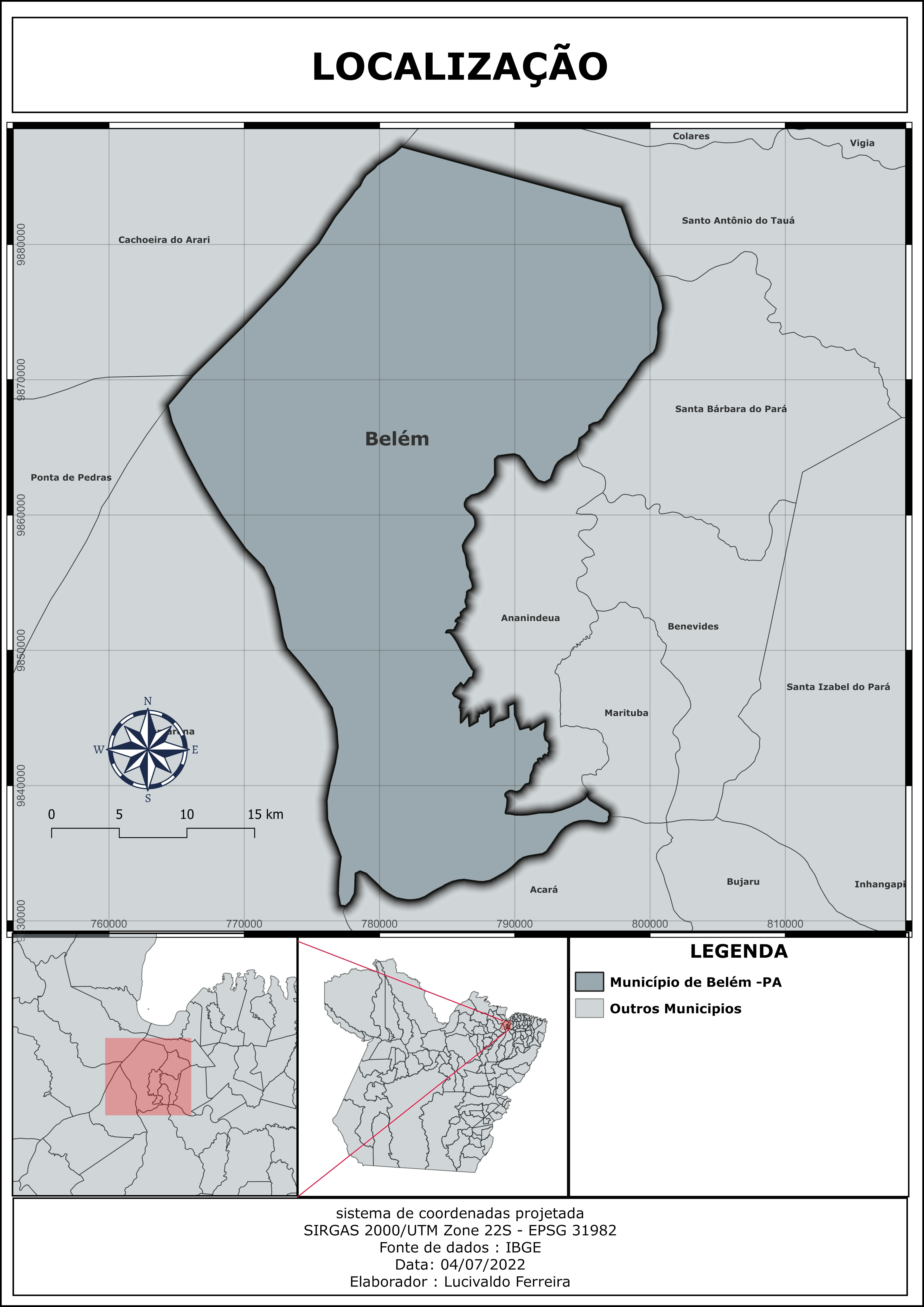
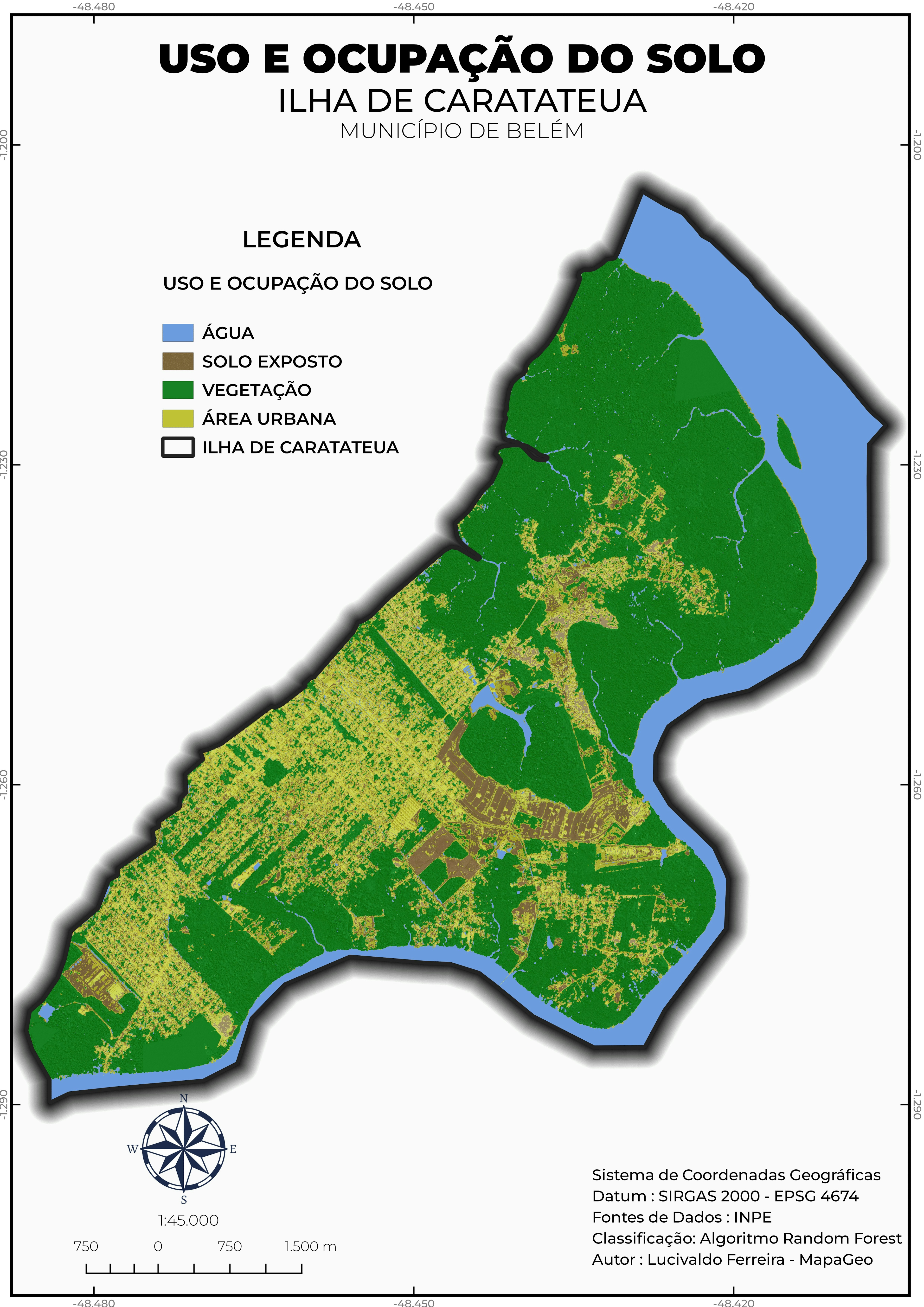
Este mapa representa o município de Belém - Pará em 1988 a partir das imagem do satélite SPOT 1


tags

ArcGIS ProgeoprocessamentoGoogle Earth Engine(GEE)QGISRemote Sensing

More by Mapa_Geo

USO E OCUPAÇÃO DO SOLO
60
LOCALIZAÇÃO DO MUNICÍPIO DE BELÉM
126
HIPSOMETRIA E CURVAS DE NÍVEL
87

You might also like

Projeto de iniciação cientifica (RAIC)
Polliana Odeth de Melo Machado
Projeto de iniciação cientifica (RAIC)
Polliana Odeth...
33
Categorias de distâncias de imóveis (m)
Felipe Pimenta
Categorias de distâncias de imóveis (m)
Felipe Pimenta
14
Urban Expansion in DC (1990-2015)
Simone Chapman
Urban Expansion in DC (1990-2015)
Simone Chapman
139
USA Drought Map for the Year 2022
Enoch Oluwaferanmi Babayemi
USA Drought Map for the Year 2022
Enoch Oluwaferanmi Babayemi
15
Leeds City Centre in 3D
Adriana Calderon
Leeds City Centre in 3D
Adriana Calderon
227
New York Storm Surge
Sammer
New York Storm Surge
Sammer
17
Distribution of spiders Mecynogea
Philip Russo
Distribution of spiders Mecynogea
Philip Russo
490
Mapa Temático - UC's Federais -  PARÁ
Gabriel Henrique Braga Matos
Mapa Temático - UC's Federais - PARÁ
Gabriel Henrique...
45
Komodo Island Tourism Map
Dian Rizky
Komodo Island Tourism Map
Dian Rizky
131
Pontos de Fiscalização DERSP
Matheus Amaral Prates
Pontos de Fiscalização DERSP
Matheus Amaral Prates
13
The Citadel of Farah, Afghanistan
Sebastian Silva
The Citadel of Farah, Afghanistan
Sebastian Silva
192
Map of Illinois
Liam Patterson
Map of Illinois
Liam Patterson
4

Join the community!

We're a place where geospatial professionals showcase their works and discover opportunities.

Sign Up for free