
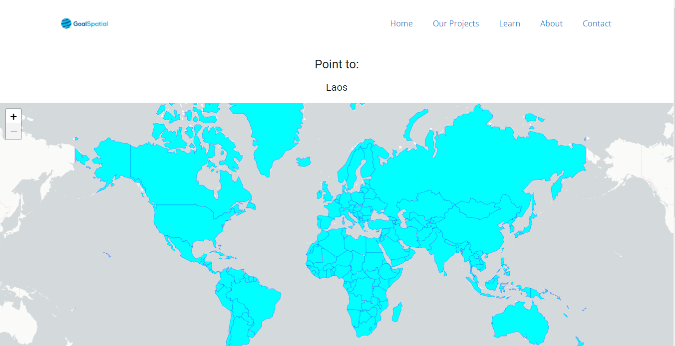
This is a game based on Leaflet and Django, that you can use to test how many countries you can locate on a map. The result is a choropleth map that shows how many countries you correctly located and how many you didn't.
Locate Countries Game.
Tools used
GeodjangoLeafletJS
Plug-ins used
GeodjangoLeafletJS
tags
Data VisualizationGDALLeafletJS
More by Joseph Thuha

You might also like
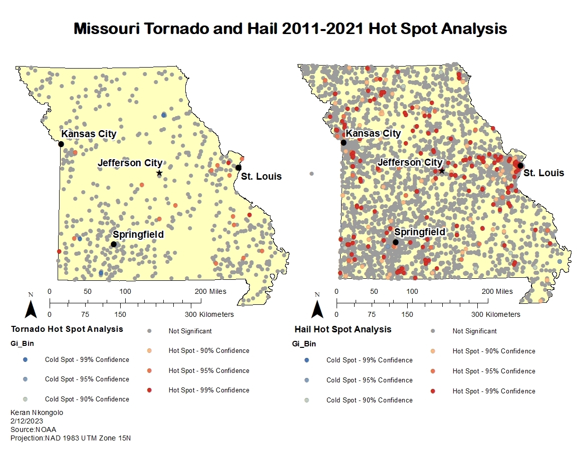
.svg "Keran Nkongolo")


Join the community!
We're a place where geospatial professionals showcase their works and discover opportunities.