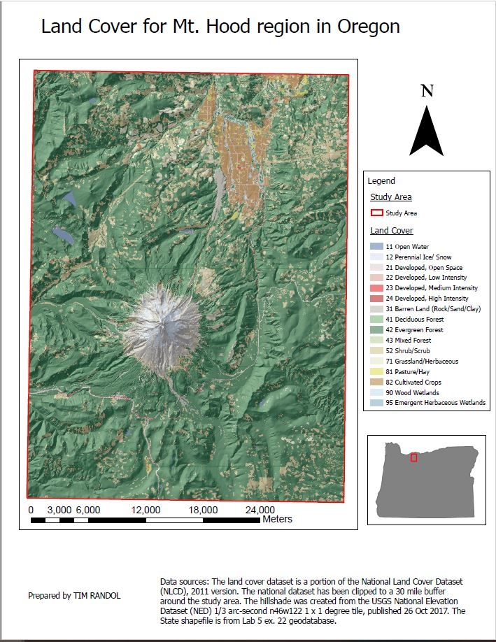
Data sources: The land cover dataset is a portion of the National Land Cover Dataset
(NLCD), 2011 version. The national dataset has been clipped to a 30 mile buffer
around the study area. The hillshade was created from the USGS National Elevation
Dataset (NED) 1/3 arc-second n46w122 1 x 1 degree tile, published 26 Oct 2017.