Introduction:
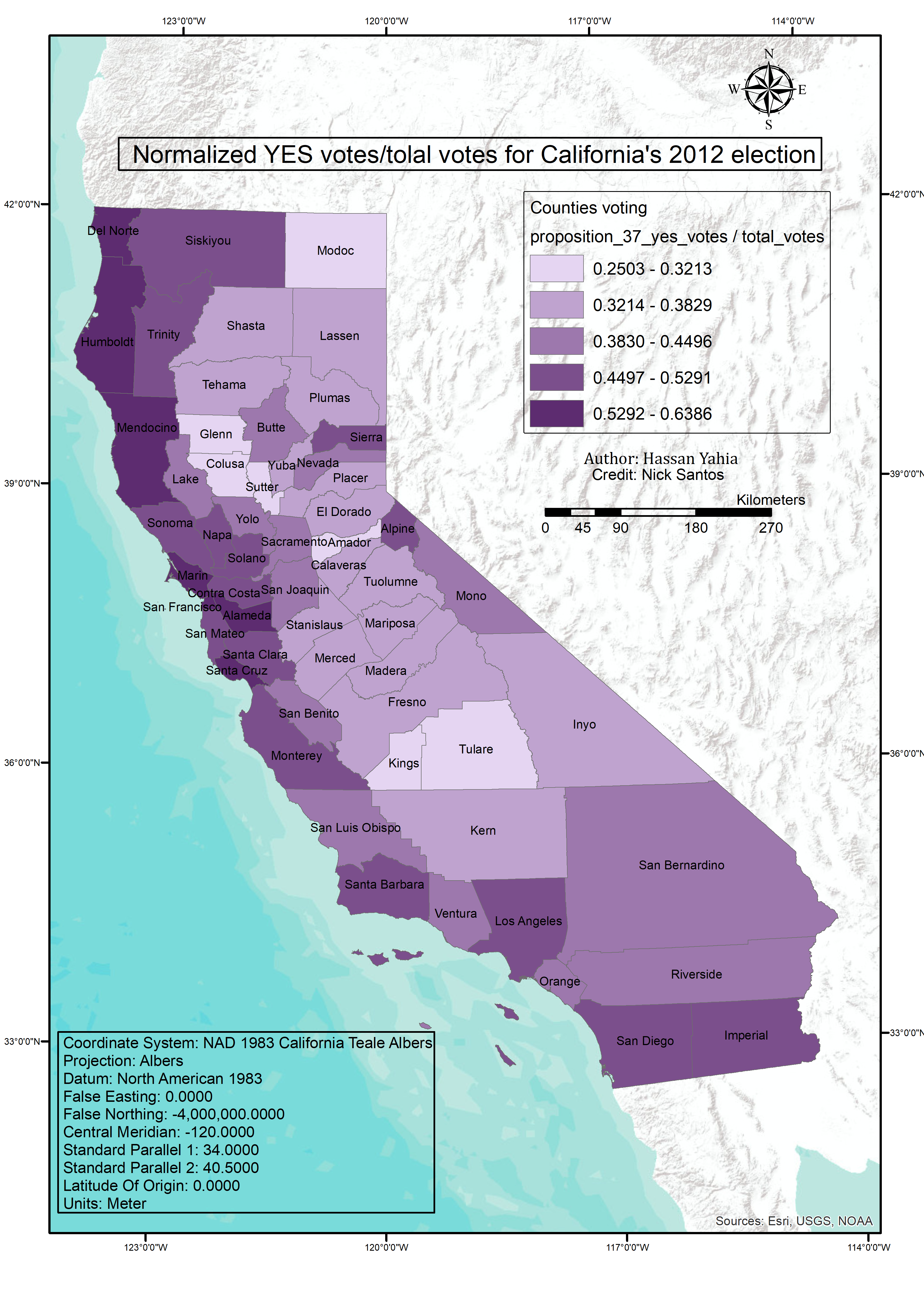
This was the final assignment at the coursera "fundamentals of GIS" course. A geodatabase containing two shapefiles was provided, one named Counties which represents the feature data for California counties and the other "PrecinctVotingData" has Feature data for California precincts for the 2012 election with two attributes one has "total_votes" and the other has "proposition_37_yes_votes". It was required to 1. Conduct analysis and aggregate the precinct total votes and yes vote data up to the county level. 2. Symbolize the counties by yes vote data, normalized by total votes. 3. Make an appropriate map layout and to Add metadata to the final county layer. 4. Export a PDF of the map’s layout and a map package of the map.
Methodology
As i had to layers one of counties and the other of California precincts which spatially relate to each other, i use the spatial join tool so i can join attributes of the precincts layer to the county layer.


.jpg&w=3840&q=100)