
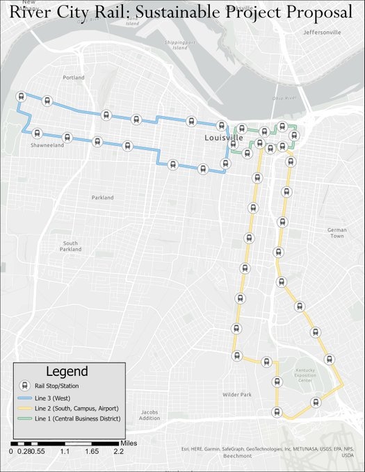
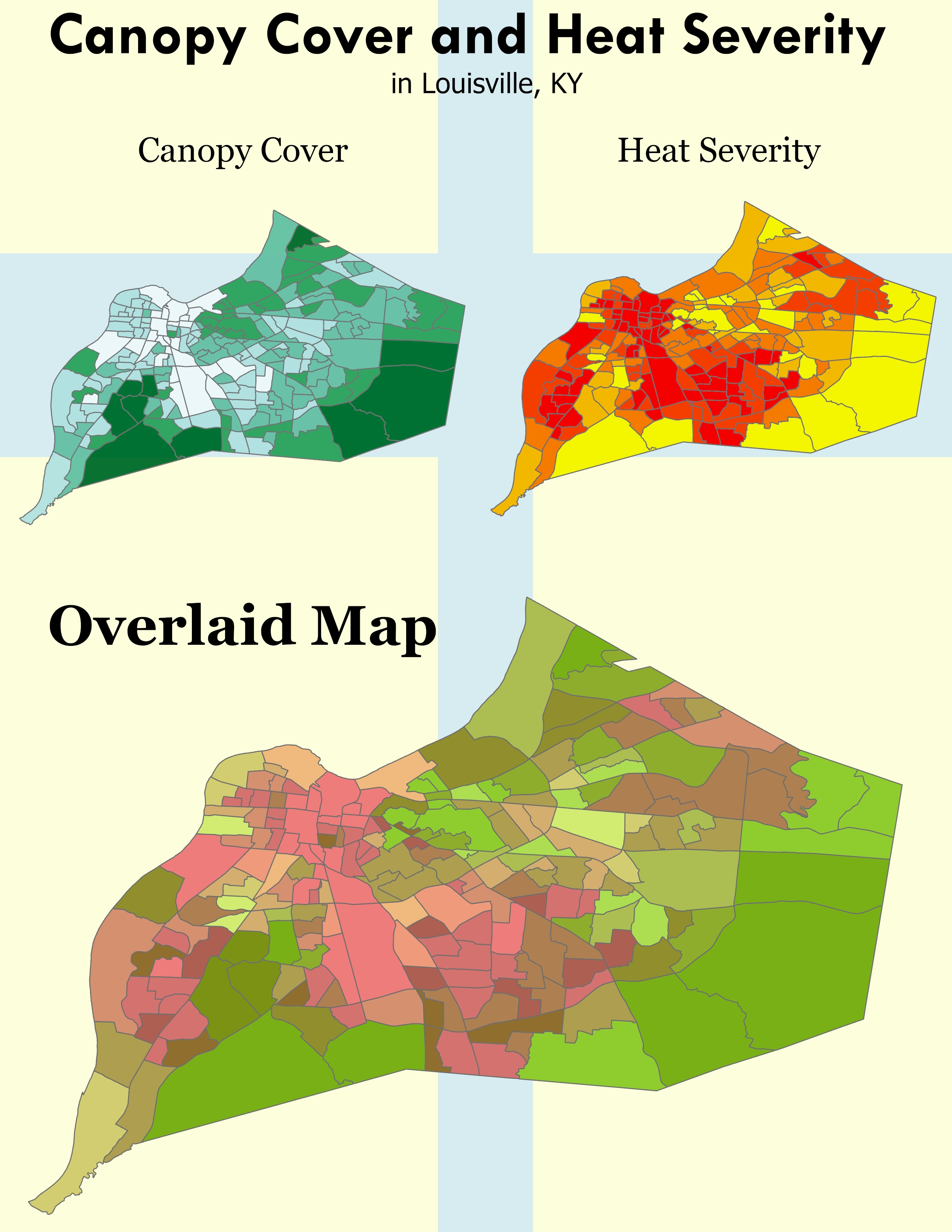
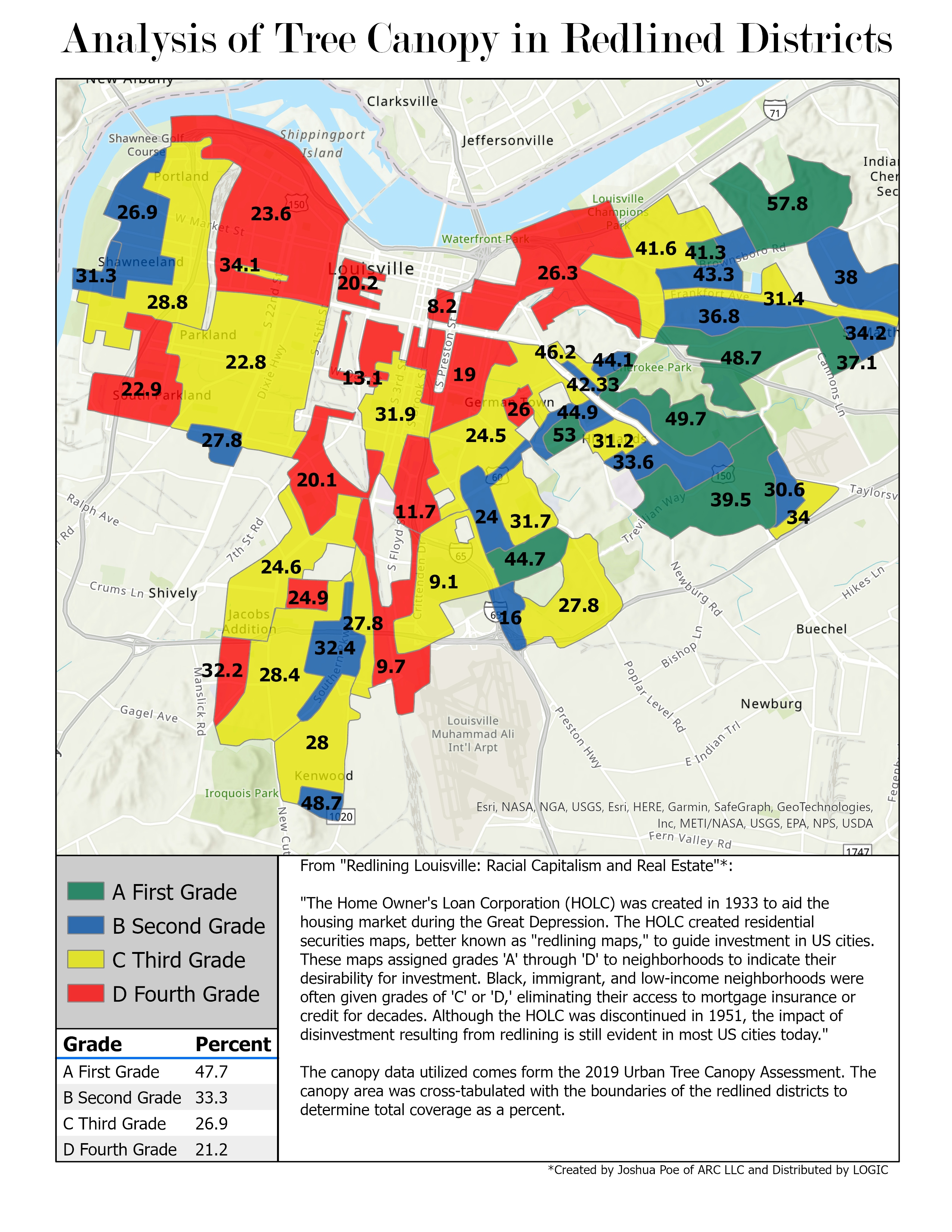
For my sustainable environments class I needed to come up with a proposal for a city project that would increase sustainability within the city. For my project, I promoted light rail as a sustainable alternative to mass car transit. This is the map I made modeling my idea for the system, at least the first phase of it.
Louisville Light Rail Proposal
Tools used
ArcGIS Pro
tags
louisvillemapsrail
More by Sean Willis


You might also like

")


Join the community!
We're a place where geospatial professionals showcase their works and discover opportunities.