
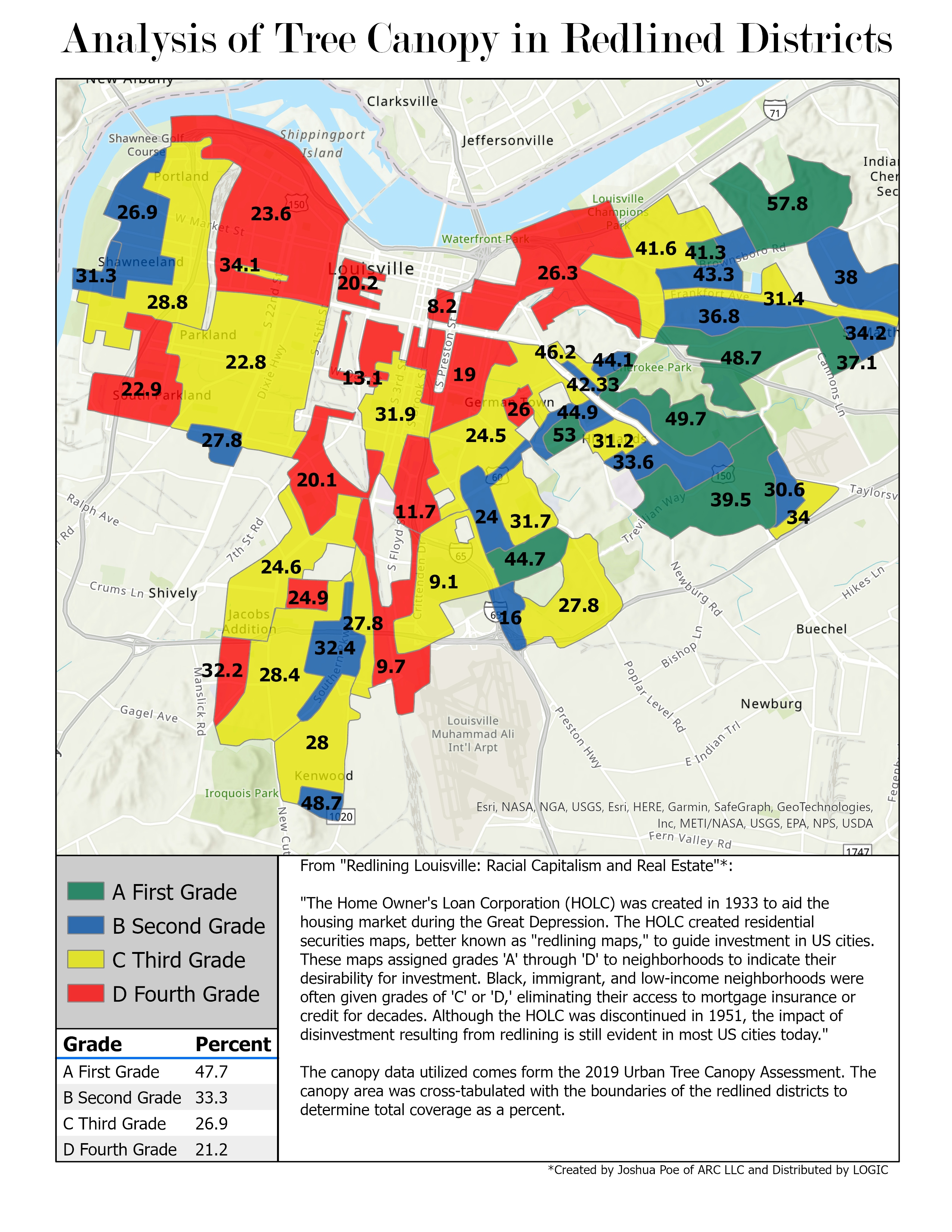
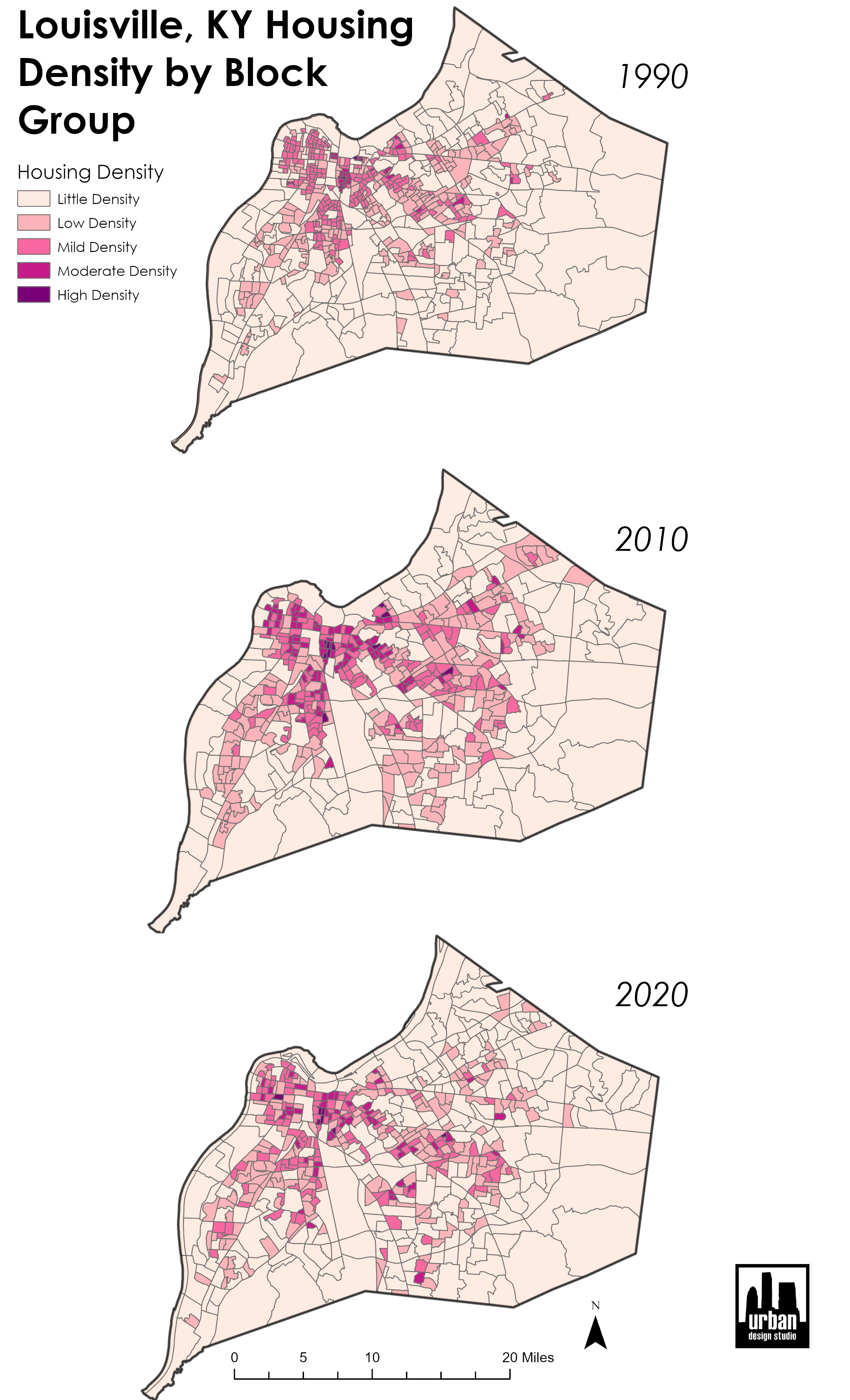
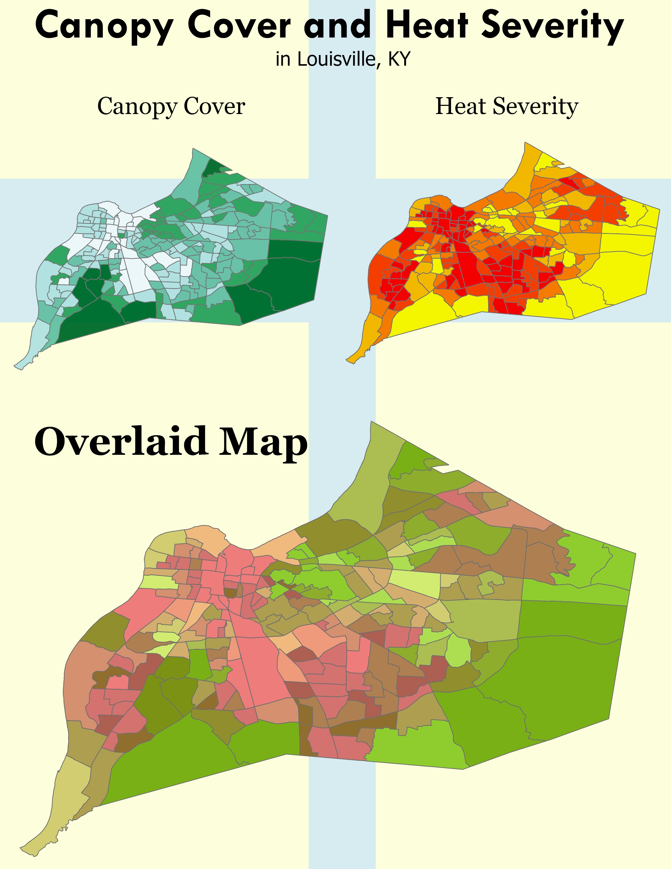
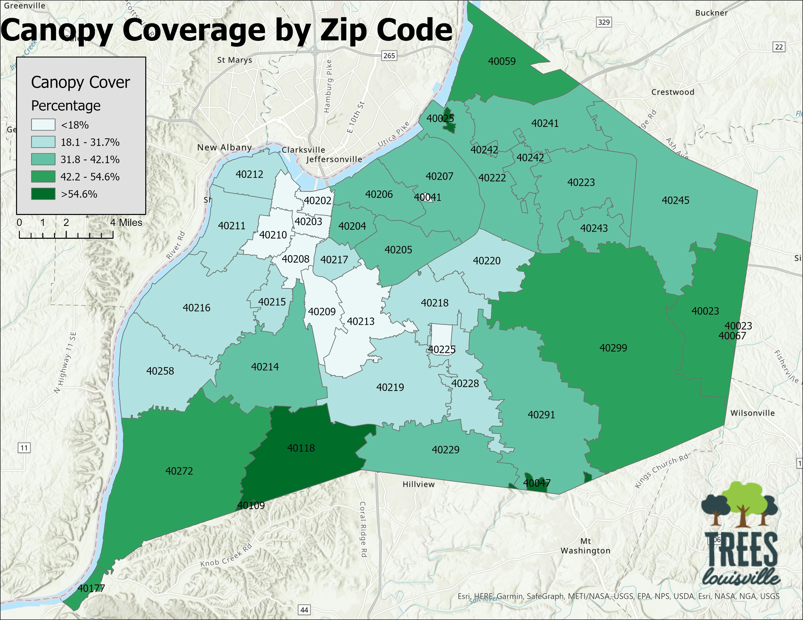
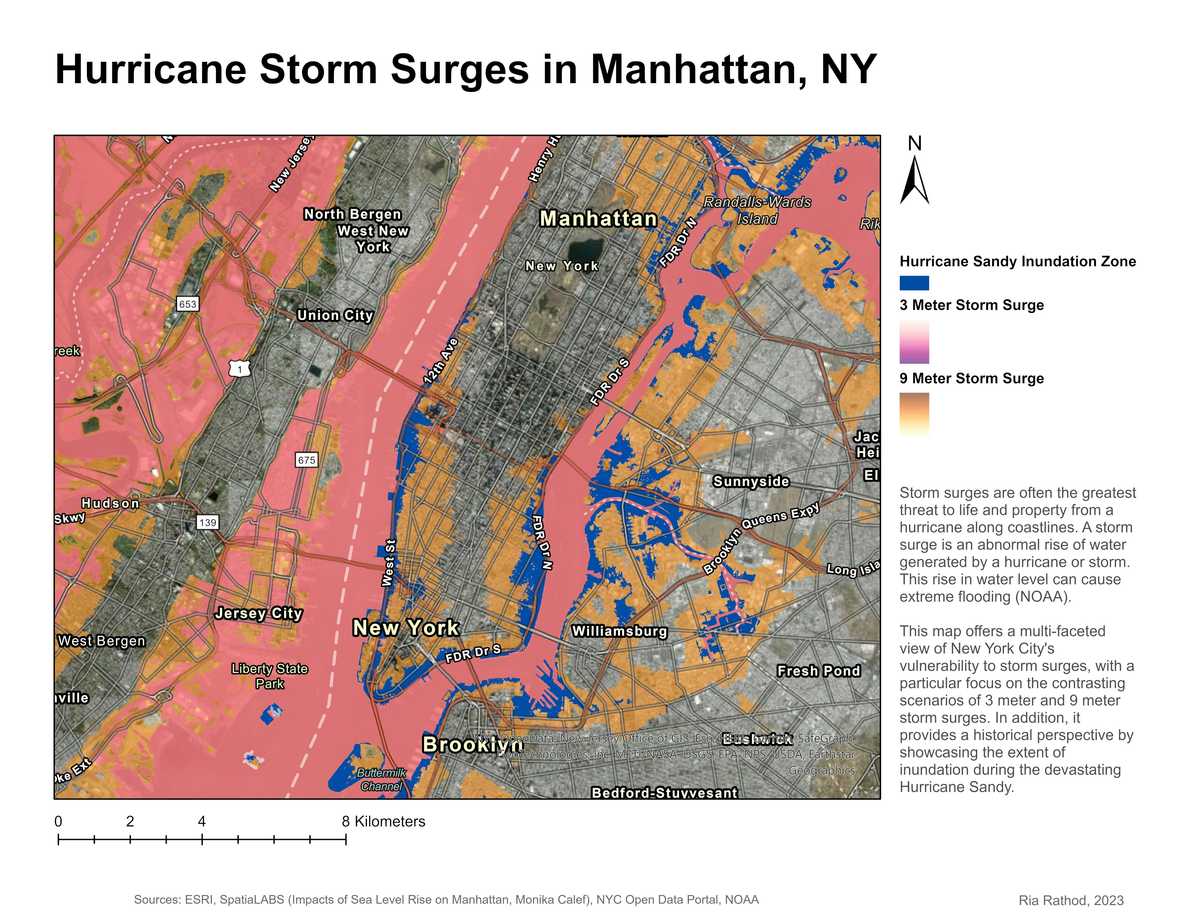
Made using a combination of data from the 2019 Louisville Urban Tree Canopy Assessment and polygons of redlined areas from "Redlining Louisville: Racial Capitalism and Real Estate" by Joshua Poe. This is an update on the 2015 version created by Robert Monsma, so full credit goes to him for the layout, original idea, and so on. This was a big project for me so I wanted to share even though its not fully original.
Tree Canopy in Redlined Districts
Tools used
ArcGIS OnlineArcGIS Pro
tags
canopyRedlineRedliningtrees
More by Sean Willis


You might also like


Join the community!
We're a place where geospatial professionals showcase their works and discover opportunities.