
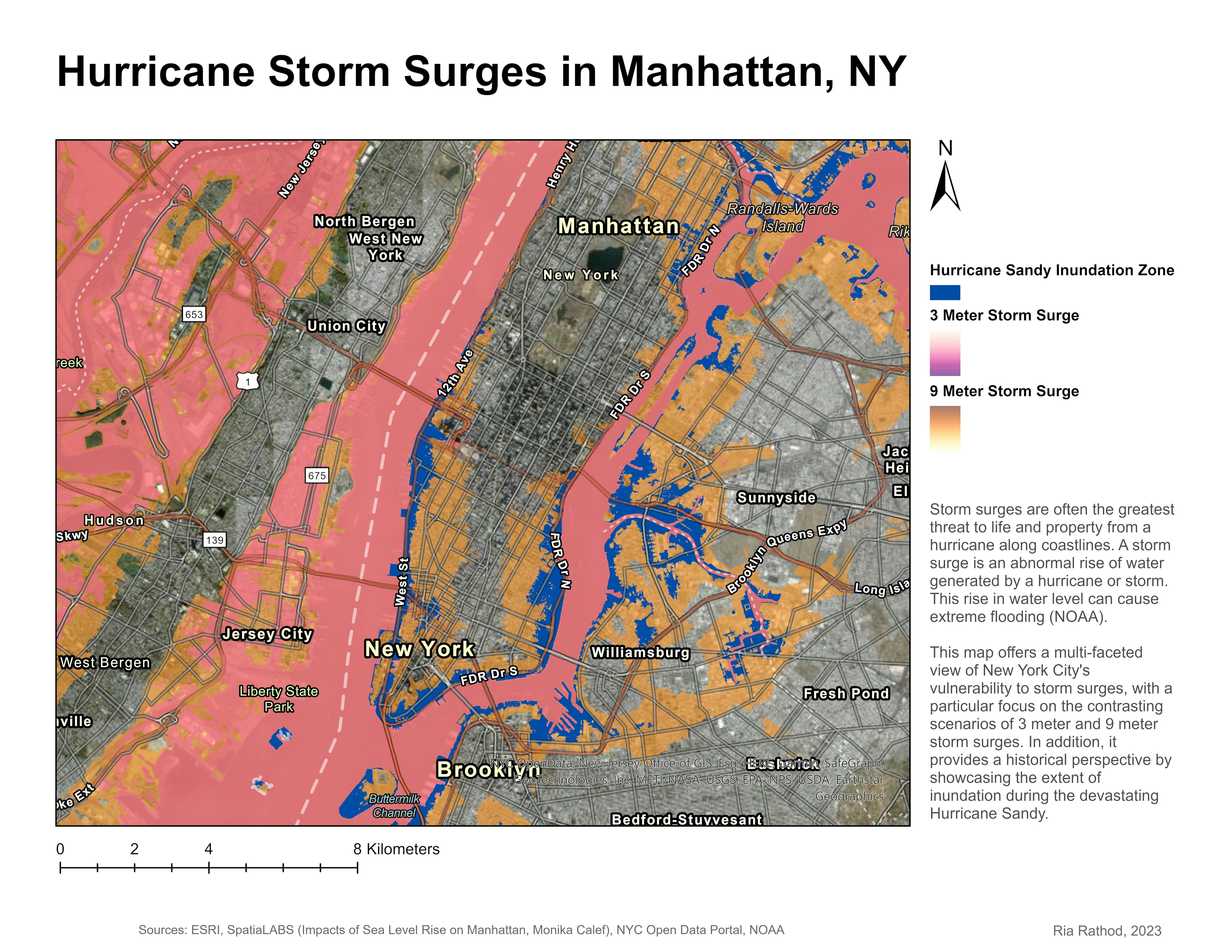
This map offers a multi-faceted view of New York City's vulnerability to storm surges, with a particular focus on the contrasting scenarios of 3 meter and 9 meter storm surges. In addition, it provides a historical perspective by showcasing the extent of inundation during the devastating Hurricane Sandy.
Manhattan Storm Surges
Plug-ins used
None
tags
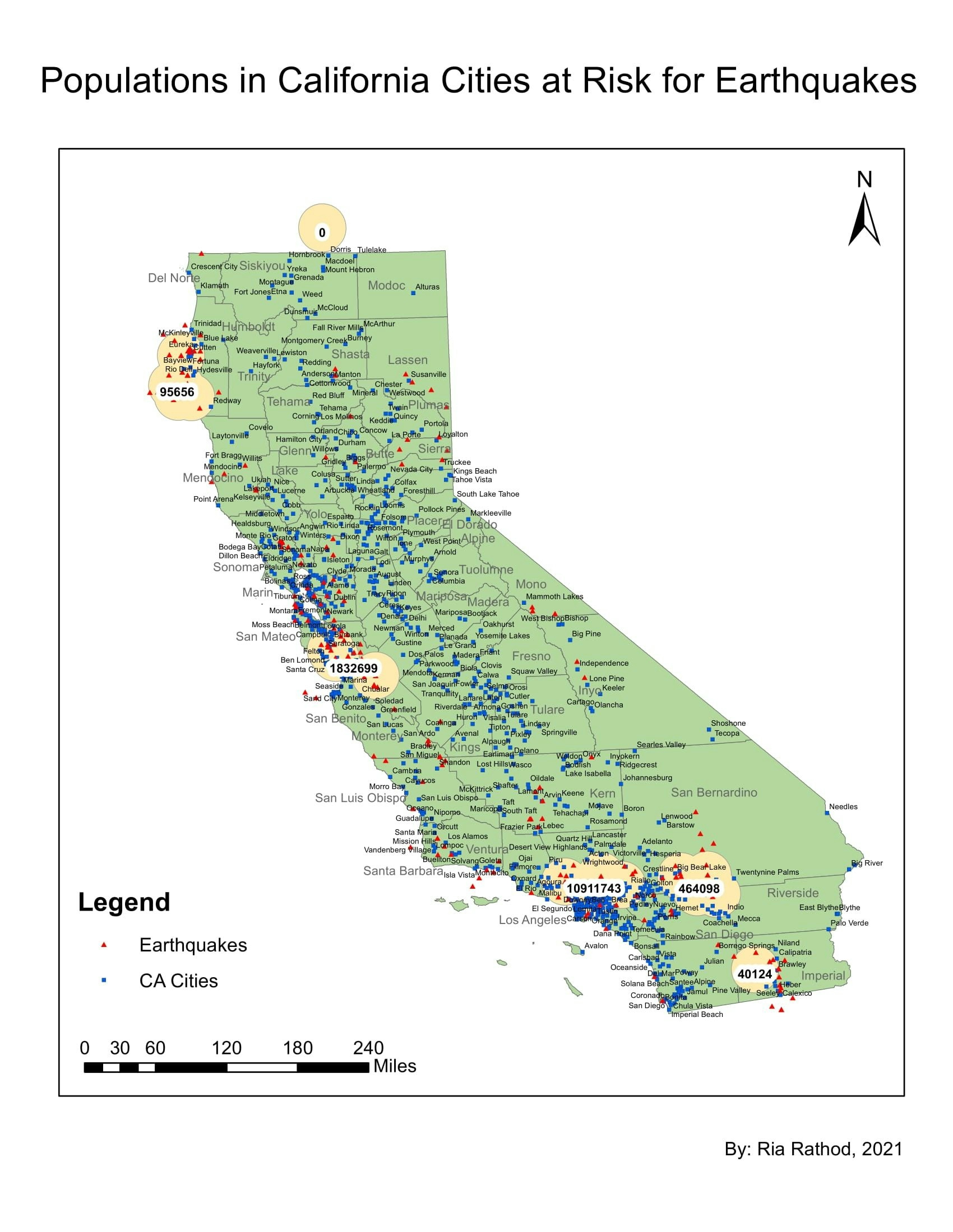
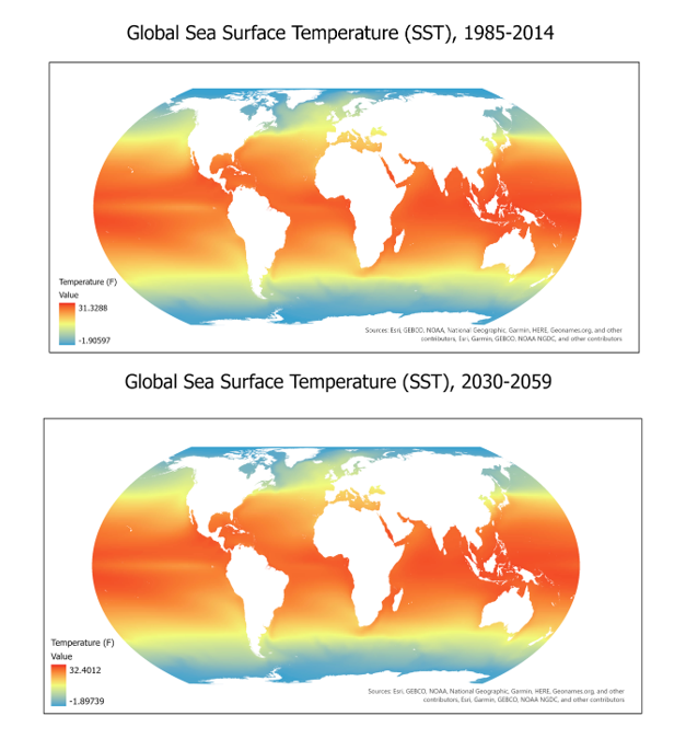
Elevationflood risk
More by Ria Rathod

You might also like


.jpg&w=3840&q=100)


Join the community!
We're a place where geospatial professionals showcase their works and discover opportunities.