
This map was created for my Intro to GIS course.
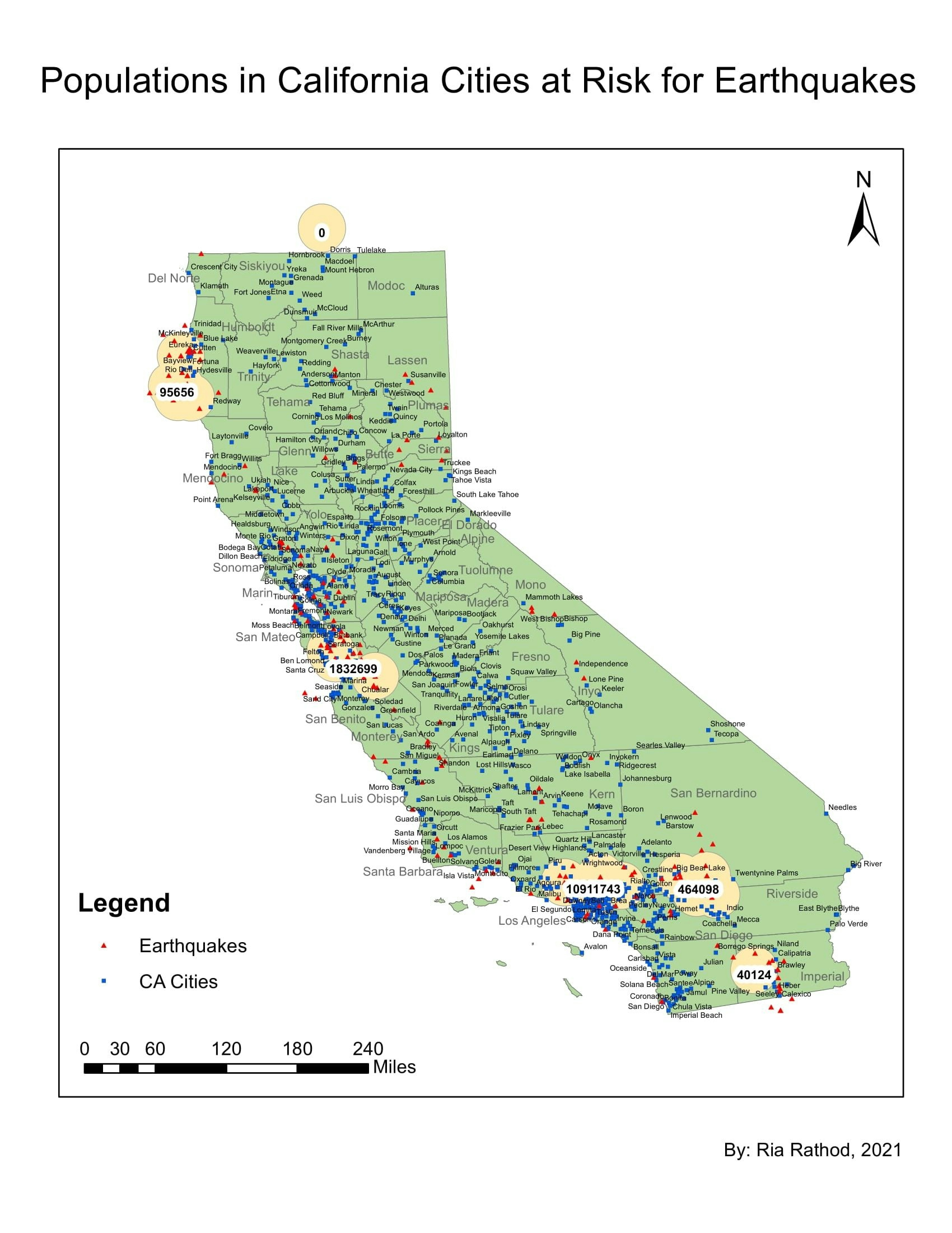
CA Cities at Risk for Earthquakes
Plug-ins used
Census
tags
BuffersEnvironmentalNatural DisasterSpatial AnalysisVulnerable Populations
More by Ria Rathod

You might also like


-1.png&w=3840&q=100)


Join the community!
We're a place where geospatial professionals showcase their works and discover opportunities.