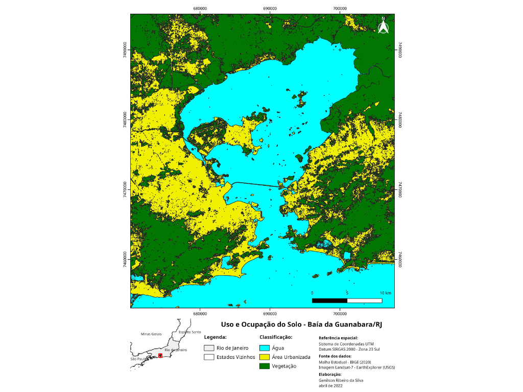
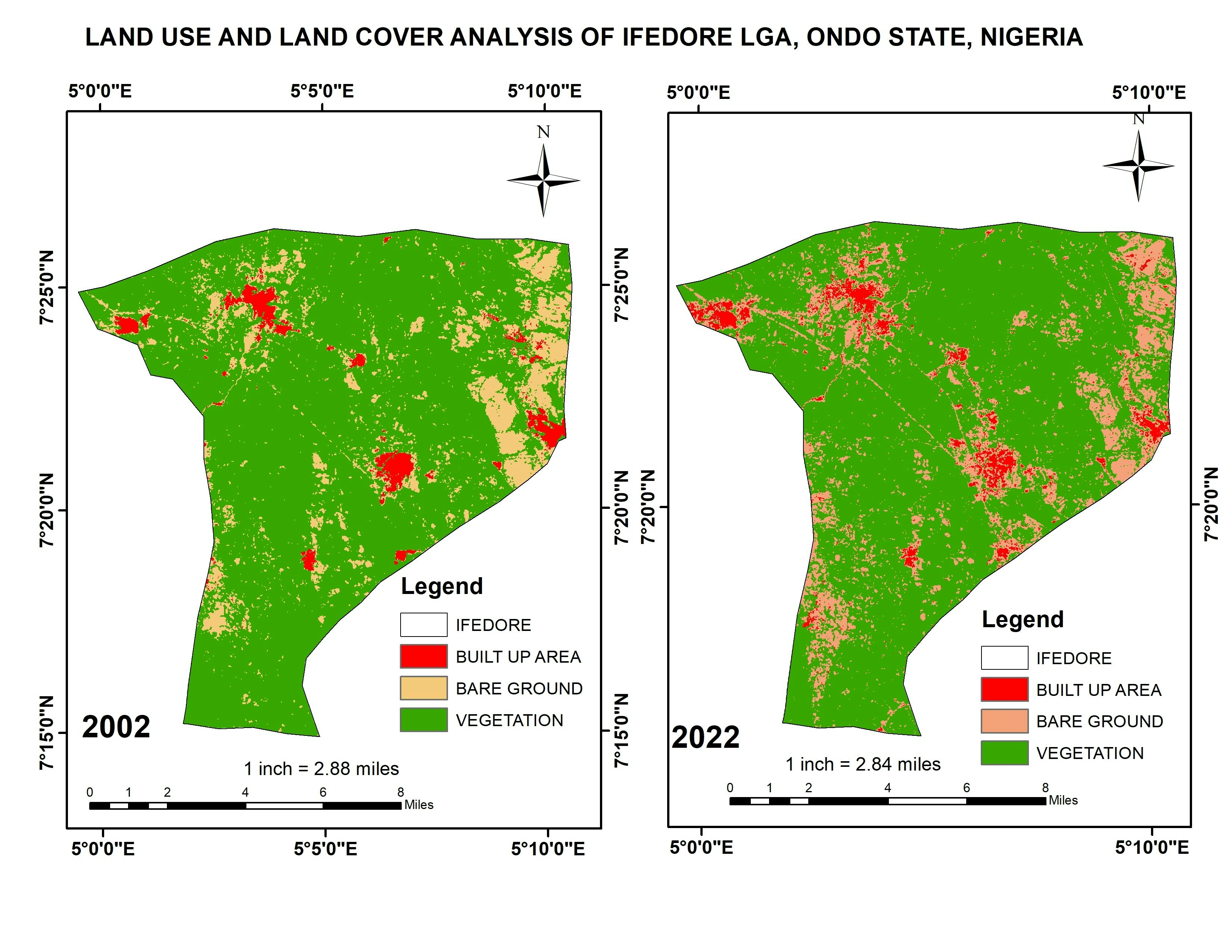
Land Use and Cover Baía da Guanabara, RJ

Tools used
QGIS
tags
land coverland useuso e ocupação do solo
More by Genilson Ribeiro da Silva

You might also like


Join the community!
We're a place where geospatial professionals showcase their works and discover opportunities.