Sign up or log in to your Spatialnode account.

Takes less than a few seconds.

DC Fast Chargers Near Interstate

Adam O Dolce
Adam O Dolce•

November 02, 2022

DC Fast Chargers Near Interstate

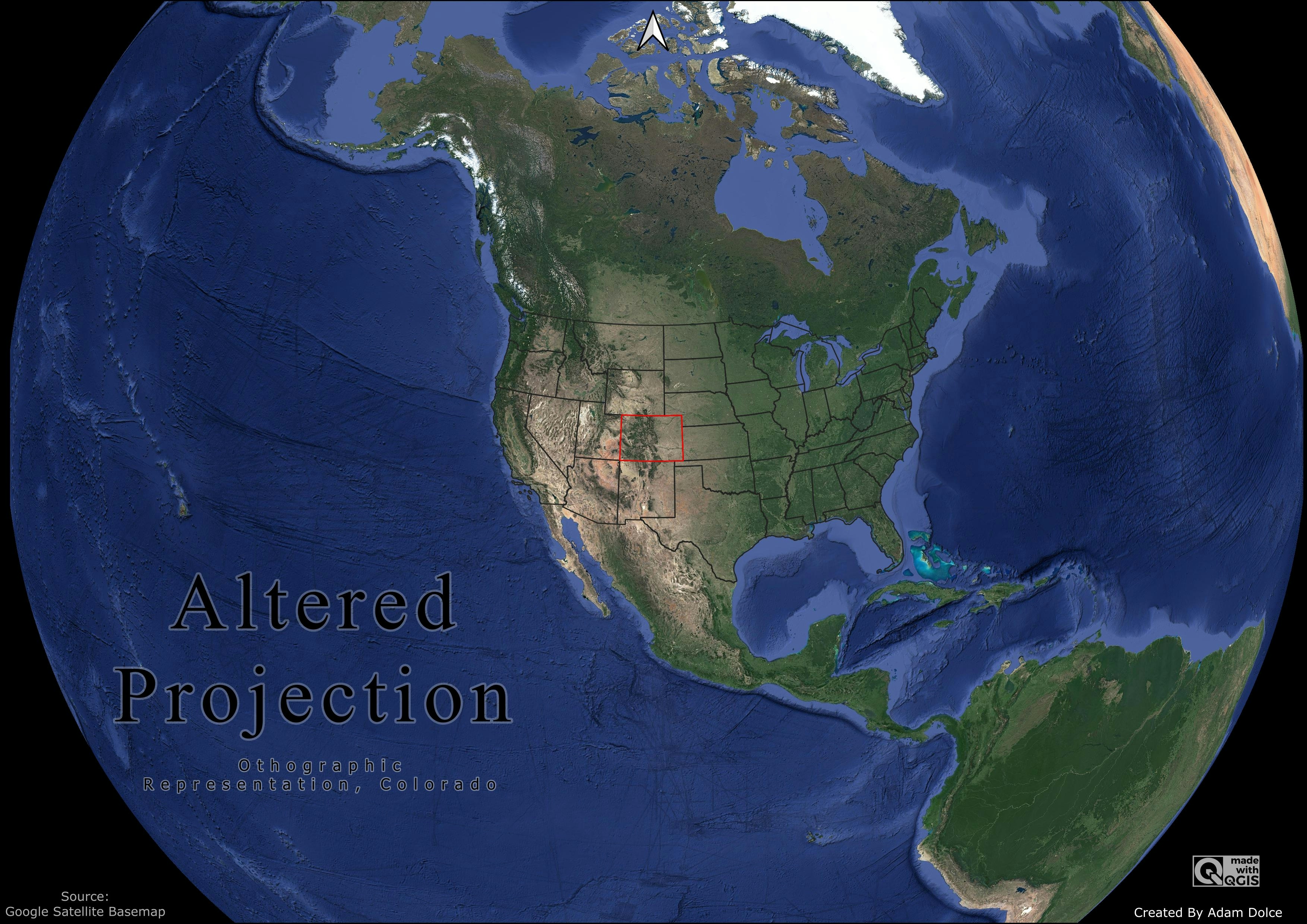
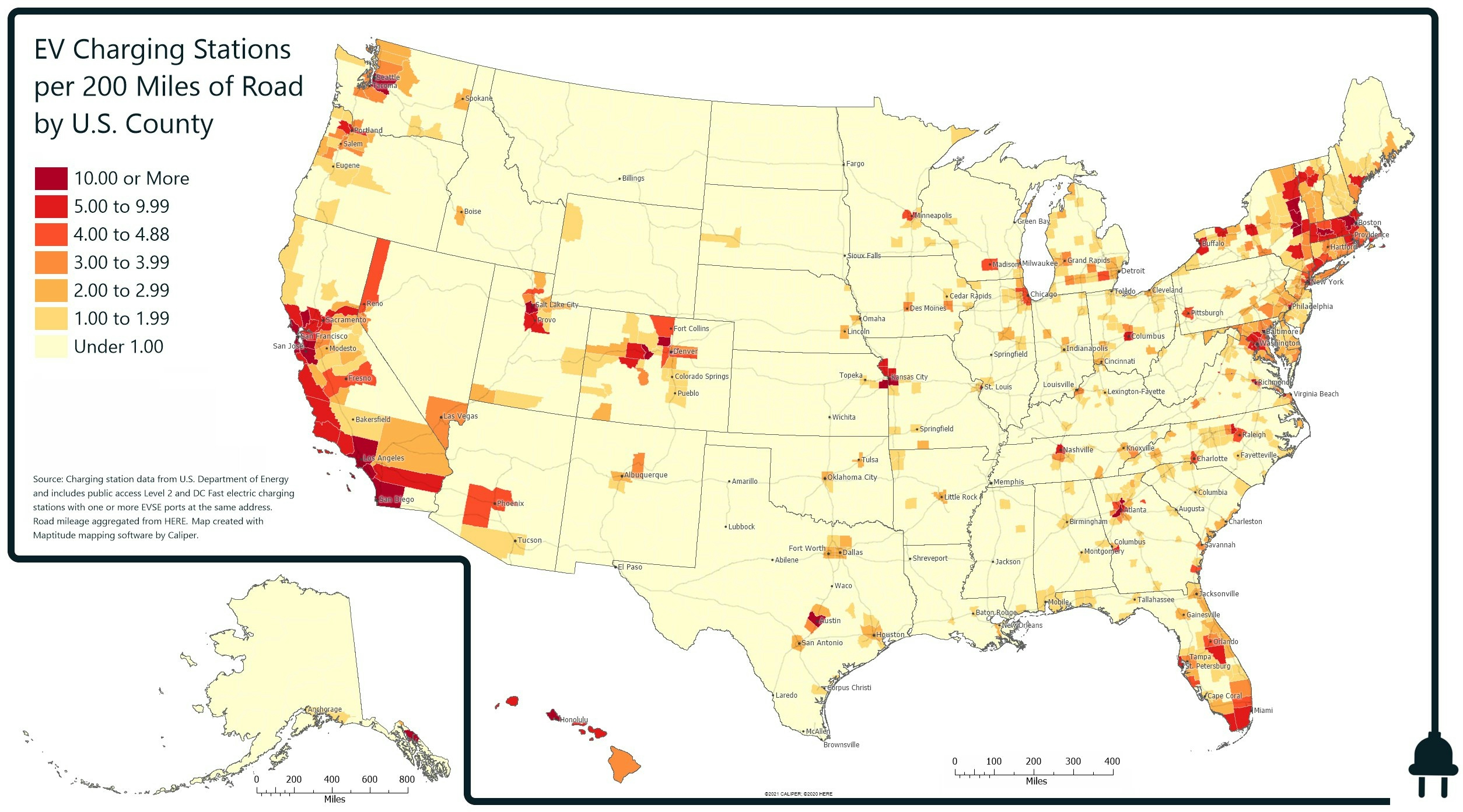
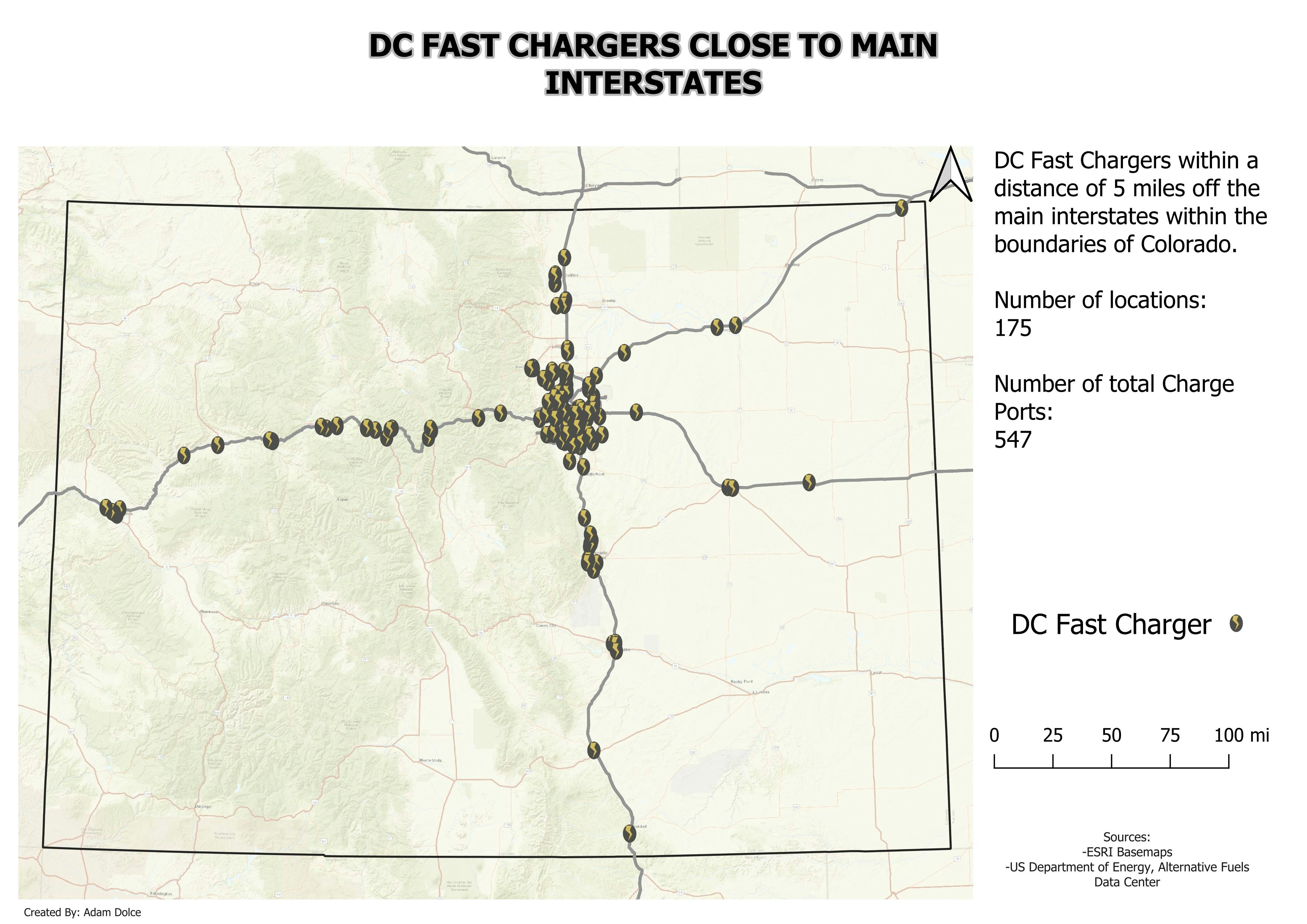
Using the line features of the main interstates of Colorado, The DCFC (DC Fast Charger) within a 5-mile buffer to the highway is displayed.

#day2 #30daymapchallenge


Tools used

bufferQGIS

Plug-ins used

QGIS

tags

#30DayMapChallenge

More by Adam O Dolce

Colorado Population
Colorado Population
27
Kiev Vegetation
Kiev Vegetation
76
Registered EV Owners
91
Hexagonal Digital Elevation Model
80
Food and Drink with Restaurant Names
90
Rivers
Rivers
56
EZ Waste Landfill Site Proposal
299
Electric Transmission Network
44
Bad Map
Bad Map
34
Boulder County Road Network
26
Food and Drink
Food and Drink
84
Open Spaces
Open Spaces
71

You might also like

Um Olhar Comparativo
Gabriel Henrique Braga Matos
Um Olhar Comparativo
Gabriel Henrique...
20
MODELO DIGITAL DE ELEVAÇÃO - MDE
Isabel Cristina da Silva Costa
MODELO DIGITAL DE ELEVAÇÃO - MDE
Isabel Cristina...
92
Relief map
Oskar Karlsson
Relief map
Oskar Karlsson
9
Spatial visualization of applicants ??
Lawrence Akpoterai
Spatial visualization of applicants ??
Lawrence Akpoterai
10
ASHANTI - REGION 3D MAP
PETER BOATENG
ASHANTI - REGION 3D MAP
PETER BOATENG
17
Drive Times for Fire and Rescue Services
Jacob Jones
Drive Times for Fire and Rescue Services
Jacob Jones
11
Exercise 4abc- City of Troutdale
Kendel Nealey
Exercise 4abc- City of Troutdale
Kendel Nealey
9
Global Flight Paths
Hamza Bouarakia
Global Flight Paths
Hamza Bouarakia
114
Cartography of public transport network
Mamadou Krouma
Cartography of public transport network
Mamadou Krouma
74
West-East Run Curaçao, 2021
Menno ter Bals
West-East Run Curaçao, 2021
Menno ter Bals
6
CROP MONITORING USING NDVI; DRONE IMAGES
MOSES MWANIA MULYUNGI
CROP MONITORING USING NDVI; DRONE IMAGES
MOSES MWANIA MULYUNGI
101
Mapa Hipsométrico do Pico do Roncador
Matheus Sá
Mapa Hipsométrico do Pico do Roncador
Matheus Sá
19

Join the community!

We're a place where geospatial professionals showcase their works and discover opportunities.

Sign Up for free