Sign up or log in to your Spatialnode account.
Takes less than a few seconds.
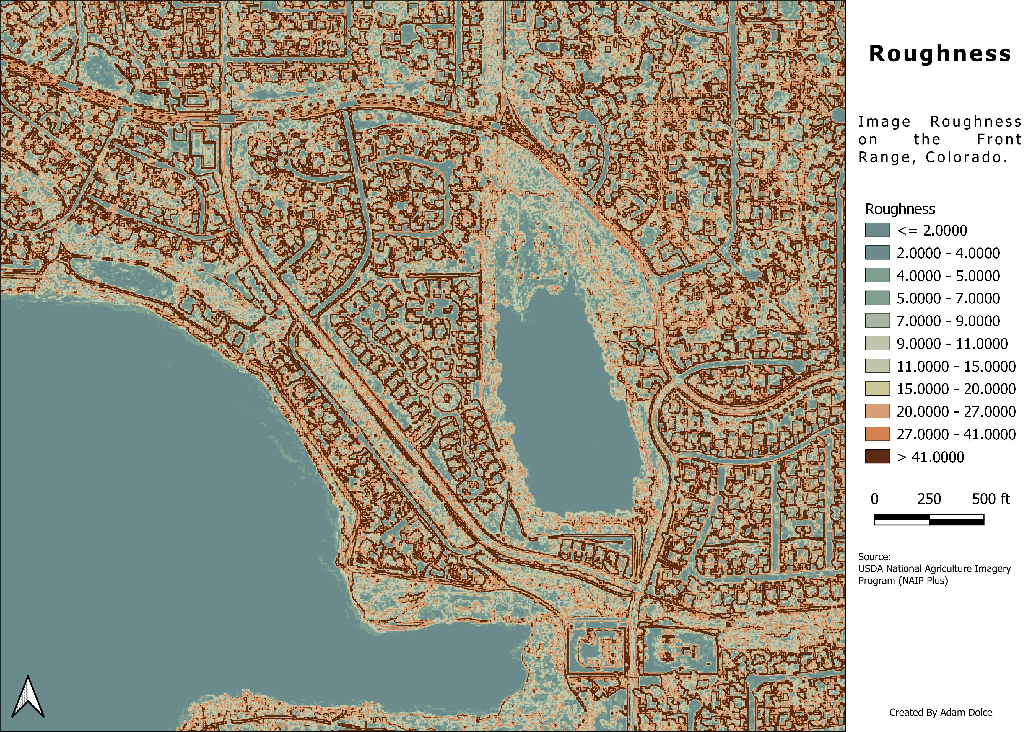
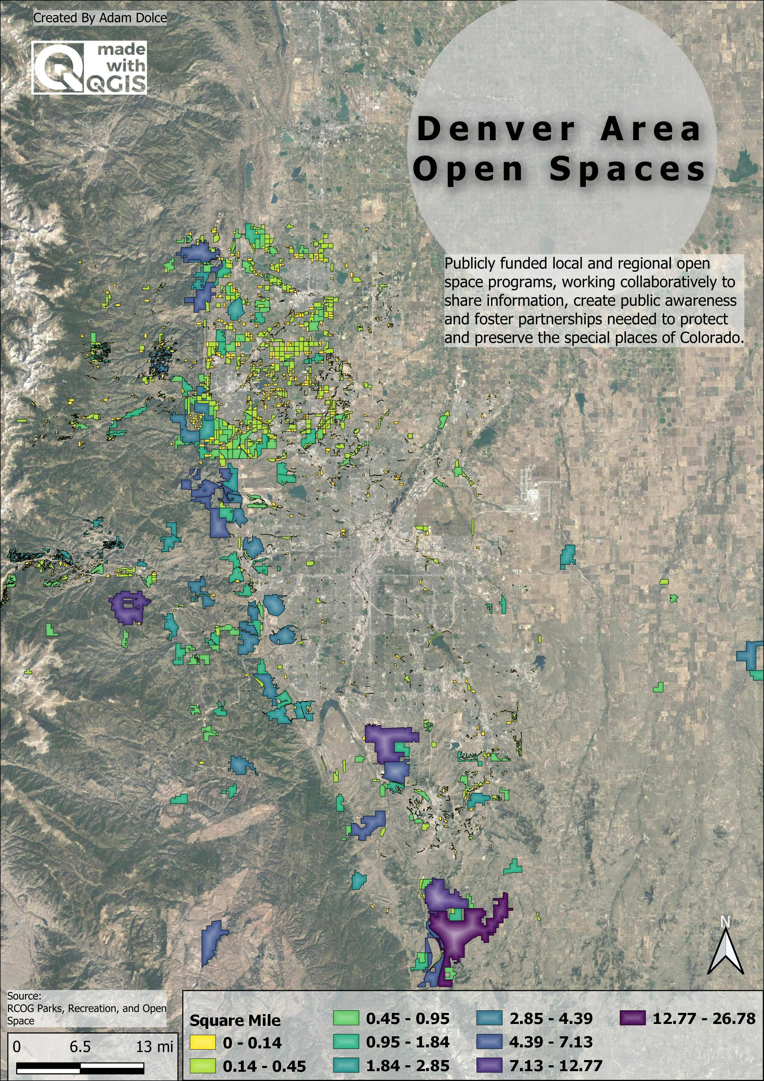
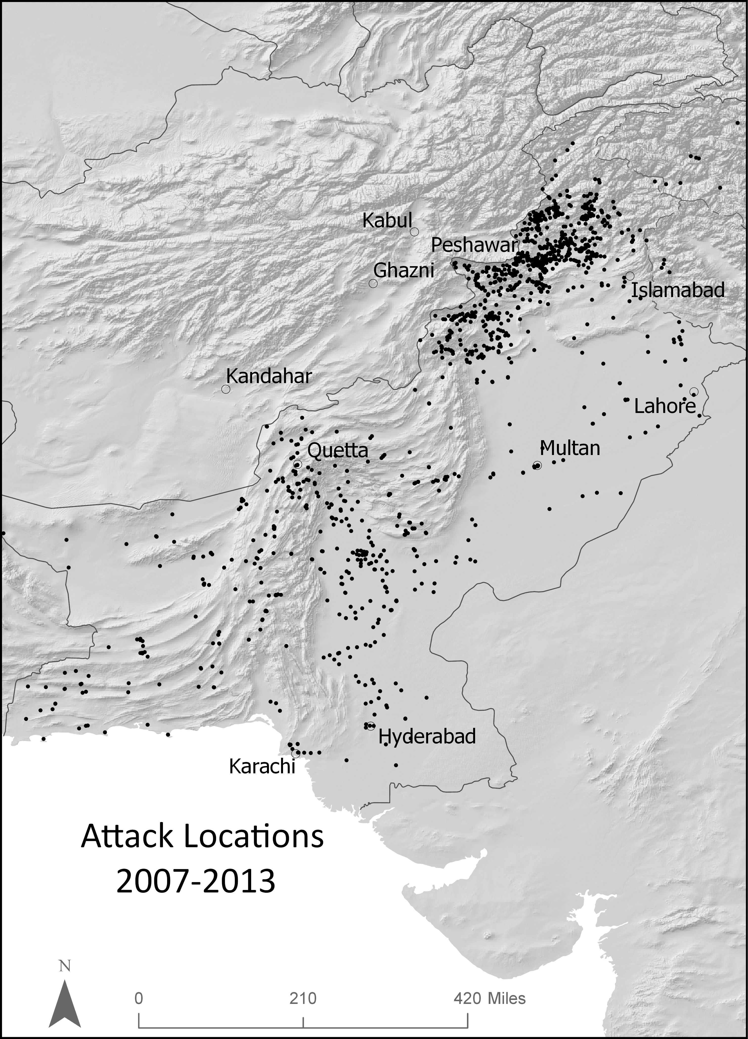
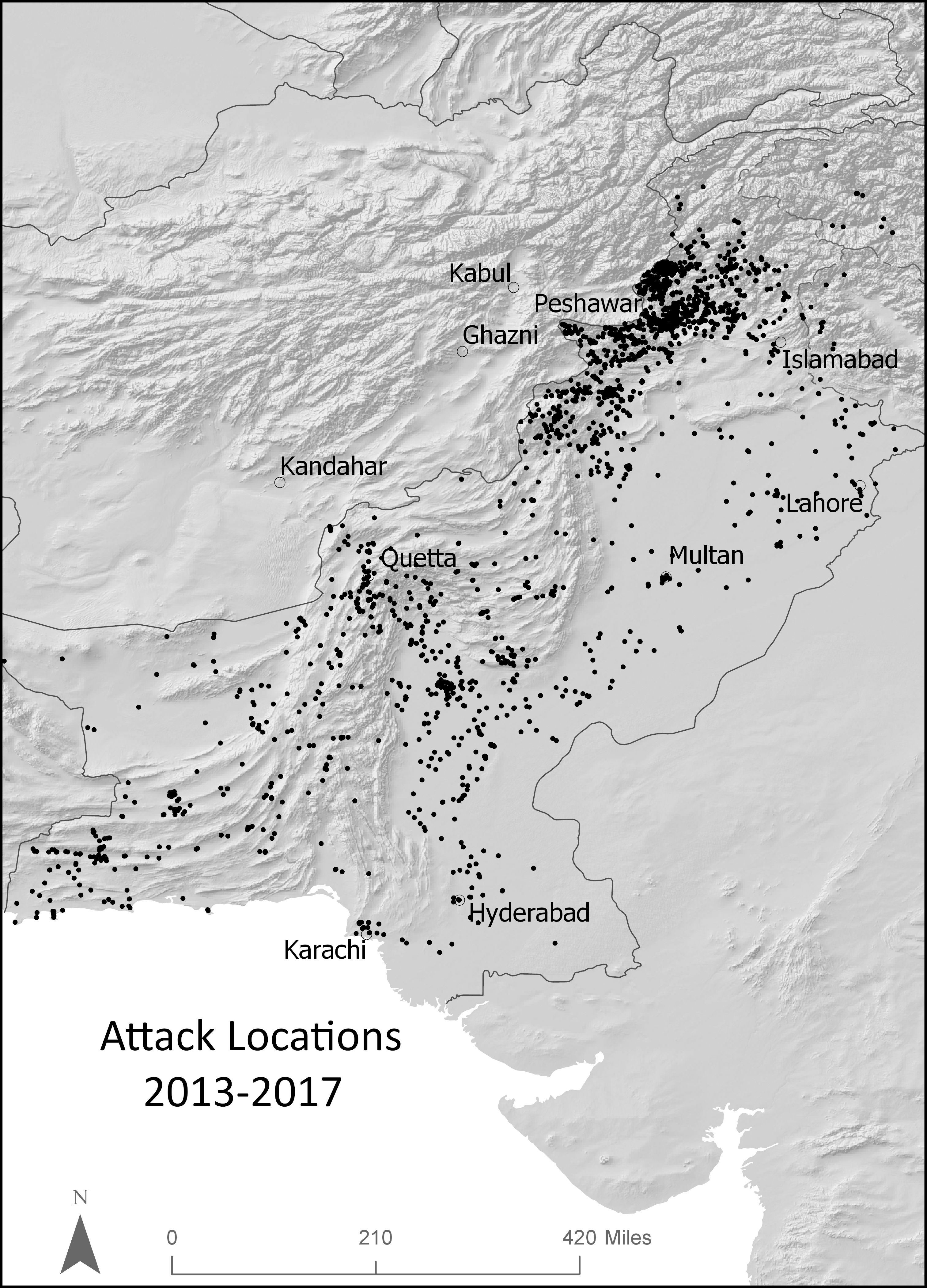
Roughness
November 07, 2022
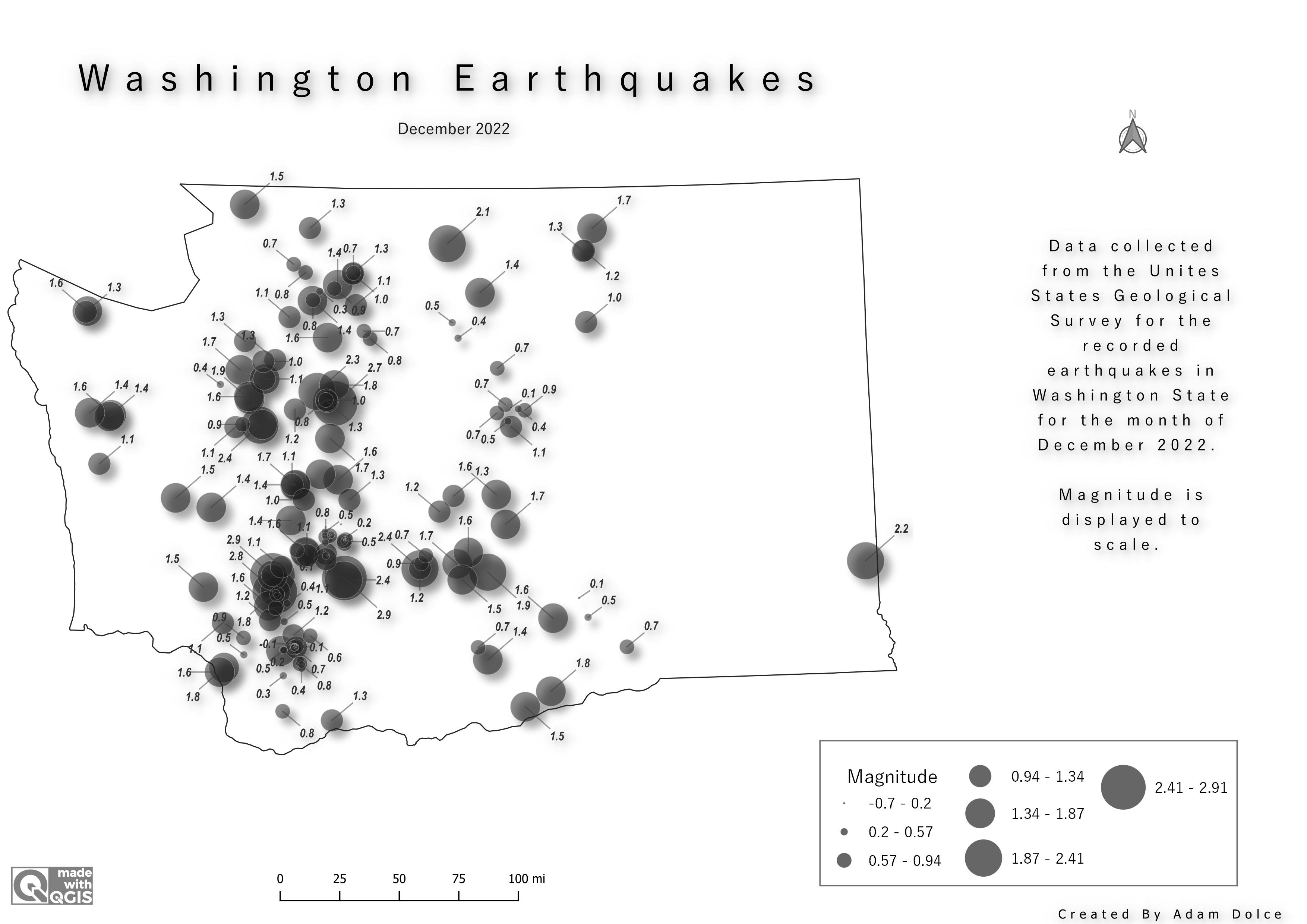
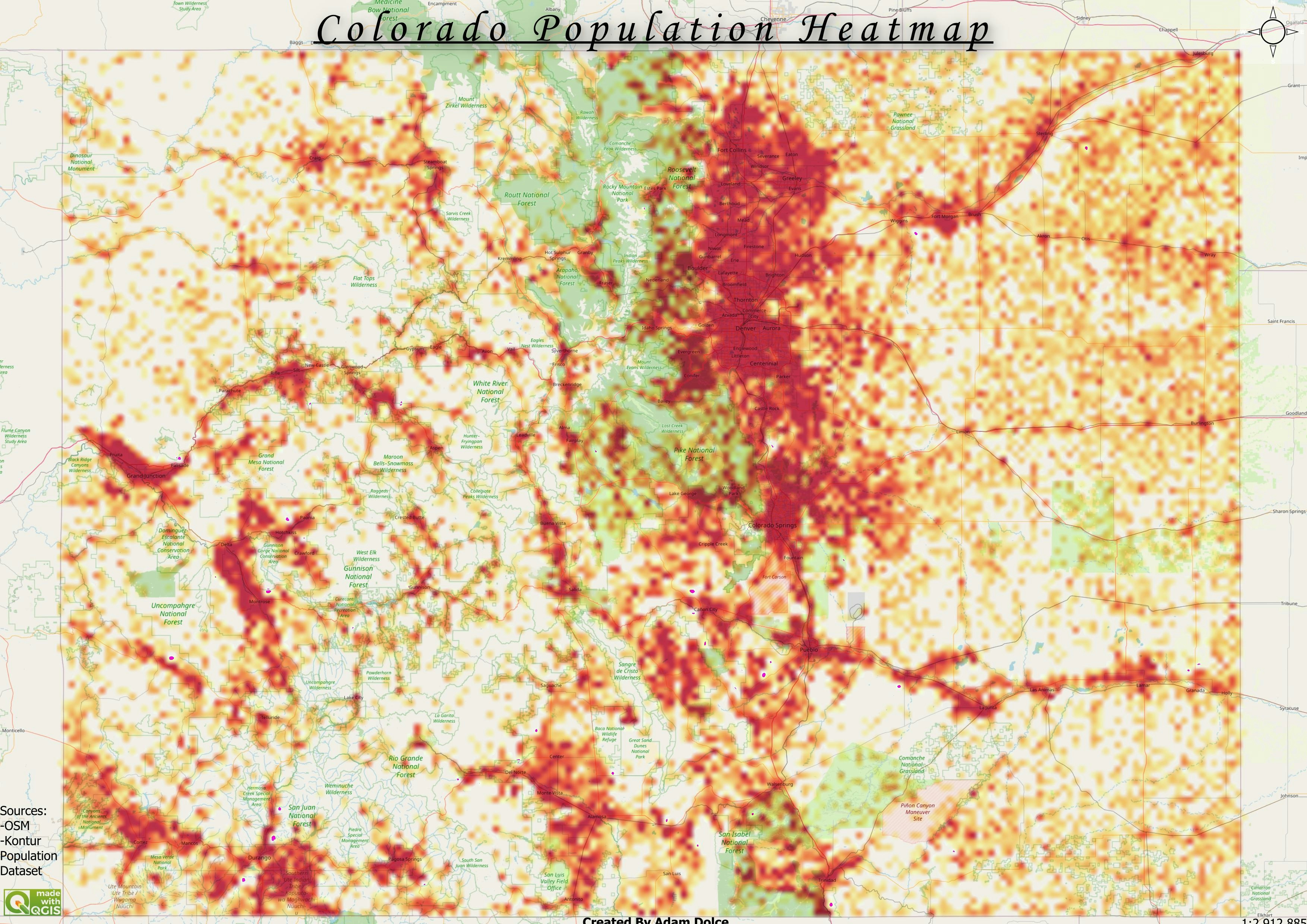
Image Roughness
#Day7 #Raster #30daymapchallenge
More by Adam O Dolce
You might also like
We're a place where geospatial professionals showcase their works and discover opportunities.