
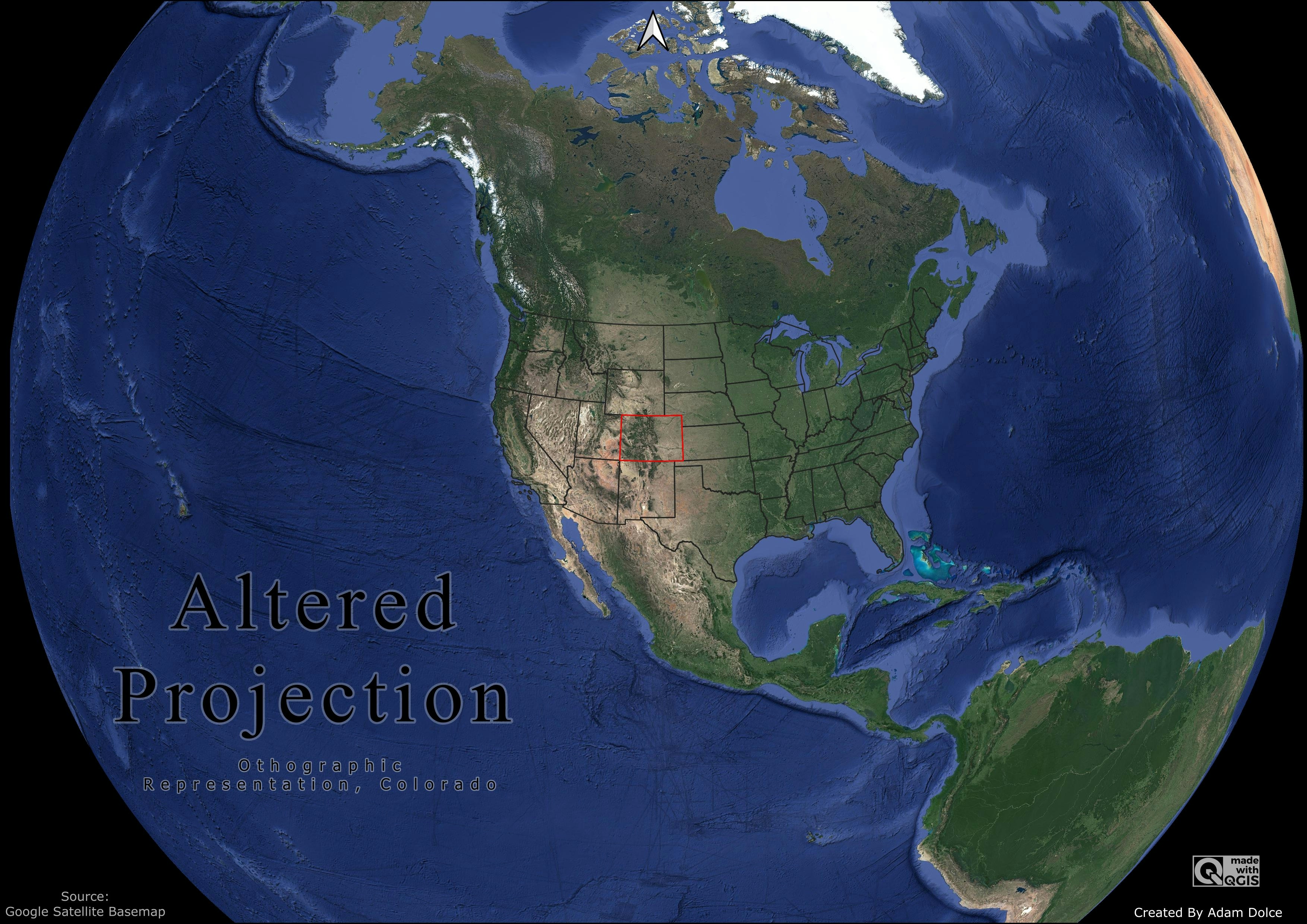
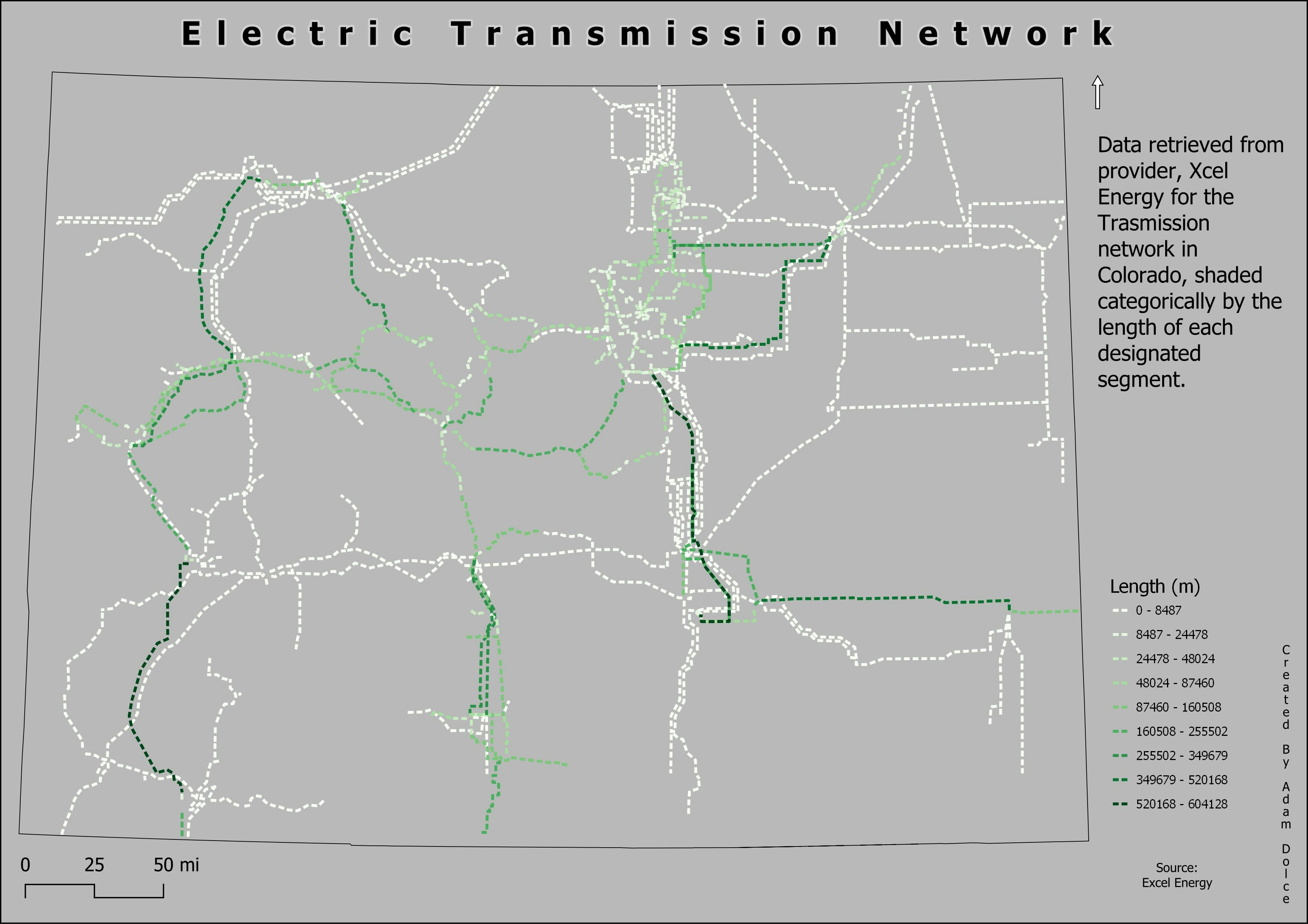
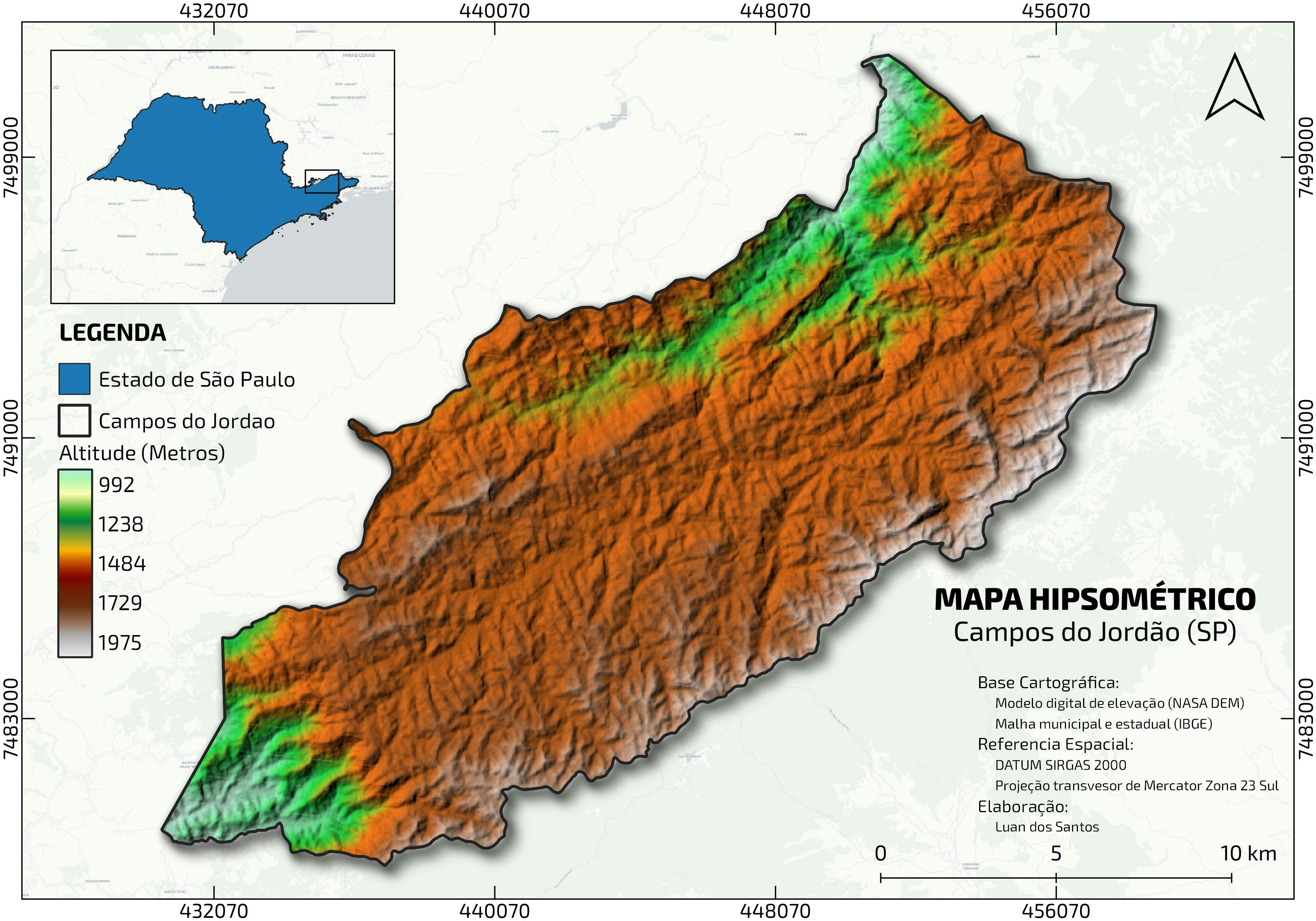
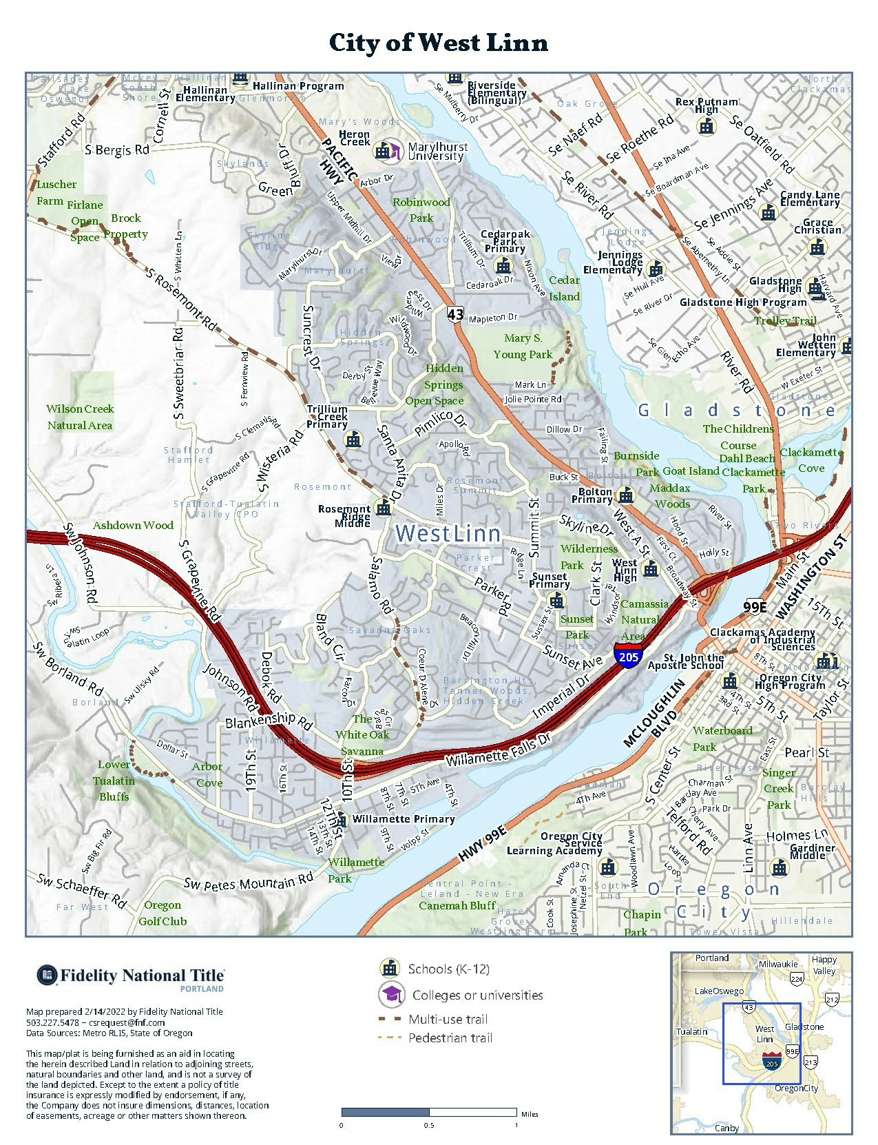
Custom orthographic projection centered on customized decimal degrees. Google imagery basemap used for realistic feel. Continental United states boundary layer added for additional reference. Colorado boundary layer highlighted.
Globe - Ortho
Tools used
QGIS
Plug-ins used
QGIS
tags
GoogleprojectionsQGIS
More by Adam O Dolce


You might also like


Join the community!
We're a place where geospatial professionals showcase their works and discover opportunities.