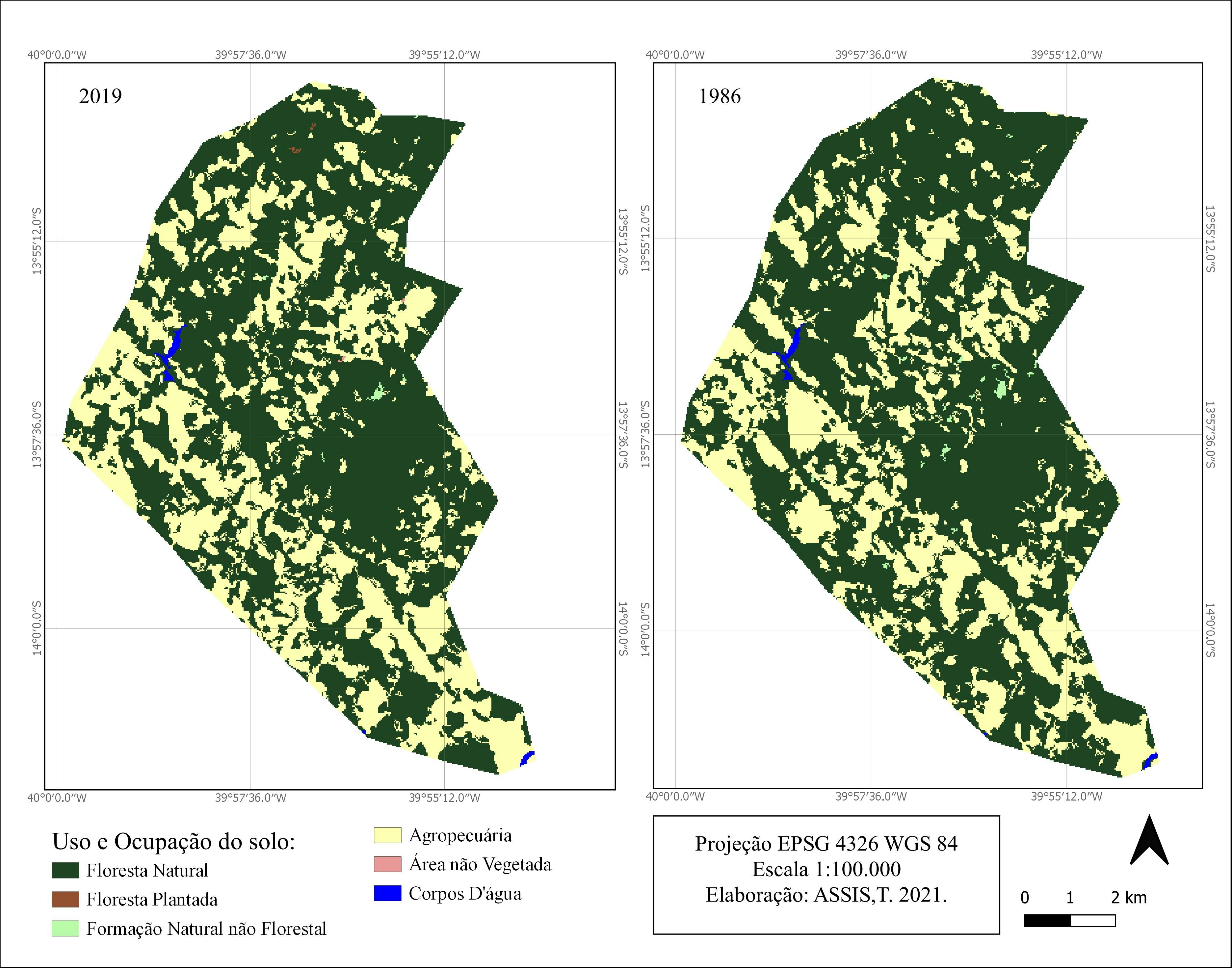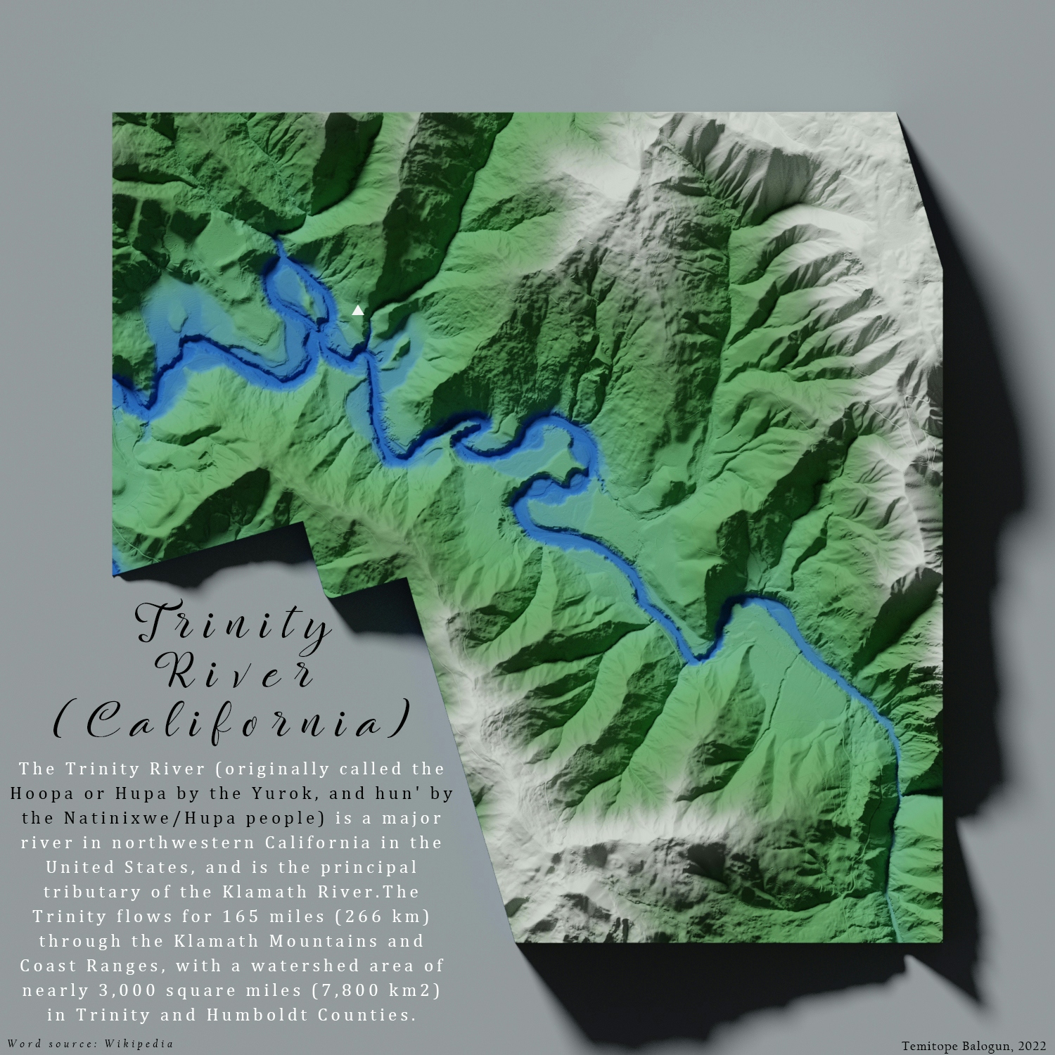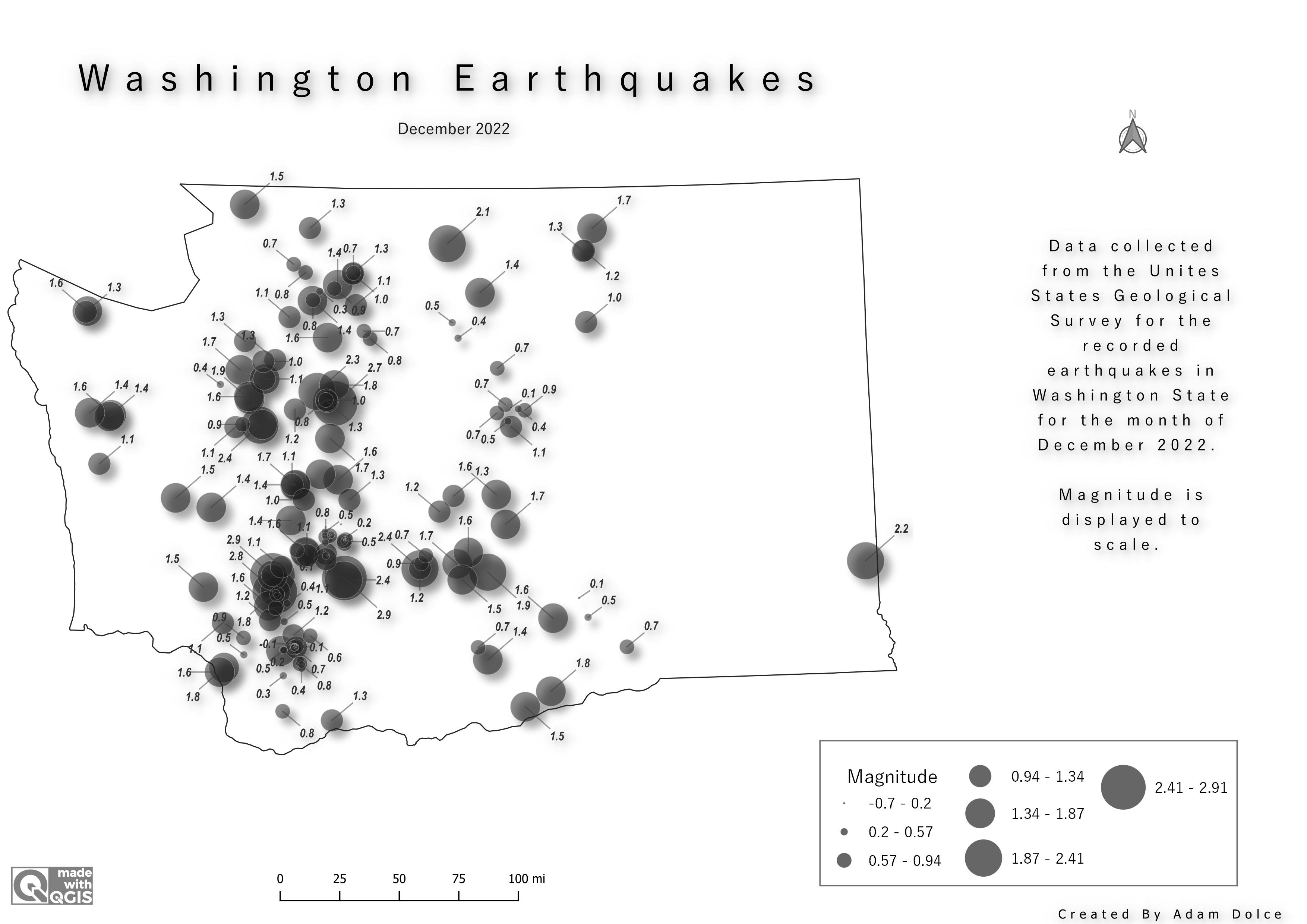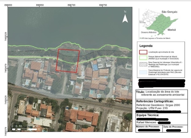
A portfolio is a collection of your works or projects and documentation of your skillset that helps to provide evidence of your competence for hire “to potential employers”. With a portfolio, you can tell the story of your career journey. A portfolio allows you to show and not just say. Regardless of the stage, you are in your career path, you need an online portfolio to showcase your work samples and maps even as a GIS Analyst, Cartographer, GIS Developer, etc.
The Geospatial people are skilled and creative individuals that should be given every means and platform for visibility, so as to ensure that their works are being appreciated duly. Spatialnode allows geospatial professionals or enthusiasts to accumulate their projects for proper record keeping and easy accessibility to the projects when there is a need for them.
Why do you Need a Geospatial Portfolio?
As geospatial personnel, there is a need to keep working on projects to test how much improvement you have gained in your skill. A geospatial portfolio would be useful in saving these projects with detailed descriptions of the “how” and the tools used. This would make it easier for you to keep track and record the projects you have worked on, the time you worked on them and the tools used.
Having a portfolio would also make it easier for you to sell yourself and also access opportunities like projects collaborations, networking, and jobs that duly suit your skills because you have readily available pieces of evidence to show that you are well-skilled and capable of the task.
Create a Free Geospatial Portfolio on Spatialnode in Minutes
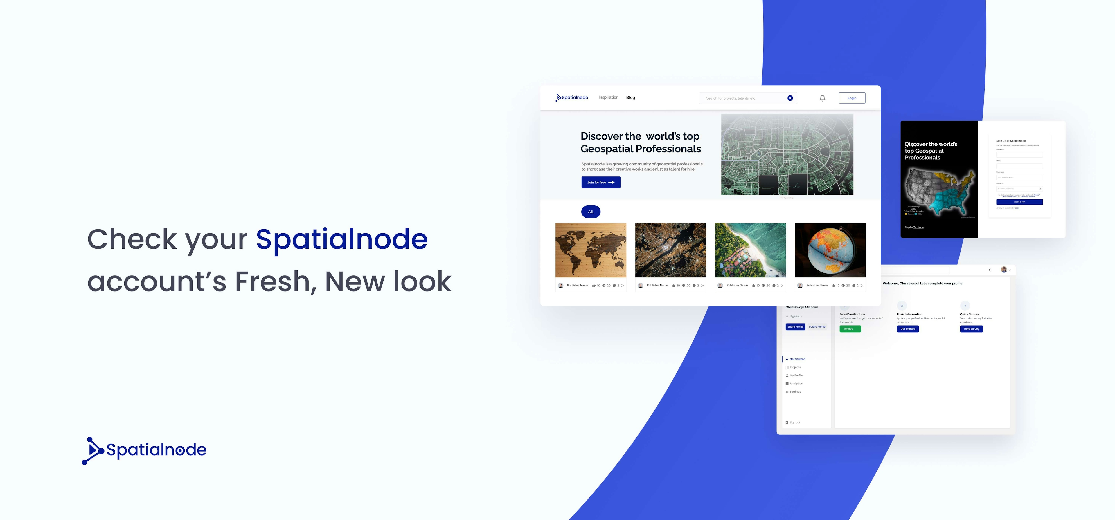
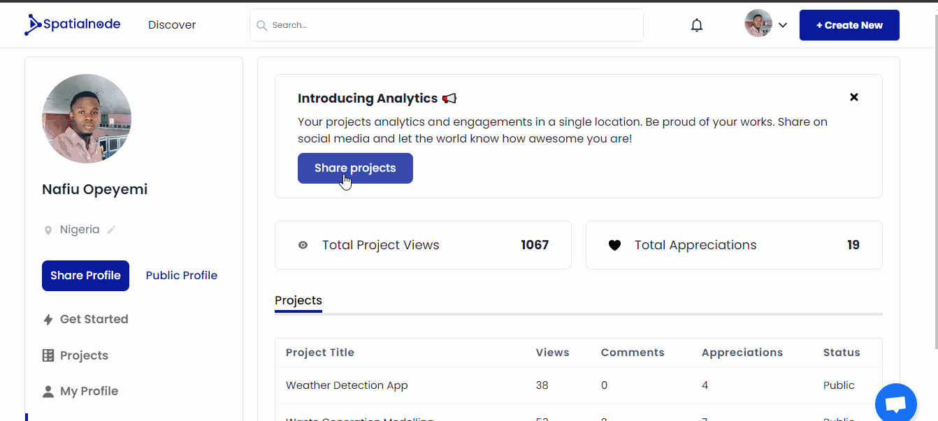
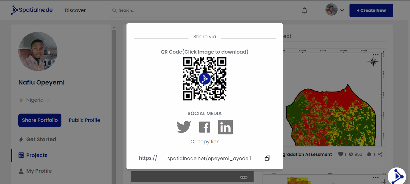
Spatialnode allows you to create a full-fledged portfolio in order to showcase your skills and projects. Also, giving you the opportunity to share your portfolio using a unique link that would be automatically assigned to you after successful registration to the platform. On your Spatialnode portfolio, you can upload your projects/maps in either JPEG, PNG, or GIF format.
Other features that can be added include the title of your project, a detailed description of the project, where you can give a brief about the project, its relevance, and also the steps you took in creating the project or map. Tools used plugins/libraries used, and tags. There is also a demo link box, where you get to add the link to your demo if there is any.
Steps to Create a Geospatial Portfolio in Minutes on Spatialnode
If you are new to the Spatialnode community, log on to www.spatialnode.net to register and create your account, follow the instructions and input the required details to get started. Once your account has been created, you’ll be assigned a unique URL –spatialnode.net/yourusername, that you can link anywhere, including your resume/CV.
After registration, update your profile with your skills and your “about”, so that people can get to know more about you. You can also add your social media handles to direct people to your social media pages.
Follow these steps to create your geospatial portfolio in minutes on Spatialnode.
- Log on to www.spatialnode.net
- On the home page click the “Join for free” icon
- It lands you on the “create an account” page, follow the prompt to fill it.
- Check the “I accept the Terms of Service and Privacy Policy” box.
- Click the “Create Account” icon.
On successful registration, you will see a pop-up message on the page stating “Account created successfully”. Then you get navigated to the “Welcome to Spatialnode!” page, where you get instructed to check your email so as to verify your account. After verifying your account using the link sent to your email, you can now log in to your Spatialnode account successfully and start publishing your beautiful projects.
Get Started
Your career needs a well-designed portfolio as a tool for growth, visibility, and opportunity as a geospatial enthusiast and professional, whether you are job seeking or not. Take advantage of the Spatialnode platform and take your career to the next level.
To create a free account and start showcasing your works to the community, kindly visit https://spatialnode.net and register.
You can also follow Spatialnode on Twitter, Instagram, Facebook, Youtube, and LinkedIn to check out the activities of the community.