Introduction
Vegetation is an important component of ecosystems and plays a key role in the carbon cycle. It is impossible to underline enough how important vegetation cover is for maintaining the global environment.(Olajuyigbe et al., 2016)
Normalized difference vegetation index (NDVI) has been widely used for numerous studies, including the assessment of ecological responses to global warming, crop status, land cover classification and desertification (Zhigila et al., 2008; Rasmussen, 2004)
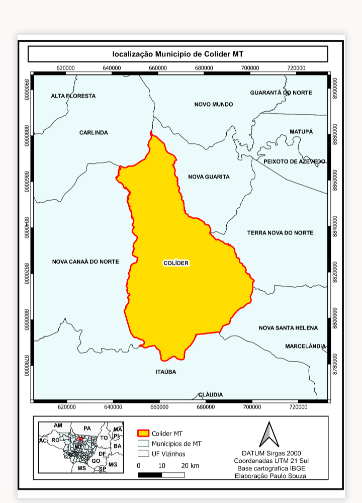
Study Area
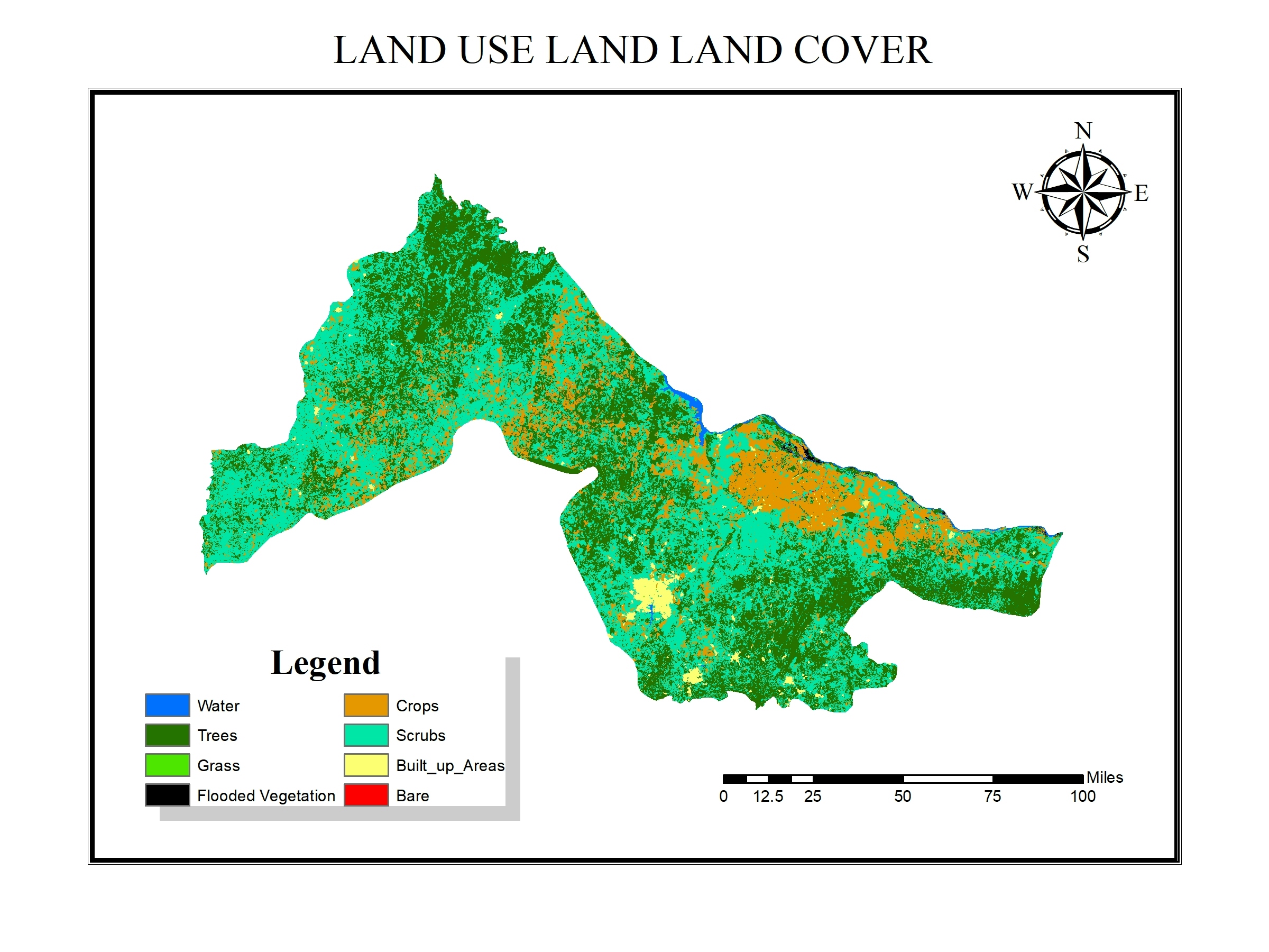
The study was conducted in Kwara State, in the North-central geo-political zone of Nigeria. Kwara state is topographically located in the western upland region of Nigeria Kwara State is topographically located in the western upland region of Nigeria.
Scope
This study is limited a portion of the North Central Part of Nigeria. The study is only concentrated on assessing the change in vegetation cover using GIS and remote sensing techniques in Kwara State, Nigeria.
Significance of Study
The study would be beneficial in the following ways:
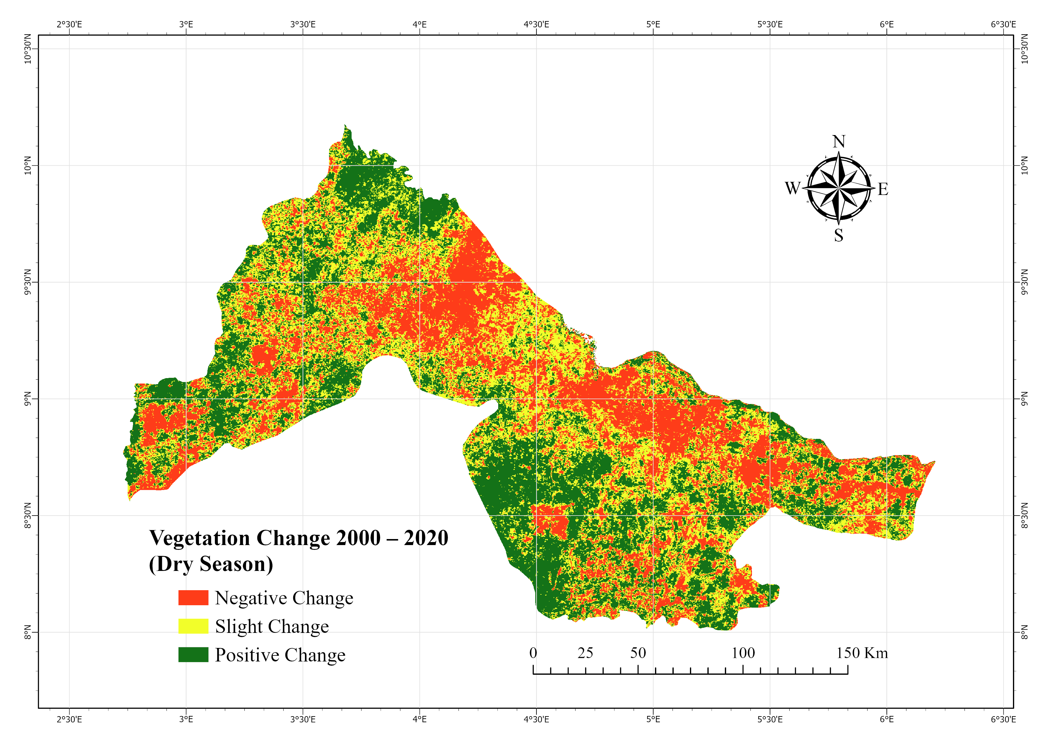
1. The purpose of this study is to determine the rate of change in the vegetation cover over time and to identify some of the variables (climate/human influences) that are responsible.
2. This is with a view to providing evidence-based information to the policy makers that would guide them in making informed decisions that would assist in conserving the vegetation in our ecosystem.
Data Used
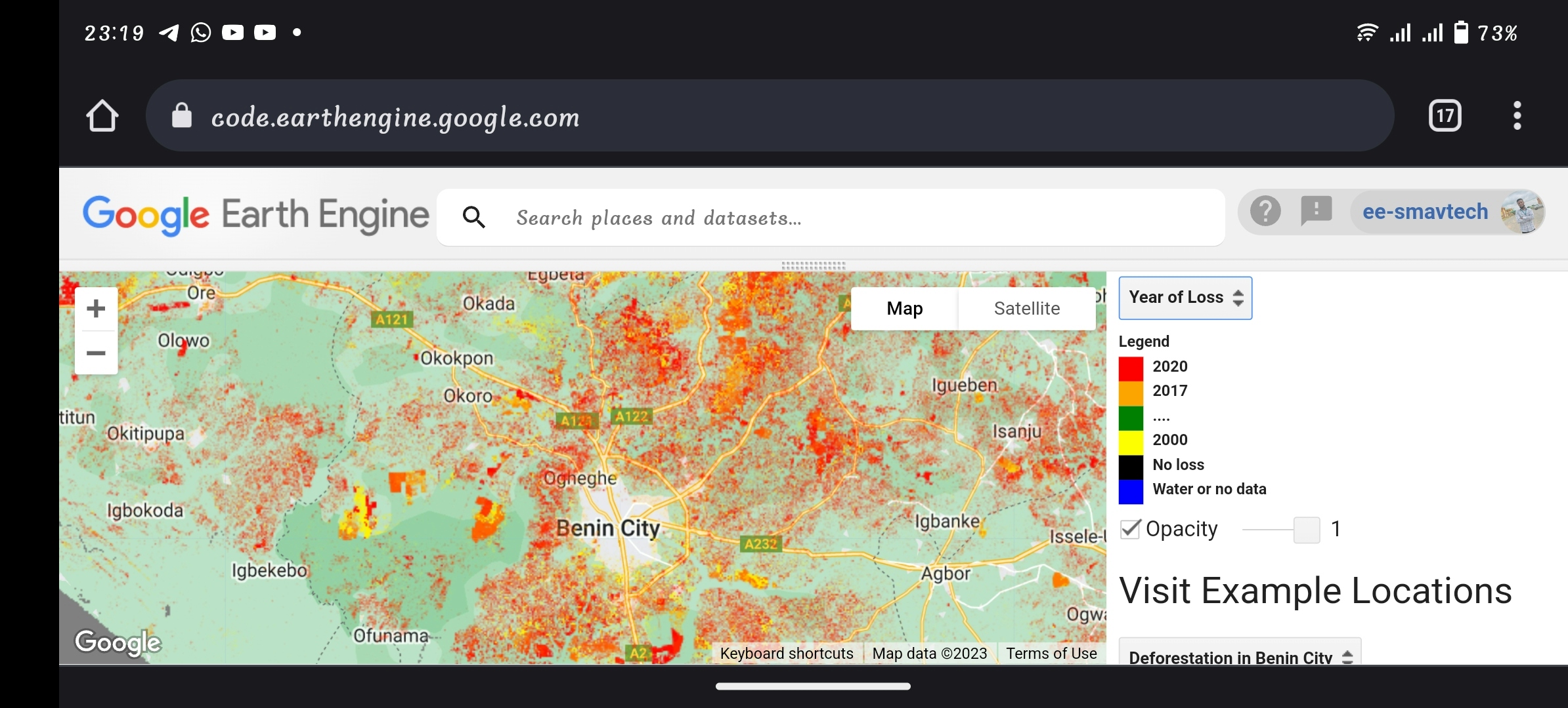
To examine large-scale vegetation changes, 30m spatial resolution time-series (2000, 2005, 2010, 2015 and 2020) NDVI data (Derived from Landsat 7/8 satellite data) were downloaded from Google Earth Engine (GEE)