Introduction
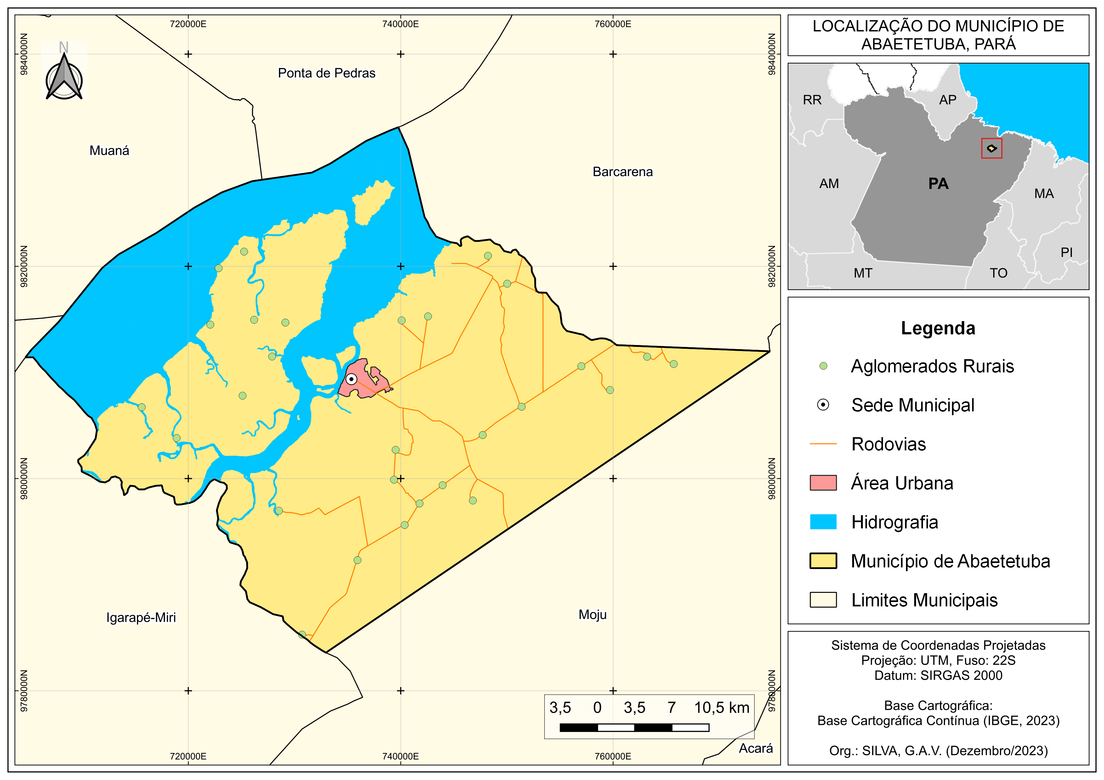
A location map allows you to visualize where a place or thing is located on the earth. A location map can be anything such as a single address, a building, landmark, or store, a neighborhood, city, or state, a sales territory, a country, or anything else that can be displayed visually on a map.
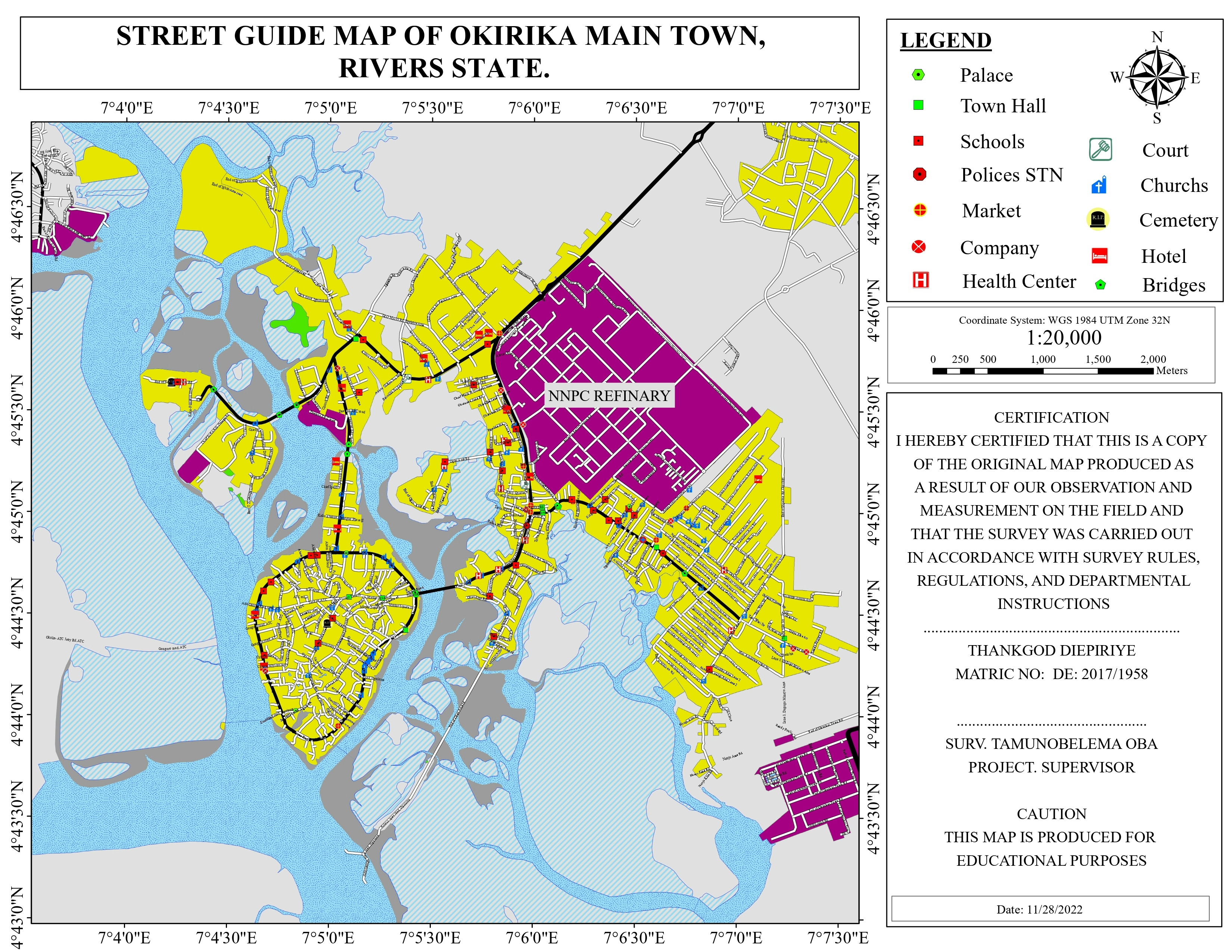
In this study, a location map was created to identify existing Features like School, hospital, market, bus stop, companies and existing road(and their types) etc around Okirika Main Town in Rivers state.
Data used
- Road network data
- Location data of features
- Base map
_2.jpeg&w=3840&q=100)


.svg "RONEIDE DOS SANTOS SOUSA")