.svg "Keran Nkongolo")
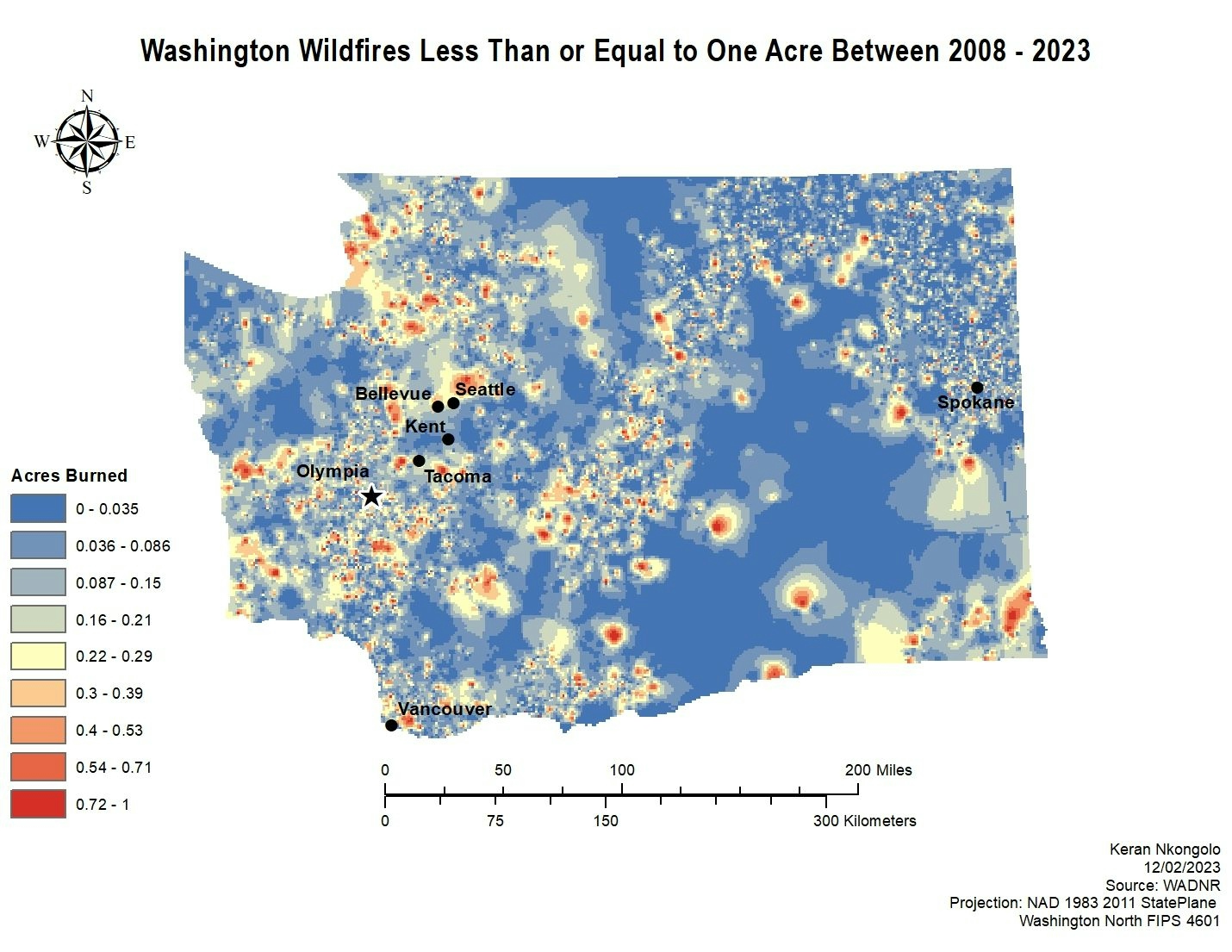
This project looked into the distribution of wildfires in the state of Washington between 2008 - 2023 less than one acre. IDW was utilized to look of wildfires and based on the results most wildfires in the state tend to burn between 0 - 0.035 acres. However, there are many areas in the state where some fires burned around one acre of land based on the results displayed on the map.
Washington WF Under 1 Acre
Plug-ins used
ArcMapSpatial analyst
tags
ArcMap
More by Keran Nkongolo


You might also like


Join the community!
We're a place where geospatial professionals showcase their works and discover opportunities.