.svg "Keran Nkongolo")
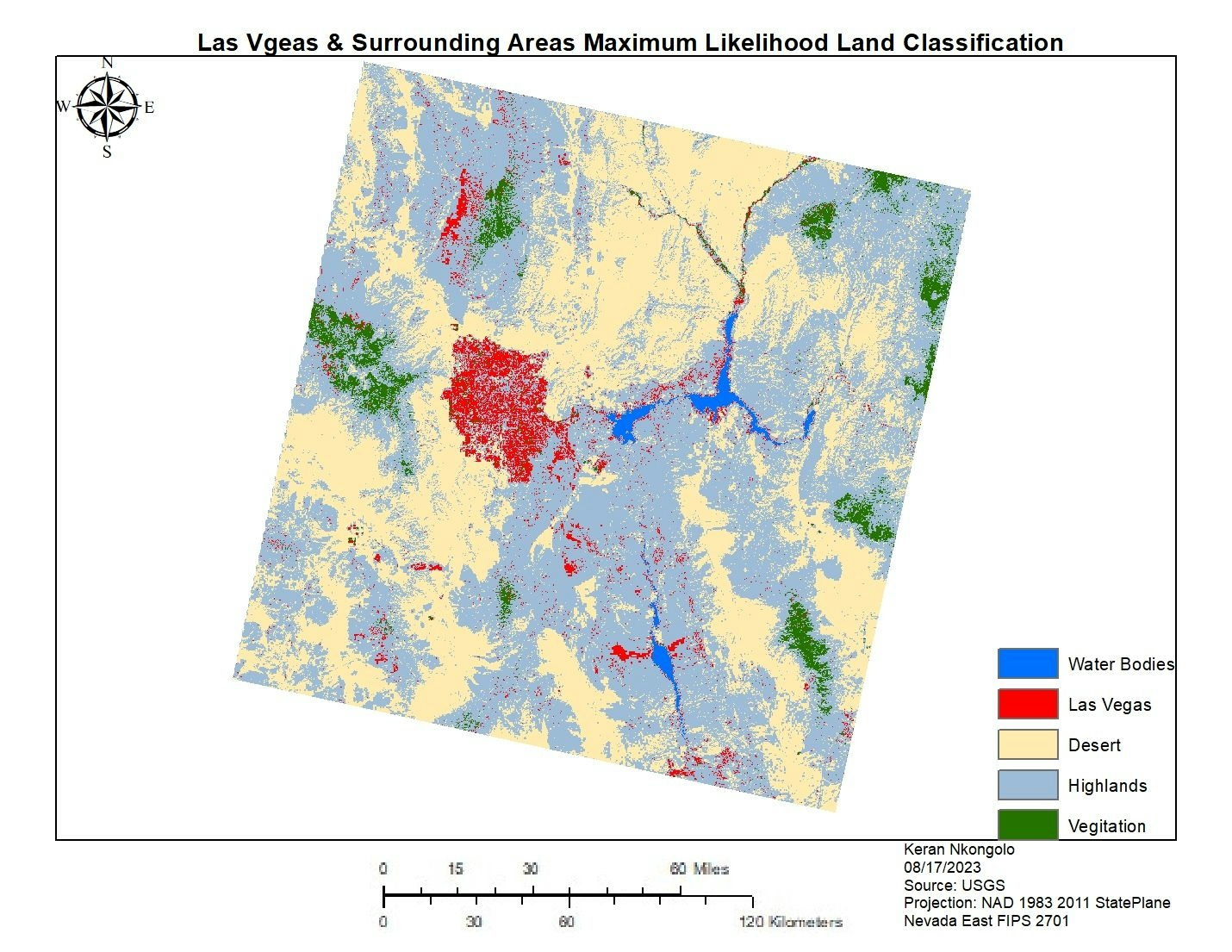
This project displays the land cover of Las Vegas and the surrounding areas, and this was done with a supervised maximum likelihood classification. The data was retrieved USGS Earth Explorer and edited in ArcMap using the extract by mask tool, and creating training samples for the classification.
Las Vegas ML Classification
Plug-ins used
ArcGISArcMap
tags
ArcGISArcMap
More by Keran Nkongolo


You might also like


 He")


Join the community!
We're a place where geospatial professionals showcase their works and discover opportunities.