.svg "Keran Nkongolo")
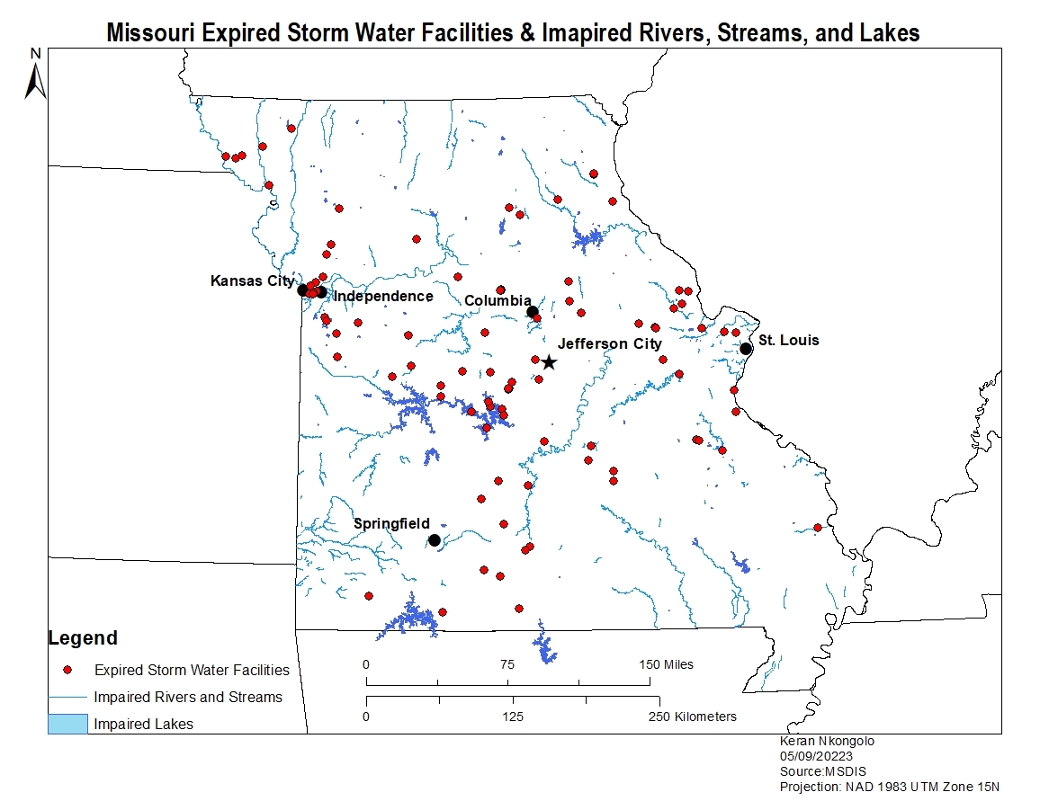
This project explored the relationship between expired storm water facilities and impaired rivers, streams, and lakes. The data for this project came from Missouri Spatial Data Information Service (MSDIS). Based on the map there looks to be some overlap between expired storm water facilities and impaired lakes in central Missouri. However, aside from the central Missouri area there is not too much overlap between the two based on the data shown on the map.
Missouri Impaired Rivers and Streams
Tools used
editor tools
Plug-ins used
ArcMap
tags
ArcMap
More by Keran Nkongolo


You might also like


Join the community!
We're a place where geospatial professionals showcase their works and discover opportunities.