Sign up or log in to your Spatialnode account.

Takes less than a few seconds.

Suitability Map for Ski Resort

Adedoyin Ajeyomi
Adedoyin Ajeyomi•

December 31, 2021

Suitability Map for Ski Resort

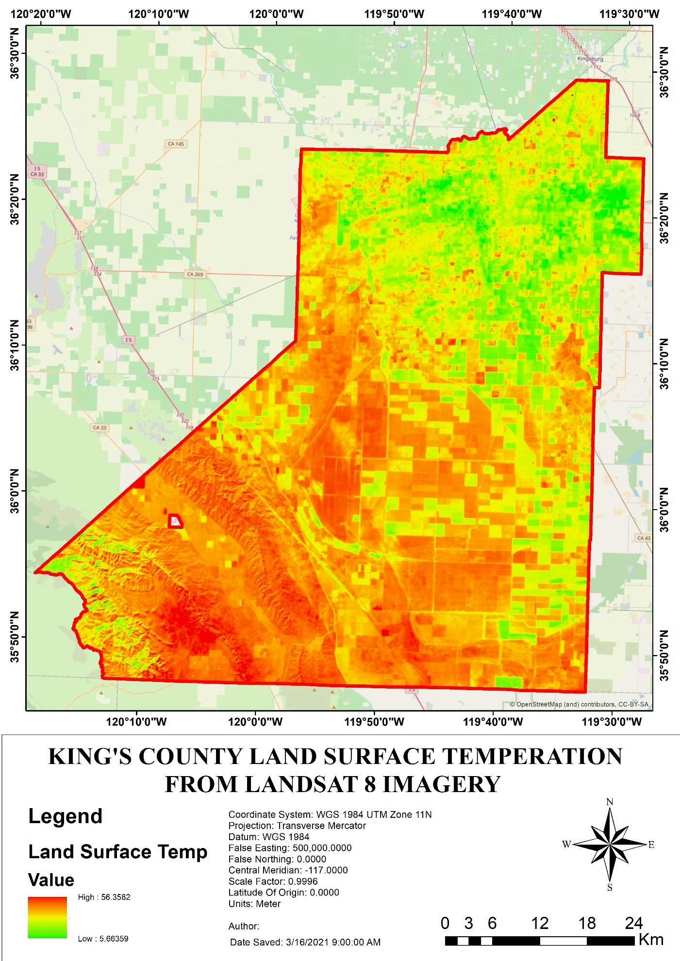
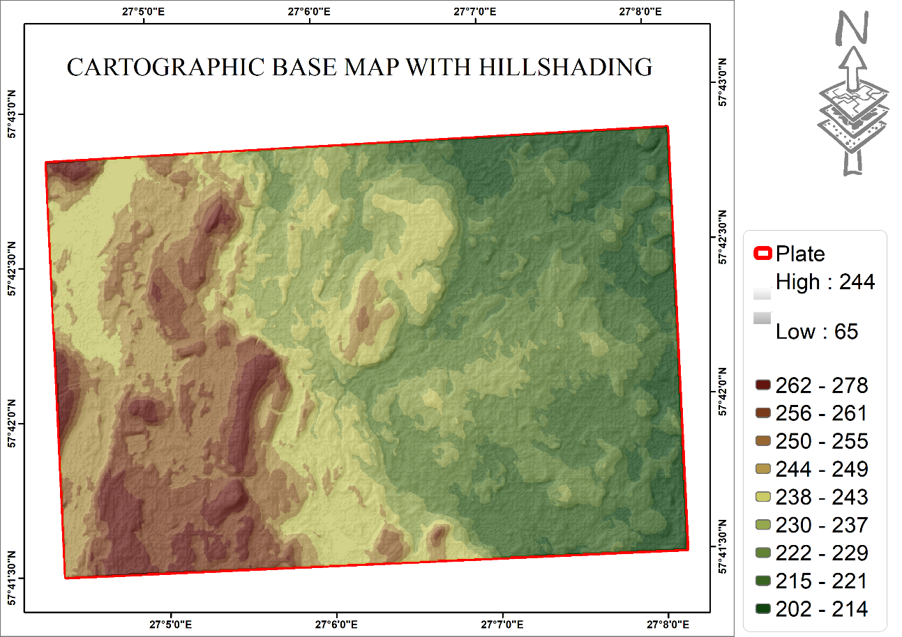
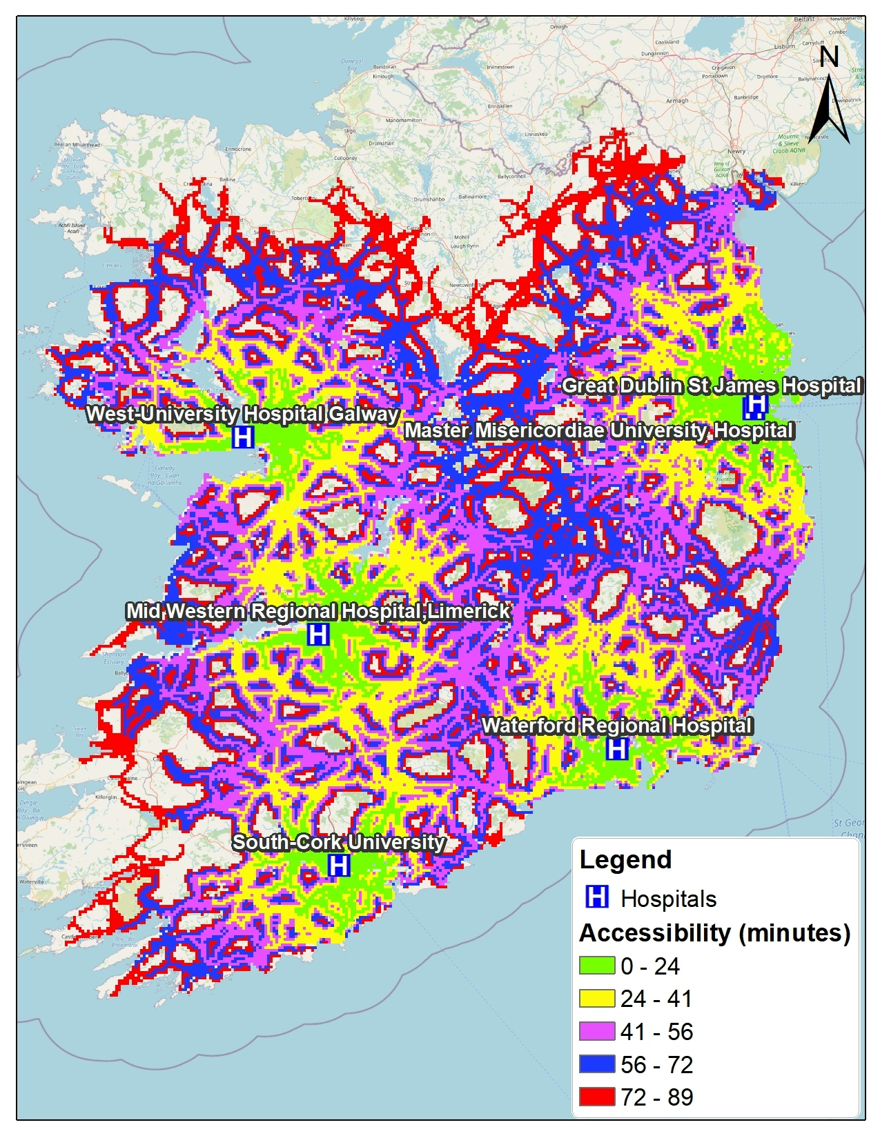
This map is create following a set of criteria define before stating the analysis.


Tools used

ArcGIS Pro

Plug-ins used

ArcGIS Pro

tags

Esri

More by Adedoyin Ajeyomi

Landuse Map from Sentinel 1
200
Study Area Map
Study Area Map
188
Lagos in a Single Map
437
Risk Assessment Map
Risk Assessment Map
184
3 PANEL MAP
3 PANEL MAP
143
Ekiti State Map
Ekiti State Map
398
Soil Properties Map for Rivers State
559
Delta State 3D Model
172
Africa Landuse Use Map
456
Unioncorn Companies Analytics
74
Lagos state population map
467
Land SURFACE Temperature
154

You might also like

Mapa de Localização com perspectiva
jucelino dos santos
Mapa de Localização com perspectiva
jucelino dos santos
28
Classification of Tehama County, CA fire
Cole Feyen
Classification of Tehama County, CA fire
Cole Feyen
10
Unilorin Teak Plantation
Damilola Fadipe
Unilorin Teak Plantation
Damilola Fadipe
248
Temperature Along Nigerian Coastal Line
Emeka Ude
Temperature Along Nigerian Coastal Line
Emeka Ude
34
The Valley of the Clueless
Andrew Middleton
The Valley of the Clueless
Andrew Middleton
165
Coffee Shop Site Suitability Analysis
Rattiyagorn Ives
Coffee Shop Site Suitability Analysis
Rattiyagorn Ives
18
UAS - Beaver Creek Restoration Project
Jeffrey Erwin
UAS - Beaver Creek Restoration Project
Jeffrey Erwin
7
Mapa de Uso e Ocupação do solo
José Luiz Anjos
Mapa de Uso e Ocupação do solo
José Luiz Anjos
184
CO2 Emissions across Africa, 2018
Lawrence Akpoterai
CO2 Emissions across Africa, 2018
Lawrence Akpoterai
105
Cobertura Vegetal da Ilha Comprida (SP)
Willian Kenzo de Sousa Kudo
Cobertura Vegetal da Ilha Comprida (SP)
Willian Kenzo...
3
FLOOD HAZARD MAPPING PART OF (LOKOJA)
John Maduabuchukwu
FLOOD HAZARD MAPPING PART OF (LOKOJA)
John Maduabuchukwu
17
Youtube as Remote Sensing
Andrew Middleton
Youtube as Remote Sensing
Andrew Middleton
768

Join the community!

We're a place where geospatial professionals showcase their works and discover opportunities.

Sign Up for free