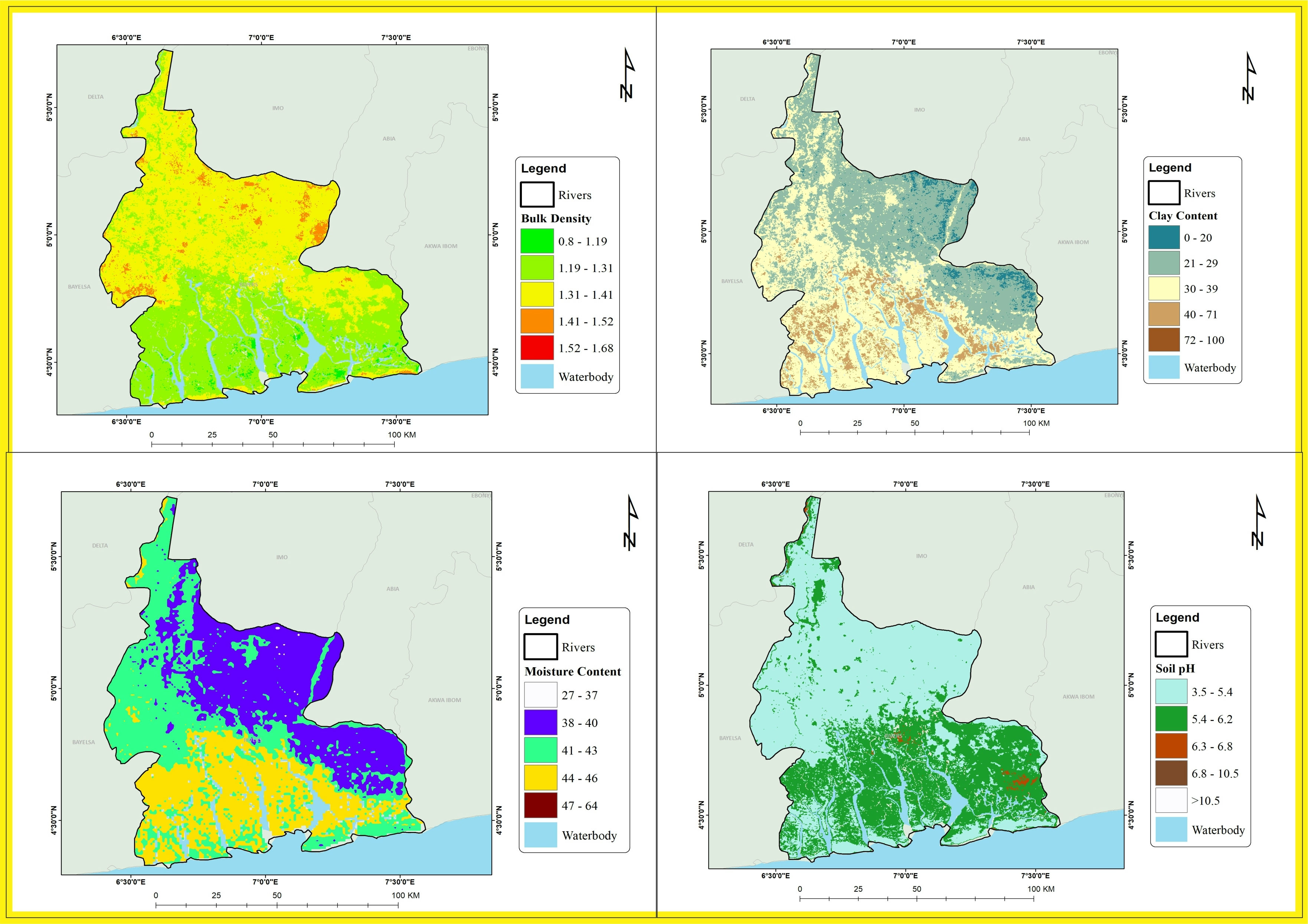
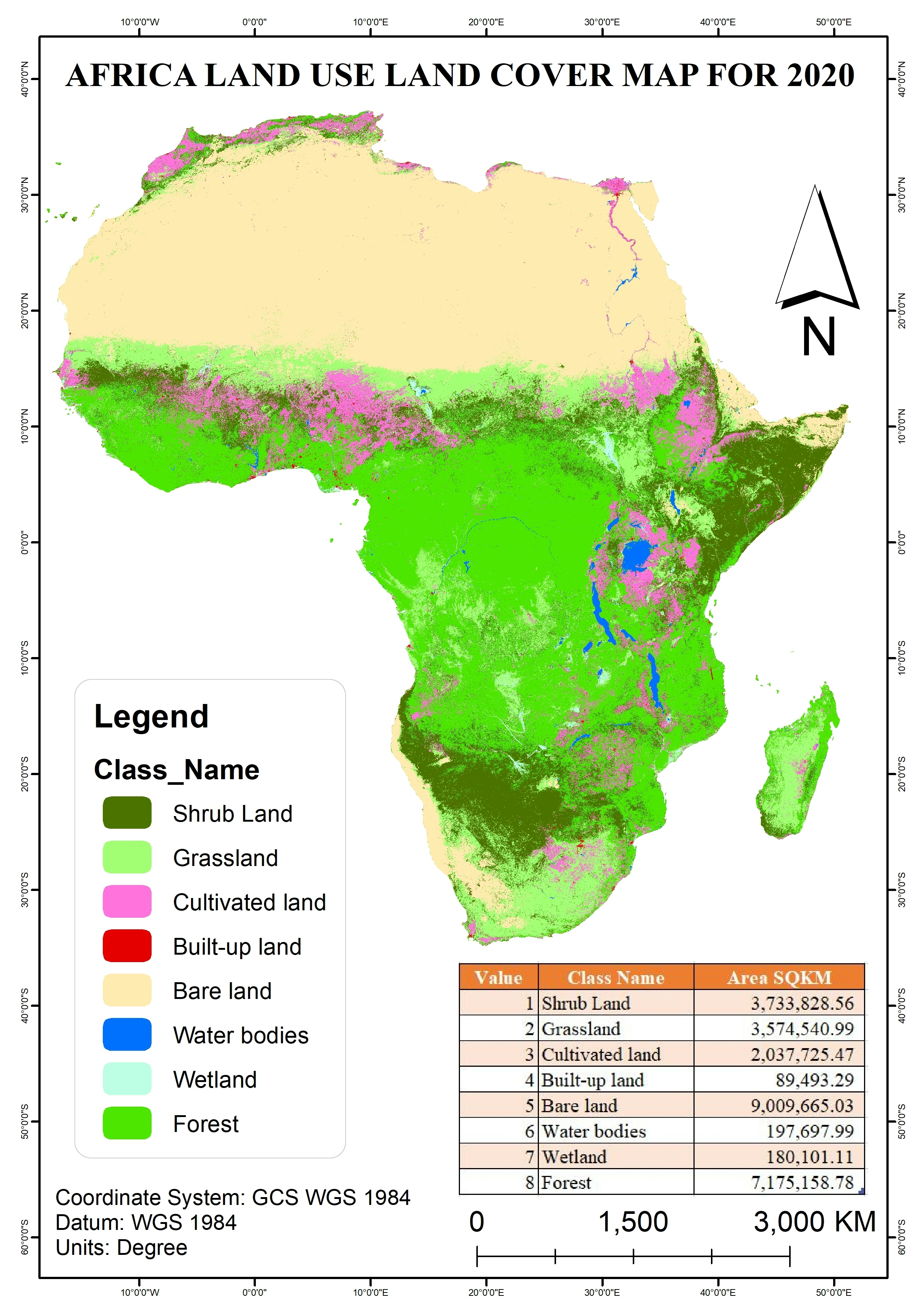
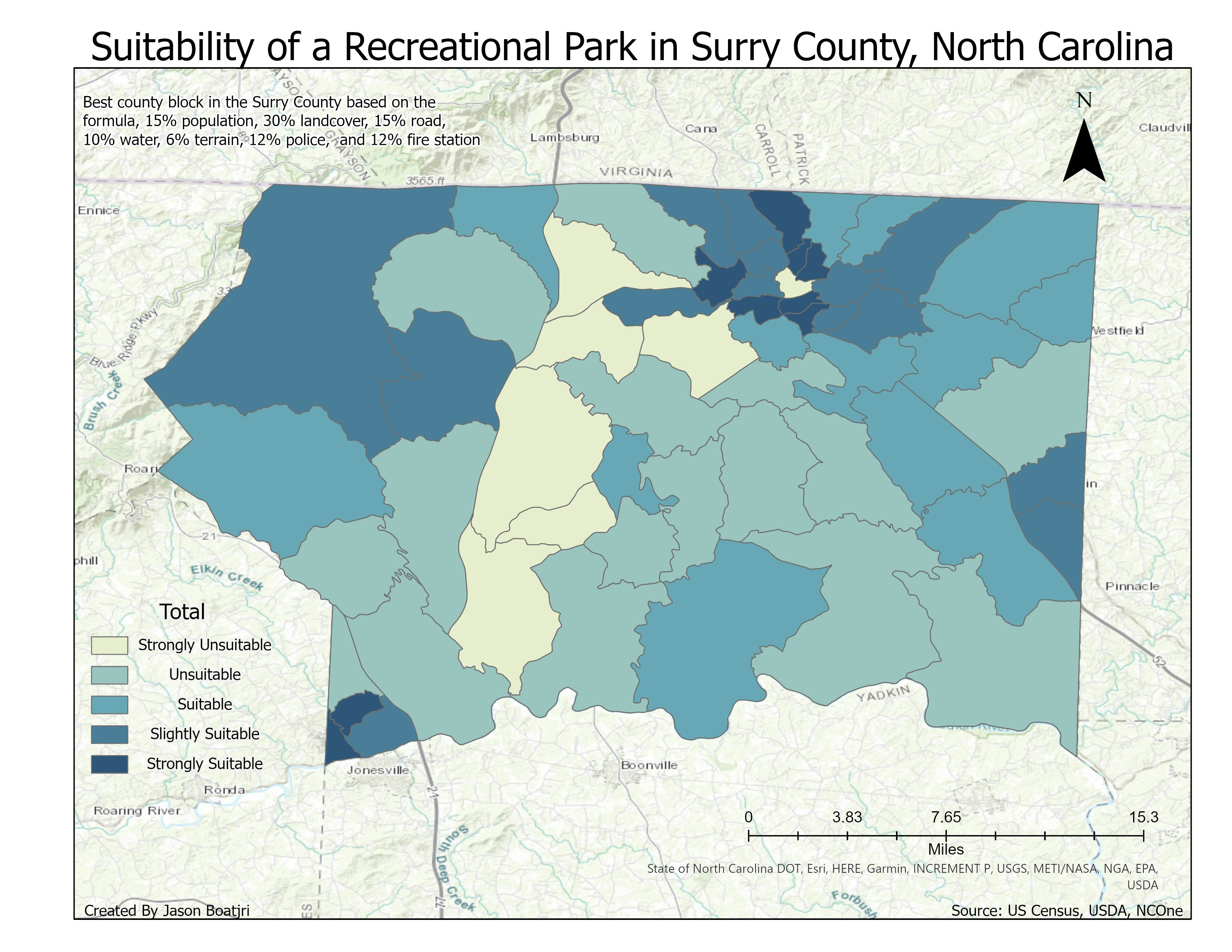
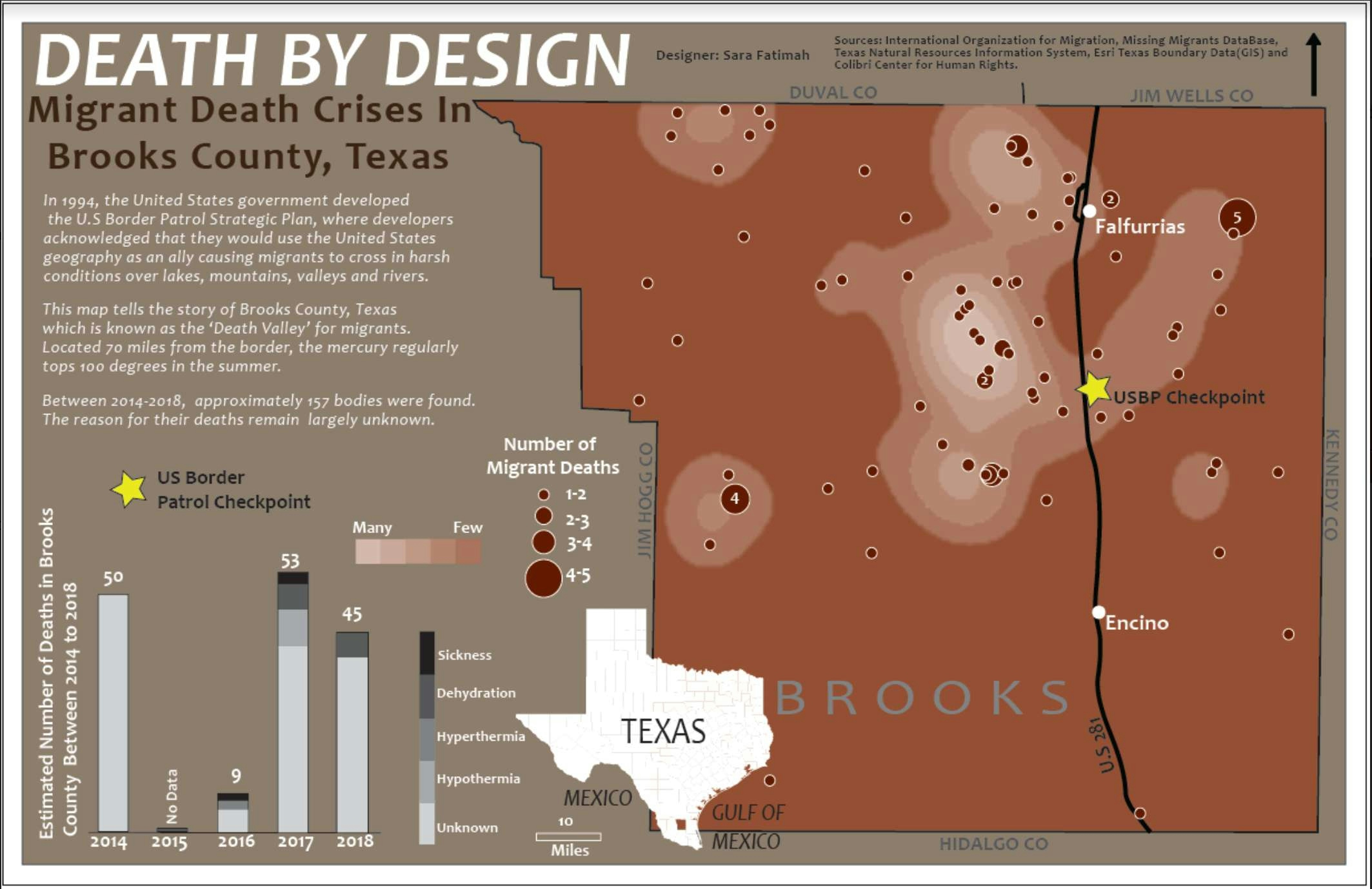
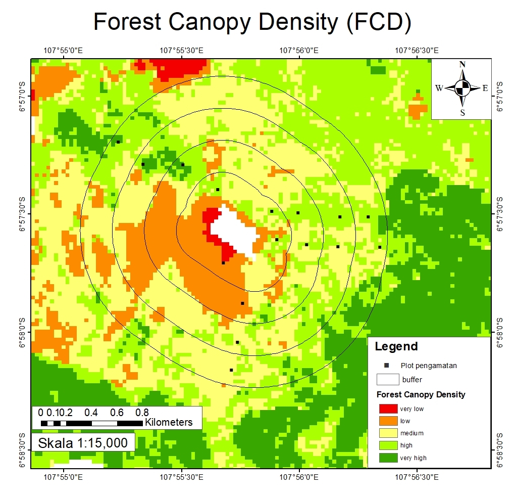
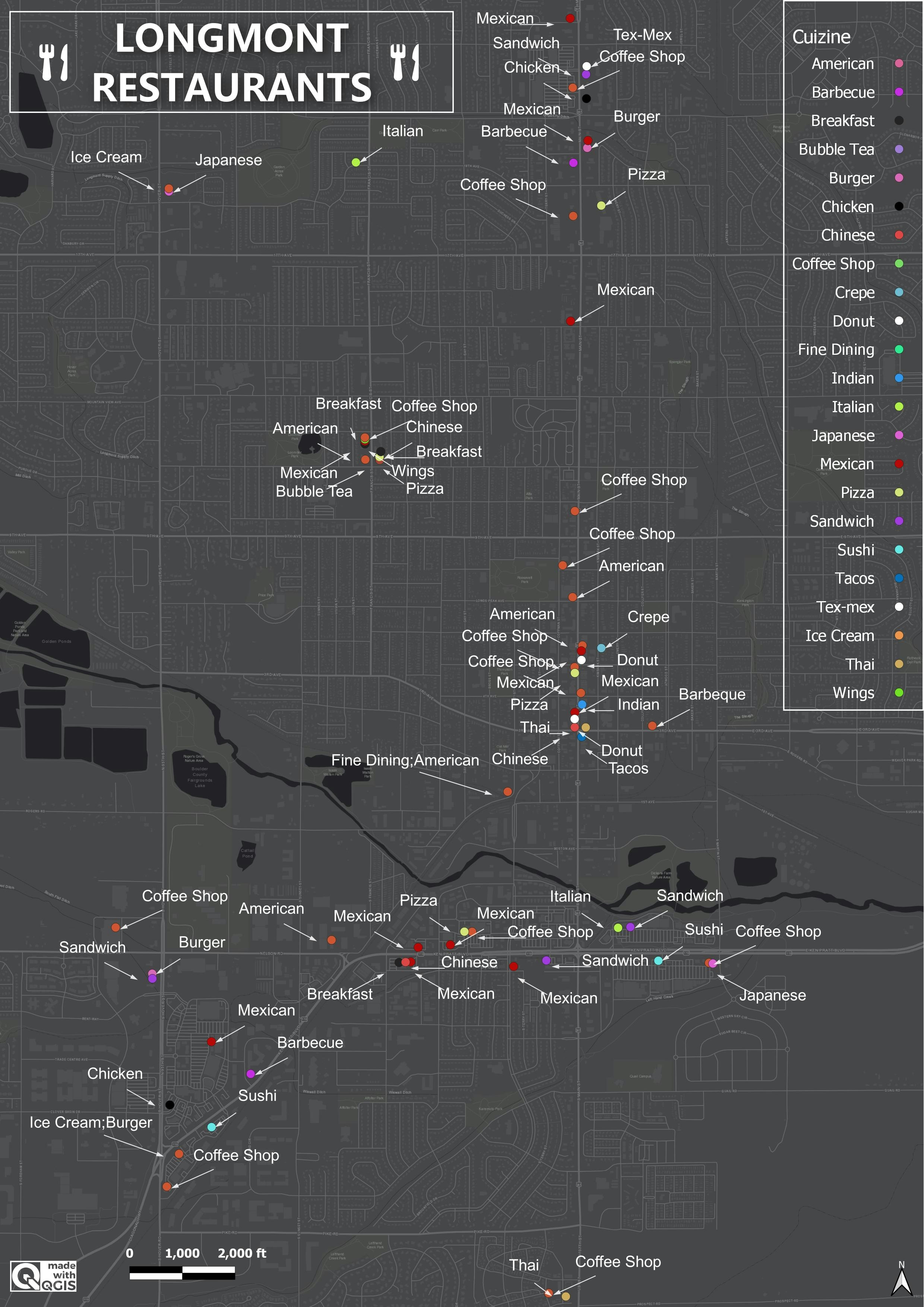
Soil Properties Map for Rivers State

Tools used
Google Earth Engine(GEE)
Plug-ins used
ArcMap
More by Adedoyin Ajeyomi

You might also like


Join the community!
We're a place where geospatial professionals showcase their works and discover opportunities.