Sign up or log in to your Spatialnode account.

Takes less than a few seconds.

Lagos in a Single Map

Adedoyin Ajeyomi
Adedoyin Ajeyomi•

November 15, 2021

Lagos in a Single Map

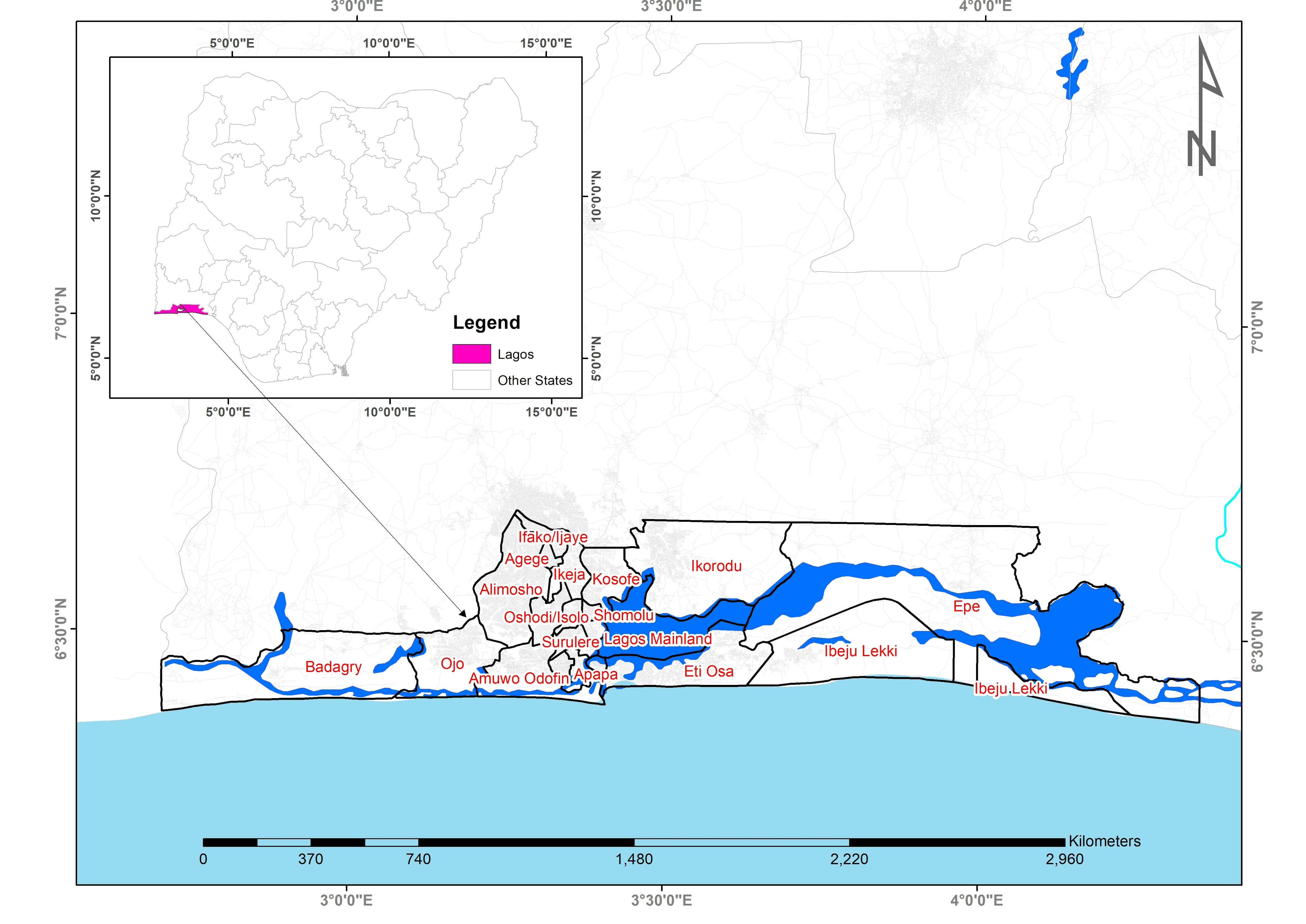
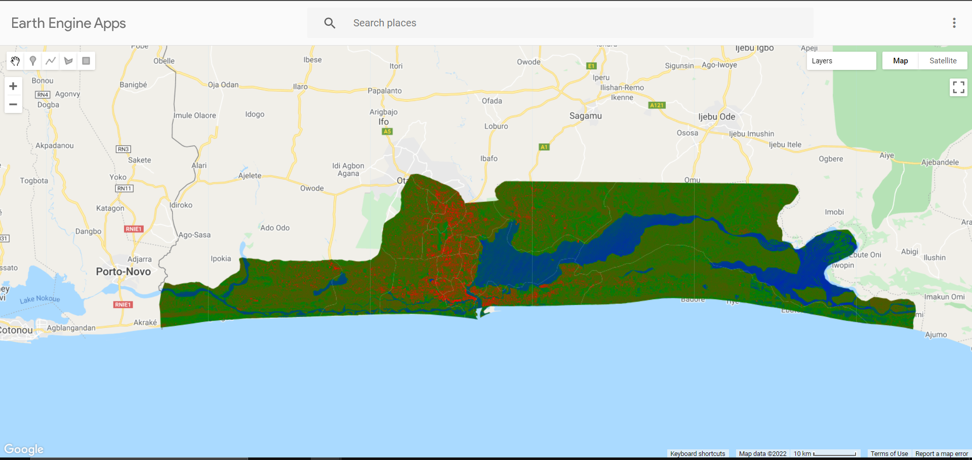
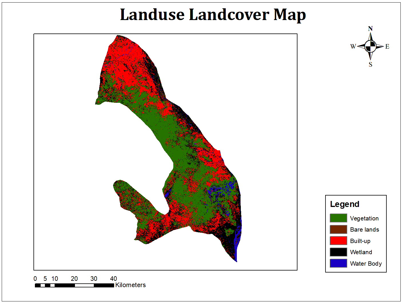
This is a map showing Lagos State in Nigeria


Tools used

ArcMap

Plug-ins used

Nill

tags

Esri

More by Adedoyin Ajeyomi

3 PANEL MAP
3 PANEL MAP
145
Landuse Map from Sentinel 1
204
Soil Properties Map for Rivers State
559
Delta State 3D Model
177
Africa Landuse Use Map
459
Cartographic basemap with hillshade
137
Suitability Map for Ski Resort
164
Ekiti State Map
Ekiti State Map
439
Study Area Map
Study Area Map
190
2020 Land Use Land Cover Map of Africa
109
Land SURFACE Temperature
154
Hospital Accessibility Map
165

You might also like

THE GEOLOGY OF NIGERIA
Williams Adaji-Agbane
THE GEOLOGY OF NIGERIA
Williams Adaji-Agbane
289
Mapa de Precipitação
Elifas Augusto Pereira da Silva
Mapa de Precipitação
Elifas Augusto...
7
Demographic Density of Brazilian
Larissa Cristina Rodrigues Lima
Demographic Density of Brazilian
Larissa Cristina...
35
Beltrami County 2025 Dust Control Sites
Isaac Ajayi
Beltrami County 2025 Dust Control Sites
Isaac AjayiPro
6
Data Visualization using Python
PETER NDIRITU THUKU
Data Visualization using Python
PETER NDIRITU THUKU
38
Troutdale Oregon's Water Distribution
Tyler Holmes
Troutdale Oregon's Water Distribution
Tyler Holmes
5
Barbados Ocean Depth Zones
Ryan Shields
Barbados Ocean Depth Zones
Ryan Shields
71
Supervised Classification Map of Hall County, Georgia
Kolawole Arowoogun
Supervised Classification Map of Hall County, Georgia
Kolawole Arowoogun
240
The Citadel of Farah, Afghanistan
Sebastian Silva
The Citadel of Farah, Afghanistan
Sebastian Silva
189
CROP MONITORING USING NDVI; DRONE IMAGES
MOSES MWANIA MULYUNGI
CROP MONITORING USING NDVI; DRONE IMAGES
MOSES MWANIA MULYUNGI
90
structural plans of the city of Al Hofuf
Mohamed Gamal Hassan Mahmoud
structural plans of the city of Al Hofuf
Mohamed Gamal...
85
Mapping Change with a Small Multiple
Zach Torres
Mapping Change with a Small Multiple
Zach Torres
91

Join the community!

We're a place where geospatial professionals showcase their works and discover opportunities.

Sign Up for free