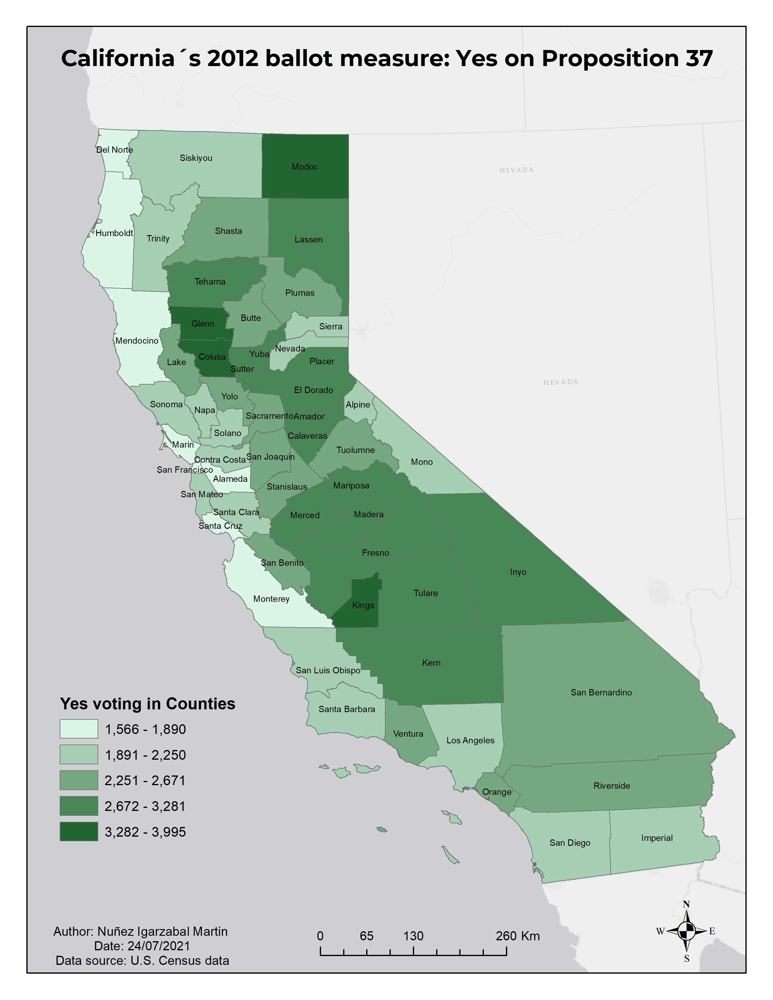
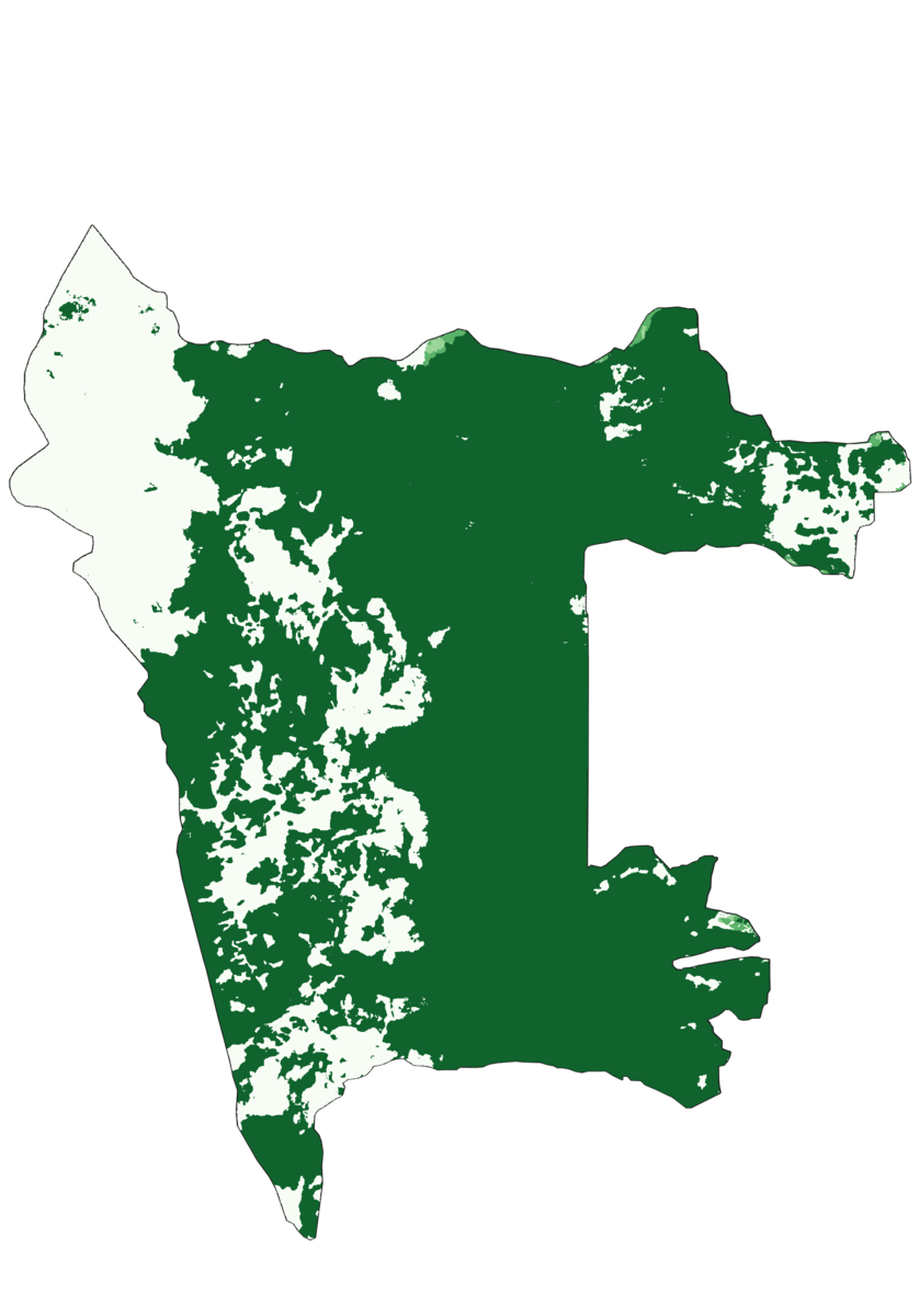
These maps represent how different vegetation groups have changed in wetland areas hydraulically connected to
Lake Erie within Ottawa National Wildlife Refuge from 1962 to 2005. These maps give insight into the impact invasive species have on native plant communities.


.jpeg&w=3840&q=100)