

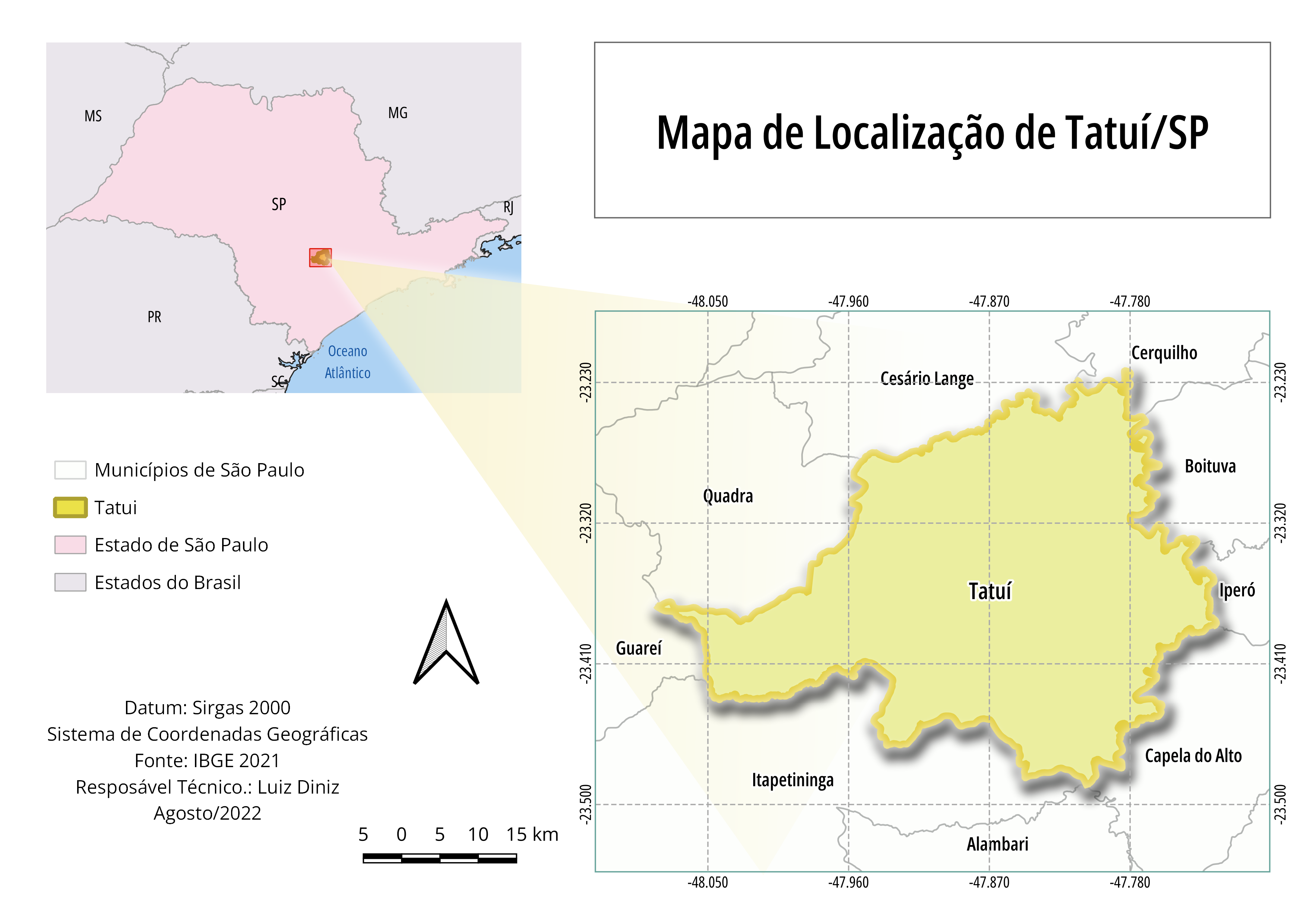
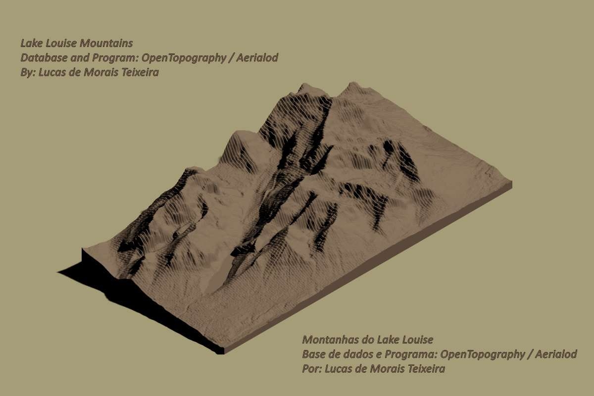
A 3D map representation using Blender.
QGIS and Blender
tags
BlenderDEMQGIS
More by Emilian


You might also like


.png&w=3840&q=100)
 He")

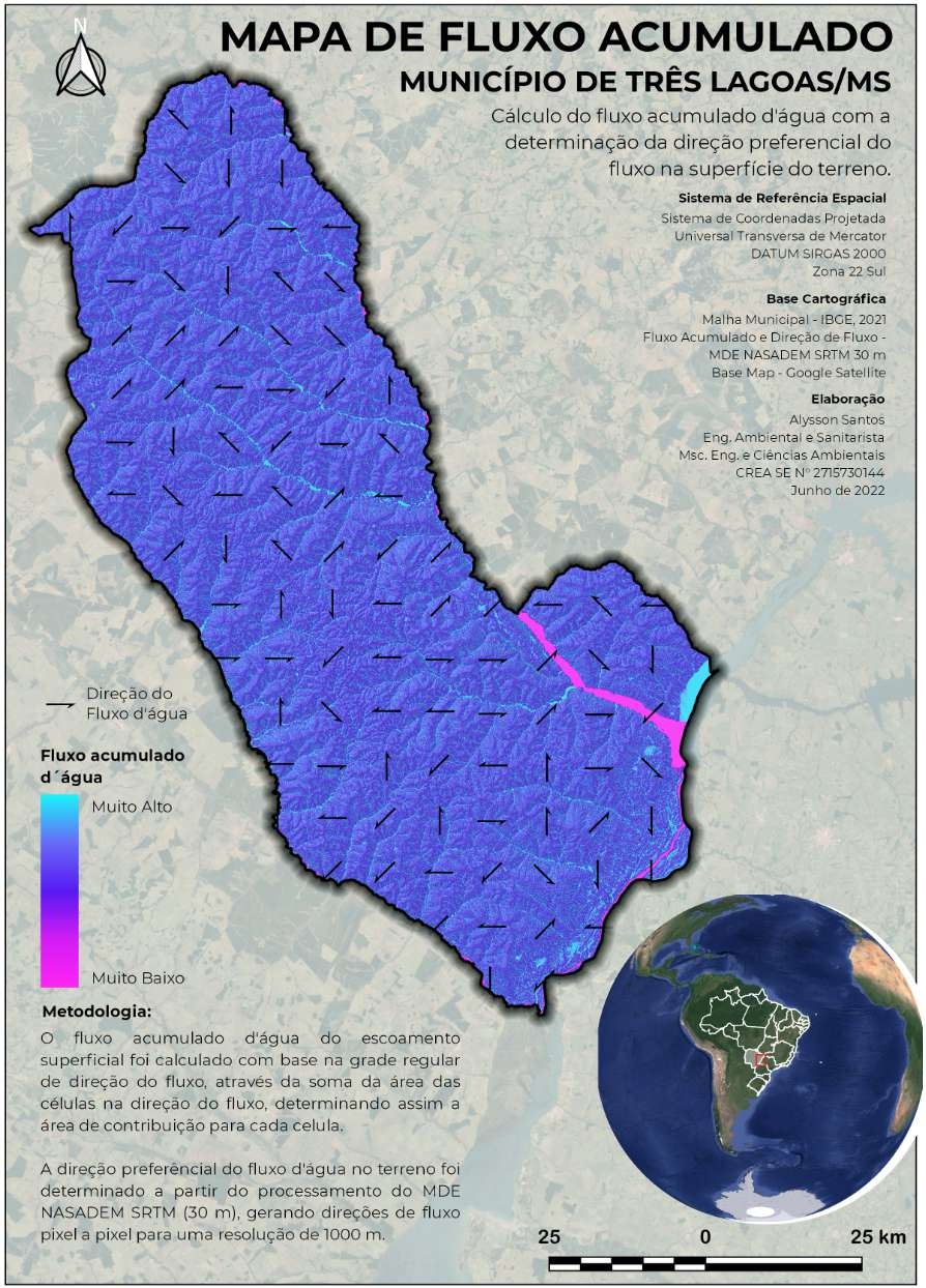
_6066108.png&w=48&q=40 "Alysson Santos de Souza")


Join the community!
We're a place where geospatial professionals showcase their works and discover opportunities.
QGIS and Blender
A 3D map representation using Blender.
More by Emilian
You might also like
We're a place where geospatial professionals showcase their works and discover opportunities.