_6066108.png&w=96&q=50 "Alysson Santos de Souza")
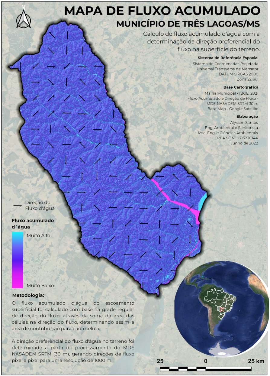
Map of accumulated water flow with direction of surface runoff on the ground.
..💧
▶️ Preferred direction of the flow flow (Local Drain Direction - LDD) was generated from the MDE of NASADEM SRTM 30 m. Most methods work with a single flow direction, that is, each cell drains water to one of its 8 neighboring cells (D8). the arrows.
..💧
▶️ Accumulating flow of water from cells that drain throught each cell was based on regular note, flow through the sum of contributions exerting cells in the direction of flow.
#mde#qgis#sig#GIS#modelodigitaldeelevacao#LDD#flowdirection#fluxoacumulado


.svg "Keran Nkongolo")