Topographic profiles


Plug-ins used
Spatial analyst
tags
ArcMap
More by Fernando Santos


You might also like


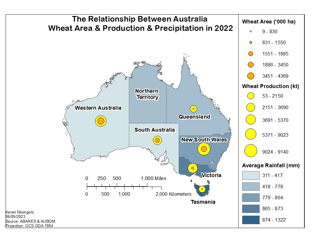
.svg "Keran Nkongolo")


Join the community!
We're a place where geospatial professionals showcase their works and discover opportunities.
Topographic profiles
More by Fernando Santos
You might also like
We're a place where geospatial professionals showcase their works and discover opportunities.