

The outlined census tracts represent the four tracts I chose to mail surveys to for my master's thesis study. These tracts were selected based on the variety of demographics represented. From the returned surveys, I recorded which parks residents visit and represented them on this map. Respondents were asked to circle on a map or write in the Cleveland parks they visit. The most popular park among respondents was Impett park with 66 separate surveys mentioning or circling it. Nearly all survey respondents from both tracts 1231 and 1241 mentioned Impett park. This is likely due to its size and proximity to the two tracts as it is the largest and closest city park nearby and even resides in the center of tract 1231. Additionally, it has many amenities such as a playground, tennis courts, a pool, benches, a basketball court, a wooded area, and numerous sports fields; with the pool being frequently mentioned in feedback responses. Every other park was described less than ten times with the next most popular parks being Halloran and Drakefield and Kerruish at eight mentions each. All but Kerruish Park are located on the West side. The Cleveland Metroparks was mentioned specifically by name of a park or by referring to Cleveland Metroparks in general 58 times in this section, with Rocky River Reservation, Garfield Reservation and Edgewater Park being the most frequently mentioned. I chose to not represent these in the map because the specific goal of this project was to highlight city parks.
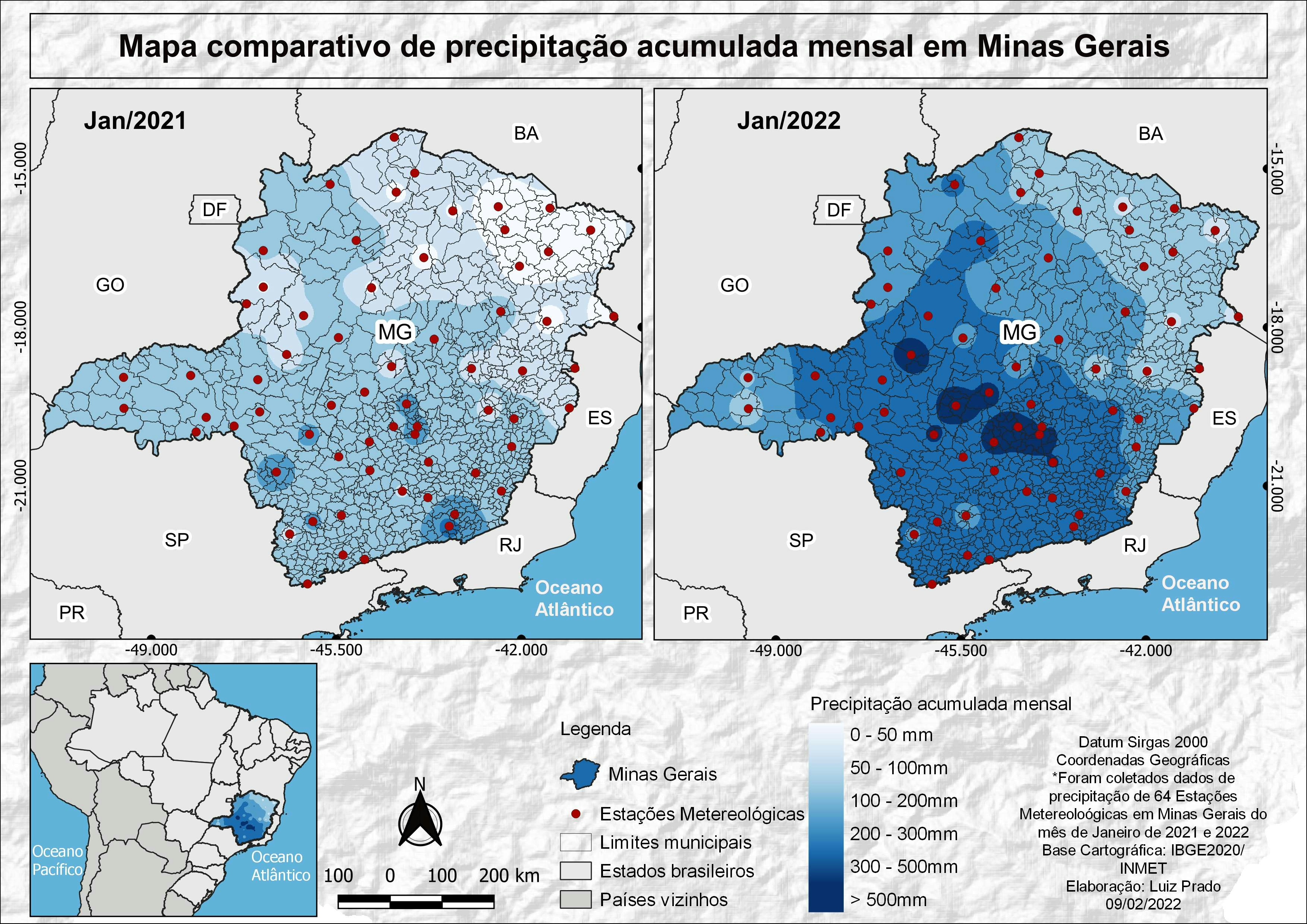
Cleveland Urban Park Use Survey Results
Plug-ins used
ArcGIS
tags
ArcGIS urban planning
More by Alexandria Hahn


You might also like


Join the community!
We're a place where geospatial professionals showcase their works and discover opportunities.