
Data acquisition: Obtain satellite imagery or aerial photographs of Lokoja from USGS.
Pre-processing: Prepare the satellite imagery for analysis by removing atmospheric and radiometric distortions, and mosaicking all the images involved.
Classification: Use image analysis tools in ArcGIS software to classify the imagery into different land use/land cover classes. This process involves creating training areas, where I assigns pixels to different land use/land cover classes, and using these training areas to classify the entire image.
Validation: Validate the classification by comparing it to Google Earth Pro.
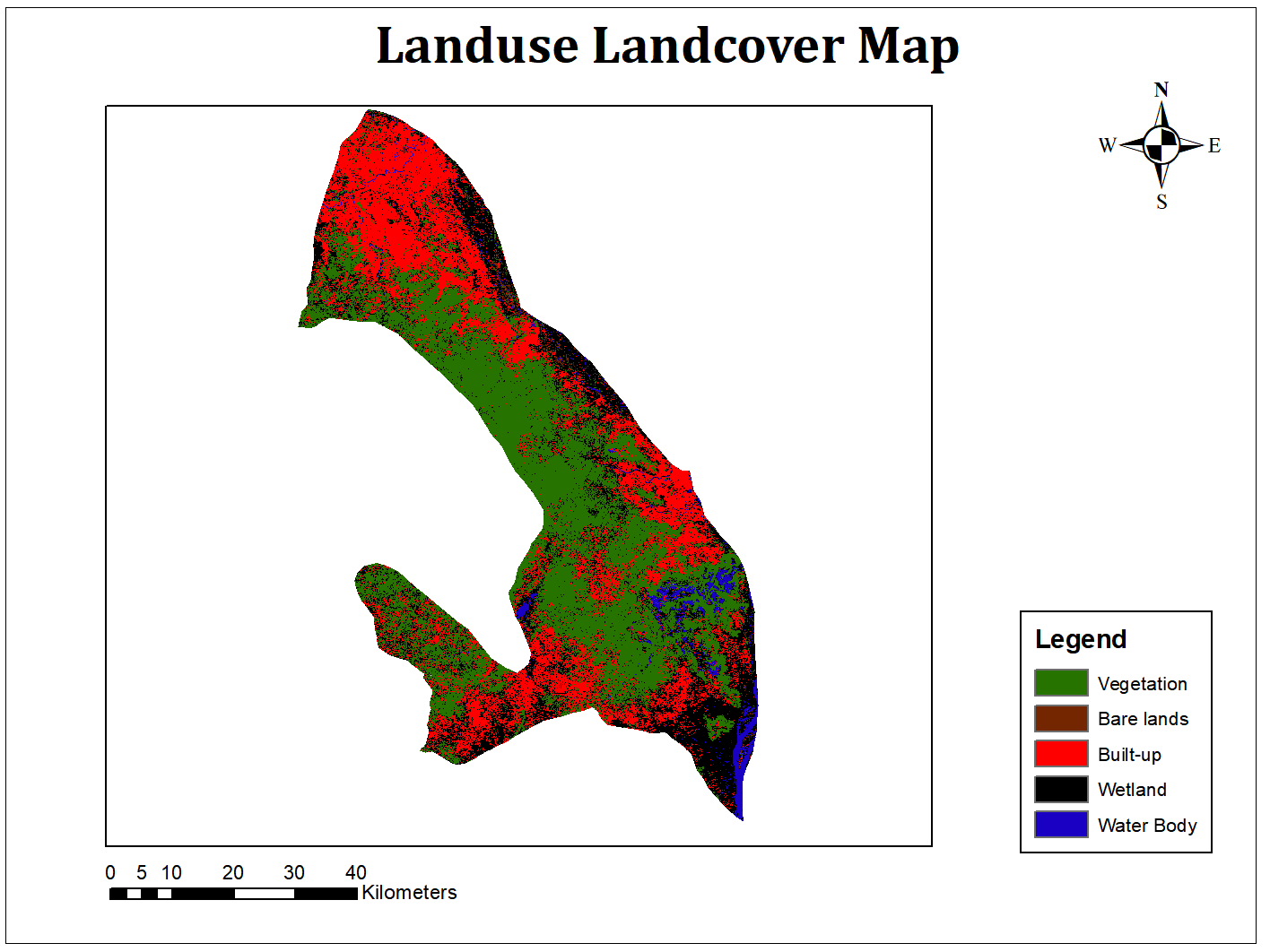
Visualization: Create maps and figures to visualize the land use/land cover of Lokoja. This includes the different landcover classes and the extent of the area occupied.
Landuse Landcover Map of LOKOJA
Tools used
ArcGISGoogle Earth Pro
Plug-ins used
None
tags
landcoverLandsat
More by Enoch Oluwaferanmi Babayemi


You might also like


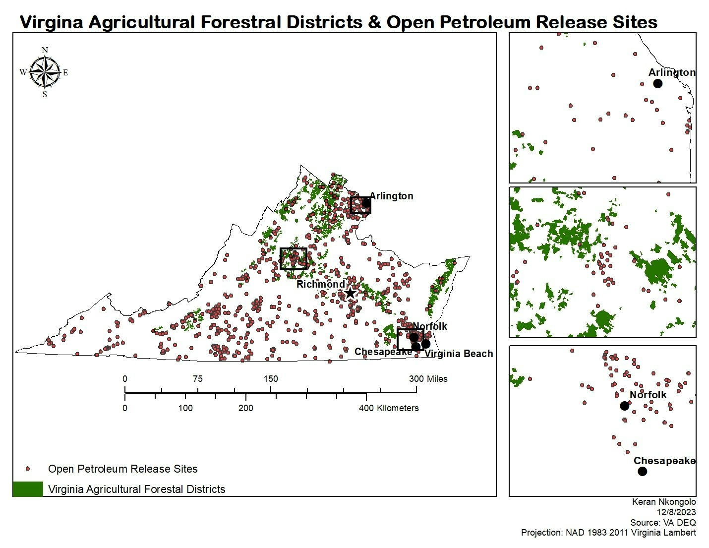
.svg "Keran Nkongolo")


Join the community!
We're a place where geospatial professionals showcase their works and discover opportunities.