
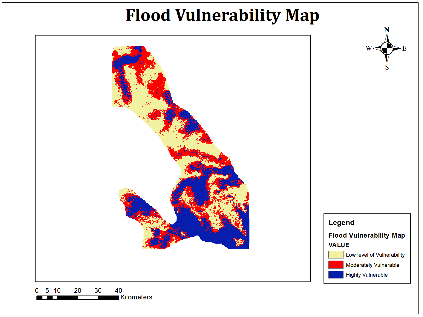
Seven Variables were used for this Project
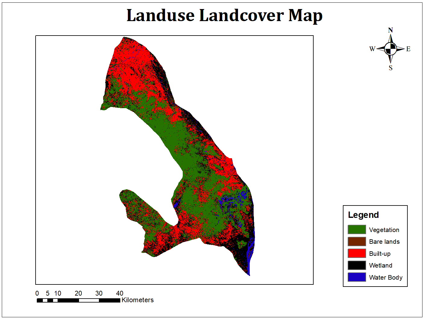
- Landuse Landcover through Supervised classification.
- Rainfall Data and Analysis
- Slope map
- Digital Elevation Model of the Study Area
- Distance to Road
- Distance to River
- Study Area Shapefile
Flood Vulnerability Map of Lokoja
Seven Variables were used for this Project
More by Enoch Oluwaferanmi Babayemi
You might also like
We're a place where geospatial professionals showcase their works and discover opportunities.


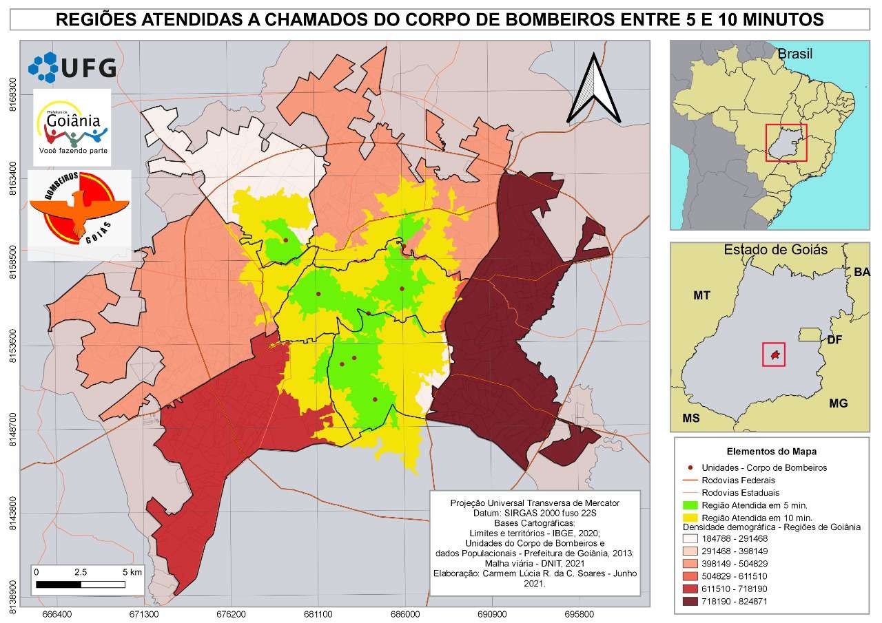
_2461995.png&w=48&q=40 "Carmem Lúcia Ribeiro da Costa Soares")


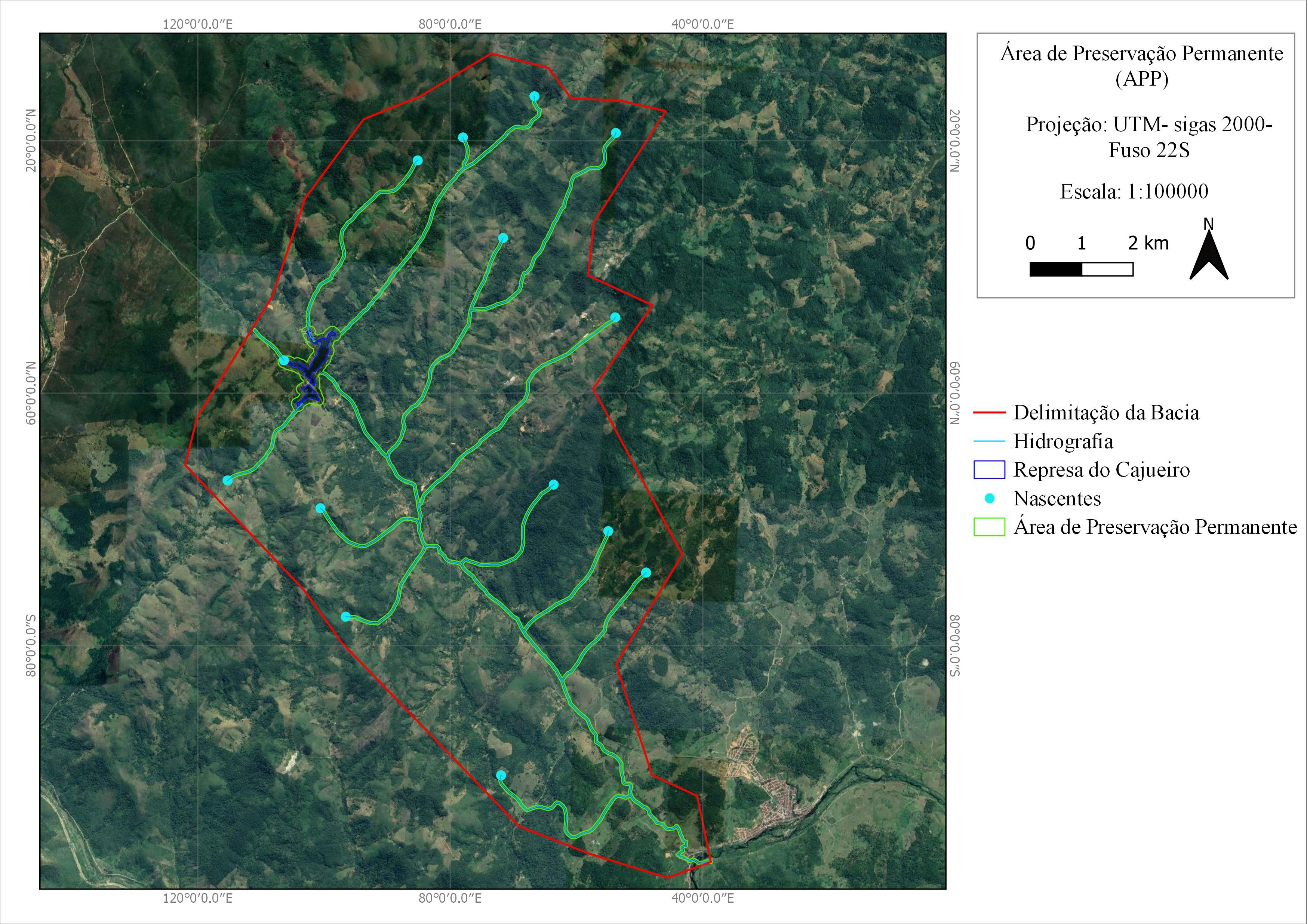


.jpg&w=3840&q=100)


![Projeto - Análise Espacial [2/2]](/_next/image?url=https%3A%2F%2Fstorage.googleapis.com%2Fspatialnodefiles%2Fprojects%2F7183e0f4-6ed3-4ba9-87a0-4a0bbe114974layoutmapavlt.png&w=3840&q=100)
