Sign up or log in to your Spatialnode account.

Takes less than a few seconds.

Topographic Map of Akure

Enoch Oluwaferanmi Babayemi
Enoch Oluwaferanmi Babayemi•

January 27, 2023

Topographic Map of Akure

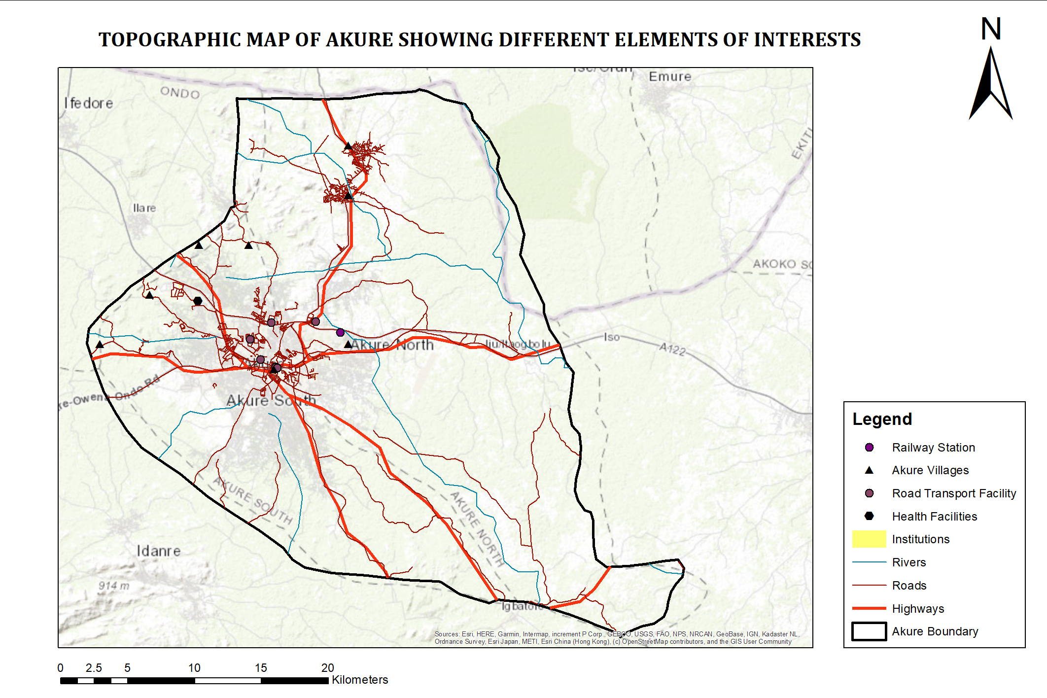
I included some basic features that are present in Akure and I loaded it over the basemap that I got using ArcGIS.


Tools used

ArcGIS

Plug-ins used

None

tags

topographic map

More by Enoch Oluwaferanmi Babayemi

Landuse Landcover Map of LOKOJA
30
USA Drought Map for the Year 2022
15
Flood Vulnerability Map of Lokoja
30
Most Populous Cities in the World
24
Total Population per Electoral Division
19

You might also like

USDA Data Science Program - Capstone
Jeffrey Erwin
USDA Data Science Program - Capstone
Jeffrey Erwin
14
Soil Loss Estimation using RUSLE Moodel
Joseph Aro
Soil Loss Estimation using RUSLE Moodel
Joseph Aro
286
FLOOD HAZARD MAPPING PART OF (LOKOJA)
John Maduabuchukwu
FLOOD HAZARD MAPPING PART OF (LOKOJA)
John Maduabuchukwu
19
Mapa Hipsométrico
Amanda Ellen da Silva Conceição
Mapa Hipsométrico
Amanda Ellen...
113
Delineations of Asa River Watershed
Emeka Ude
Delineations of Asa River Watershed
Emeka Ude
95
Planta Topográfica Planimétrica
Ana Paula Dias Pena
Planta Topográfica Planimétrica
Ana Paula...
2
APP hídrica demarcadas em dois períodos
Poliana Marilia da Silva Mello Betella dos Santos
APP hídrica demarcadas em dois períodos
Poliana Marilia...
17
MODELO DIGITAL DE ELEVAÇÃO - MDE
Isabel Cristina da Silva Costa
MODELO DIGITAL DE ELEVAÇÃO - MDE
Isabel Cristina...
90
Vista Iluminada do Pico da Bandeira
Vitória Serra Bernardes
Vista Iluminada do Pico da Bandeira
Vitória Serra Bernardes
469
Cobertura do Solo - Região de Brasília
Murilo Silva
Cobertura do Solo - Região de Brasília
Murilo Silva
11
CROP MONITORING USING NDVI; DRONE IMAGES
MOSES MWANIA MULYUNGI
CROP MONITORING USING NDVI; DRONE IMAGES
MOSES MWANIA MULYUNGI
90
IdahoDarkRoads
Michael Nau
IdahoDarkRoads
Michael Nau
43

Join the community!

We're a place where geospatial professionals showcase their works and discover opportunities.

Sign Up for free