
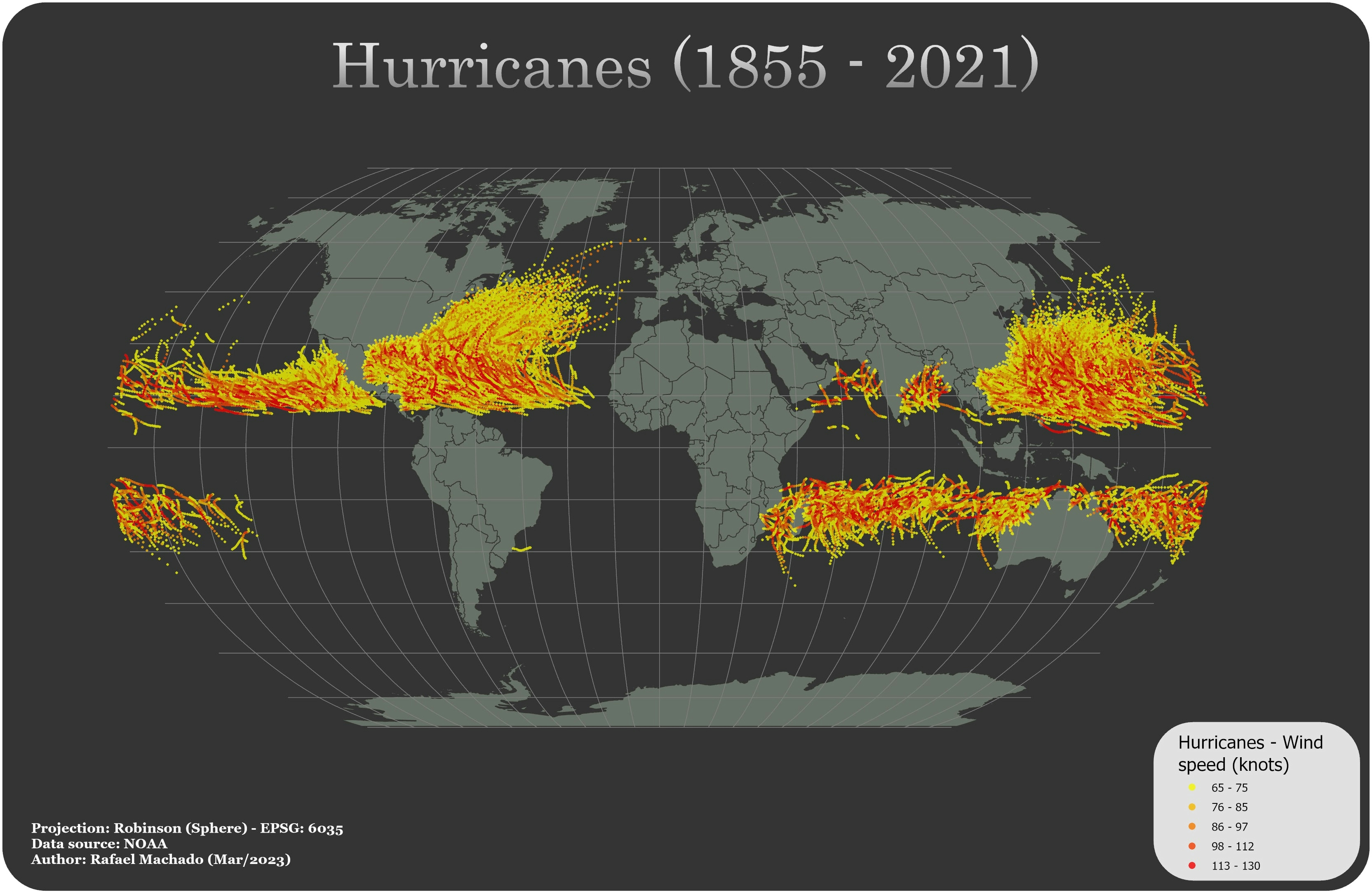
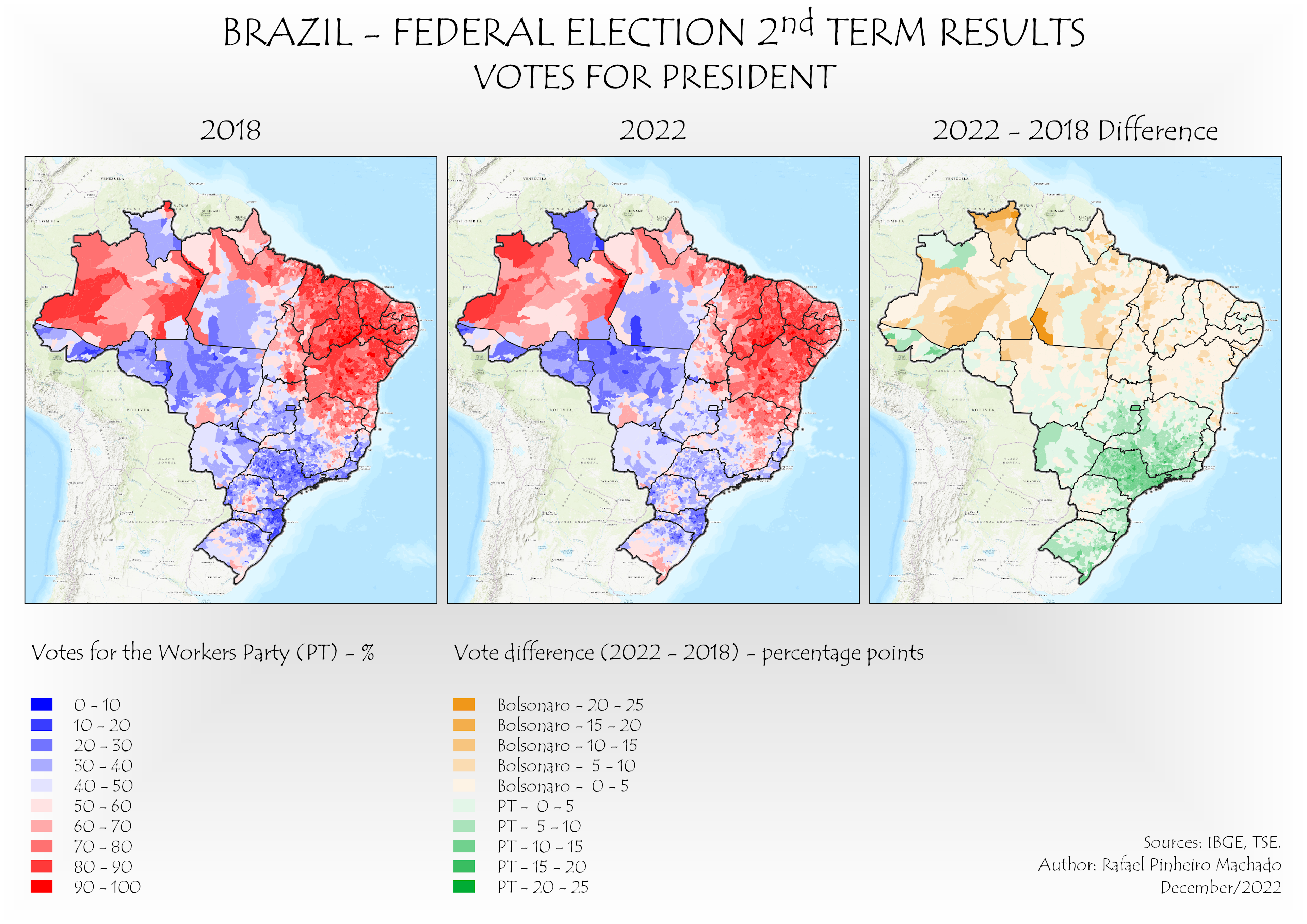
The map displays hurricanes that occurred on Earth from 1855 to 2021, with the wind intensity (in knots) represented by a gradient color scale. Notably, hurricanes tend to concentrate around Parallel 15° in both hemispheres, as shown on the map. Additionally, hurricanes at lower latitudes are generally more intense than those at higher latitudes.
Hurricanes (1855 - 2021)
Tools used
ArcGIS Pro
Plug-ins used
None
tags
ArcGIS ProHurricanesNOAA
More by Rafael Pinheiro Machado


You might also like


 He")


Join the community!
We're a place where geospatial professionals showcase their works and discover opportunities.