.svg "Keran Nkongolo")
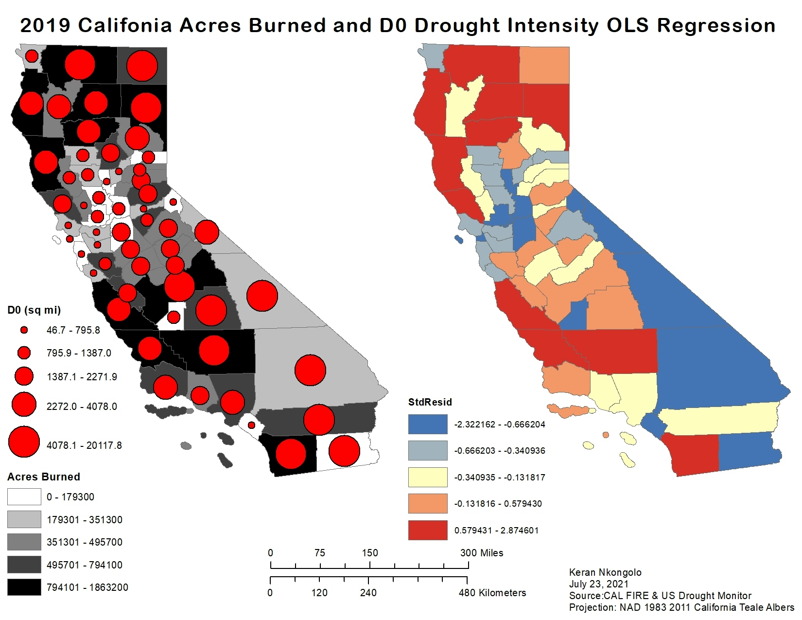
This project explored the relationship between D0 drought intensity and acres burned in 2019, this is displayed as a cholorpleth proportional symbols map and OLS Regression. The data for this project came from California Department of Forestry and Fire Protection (CAL FIRE), and U.S Drought Monitor. Results of this project reveal that there was a strong relationship between counties with a lot of acres burned and D0 Drought intensity as seen in the northern California counties. Additionally, the OLS regression supports this as counties which had a great amount of acreage burnt and D0 drought intensity displayed a strong relationship in the OLS regression.
CA Acres Burned & OLS Regression 2019
Tools used
ExcelOLS Regressionspatial joinSpatial Statistics
Plug-ins used
ArcMap
tags
ArcMap
More by Keran Nkongolo


You might also like


Join the community!
We're a place where geospatial professionals showcase their works and discover opportunities.