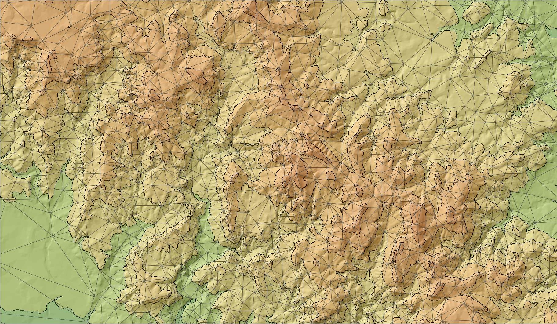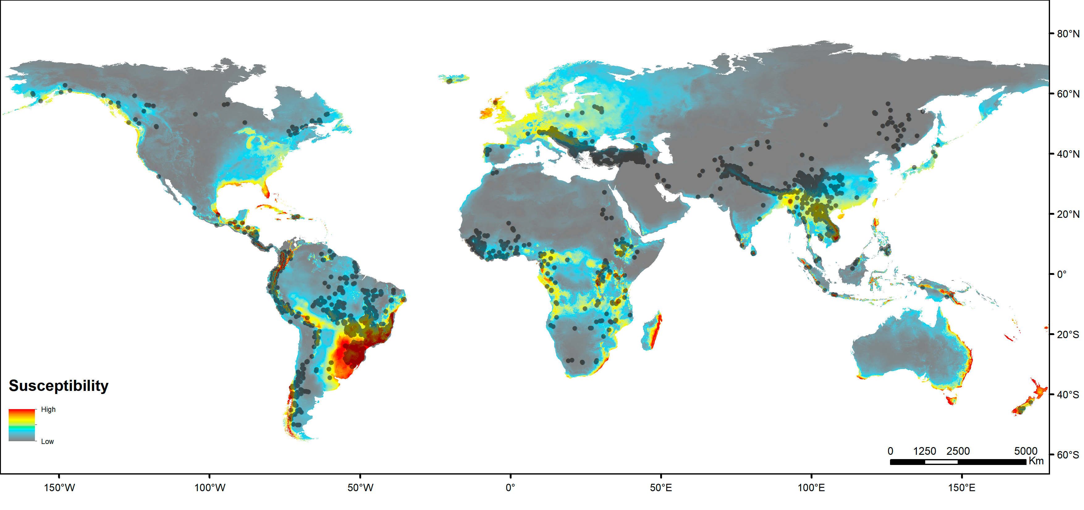
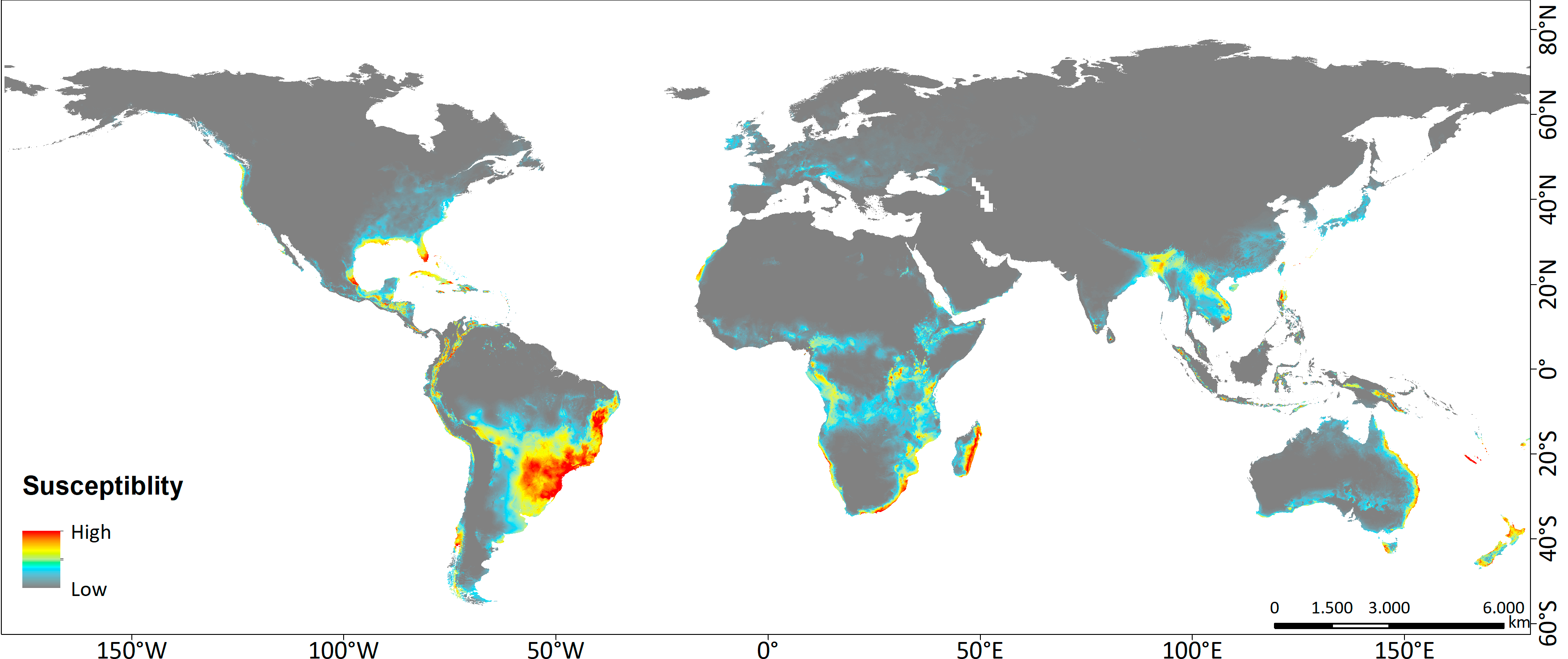
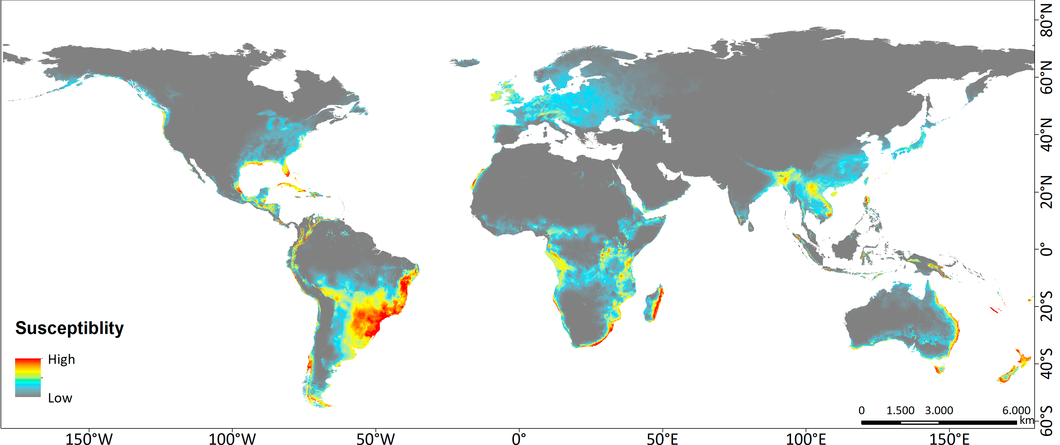
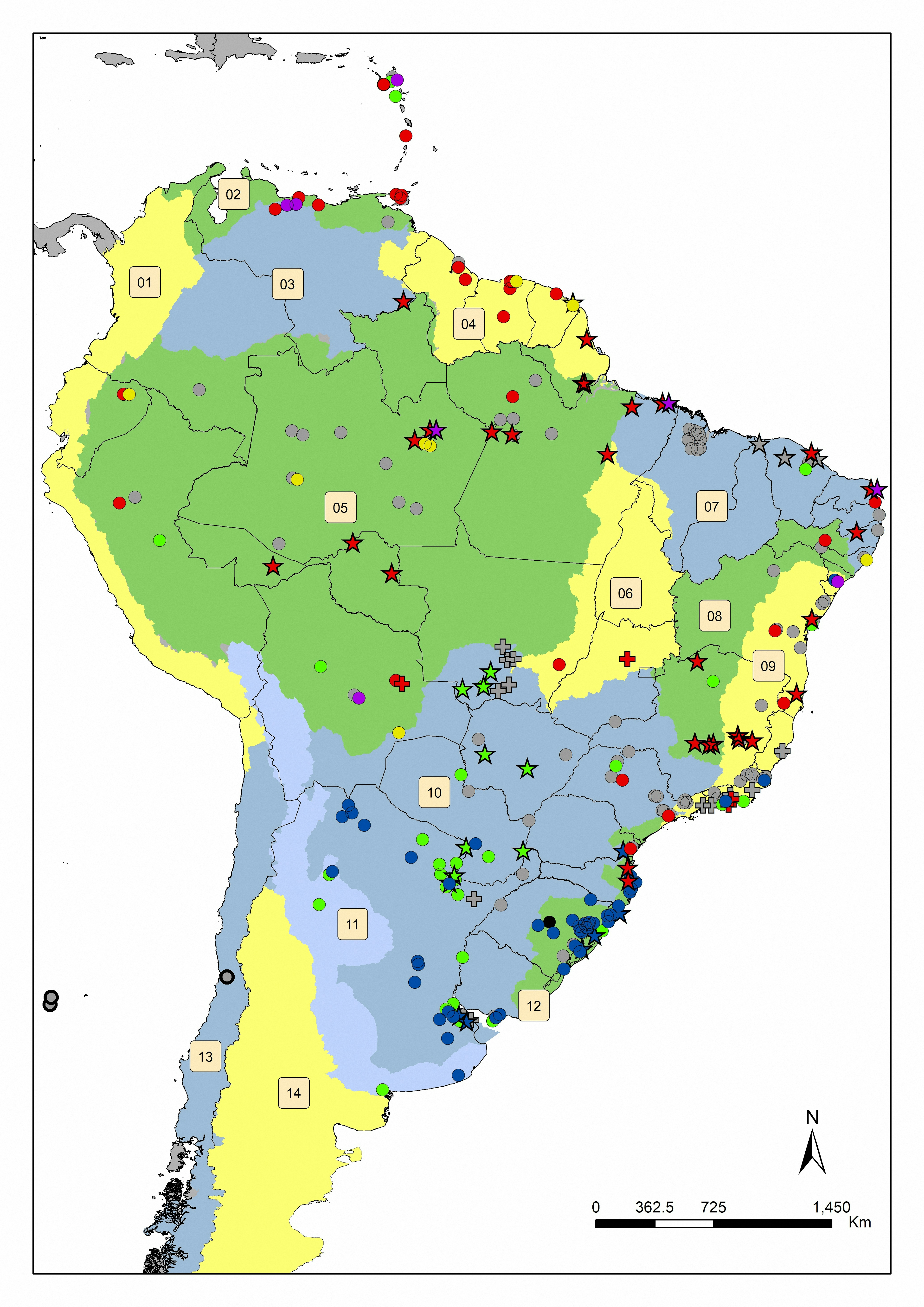
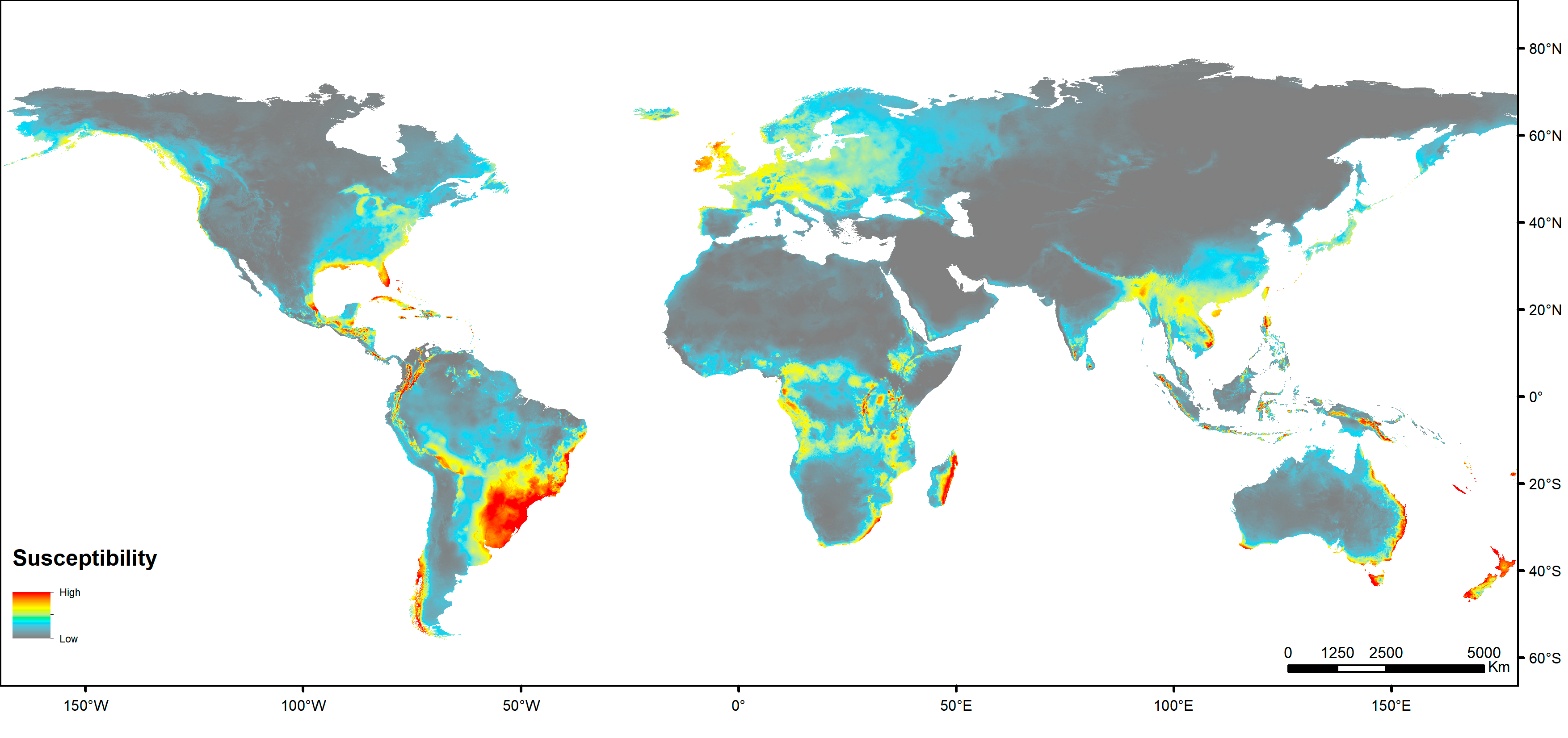
EN:Map showing the localization of the dam constructions predicted until 2030 (Future Hydropower Reservoirs and Dams Database) on the map of climate areas most susceptible to invasion of the dinoflagellate Ceratium furcoides in the world at the scenarios of the climate change by CO2 emission (CMIP6), using the algorithm MaxEnt to make the Species Distribution Modelling (SDM). Map published at: http://dx.doi.org/10.1016/j.ecolind.2021.108408
PT:Mapa de localização das construções de barragens previstas até 2030 (Future Hydropower Reservoirs and Dams Database) no mapa de áreas climáticas mais suscetíveis à invasão do dinoflagelado Ceratium furcoides no mundo nos cenários das mudanças climáticas por emissão de CO2 (CMIP6), utilizando o algoritmo MaxEnt para fazer a Modelagem de Distribuição de Espécies (SDM). Mapa publicado em: http://dx.doi.org/10.1016/j.ecolind.2021.108408


.jpg&w=3840&q=100)