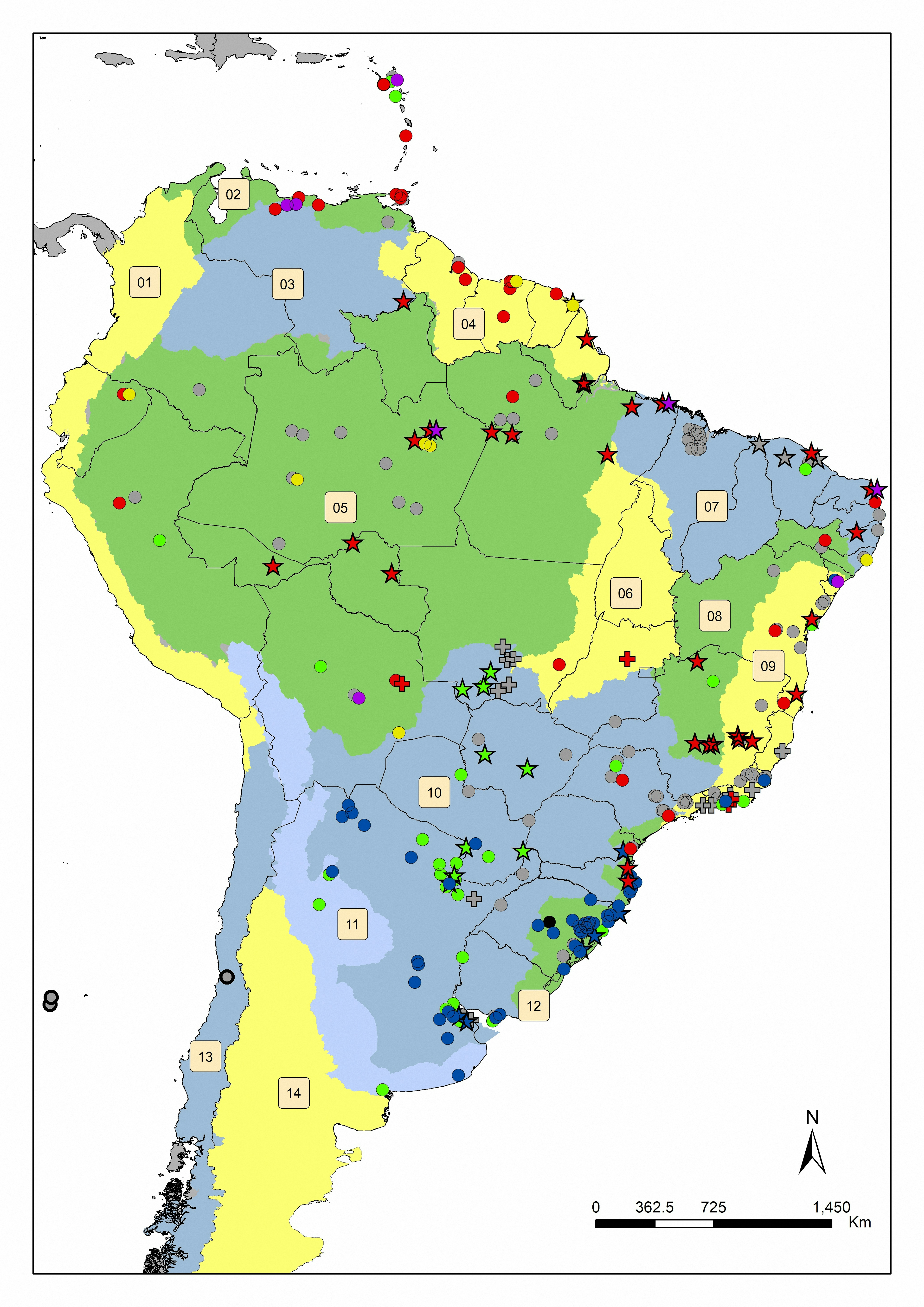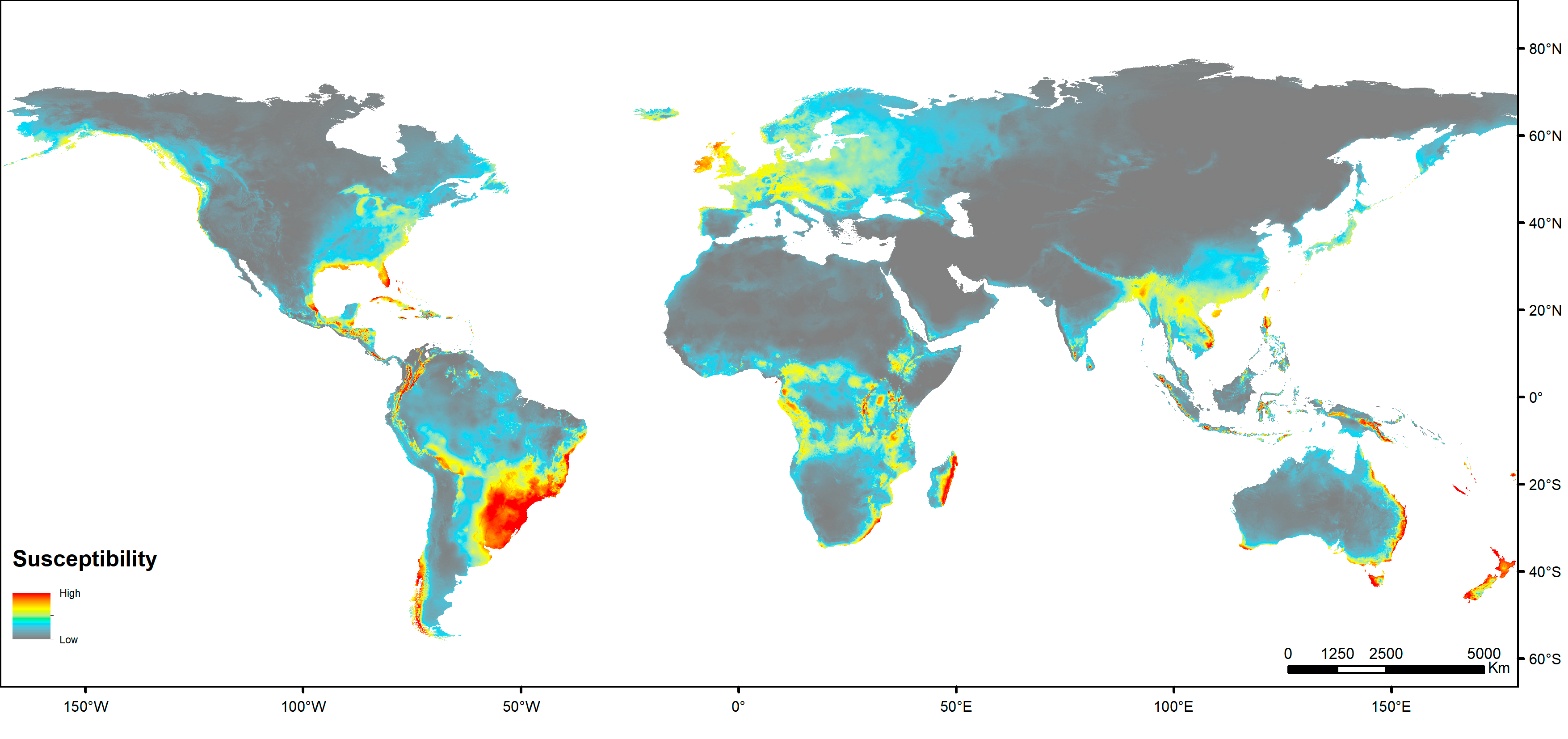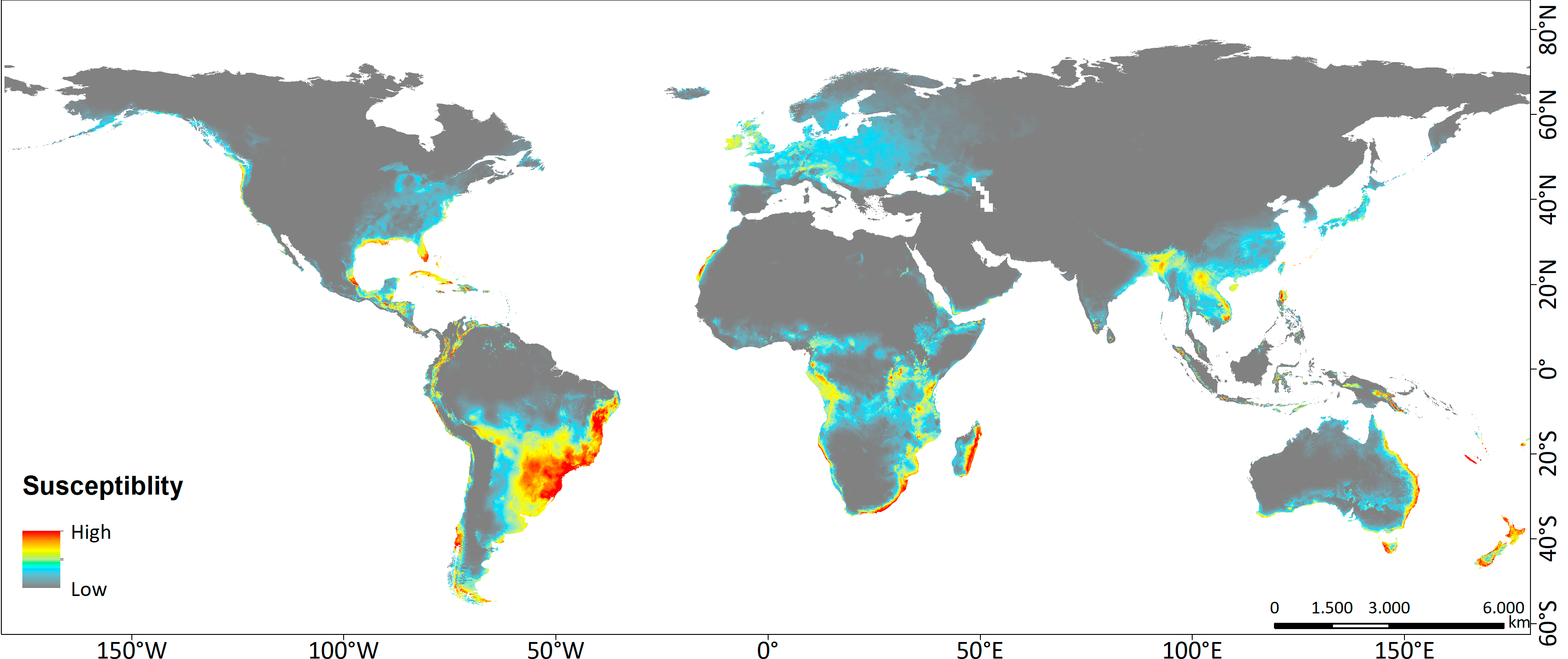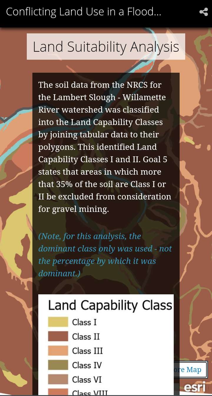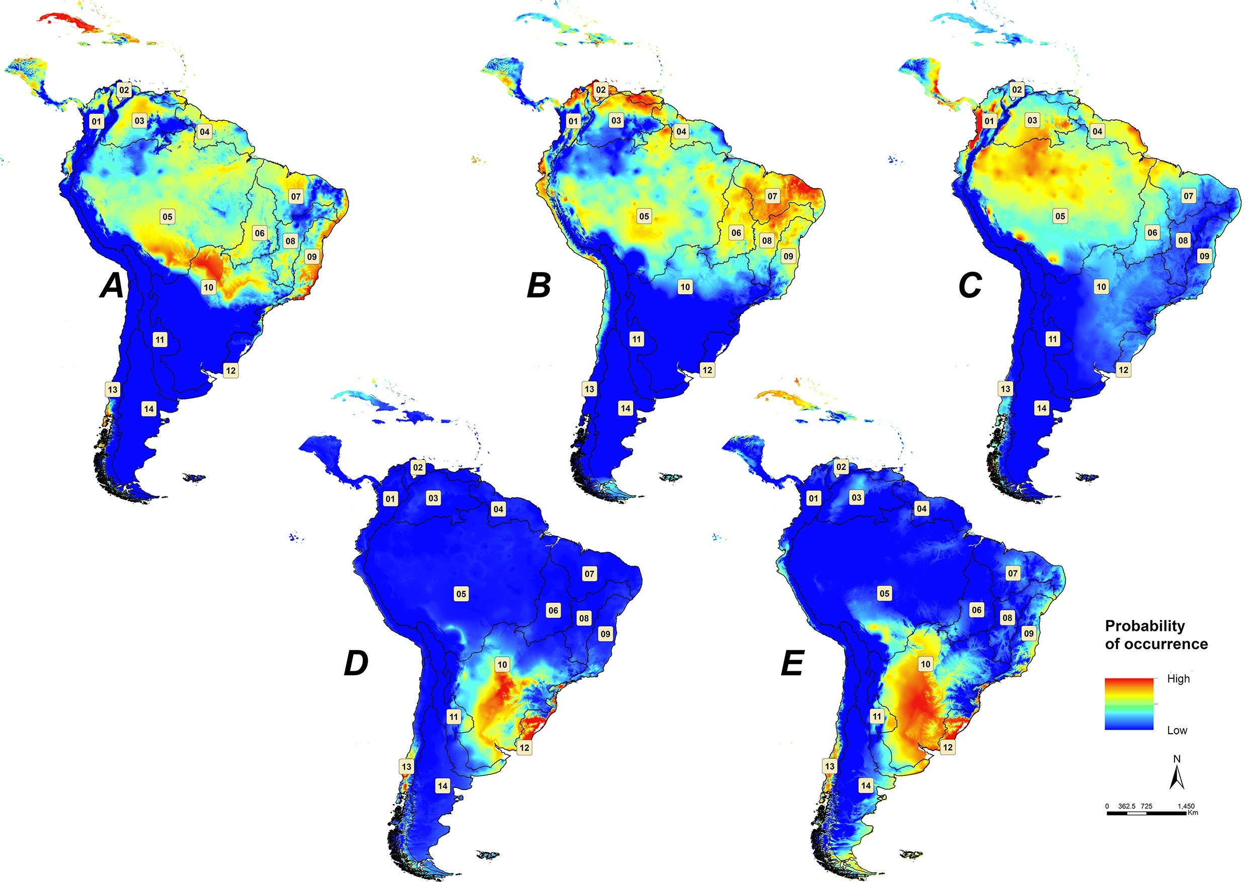
EN: Maps showing the potential distribution of the slugs Omalonyx species in the South America plus part of the Central America and Caribbean region, using the algorithm MaxEnt to make the Species Distribution Modelling (SDM). (A) Omalonyx matheroni, (B) Omalonyx pattersonae, (C) Omalonyx geayi, (D) Omalonyx convexus, (E) Omalonyx unguis. The numbers represents the main watersheds within South America: 1) Pacific Coast; 2) Caribbean sea; 3) Orinoco River; 4) Amapá-Esequibo; 5) Amazon River; 6) Tocantins River; 7) North Atlantic; 8) São Francisco River; 9) Eastern Atlantic; 10) Del Plata; 11) Border strip of the Brasilica (North) and the Chilean-Patagonian (South West) Subregion; 12) Eastern; 13) Chilean-Patagonian Subregion of the Pacific Versant; 14) Chilean-Patagonian Subregion of the Atlantic Versant. Map published at: http://dx.doi.org/10.1590/1676-0611-bn-2017-0409
PT: Mapas mostrando a distribuição potencial das espécies de lesmas Omalonyx na América do Sul e parte da América Central e Caribe, usando o algoritmo MaxEnt para fazer a Modelagem de Distribuição de Espécies (SDM). (A) Omalonyx matheroni, (B) Omalonyx pattersonae, (C) Omalonyx geayi, (D) Omalonyx convexus, (E) Omalonyx unguis. Os números representam as principais bacias hidrográficas da América do Sul: 1) Costa do Pacífico; 2) Mar do Caribe; 3) Rio Orinoco; 4) Amapá-Esequibo; 5) Rio Amazonas; 6) Rio Tocantins; 7) Atlântico Norte; 8) Rio São Francisco; 9) Atlântico Leste; 10) Del Plata; 11) Faixa de fronteira da sub-região Brasilica (Norte) e Chileno-Patagônia (Sudoeste); 12) Oriental; 13) Sub-região Chilena-Patagônica do Versante do Pacífico; 14) Sub-região chileno-patagônica do Versante Atlântico. Mapa publicado em: http://dx.doi.org/10.1590/1676-0611-bn-2017-0409